Hi All~
This Eletter with
all the links to fabulous life-sized photos is at:
http://www.ciekurzis.org/Andros Island/Andros
Island.htm
Andros Island – The REAL Bahamas
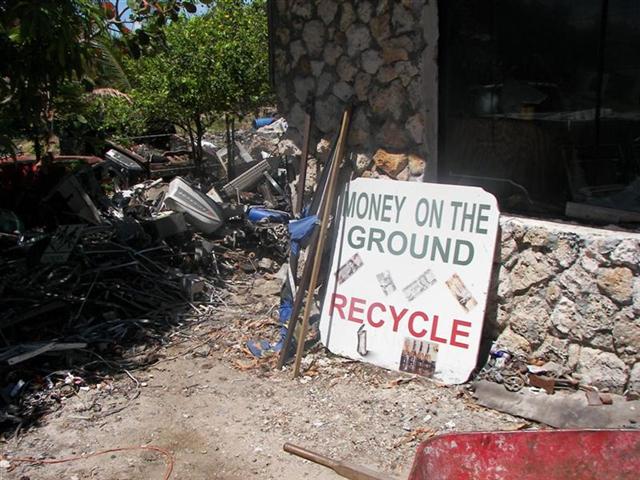
We have arrived at Andros Island – I call it The REAL Bahamas. Not highly developed, this is the largest of the Bahamian Islands; but is sparsely populated = 7,000 residents total. You can find a few things here (I searched the junk yard for Pedigo parts and I think this guy is a doctor) but no Wal-Mart, for sure! It is completely rural and has beautiful beaches on the ocean, beaches on the shallow banks, pine forests, (PIRATE) caves, rocky shores, and very smooth lightly-traveled roads along the entire 44-mile length of its north contiguous portion. So anywhere on the north section of the island is accessible in one day by bicycle!
The Character Of The Land.
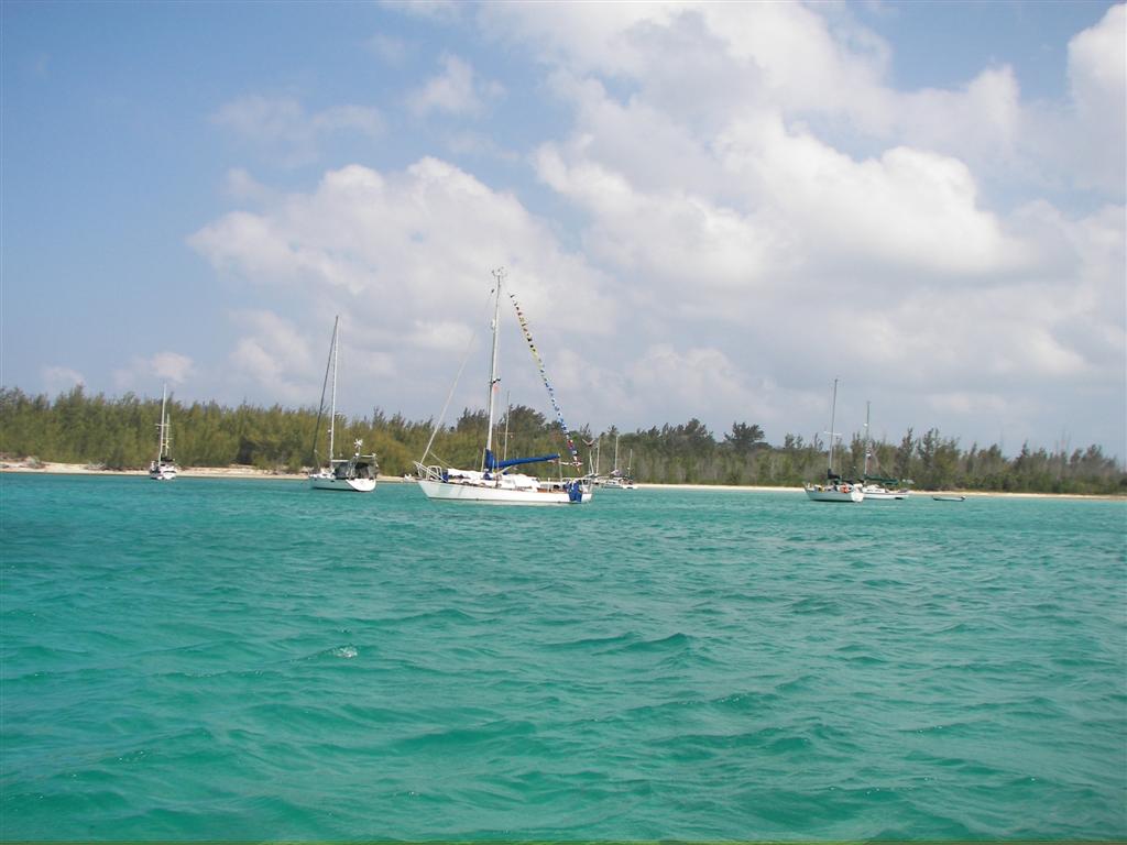
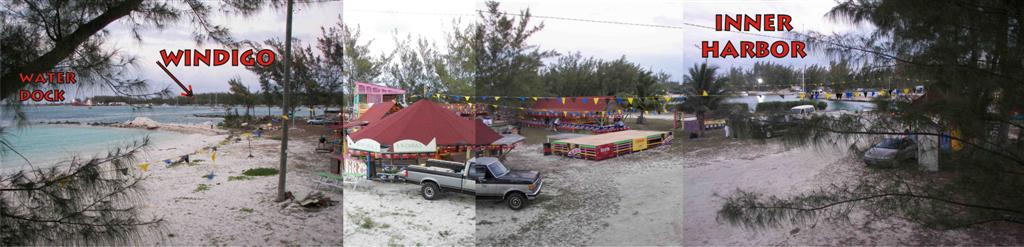
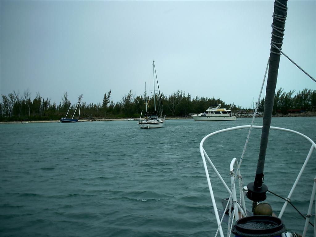
We are anchored in the harbour of Morgan’s Bluff just ˝-mile from the Tongue of the Ocean and its mile-deep waters. Two miles south of our anchorage is Nicolls Town and the Pineville Motel with reasonable room rates and a car available. The rooms are uniquely decorated and the courtyard is landscaped into the ‘areas’ of “the Patio”, the “Indian Village”, and the “Zoo”. Yes, there are animals in the zoo! It is five-years old and has a crumby website at: www.PinevilleMotel.com. [Eugene is workin’ on it!]
The reef that runs along the east side of Andros Island is the third longest in the world behind the Australian and Belizean reefs. The Tongue of the Ocean is a unique & gorgeous strip of deep water. On land we have access to the coconuts on the trees, are looking for the areas rich with conch, and once a week a freighter loads up with grapefruits from the orchard here and the forklift drivers fill up our large bag for a tip they initially refuse.
Getting here is easy; flying into Nassau can be accomplished from several East Coast Florida airports. There is air service to Andros Town or San Andros Airports and a ferry comes from Nassau right here on Saturdays and Mondays.
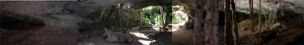
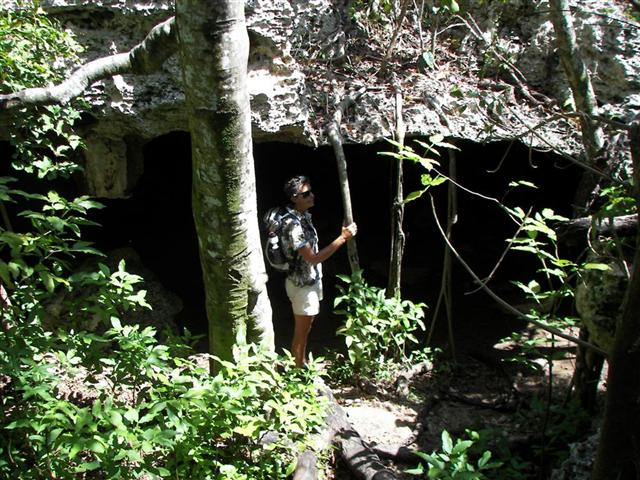
Did I mention there are PIRATE CAVES!
So this combination of exciting features makes Andros the perfect place to have the Grandchildren come for their first visit to Windigo (Joshua, in his three-year-old world of fun calls it “Grandpa’s Pirate Ship”) so in July we will return here for a week of Pirate Adventures.
The Good Peoples Endure.
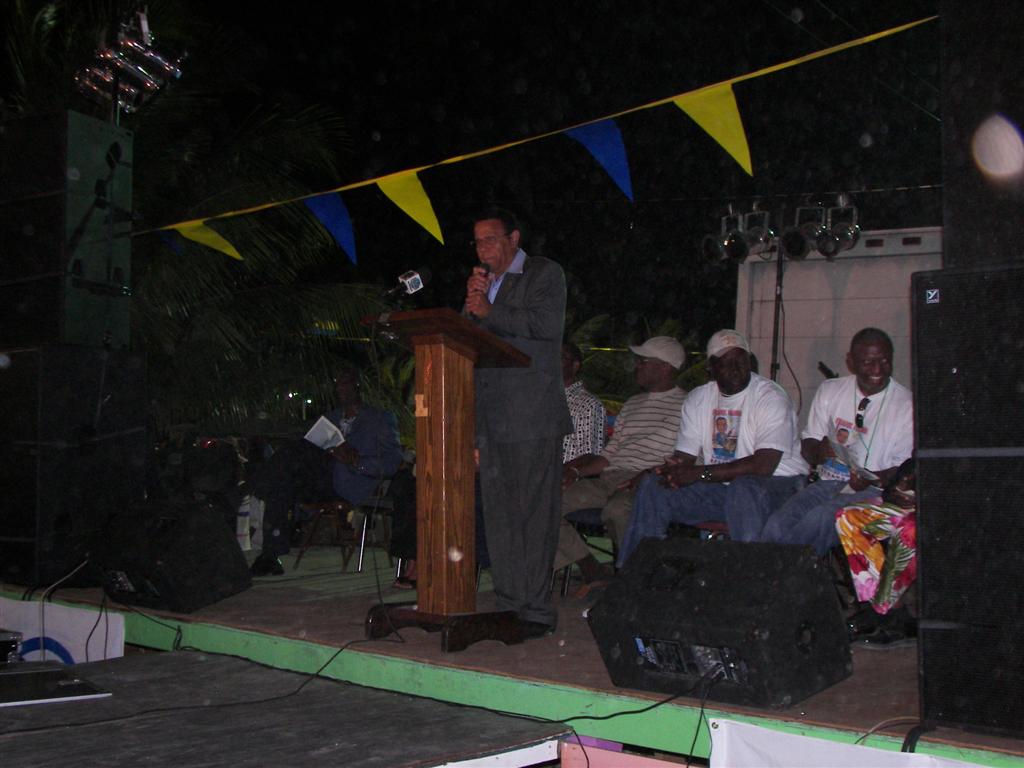
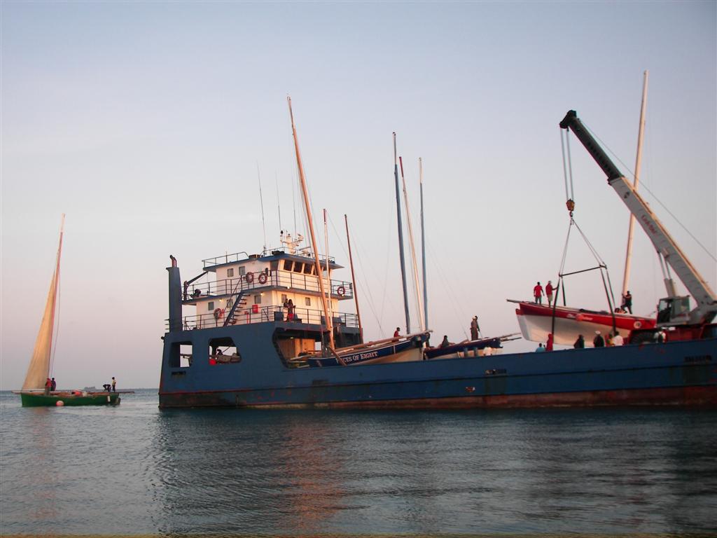
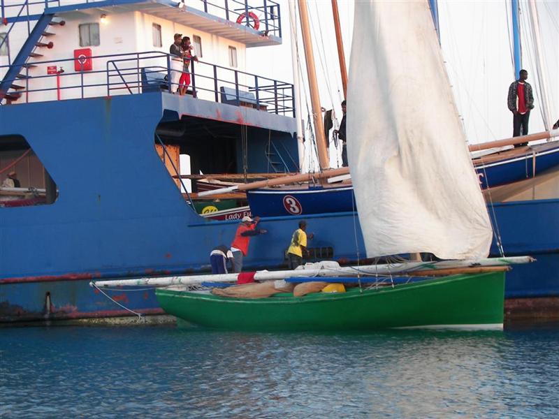
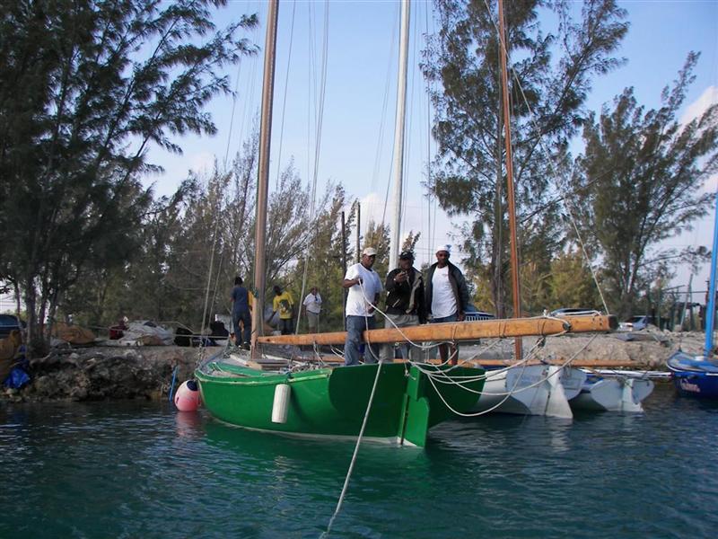
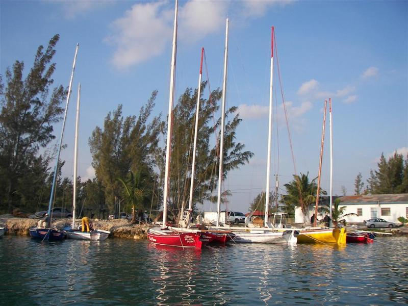
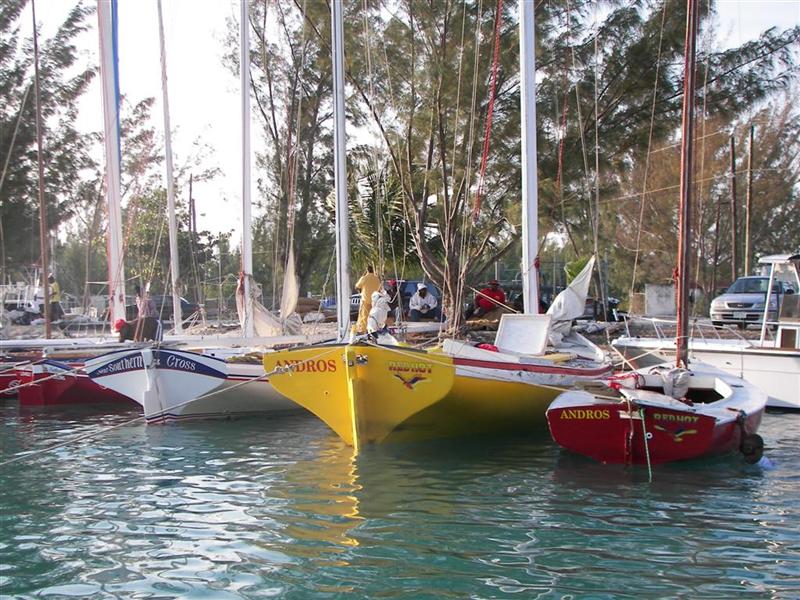
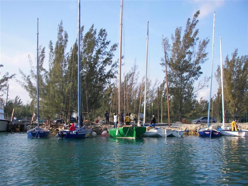
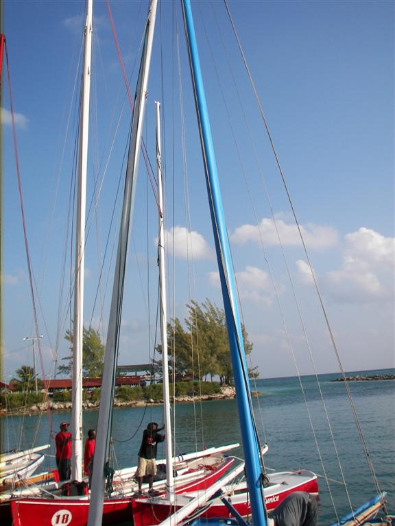
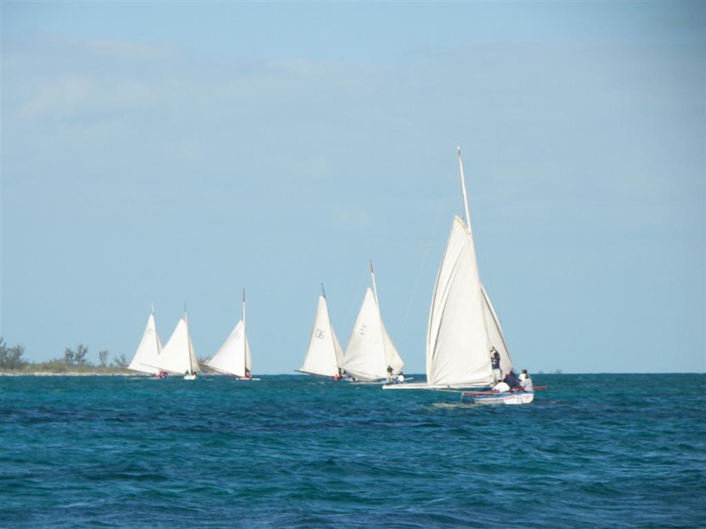
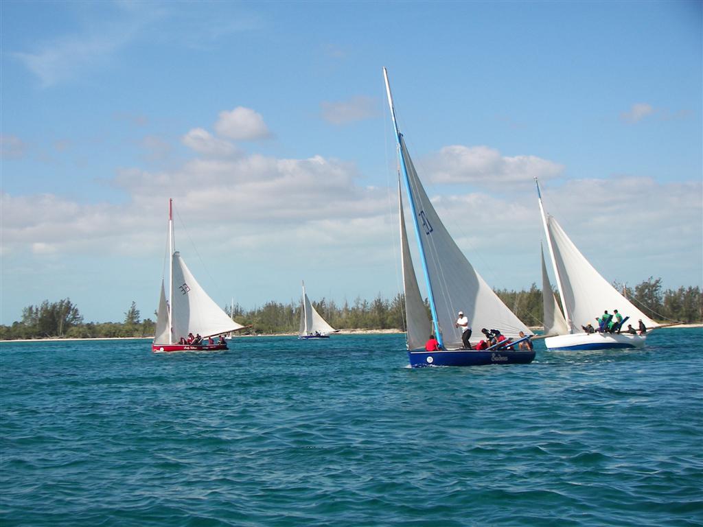
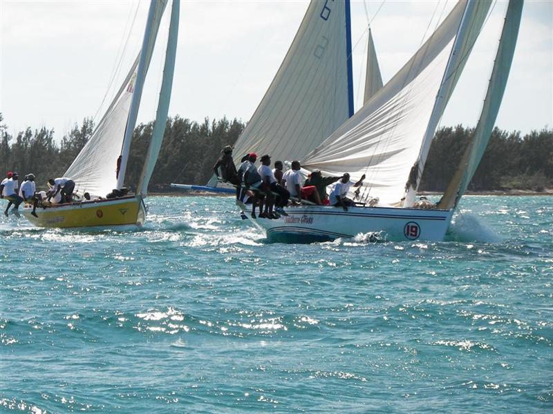
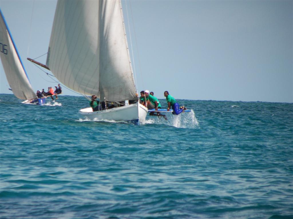
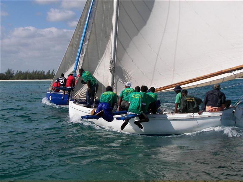
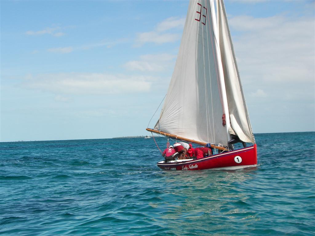
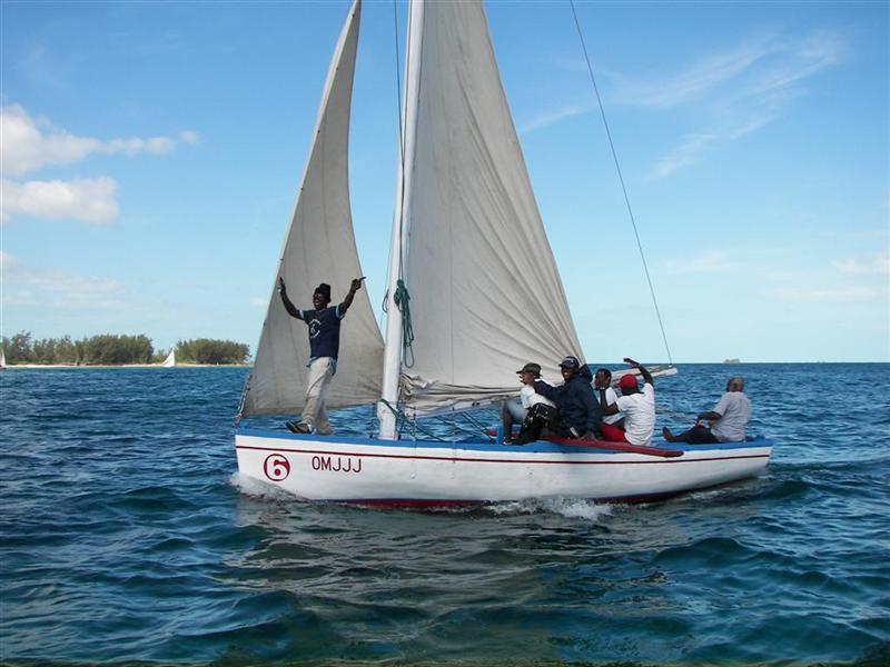
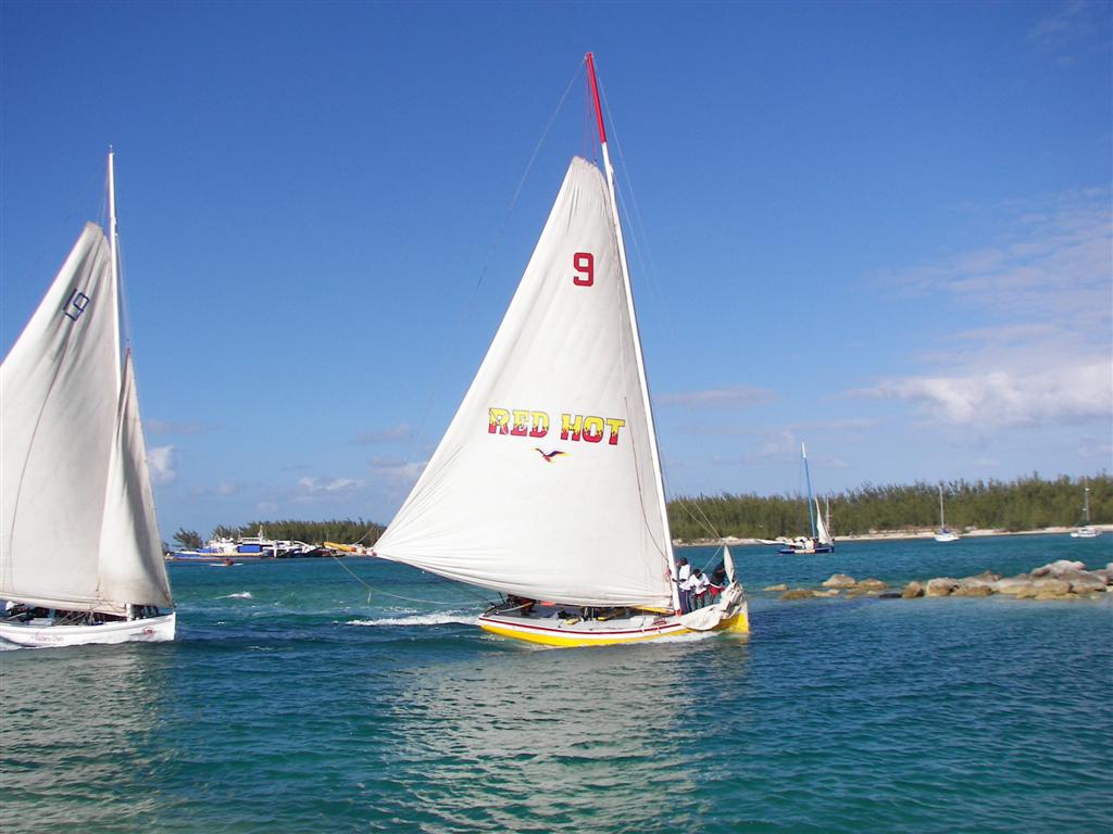
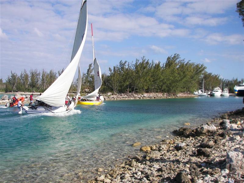
The first weekend we were here was the largest event of the year on Andros = The Morgan’s Bluff Regatta, now named the Frank Hanna Berry Island and All Andros Sailing Regatta. Native Bahamian wooden sailing vessels from all the islands gather here to race and party. This event has been in July for over a decade, but an attempt to spread the tourist-attracting events over a longer season [the much smaller Crab Festival is in July] and avoid the final election weekend held near Independence Day [10 July] the powers-that-be moved the Regatta to the end of March.
[Some problems arose: they moved it nearly at the last minute making it the first Regatta in the series; causing some boats to rush to readiness, others to be unprepared, and still others to be outraged at the jostling of the schedule so they boycotted the event!
The Crab Festival may be small, but the timing of it is significant = land crabs crawl over the fields, roads, swamps and towns of the whole island; the warmer waters in the Tongue of the Ocean allow fishermen to fill the Festival with fresh, cheap seafood. The Regatta needed to import a lesser quantity and quality of these foods from other places in the islands, raising the cost of eating at the Regatta.
The weather in July is in the summer pattern = gentle SE breezes, very conducive for the Regatta boats with their over-powered sailplans and low ballast. The higher winds for this Regatta caused races to be delayed, cancelled, or combined.
The very political nature of this dispute (in the highly-charged arena of ‘election year’) resulted in hard feelings and much crowing, exaggeration and chest-pounding by the powers-that-be at the event.]
How lucky can we be to have a front-row seat for all this action?
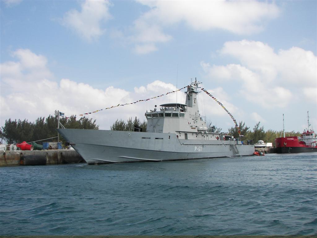
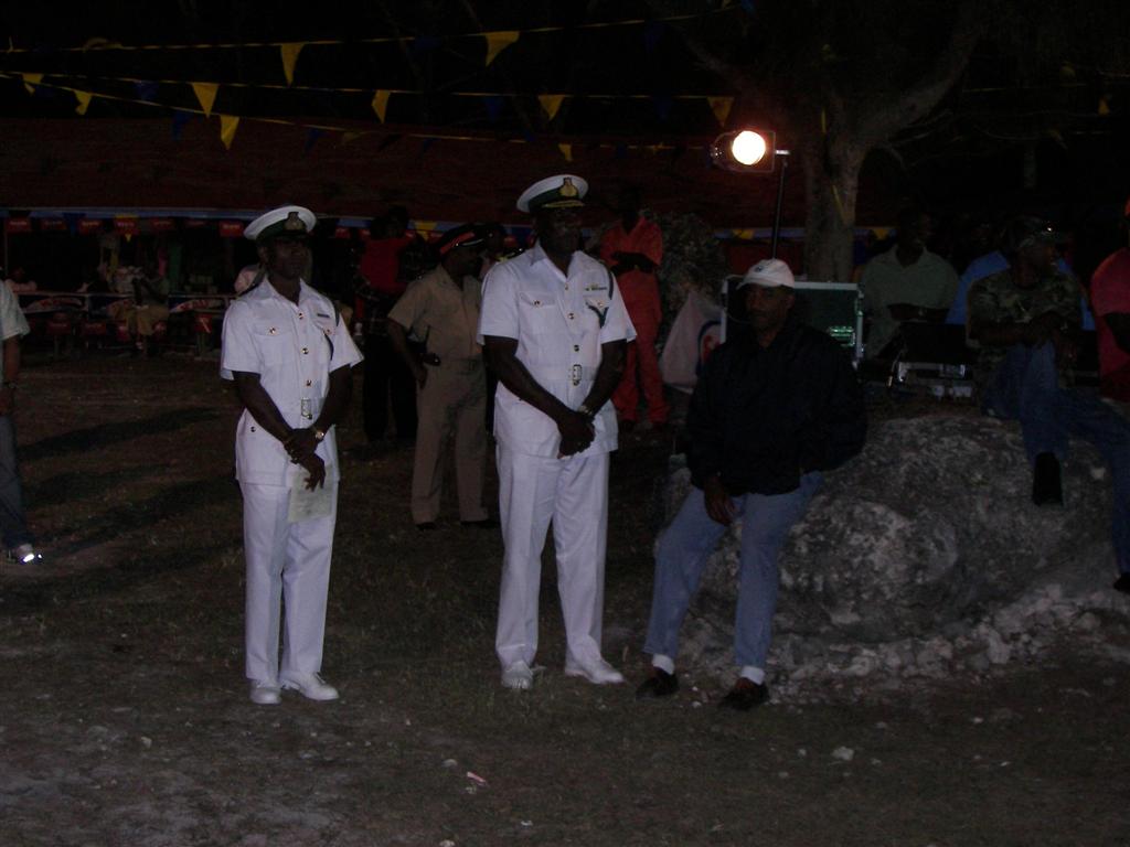
Being a large politically-charged event, the Royal Bahamian Defense Force stationed a cruiser on the water dock. Trying to keep up with Windigo’s festive decoration, the P-61 dressed out the colors, also. Later, to enforce good international relations, I bought the Commander a fruit juice at the Regatta party.
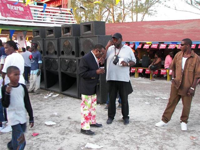
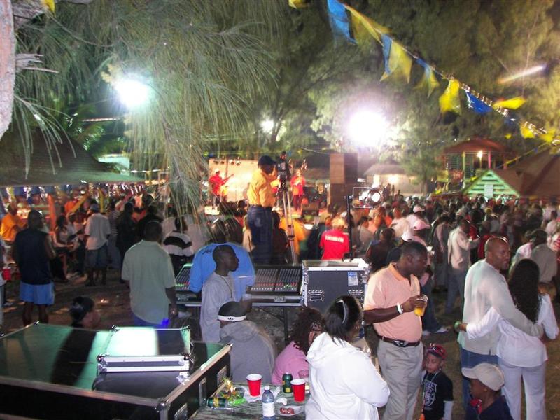
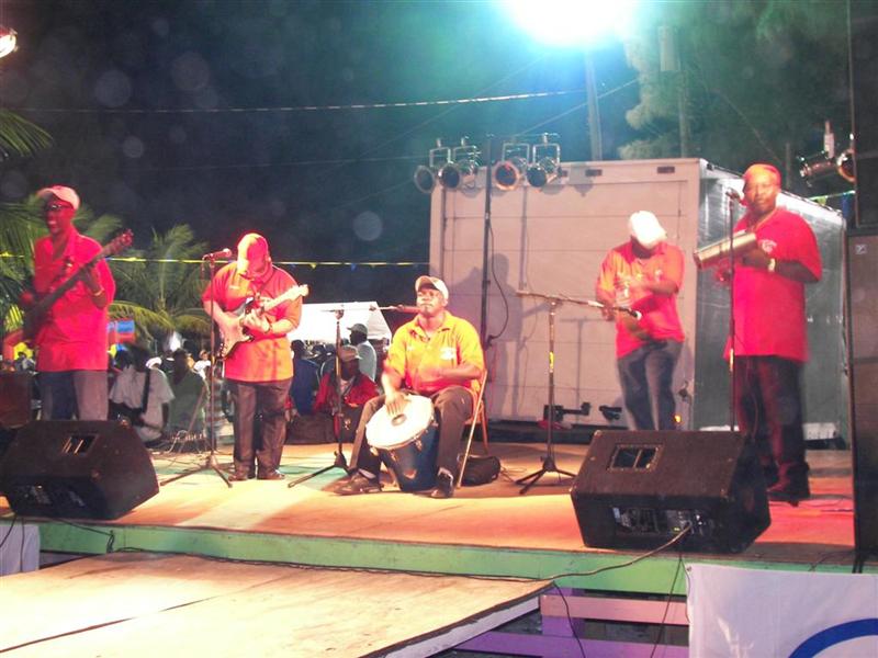
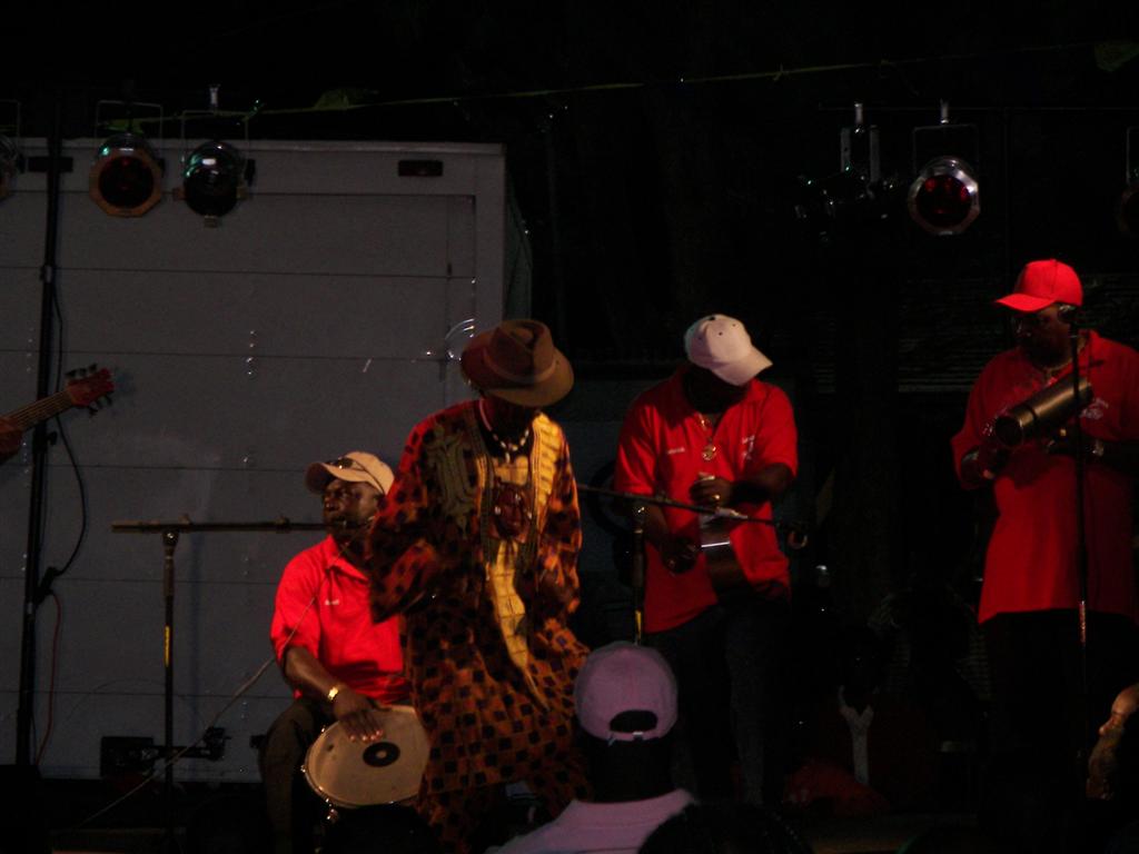
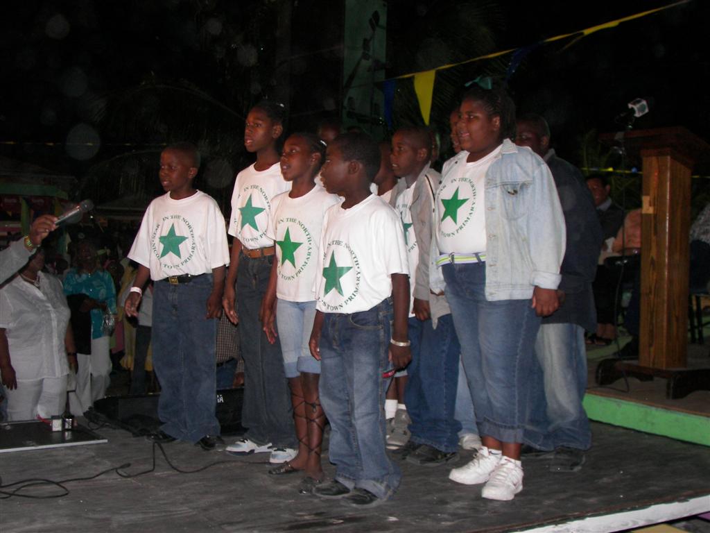
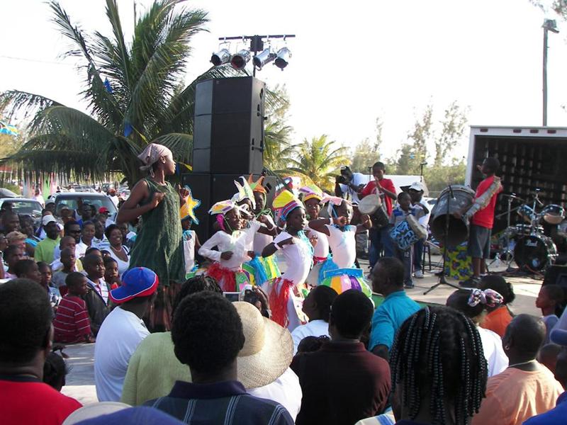
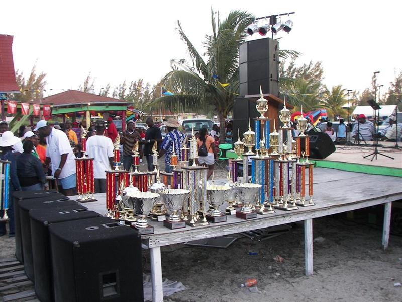
The event’s party is held at Regatta Village, the heart of Morgan’s Bluff. A wide variety of musical groups were presented, groups of schoolchildren performed music, dances and skits. We mingled with the locals and other cruisers, including Lee Shalom, Harbormaster for Morgan’s Bluff (he is wearing a Denis Sullivan cap – the Flagship of Wisconsin that we worked on the constructions of for two years.)
The buildings in the small fairgrounds are constructed mostly of plywood and old palettes, with shingled roofs on top. The water and electricity is run in PVC pipe on top of the rock substrate with a dusting of sand and chunks of rock scattered about, leaving the utilities mostly exposed. I forgot to get a photo of the electrical service, but it would be a good joke to send one to the picky inspectors I dealt with back in Wisconsin!
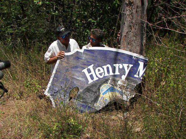
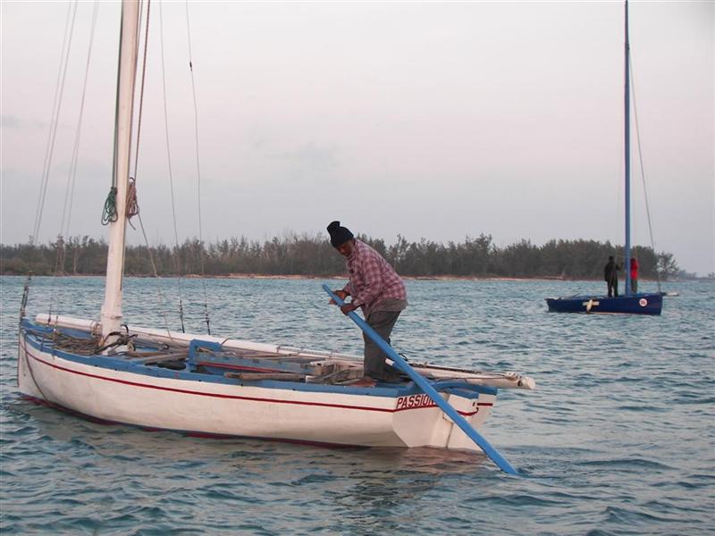
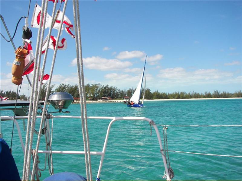
I was the event photographer, and for the first time the sailors had an on-course spectator and some action shots of their unique craft. So instead of hyper linking a bunch of blah-blah-blah, here are some pix of the delivery, setup, and racing of these Bahamian sailboats. [More photos and complete racing story soon in Southwinds]
A B C D E F G H I J K L M N O P Q R S
I sent a report to Southwinds Magazine to spread the word for these events that are the National Sporting Event in The Bahamas. I made friends with a couple builders and will visit them at their home islands when we travel. Bill Pratt is one craftsman here in North Andros with a long history of participation, he has a trophy named for him, and I visited him at his home & shop.
Other Activities.
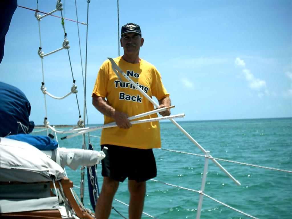
I had some kite flying experience with my
kiteboard kite.
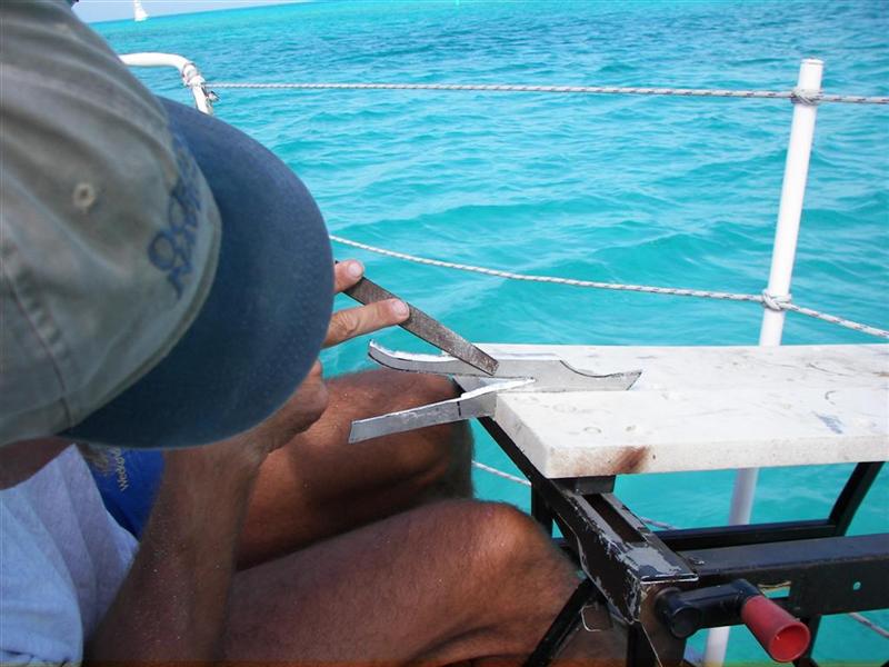
I finished the Klingon
Battle Spear I started in Chub Cay. Actually, it’s a ‘coconut hook’ and it works well for a
guy unwilling to climb palm trees barefoot!
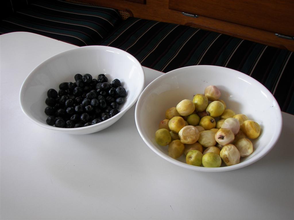
While we were cycling, we discovered coco plums along
the roadside. The locals often stop and snack on these just as Wisconsinites
pick wild asparagus and Michiganders fill small containers with blueberries.
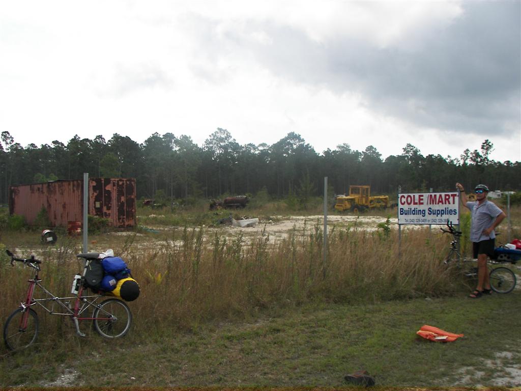
Lots of cycling –it’s a big island with
several remote settlements. See Cycling Notes.
We met some friends (Jennifer & Jay) that were in a boatyard in St. Pete with us that have lived here since November. Another boat (Mark & Rita) we stayed at Chub Cay with arrived a few days after we did, and we ended up following each other for a few weeks, which happens frequently while cruising. See Cycling Notes.
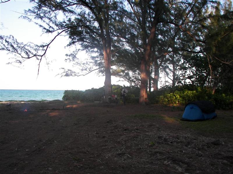
Camping came into the agenda as a necessity for comfort as twice during our stay the regularly-spaced winter fronts from the NW brought strong north winds to the harbor that is open to the north. Sleeping was easier in the Regatta Village than on Windigo in the choppy harbor.
We also camped during our ‘Cycling Tour of Andros’. See Cycling Notes.
[I guess cycling was the highlight of our first visit to Andros . . .]
Island Geology.
It is here that Captain Sir Henry Morgan had his
Pirate Cave, and we anchored 1000 feet from it. No treasure buried on an
aragonite island – only a few inches of soil if any; but if a guy had 40 men on
his Pirate Ship, how big of a rock could they lift? And there are lots of holes
and caves around. I suppose that
would be excellent security, ‘cause one or two traitors couldn’t access
something under a one-ton lid! So now I’m checkin’ out my theory under all the
big rocks lying loose on the island . . .
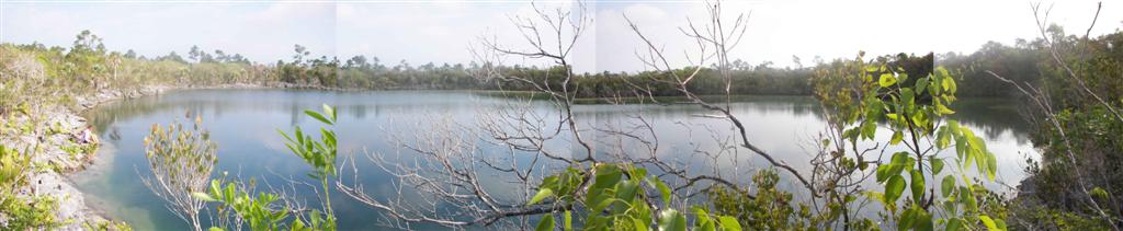
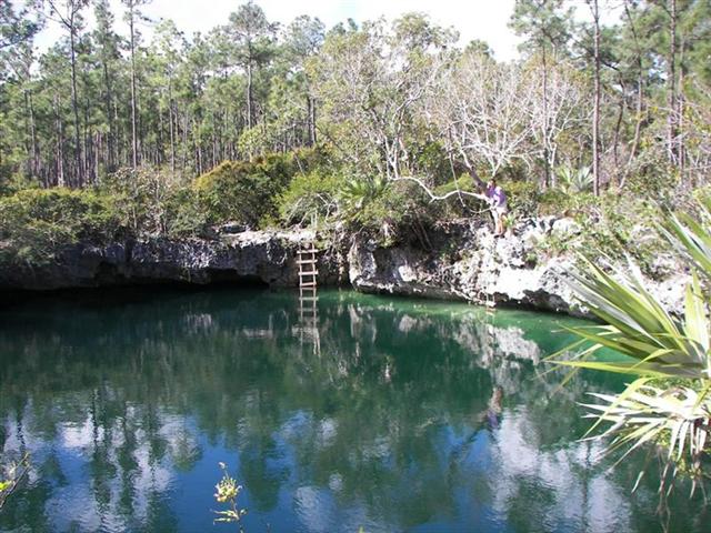
There’s
a few blue holes on the island both
inland and out in the bays which we explored. A feature of the Bahamian
blue holes that I didn’t note in the explanation in the Bimini eletter is that
The Bahamas has the only ‘tidal’ blue holes in the world. The strong flow of
water in & out of the holes makes for interesting phenomena = during rising
tides fish can be spewed out in great numbers; and during falling tides,
careless divers may be held in the hole for the duration of the strong tidal
flow, which may last up to five hours. Not good if they carried only one
tank!
Also the ‘bluff’
of Morgan’s Bluff is about as impressive as a Bahamian hill can be. The
jagged vertical surface dropping to the ocean is used as a repelling training
aid.
.jpg)
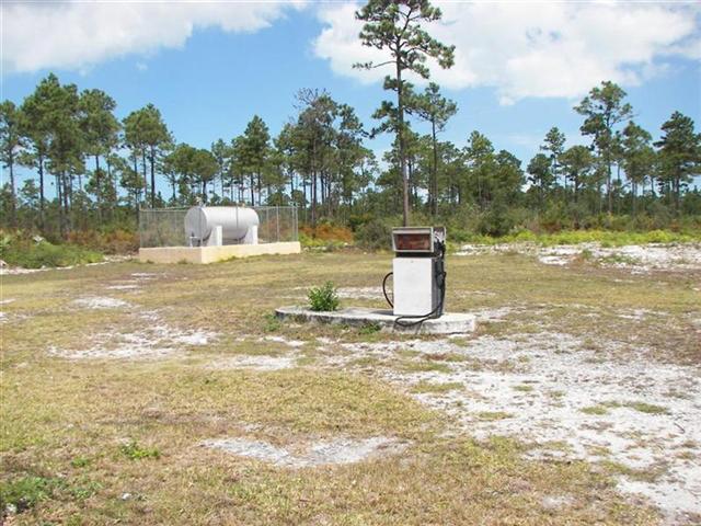
This being the largest island in The
Bahamas, Andros affects weather as any other land mass near water and gets
frequent rainfall. This combined with the typical Bahamian structure of being a
flat “rock”, it ‘collects’ a lot of water when it rains and has done so for
millennia. This rainwater has eroded and flowed into pockets in the aragonite
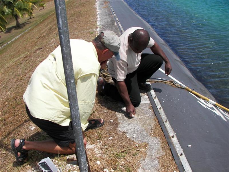
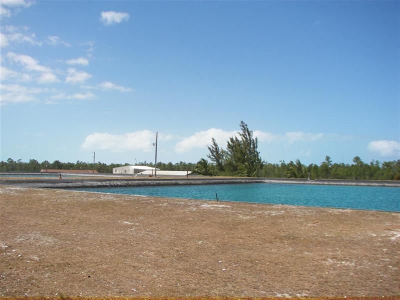
and is held there. Thirty years ago, just after independence, the Bahamians
engineered a water collection system to utilize this great natural resource for
a (sub)tropical island. My
friend Bill Pratt Jr. [son of famous boat builder Bill Pratt mentioned
above] has worked for the water utility since Day One and is now in charge of
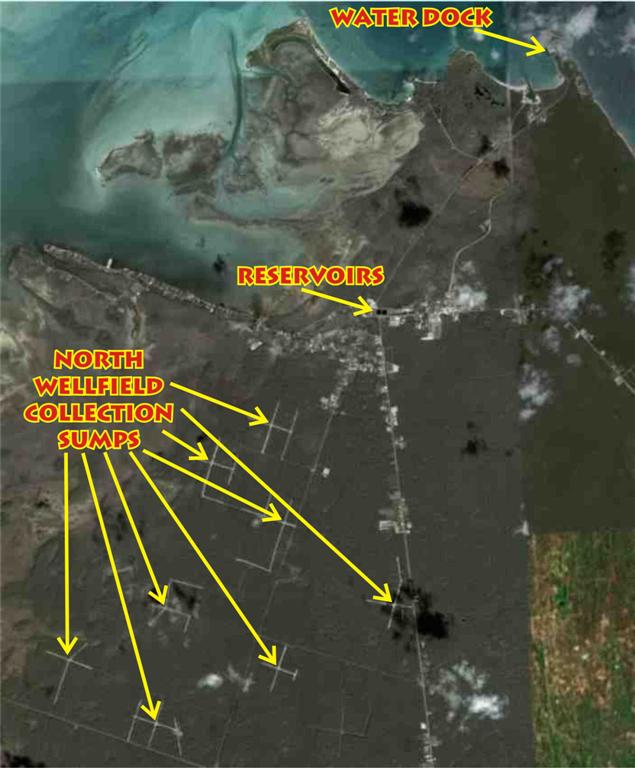
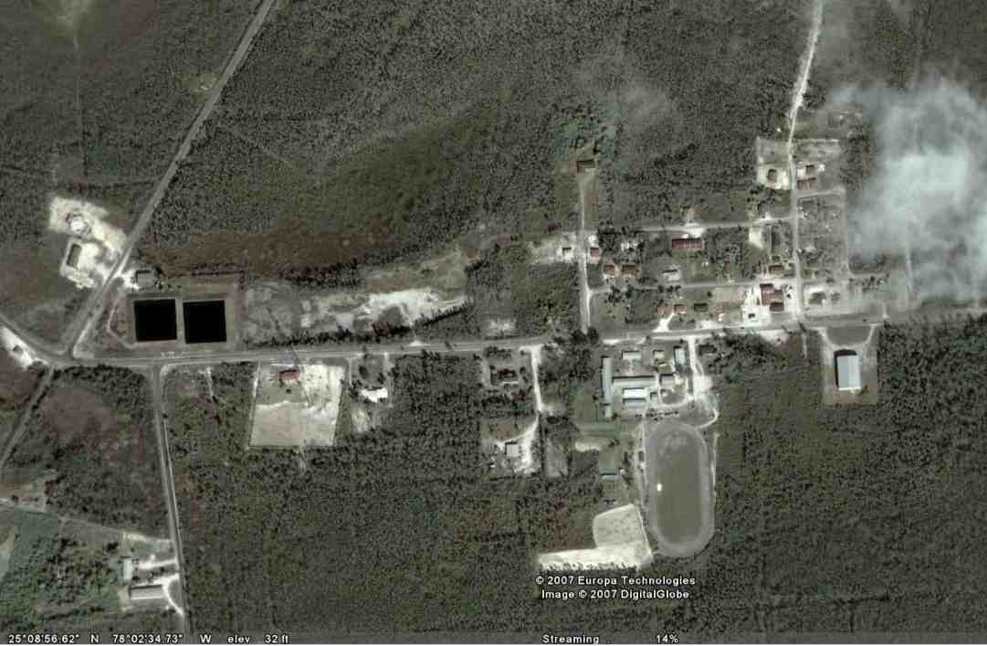
the reservoirs. He helped cut long cross-shaped
channels in the rock to collect the water in the “wellfields”. There is a
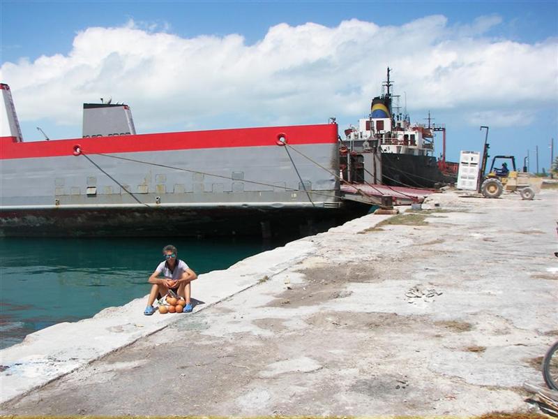
sump at the intersection of these canals and water retrieved there is pumped to
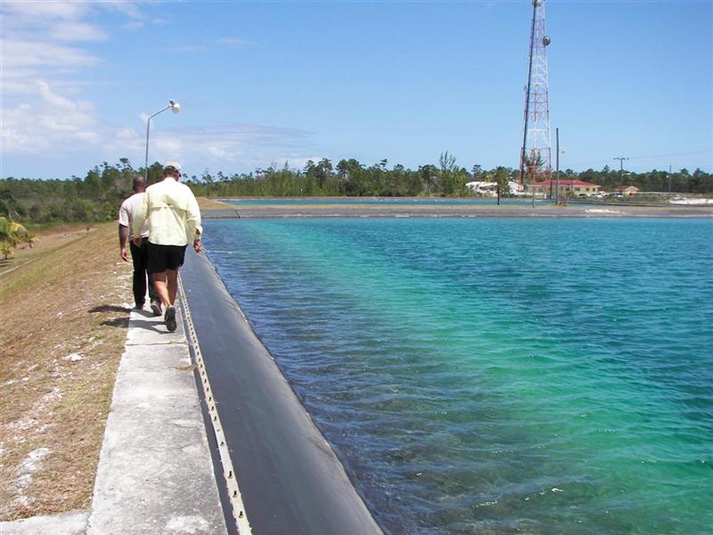
a pair of reservoirs. Seven million gallons of fresh water are stored in the reservoirs. There are two
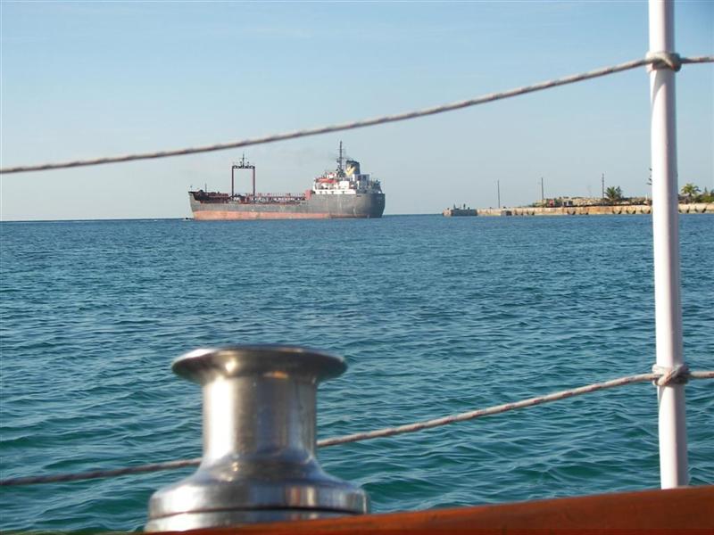
pipelines from the reservoirs to a dock on
the north tip of the island
and two water tankers makes continuous trips
back and forth to New Providence Island carrying this water to Nassau to
supplement the reverse-osmosis water made there.
It is interesting to note that Andros has
fully one-half of all the daily water available [420 million gallons] in The
Bahamas, but uses less than one-third of a million gallons per day. New
Providence (and Paradise Island) are able to make ten million gallons per day
through reverse-osmosis, but their demand far exceeds this, so they take as
much water as they want from Andros as their “birthright” [the Island of Andros
receives no compensation for this]. Two-thirds of the total population
[300,000] resides on New Providence, but the water requirements are much
greater as the tourist consumption has been found to be three to four times
the volume per capita compared with residents. Andros helps sustain the huge
tourist trade in Nassau, but the Government only just this month opened a
tourism office on Andros. The disparity of development in The Bahamas is caused
by many, many factors; the island isolation may be the obvious one, but
political mechanics is a major dynamic in the modern era. Also interesting is
the fact that 15 miles to the north on Chub Cay water is 42˘ a
gallon and here on Andros it is plentiful and
free.
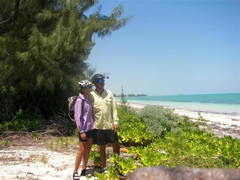
Cycling Notes.
My method of discovering much about an
island by cycling it thoroughly got a little out of hand here in Andros.
Because of is large size and interesting nature, the ‘Andros Century’ became
the First Annual North and Central Andros Bicycle Tour And Camping
Extravaganza. FANCABTACE was a roaring success with two participants, Karin
& me. We spanned the whole length of the island
from Morgan’s Bluff to Coakley
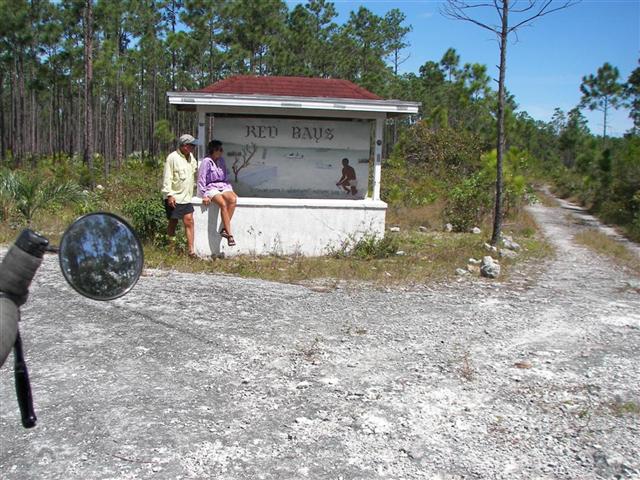
Bight and as far west as Red Bays. It became a
400+ ride, 30 to 50 miles a day with century options. I believe I cycled
through every major settlement on the island:
Bowen, Conch, Man-O-War, Lowe’s and North & South
Blanket Sounds
Fresh, Davis, Staniard, Stafford and
Cargill Creeks
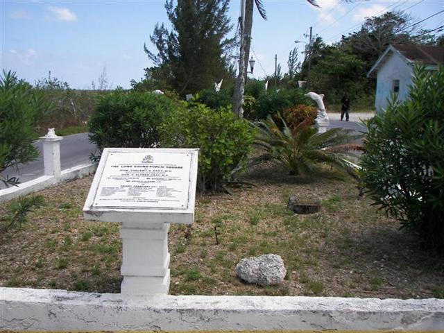
Andros, Coakley and Nicolls Towns
Behring and Mastic & South Mastic Points
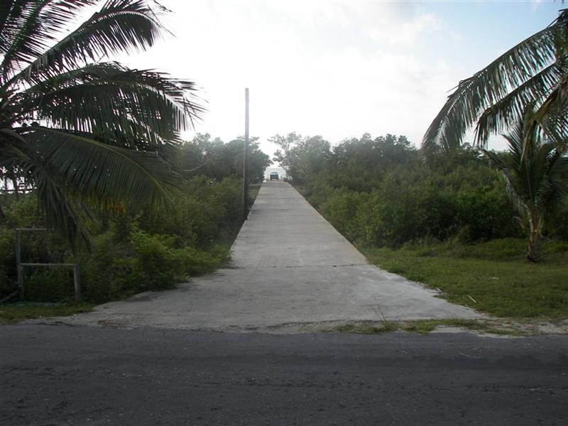
Calabash & Red Bays
Pineville Estates, Love Hill, Coakley
Bight, Morgan’s Bluff, Small Hope and San Andros.
We rode past Kamalame Cay, a very
ritzy development with a marina. Dockage is $3/ft. with a $100/day minimum. An
additional $80/day for each person is charged for facility use; besides
showers, water and electricity, this includes breakfast & lunch. But supper
is an extra $100/person. So at $360/day, Windigo could afford to stay through
the weekend! Now you see why we rode past it.
We also cannot get into the AUTEC sites,
but cost is not the issue. The acronym is for the Atlantic Underwater Test and
Evaluation Center, in other words, a US NAVY submarine base! There are several
shoreside installations, some with great harbors, but unless your vessel is
immediately threatened by a hurricane, I wouldn’t breach security there. [I
heard one local story of an old sailor that bumped into a submarine here years
ago. The sub surfaced, both vessels did a damage check (none), chatted briefly
on the radio, and went their merry ways. Cool.]
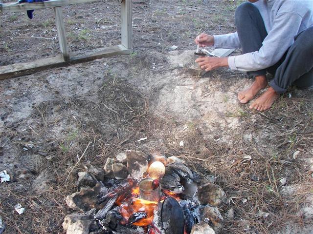
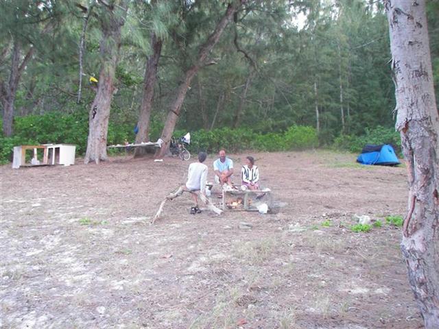
We made a remote camp in Fresh Creek as a base to explore the southern portion of the island, and Mark & Rita sailed down with their shoal-draft boat and joined us for an evening of campfire stories and s’mores.
Cruising Notes.
This section is NOT a substitute for
cruising guides; I’ll just try to supplement their information with up-to-date
local knowledge and some tidbits a book publisher may hesitate to print.
Remember: this advice is FREE,
is well worth the price, and there’s a money-back guarantee.
The entrance to Morgan’s Bluff is EASY.
There is a set of red & green channel buoys, and then what looks like a
bunch of giant metal mooring balls. I passed them on every-which side when I entered;
staying within a few hundred feet of them thinking it is a mooring field for
LARGE ships. Then someone told me they are “channel” markers. Dubious at best –
why mark a zigzag path when a straight-shot works? There’s 25 feet of water all
around them with the Goulding Cays (closest hazard) way off to the north.
Anchoring out in the harbour at Morgan’s
Bluff is great; the only hazards in the harbour are the entrance jetties to the
inner harbor. go as far south toward the beach as you feel comfortable. The
closer you get; the more sand covers the rock. You will only get a couple feet
of this sand at most, so use the heaviest ground tackle you have. We use our
70# claw with confidence, letting out 120’ or more of 3/8” chain. We do this
EVERYWHERE, EVERYTIME. Why leave any doubt when anchoring?
Get ready for a ride when it blows out of
the north! We camped on shore (in the Regatta Village) when it did this a
couple times; the rest of the boats dragged while we were on our one anchor. No
kidding, five sailboats and two motor yachts trying to deal with conditions
after they are developed instead of planning ahead. If a Danforth is your
choice of anchor here, you may end up as Blue
Dolphin did: near the beach, just a few feet (FOUR feet!) from being on
the rocks. Luckily the tides were kind and they were pulled off by a motor yacht at high tide
with their mast heeled over by a large dinghy. [Remember: there is no Tow Boat
US here!]
.JPG)
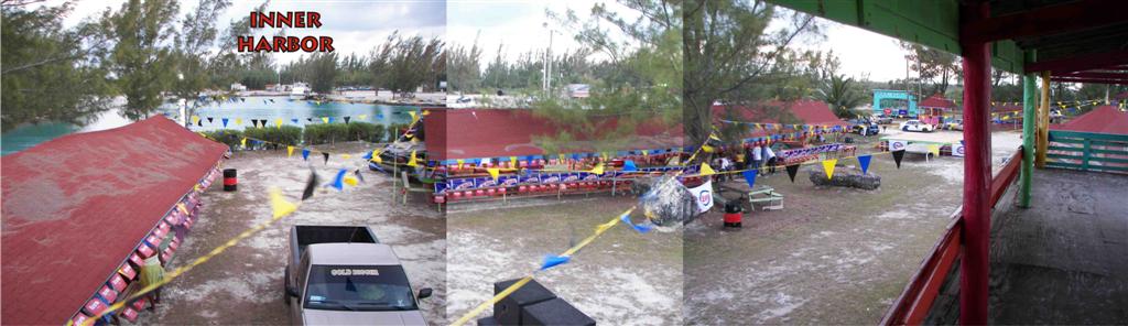
This inner harbour may appeal to you. It is
small, but the large high-speed ferry to Nassau docks in there, as well as the
grapefruit freighter [it has to back-in ‘cause the channel is only as wide as
the ship!]. The most available space in there is med-mooring with your own
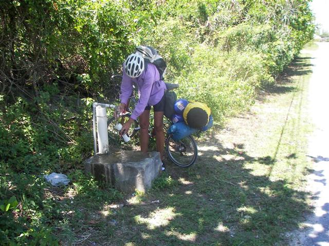
anchor at the bow with the stern tied to the trees. It’s free. So is the water
(most convenient at the east concrete dock). So is the trash collection. So are
the noseeums and mosquitoes.
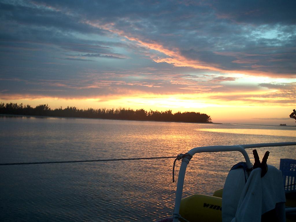
All in all, we REALLY
enjoyed Andros, and will be back in July for the First Annual Pirate Days
Aboard Windigo with the grandkids!
See where Windigo
has been:
http://shiptrak.org/
Enter Windigo's
callsign: W3IGO
Where we are right
now:
Our permanent and
EXACT address:
Capt.KL &
Karin Hughes
S/V WindigoIII •
PMB 365
88005 Overseas
Hwy. #9
Islamorada,
FL 36033-3087
Text-only Email
addresses aboard Windigo, checked daily:
[reliable
communication]
Email addresses
checked when at a land-based computer
(infrequently, but
good for attachments):
And of course, the
Windigo Travelogue Catalogue: