7
OCT – 18 OCT 2001
Cumberland River
Can
we take a vacation from our sailing voyage to Central America to sail somewhere
else? We decided to take a 260-mile round-trip on the Cumberland River to visit
Karin’s longtime friend Karen Josephson, who is in the music business [as Karen
Angela Moore, producer & jazz singer- look for her latest award-winning CD
on amazon.com] (karin&karen
peddling.jpg).
The
Tennessee & Cumberland rivers both empty into the Ohio River upstream of
Paducah, KY and are dammed in Kentucky about 23 miles north of the Tennessee
border. These dams are less than 3 miles apart, and the Cumberland River
roughly parallels the Tennessee River for about 50 miles down through Kentucky
& Tennessee before shooting off to the east. The area between the lakes
formed by the dams (Kentucky Lake on the Tennessee River and Barkley Lake on
the Cumberland) is a HUGE recreational area called Land Between The Lakes.
The
Tennessee River starts at the confluence of the French Broad & the Holston
Rivers in eastern Tennessee and winds its way through Knoxville and
Chattanooga. Then it dips into Alabama and crosses the entire width of the
north end of the state before flowing north through Tennessee to Kentucky Lake.
The
Cumberland River starts as a combination of four ‘forks’ in the extreme
southeast corner of Kentucky. It flows across half of Kentucky near the
southern border until it drops into Tennessee, down through Nashville, then it
schucks & jives its way up to Barkley Lake.
Got
that?
We
will need to take the Tennessee River to the Tennessee/Alabama/Mississippi
border to get on the Tenn-Tom Waterway to the Gulf of Mexico (which is at the
confluence of the Tennessee River & the Yellow Creek). But it hadn’t been
real cold, and we decided we should watch the leaves turn in the
deciduous-covered hills of Tennessee.
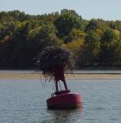
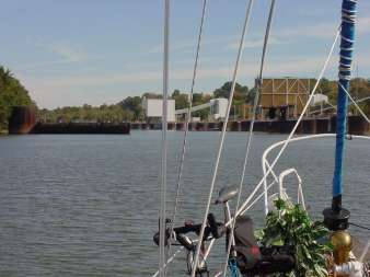
Other
than in Barkley Lake, the Cumberland River is fairly narrow, with lots of
twists and turns (nesting bouy.JPG). There is
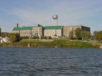
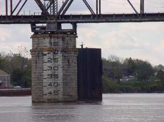
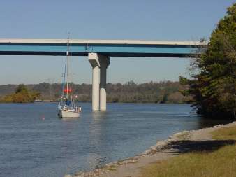
a bit of development here & there, even a “Jail with a View” (ky state prision.jpg). The lowest bridge we have encountered was
here; it rose a bit while we were in Nashville because of a rain storm. A
couple more inches of rain, and we may still be there! (lowest bridge -50'- in
clarksville.jpg) Although it doesn’t support the quantity or size of the
barge traffic we were used to on the Ohio & Mississippi, there is still a
bit of commerce and small-to-medium sized barges transiting the river. It is a
good thing it is deep to the shore in most places, so Windigo was able to give
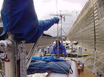
the giant river trucks a wide berth. We
locked through with a barge tow in the chamber with us. That was a first for
us! (in lock WITH a barge
tow.jpg)
Barkley
Lake is a unique sailing area, a bit similar to our experiences in St. Mary’s
River between Lake Superior & Lake Huron. It surface area is expansive –
created by Barkley Dam, and heralded as a recreational paradise. Many resorts,
marinas, parks & wildlife refuges cover this entire area. But sailing this
lake requires navigational skill in a boat with 2 meters of draft. There is a maintained
channel, and great care is needed to sail outside of the marked passage.
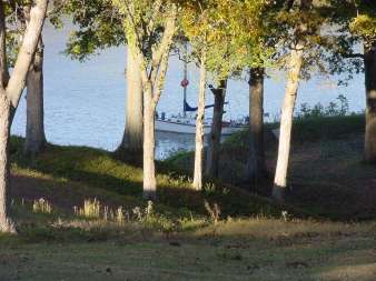
We
did find treasures outside of the channel, anchoring overnight in narrow bays
and creeks out of sight of the main river (foggy
sunrise.MPG). At one anchorage, we were so far in the tiny bay, none of the
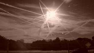
river influences reached us. If the jet trails from the recently commenced air
traffic hadn’t filled the sky, we would have felt as if we had reached Belize
already! (contrails.jpg)
Sometimes
islands create a channel off the main ‘sailing line’ of the waterway. These are
usually very quiet, natural areas we take advantage of for anchoring. One
exception turned out to be fun, anyway – at Cumberland City they constructed a
multi-port commercial docking complex. Grain, stone, coal, lime, and all other
manner of cargo is on- and off-loaded. We anchored bow & stern just ahead
of the last ‘mooring cell’, the huge concrete-filled steel structure in the far
left-hand side of industrial canal.jpg.
These cells line the shore wherever barges are fleeted up, stored, loaded or
otherwise handled.
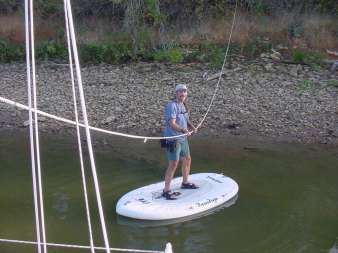
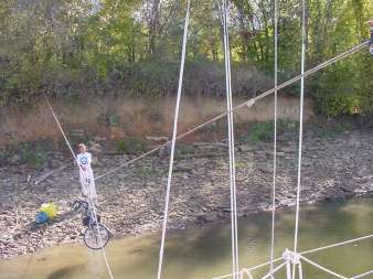
Anchoring
both ends of Windigo in the deep water real close to shore allowed us to try
some interesting ways to get to shore. Tying a line to a tree and to Windigo’s
mast provided a trolley. We attached gear [bicycles, fuel can, groceries, etc.]
to a pulley, and send it down the line to shore. We could pull ourselves back
& forth on Boardigo, too. (KL trolley
ride.jpg & pull bike trolley.jpg)
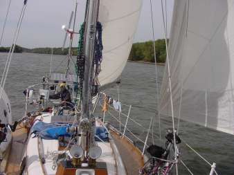
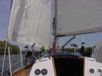
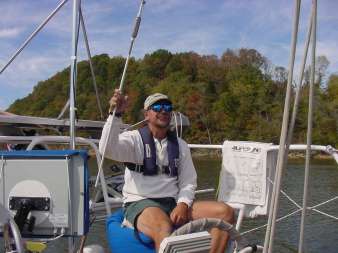
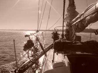
Sailing
up the river was a real treat. We only attempted it when the wind was “abaft
the beam” [at an angle behind us] so we wouldn’t have to tack across the narrow
passage. We could get nice 4-8 mile stretches, but the river winds north,
south, east & west! It was still nice to shut off the engine for an hour or
so once in a while. (river sailin'.JPG & wing 'n' wing on the cumberland.JPG)
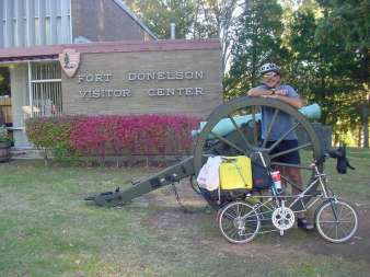
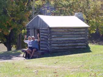
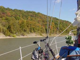
The
autumn colors are starting to break out – many of the cruising boats we
encountered early on in our journey south were on time constraints, and
regretted not planning the trip later in the year to see the fabulous color
change. The tourist sites are nearly empty, sometimes we anchor right next to a
landmark and visit with Pedigo (fort
donelson visitor center.jpg & anchored
in the trees.jpg & our kentucky
home.jpg). We are dilly-dallying to catch as much as we can! (KL fall color start.jpg)
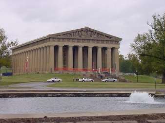
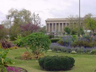
Now,
the Tuesday morning story:
We
were visiting Karin's friend in Ashland City, TN, by Nashville (parthenon.jpg & parthenon
gardens.jpg). Monday was our last day there, and we had moved the boat
Sunday afternoon to be by a restaurant dock, and then anchored across the river
that night (anchored
by the bridge in Ashland City.jpg). The wind was opposing the river
current, and it was breezy enough to set the boat's anchor chain [and windigo]
against the current.
Debris
from past storms, in the form of at least two huge branches, came by &
snagged on both the anchor rode and the separate trip line & float we
always use. Much fishing line was entangled in these tree parts, and some of
the wood held fast to the trip line float, pulling the anchor OUT with the
current.
Another
'V' shaped, water-logged branch about 5" in diameter slid down the chain
and wedged nicely in the 'claw' of our 70# stainless steel anchor (we call it
our 'mooring' anchor)
With
the float pulling one way & the boat blowing the other, Windigo moved out
into deeper water with the anchor dragging this tree all over the bottom.
Right
by a bridge. And a creek inlet. In the Cumberland River, with barge traffic.
When
the motion awoke us at 0335 hrs, we had nearly returned to the restaurant dock
(sleepy thought: maybe Windigo was hungry?)
We
got the engine started, and I hauled up the anchor. It was too dark to
determine how to extract the flora from the ground tackle, so I got it up to
the bow and lashed the rode and the entangled trip line to deck cleats. Most of
it was out of the water, so we headed slowly toward the lock that was about 6
miles downstream, timing our arrival with daybreak. I was able to clear the
forest from the front of Windigo prior to entering the lock.
Wonder
around each bend; a prize in every box; a lesson to be learned. (magic bike.jpg) The adventure is EVERYday aboard Windigo!
(not quite autumn.jpg)
Kevin
L & Karin J Hughes
S/V
WindigoIII