Hi All~
This Eletter with
all the links to crappy underwater camera photos is at this link [next eletter
gets REAL pix once again]:
http://www.ciekurzis.org/Eleuthera/Eleuthera.htm
Either cut &
paste this URL into your address bar or just click on it.
The Skinny on Eleuthera
This is indeed the longest, skinniest of
the Bahamian Islands (accounting for the long, skinny eletter!). While
Andros has the greatest landmass area (even though only about 40% of that island
is contiguous � the rest is low-lying salt marshes and ponds, or islets
separated by ocean cuts) and Great Abaco is the second largest.
Eleuthera proper
is well over 100 miles end-to-end and has many
well-established towns and communities. (See history: http://www.ciekurzis.org/Devils%20Backbone/Devils%20Backbone.htm.) Its population is about the same as the
Abaco Islands, but is contained on only 4 or 5 main islands [Spanish Wells,
Russel Island, Harbour Island, Eleuthera proper, and a few more living on
Current Island and Royal Island] as compared to dozens of inhabited islands in
the Abacos.
The Character Of
The Land.
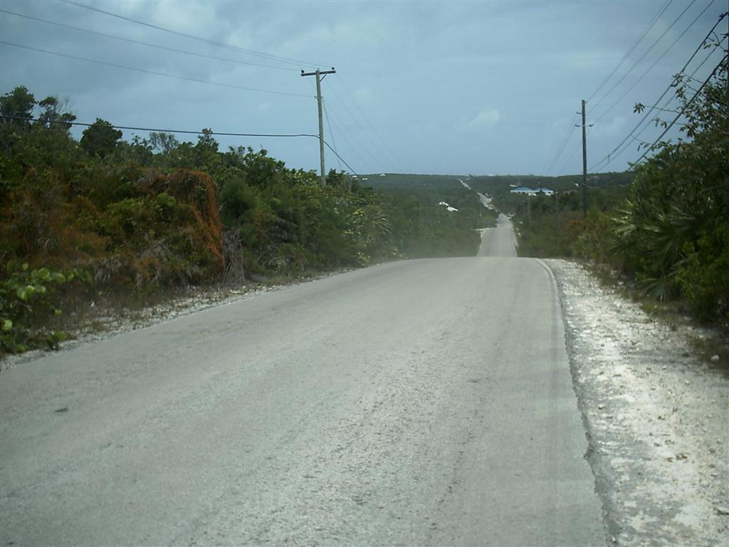
As every island, except for New Providence (with Nassau) and Grand Bahama (with Freeport, which we will probably not visit), Eleuthera would be considered rural by any standards. But Eleuthera has a history of actually trying to support itself with large-scale farming, which has never quite worked out.
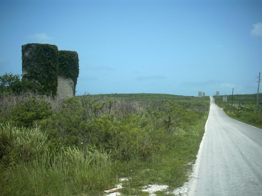
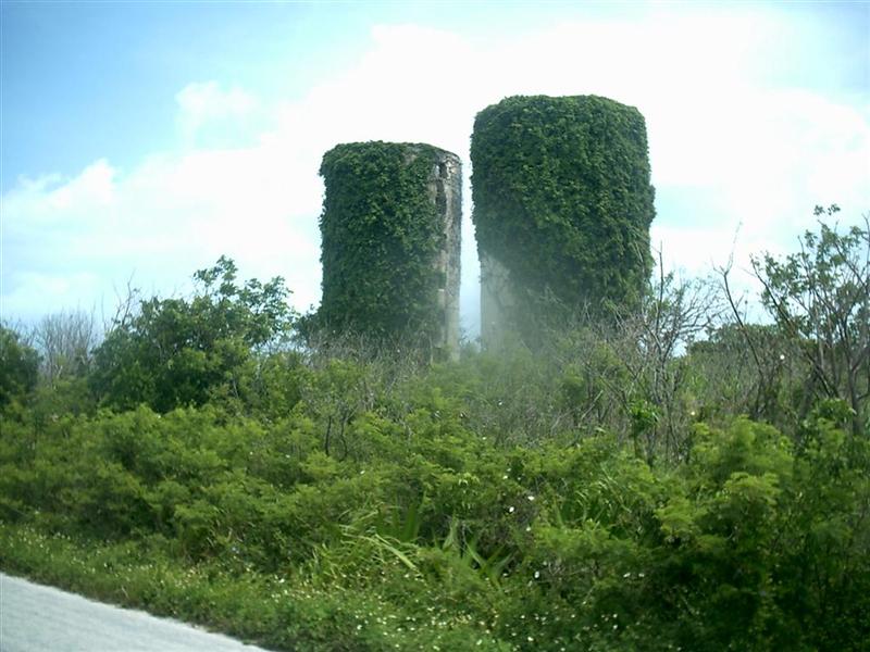
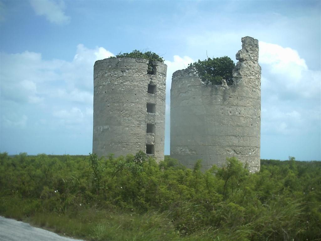
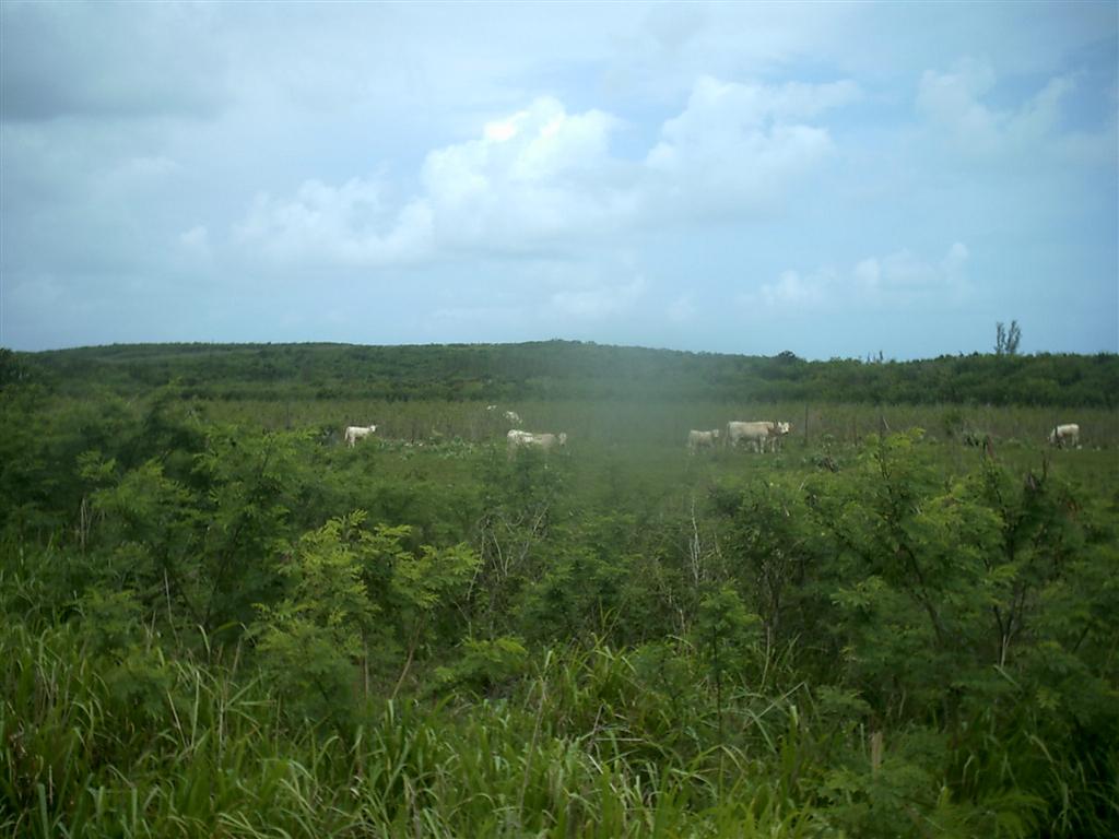
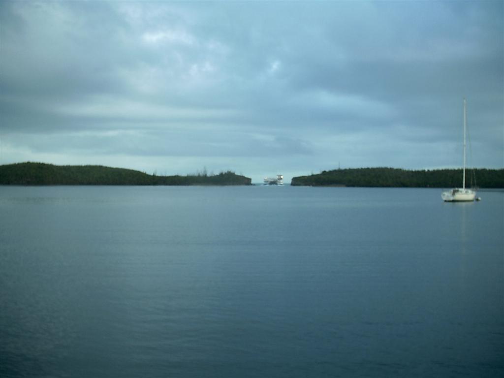
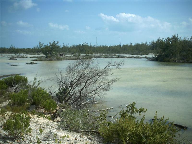
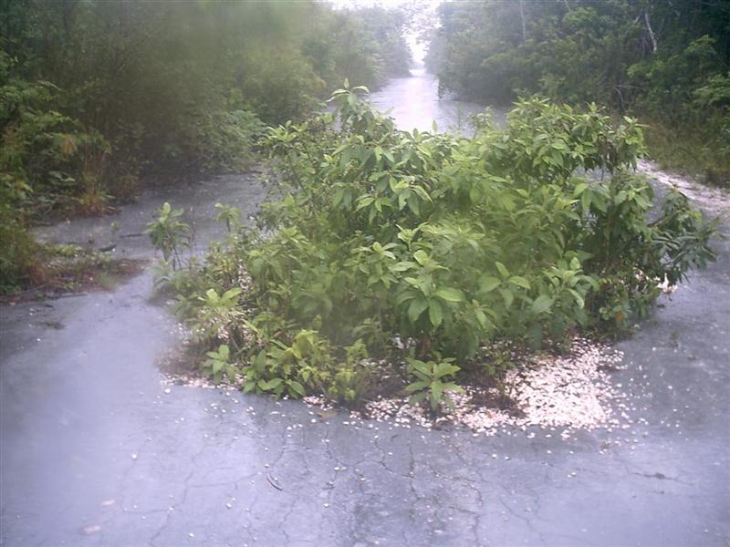
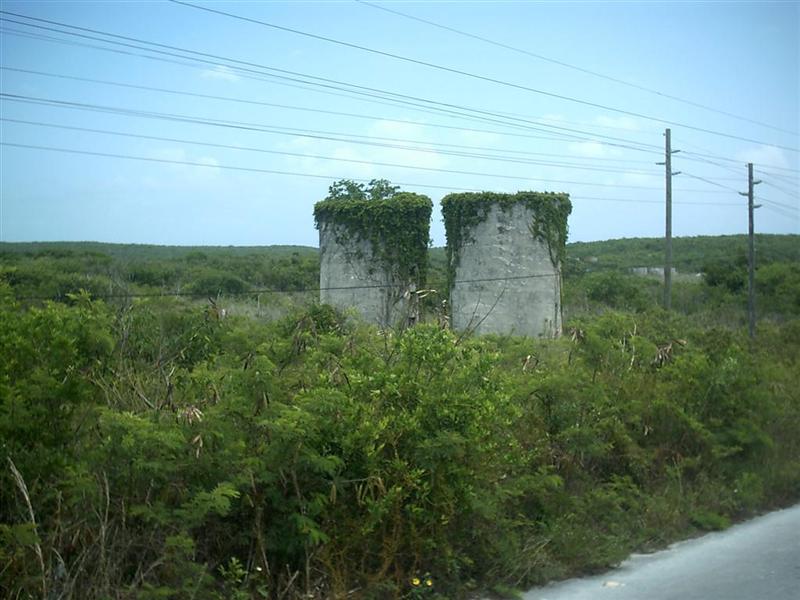
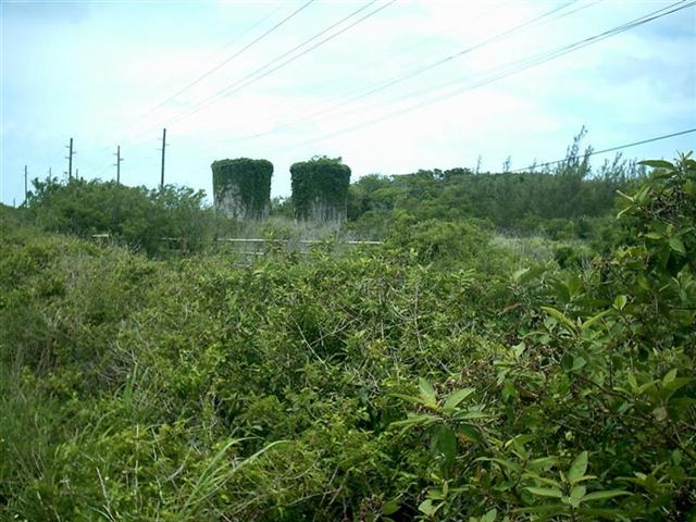
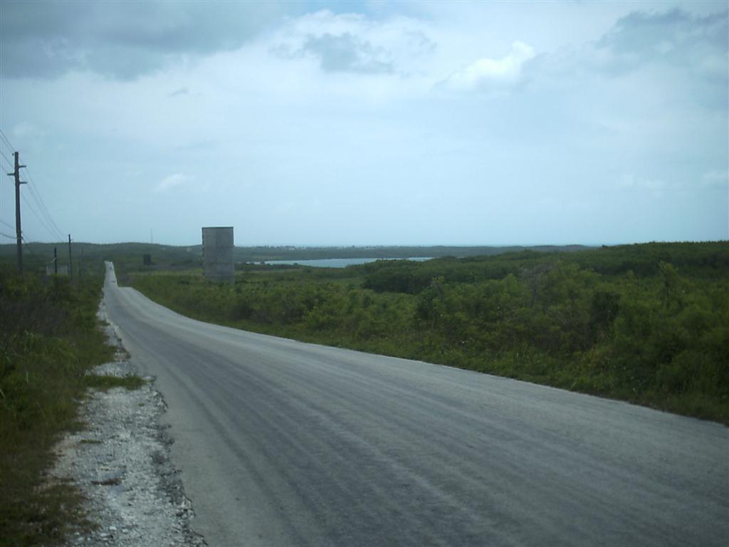
In the 60�s & 70�s, a huge effort was made to raise cattle for meat = dozens of silos were constructed, farm implements for grow feed were imported, land was sectioned off, and hundreds of cattle were brought to the island. Today, the machinery rusts in remote locations, the silos stand abandoned along the Queens Highway, and after cycling EVERY road on the island, my bovine census turned up about a dozen left together from the herd. One more interesting remnant is the Hatchet Bay Pond: a former salt pond where the cattlemen cut through the massive cliff separating it from the ocean on the Bight of Eleuthera, making a snug enclosed harbor designed for shipping & receiving, but now used for the ferry boat dock and boat mooring & anchorage. We enjoyed the worst weather during our visit to Eleuthera in Hatchet Bay Pond.
In the late 20th century, the pineapple harvest was growing significantly enough to allow the export of the fruit. Then a hurricane in 1998 damaged or destroyed the pineapple fields, dashing the hopes of continuing the production of 50,000 pineapples annually. Today, individuals produce enough pineapples to spur the memory of the good years, but the yearly Pineapple Festival in Gregory Town was actually cancelled this year until an emergency meeting saved it just a week before the date. We were lucky to enjoy this Eleutheran tradition, and I hope things continue to improve for the �pines� so there is always a reason to party in Eleuthera during June.
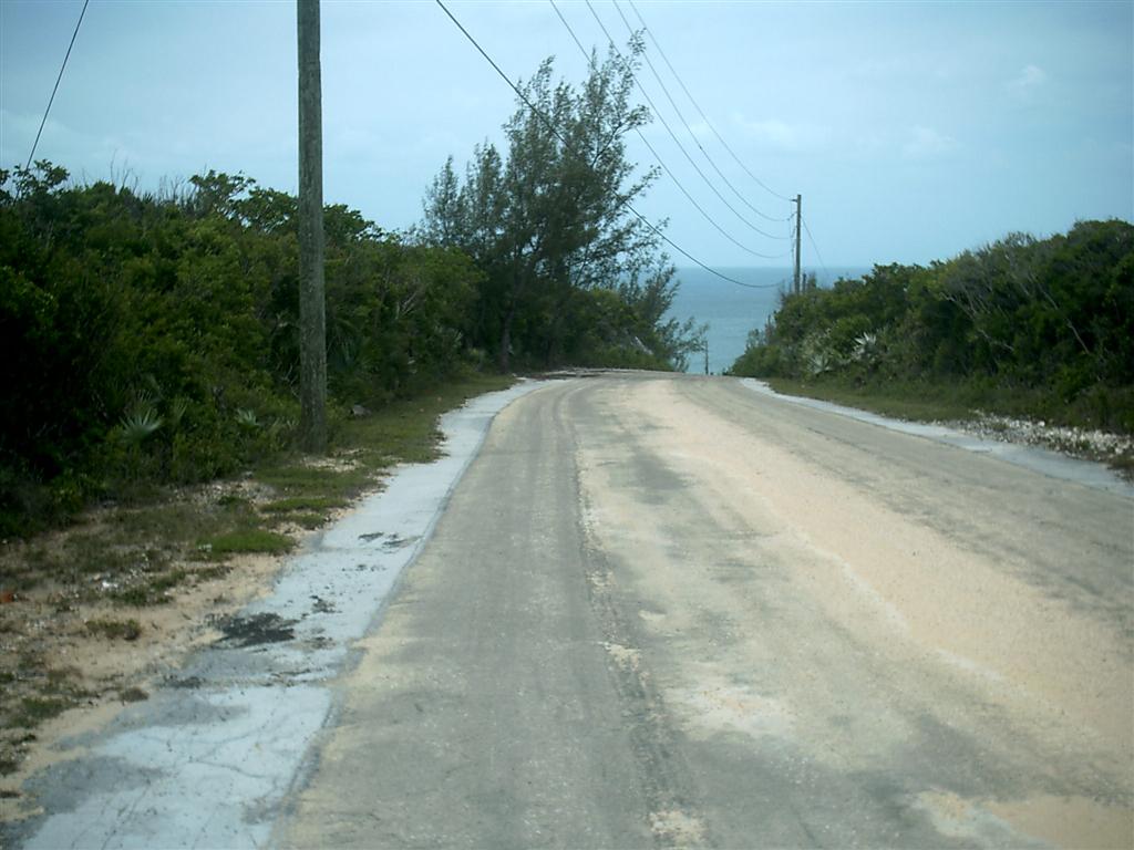
The descendants of the original white settlers of Eleuthera are apparent as you travel south, although more modern white �settlers� increase in number along the island. Several large developments, such as Rainbow Bay, Windermere Island and The Cove, house get-away retreats for the rich & famous. These planned, manicured neighborhoods provided nice roads for cycling the short one-mile stretch across from The Bight to the ocean and back; and stand in contrast to the traditional Bahamian towns where fishing is still king and a slow, country attitude prevails. You will always find British and American expats in these sleepy towns, too.
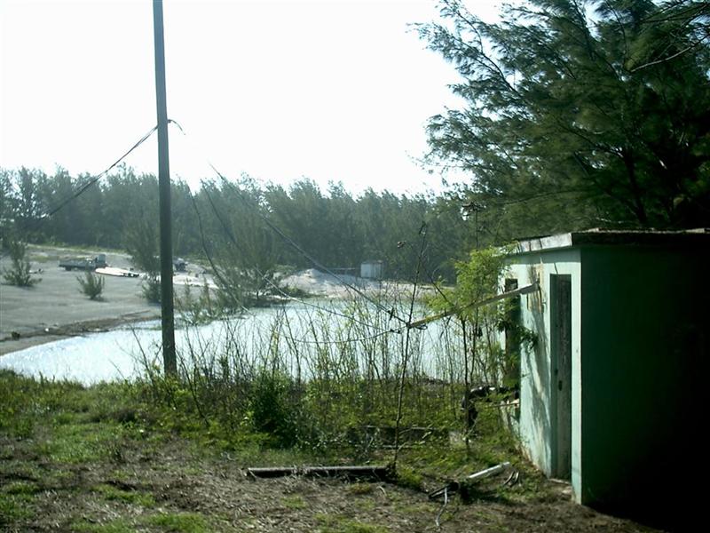
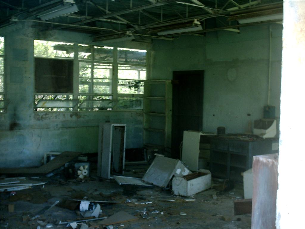
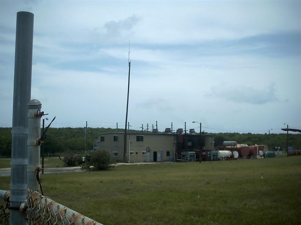
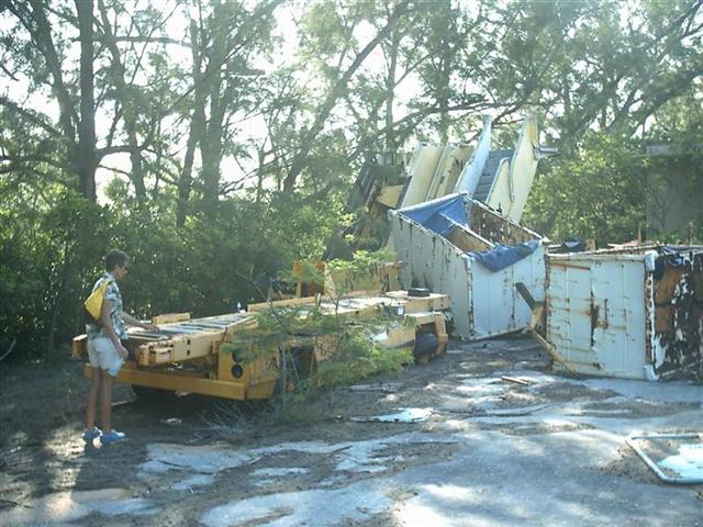
An abandoned US Navy base was fun to explore. It is amazing how the Military/Industrial Complex spreads itself across the globe, and just walks away from a place after they�ve �used� it. The Bahamians did get one gift though = a mile-long runway [and an improved road system] which they are using as Governors Harbour International Airport (remember, EVERY airport in The Bahamas is an International Airport!). They also utilized the roads and paving to place a reverse-osmosis water plant at the edge of the base. That is all well and good, but the buildings the US put there were simply left when they walked away, and are now rotting in-place. Very rude.
%20Airport%20tower.JPG)
The Good Peoples.
Again, Bahamians prove to be the most friendly and
easy-to-get-along-with peoples anywhere. Always cheerful and helpful, their
slower lifestyle propagates only good personality traits. To become a better
person, I am adhering to �The Bahamian Way� from now on!
The Trip.
[click for simple map]
![The Trip. [click for simple map]](Bight%20of%20Eleuthera.jpg)
After passing through The Current pass, we attempted to stay off Lower
Bogue, but the wind was blowing 20~25 knots, the bottom was very hard marl, and
the seas caused us to rock & roll. So instead of dragging across the coast
of North Eleuthera, we motored into the wind and spent two days anchored just
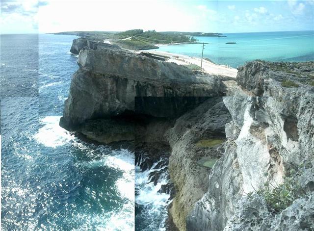
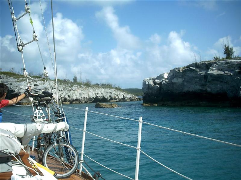
off the Glass Window, an natural bridge that was wiped out by a hurricane a few
years ago. So now it is a manmade
bridge across a very narrow spot in the island that gets wiped out by a
hurricane every few years. The view under the bridge to the other side is where
it got it�s name, for one side is miles-deep ocean all the way to Africa, and
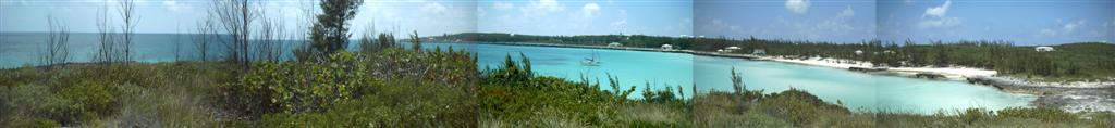
the other is The Bight of Eleuthera, a 15~30 foot deep bank on east of the island.
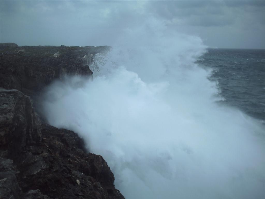
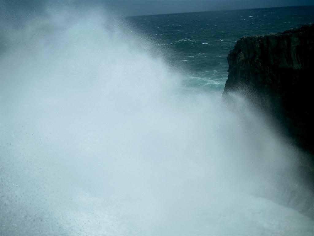
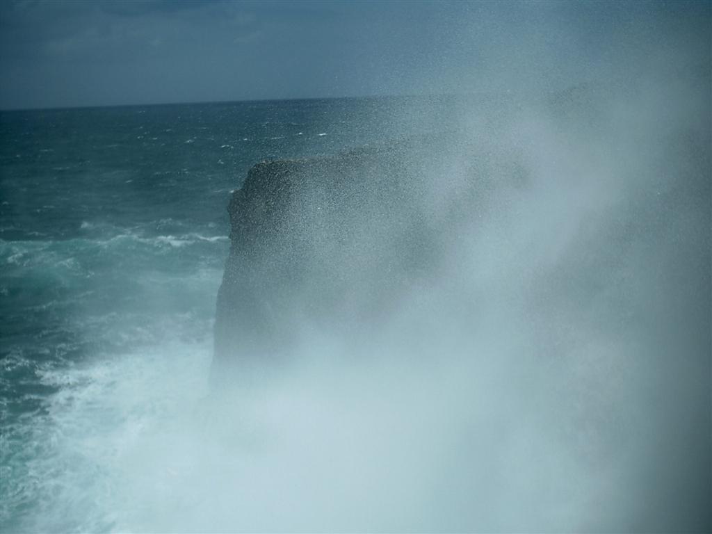
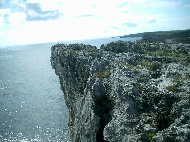
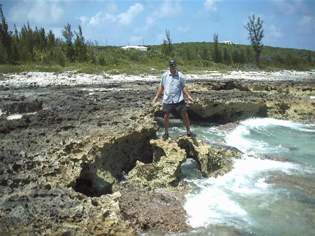
Tremendous forces of
the ocean are tamed by the island, but at a cost of erosion and bridge-replacing!
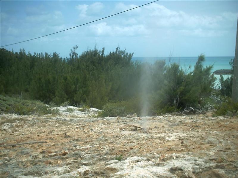
One ocean-side cave is connected to a small hole on the Bight side so that when
big waves crash into
the cave, water mist shoots up out of the hole resembling a saltwater geyser. Other times the ocean calms and
the only difference is the fabulous colors of the water and the sea bottom.
Timing our route to swing by Gregory Town during the Pineapple
Festival, we decided to pass several landfalls and spend a few days in
Alabaster Bay. This is a large open bay with a tiny resort ashore with the
abandoned US Navy base nearby. Hiking and cycling ensued.
James Cistern was the next stop, back-tracking north to Gregory Town.
Here I met Pastor Edward St.Fleur, a Seventh-Day Adventist serving four separate parishes on
Eleuthera. Pastor Ed is originally from Haiti, and has developed a plan to
install and operate the first radio transmitter on Ile de la Tortue, a very
Bahamian-like island 20 miles off the NW coast of Haiti. He has invited Windigo
there to assist with the installation of the power infrastructure for the
station. He will broadcast only good news to the peoples � educational
programs, self-help instruction and advice on how to develop their island to
bring it to a more prosperous level. A big job for one guy, but his wife and
daughters are behind him, and his plan is sound. God bless his effort.
When it got a bit rough on the water in JC (as the locals call it) we
went around the corner to Rainbow Cay. This
tiny islet is actually attached to the mainland, but its name was given to
the largest planned community on Eleuthera. Several miles of roads along both
coasts take hundreds of people to their very
nice homes. The coasts are less than a mile apart, as they are along most
of Eleuthera, so one can see both sides of the
island from one spot!
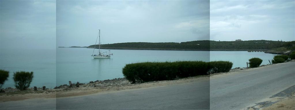
We then sat in Hatchet Bay Pond, only a couple miles from Gregory Town,
for a bit of rest from the rolling in the open anchorages along The Bight.
Hatchet Bay Pond is totally enclosed, and storms that blew through while we
were there were hardly noticed. A calm period in the weather coincided
perfectly for us to move to Annie Bight, right next to Gregory Town. We were
within walking distance from the Pineapple Festival, but I still cycled quite a
bit at every anchorage.
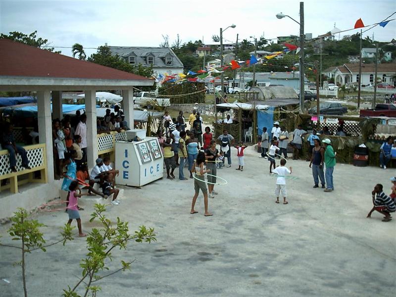
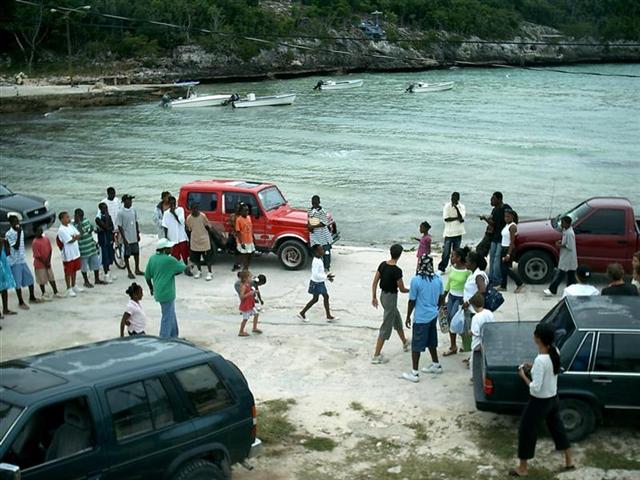
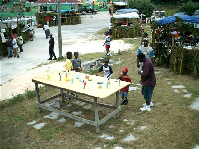
The Pineapple Festival was
a great celebration of the Bahamian tradition of . . . . well, CELEBRATING! The
Pineapple crop is pretty small (we bought one � for $8!) but the Festival
continues with loud music, lots of �take away� food [called �carry-out� in the
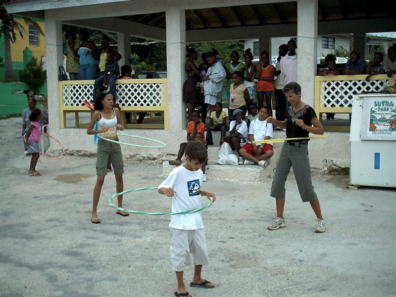
US], and, best of all, crazy sports for the kids. Karin and I assisted with the
games, sometimes having to get involved to encourage participation.
This led to Karin becoming the Hula-Hoop Queen of the
Festival, and my getting on national TV with my apple-bobbing prowess. Although
the hula-hoop thing actually required a skill,
the only thing needed to start the kids apple-bobbing was to be from Wisconsin;
you see, the apples were floated in ice-water, and Bahamian children have no
experience whatsoever in placing their bodies in ice-water. I just pretended I
was at Bradford Beach on Lake Michigan on a nice summer day . . . the kids were
amazed, and soon all were braving the frigid waters for an apple! And now, I am
recognized throughout the country as the guy crazy enough to stick his head in
a barrel of ice-water.
Karin and I helped with the egg
race, ring toss, and other games for the kids
while enjoying the food, music, and Bahamian
atmosphere always present at these events. We seem to hit each island at
EXACTLY the right time: Andros for the first Regatta in the series; Chub Cay
& Harbour Island for the biggest fishing tourneys of the year; Nassau
during national elections and a change of government; and now the Pineapple
Festival. One lady in a government office told me they were arranging it all
just for us � that�s not far from the mark to describe Bahamian friendliness!
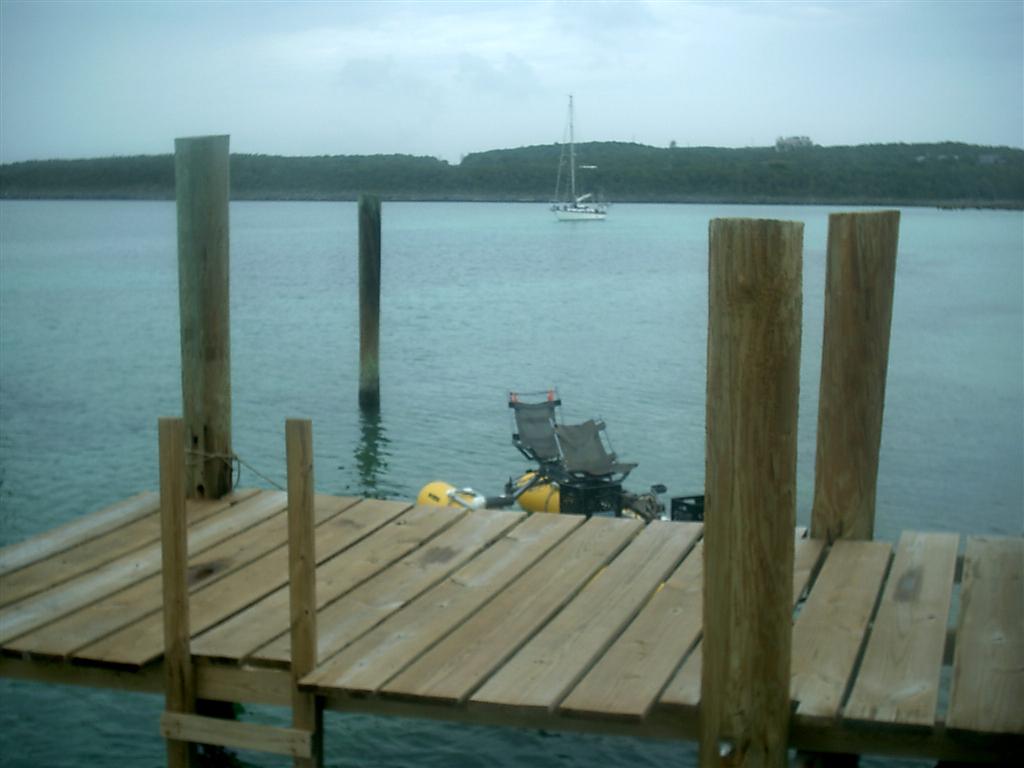
Another four-day stay in Hatchet Bay Pond to let the weather settle,
and then on to Levi Island, a couple miles north of Governor�s Harbour. We
stayed tucked between this rock and the shore to let the weather continue to
veer, and made a Pedigo visit to the Harbour. Unfortunately, it was during this
fairly long trip that the seven years and hundreds of miles took their toll on
the pedal/shaft drive/propeller system of the Pedigo. Losing ability to make
way with the drive, we drifted to shore and found two stubby planks with nails
to paddle ourselves home. As tired as I was upon returning, I still managed to
spend the last hour of daylight to strip down the drive unit and identify the
stripped coupling deep in the bowels of the mechanism. Machining a Craftsman
socket to replace the worn part took the rest of twilight, and the mosquitoes
attacked ferociously. Reassembly had to wait until morning! [the repaired drive
is still working, but may be on its last leg = I AM SEARCHING FOR A
PEDAL-DRIVEN PROPELLER ASSEMBLY TO USE ON PEDIGO � IF ANYONE CAN DIRECT ME TO A
SOURCE, IT WOULD BE GREATLY APPRECIATED.
Our time in Governor�s Harbour was spent in the library, on the bikes,
involved in boat projects, and sending out the eletter. Then the birds came.
See �Wildlife� below.
We looked to anchor off Tarpum Bay when we left Governor�s Harbour, but
could not get within a mile of the beach and the bottom was very smooth, hard
marl, so we bopped around the corner and anchored in the open on the other side
of Tarpum Head.
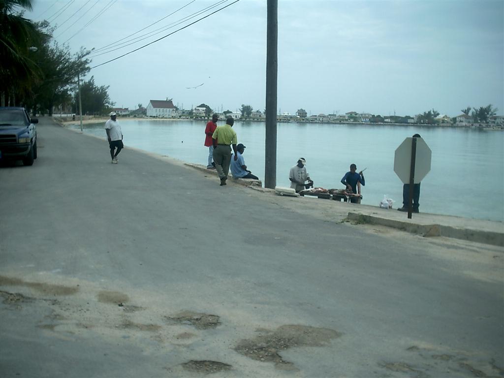
It was a short trip to Rock Sound because in true Captain Bahamas
style, I took an unrecommended inshore route through the coral heads off Kemps
Point. We entered and anchored WAY close to shore in Rock Sound without incident.
This is a very nice place, about as far south as an anchoring sailboat can
cruise in Eleuthera. It was a long bike ride to the southern tip(s) of
Eleuthera, but I made them both on the same day, visiting the �cruise ship�
city of Bannerman Town and the Cape Eleuthera area.
Bannerman Town is only inhabited when the giant cruise ship comes and
the guests flood the sham village to ride jetskis and buy trinkets (probably
brought aboard the cruise ship!) and eat lunch. Cape Eleuthera is 20 miles to
the north across the whale�s tail-shaped end of the island, and has two notable
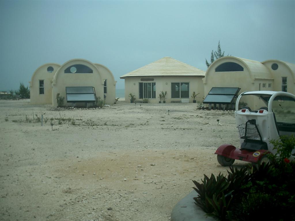
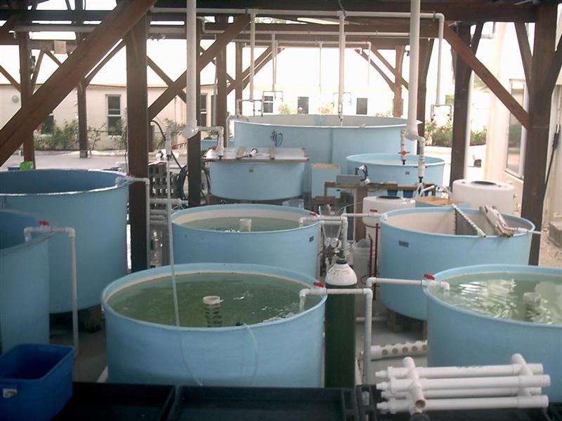
landmarks: the Cape Eleuthera Marina [very nice] and the Cape Eleuthera Institute (CEI) and
Island School.
CEI and the school were started by the same guy, but now have different
staffs but combine their efforts into a very unique encounter for 50 different
high school students each semester. Kids (mostly from America) pay big tuition
to spend a semester (for credit) away from their school and country and
experience! Here at the Island School, they still get some readin�, writin�,
and �rithmatic, PLUS they come together in groups of six to do REAL science.
The research is usually marine-based, and involves vast real-world experiments
with hydroponics, laboratory
studies and deep-sea trials.
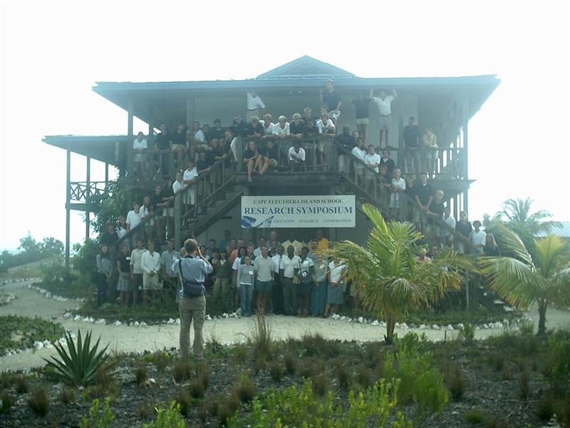
I attended the semester-end
report presentations [again at-the-right-place, at-the-right-time thing]
and saw (and learned!) detailed presentations of cobia breeding in a cage 150�
across and 90� deep in the ocean to provide food for island residents; the
effects of utilizing modern farming techniques in the raising of traditional
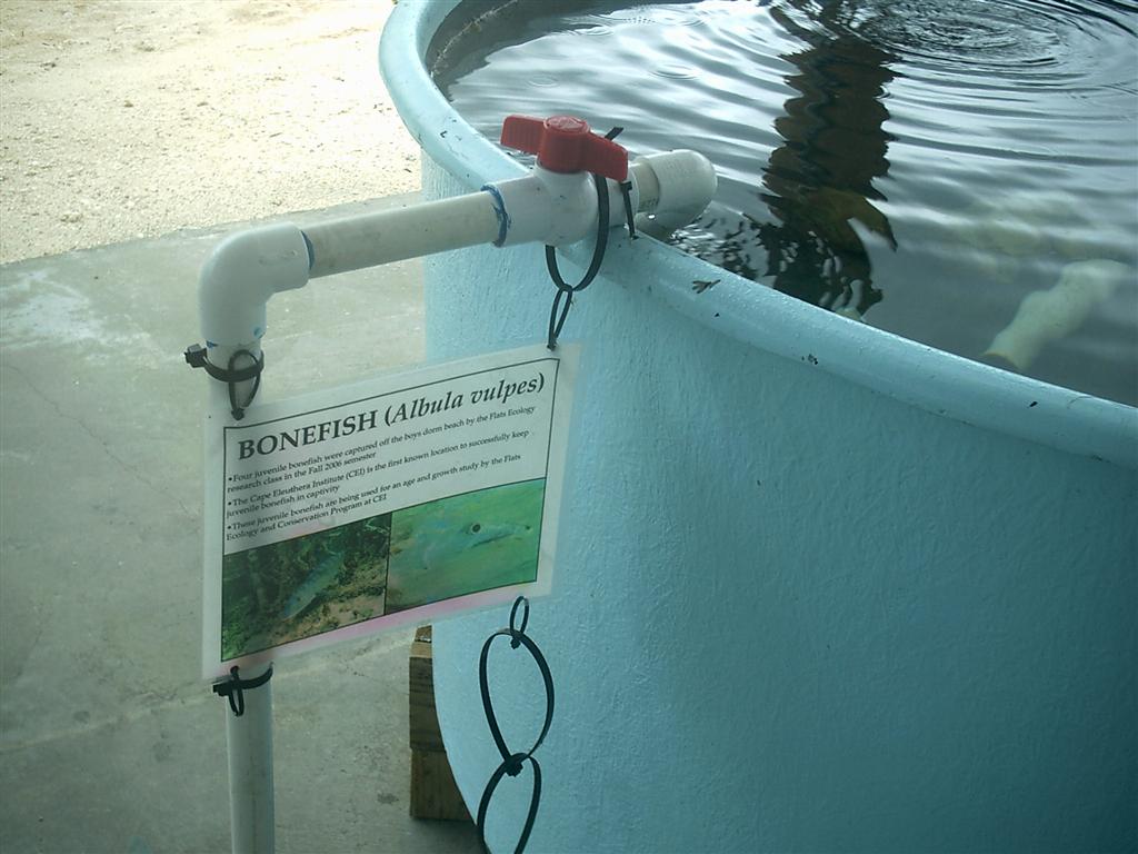
bush-medicine plants of The Bahamas; a detailed bonefish study
which involved raising bonefish fingerlings in captivity, the first time it has
ever been done successfully; and many more projects, each worthy of several
pages in Scientific American. This is all done by high school sophomores and
juniors!
The lives of these kids has got to be affected by this experience, and
the results of years of this school alone will be felt on a global level.
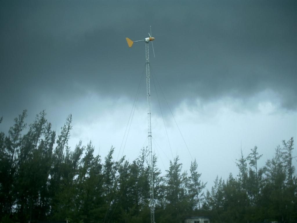
The CEI has full-time researchers practicing renewable energy
deployment here in The Bahamas. They have installed solar-heated water systems
throughout the islands and are researching wind-generated electricity.
These are incredibly important fields of study and will only become more
prominent in the coming years. Just as the cattlemen tried to improve the use
of the land, increase the standard of living, and expand the Bahamian economy,
CEI is daring to utilize renewable technologies to the same intended outcome.
There have been successes in this
very young country, and it is great there are those still willing to try
new things.
The Bahamas really has the conditions to be 100% operated on renewable
power, probably the most significant country to have this opportunity. [they
have a low per-square-foot-usage, lots of sunlight, and enough trade winds to
power their infrastructure.] Right now, every community and settlement builds a
diesel-powered electrical
generator plant on the outskirts of town, and distribution is the cheapest
way = above-ground and VERY prone to damage in hurricanes. It is a good system, but not truly
reliable. Distributed, renewable power production would leapfrog normal US
�grid� reliability and cut maintenance costs substantially.
Windigo is starting its seventh year of being entirely run on renewable
energy. Pastor Ed wishes to run his radio transmitter on Ile de la Tortue,
Haiti with renewable power, as there is no infrastructure on the island. Free
power is cool!
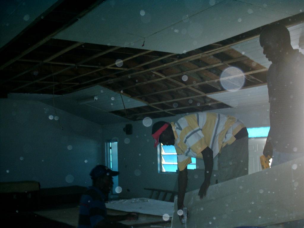
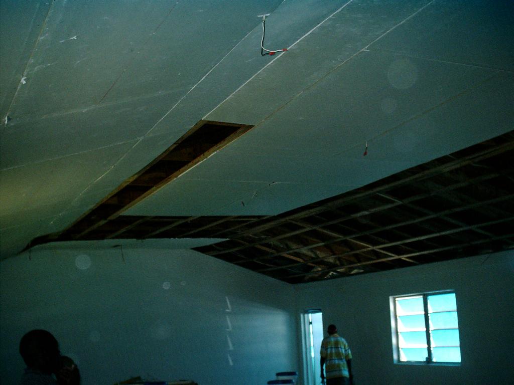
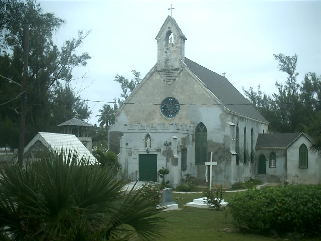
Speaking of Pastor Ed, I was reunited with him as he and some
parishioners were renovating his church building in
Rock Sound I pitched in with moral support and some electrical work (those boys could really hang drywall!).
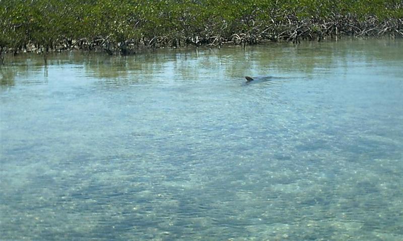
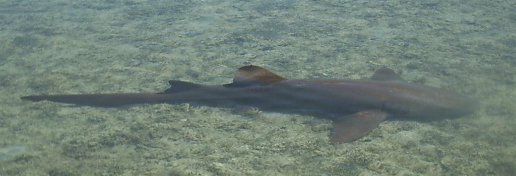
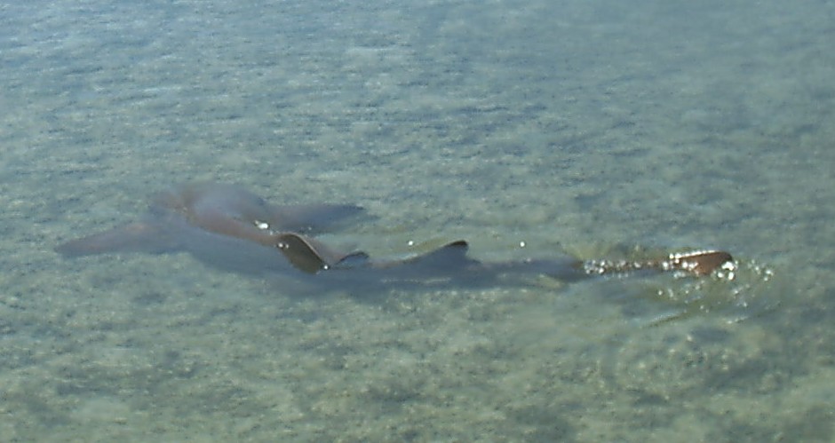
The Pedigo repair was thoroughly tested with a circumnavigation of the
Sound; during which we happened upon several 6- to 8-foot sharks in the
shallows. Thinking they were relatively docile nurse sharks, we lingered nearby, snapping
photos and watching their antics � one even swam some distance
upside-down. A reference book check, back aboard Windigo, revealed that
they were in fact lemon sharks, a very similar fish in appearance and activity
to the nurse shark with only the slightest variation of fin shape, placement
and coloration. To Karin�s consternation, it turns out there are big
differences in their disposition and tooth structure = nurse shark have rough
�sandpaper� teeth and lemons have full-fledged triangular shark�s teeth and can
become �quite
aggressive when approached�. So, was it our innocence or ignorance that
kept the lemon sharks calm even though they were shepherded by the Pedigo crew
for a half-hour?
After saying goodbye to the folks at Dingle�s Motors, we sailed away from Eleuthera
and across Exuma Sound.
Wildlife.
Typical of the islands, there are no large
land mammals other than a few dogs. Lizards, birds & bugs make up most of
the fauna ashore. It is amazing that I have not seen one rat since entering The
Bahamas, even in the ruins of
the old Navy base [they all left when it closed . . . ?].
But we had a serious problem in Governors
Harbour and Rock Sound = a couple birds decided to attempt roosting on the top
of Windigo�s mast. These were nasty, blue jay-type, boisterous, aggressive, and
full-of-poop birds. There efforts were completely thwarted by the gusty winds
and movement of the masthead, but they persisted on bringing hundreds of sticks
and dropping them on Windigo�s deck. This was NOT the only thing they were
�dropping�, either!
Now I LOVE nature, and when a person lives
outside most of the time as we do, WE must accept nature�s ways, but for crying
out loud, �Your damn eggs would NOT be safe up there, and the acid in your
waste is ruining the finish on the wood and fiberglass of my boat! Get the heck
outta here!�, I yelled. Then I shook things, rattled things, and pounded on
things. Karin made a �scarecrow� out of a large orange fender by putting
reflective �eyes� on it. We played music loud enough to make every other
creature keep a mile from the boat, but the birds returned with more sticks. To
stay a couple days longer in Governors Harbour, I went up the mast and put a
large black plastic garbage bag over the entire masthead. That was pretty . . .
We were rid of them when we left, only to
encounter them [the exact same birds???] again in Rock Sound. We cut our stay
short and just left! No solution was found as killing the little pests was not
an option . . .
Other Activities.
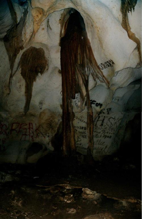
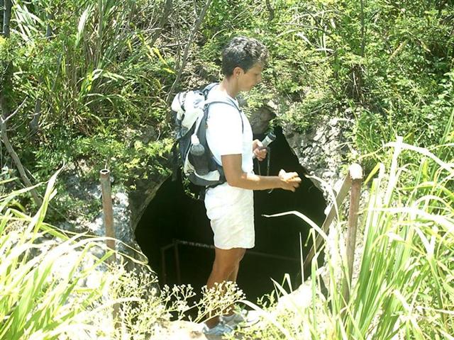
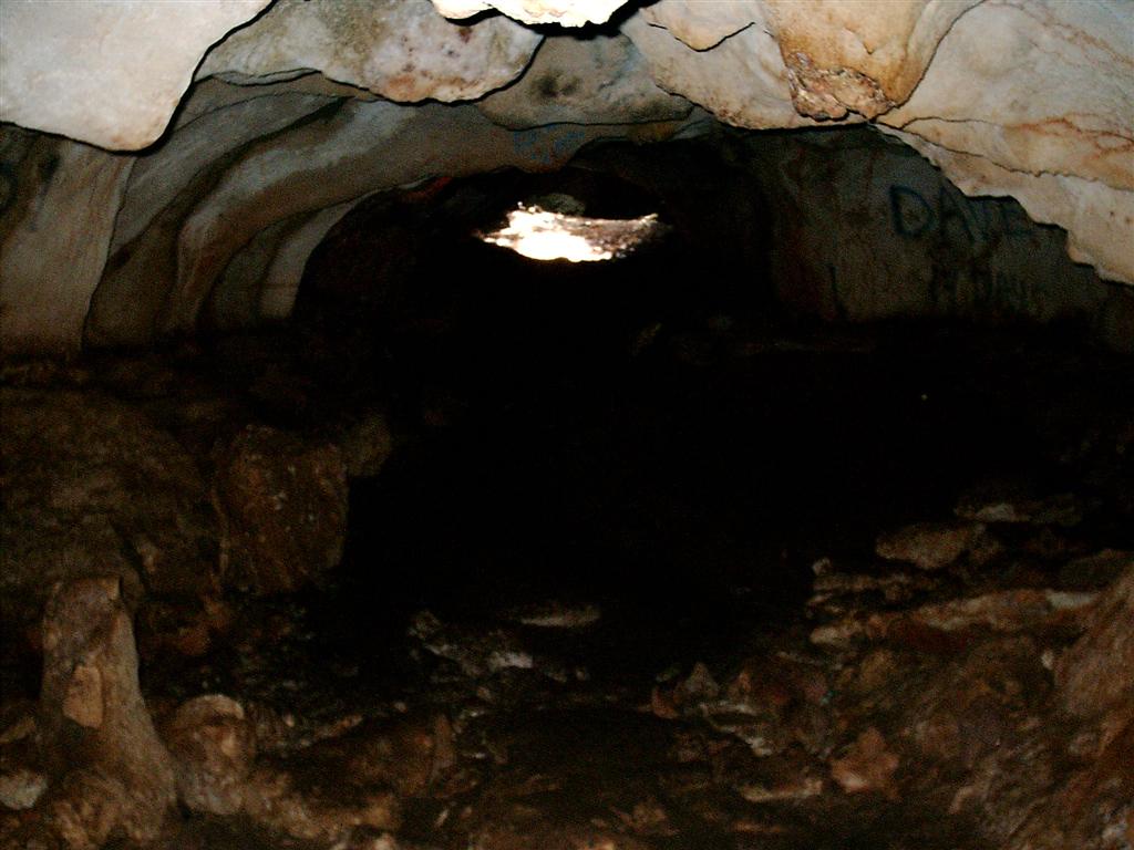
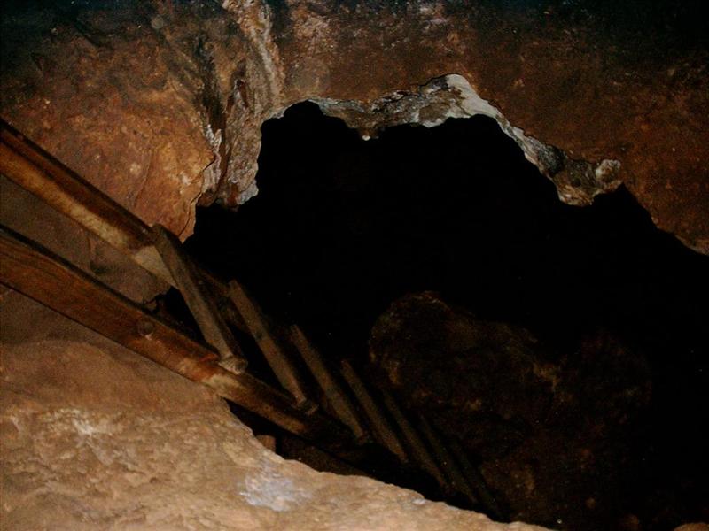
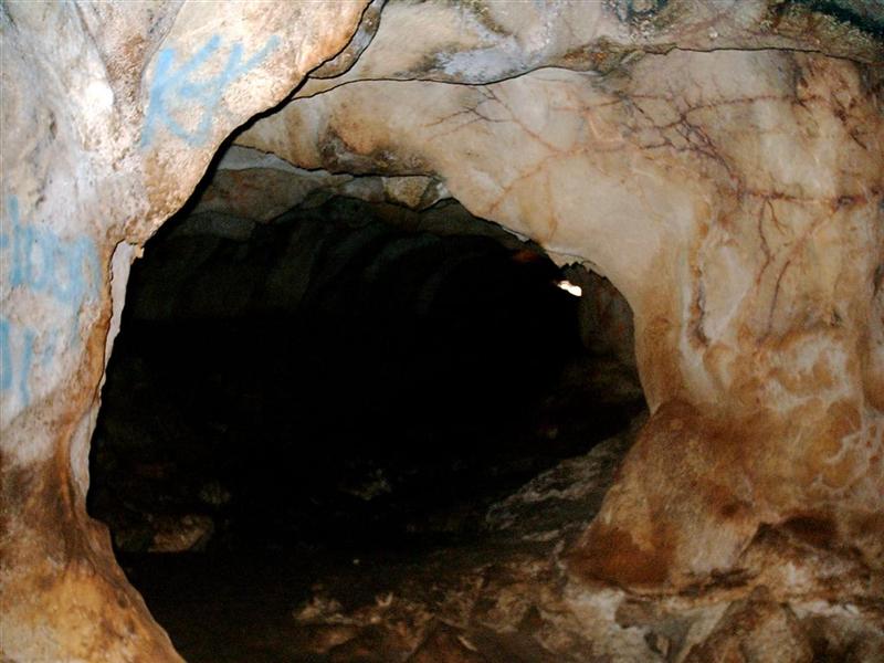
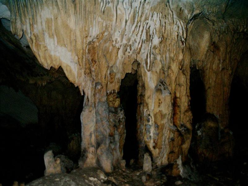
The long weather-waiting stays in Hatchet
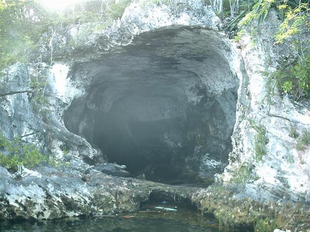
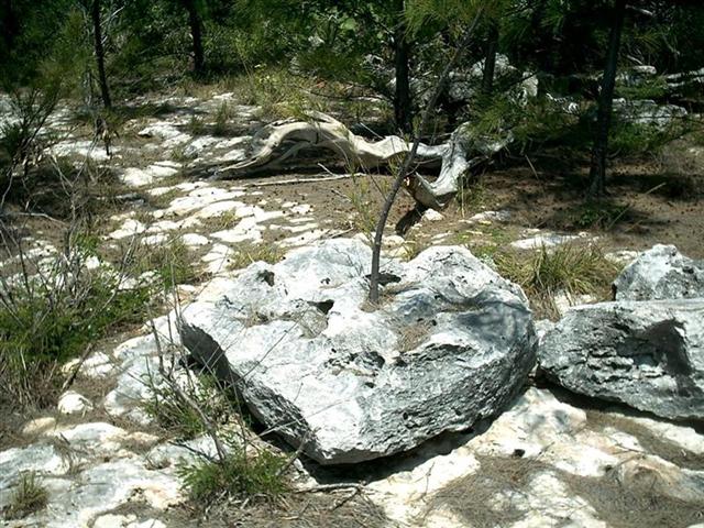
Bay Pond gave us an opportunity to explore a few of the caves in the
area. As you have read in these eletters about Bahamian geology, there are
hundreds of places eroded by wind,
rain, and waves to make caves, ocean holes, blue holes, and boiling holes.
The �Hatchet Bay Caves� are
just north of town, and totally undeveloped. You are definitely on you own
here.
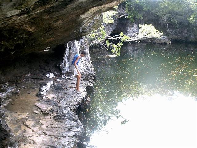
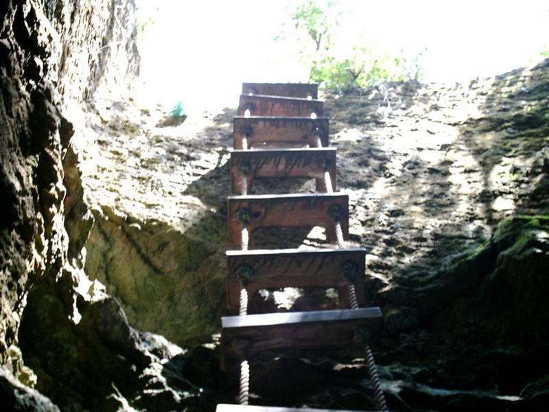
Karin�s loathing of small, dark, damp
places along with a good dose of claustrophobia usually would keep her from
spelunking, but after I toured the cave from end-to-end, and reassured her is
was mostly dry, easy to walk, and very cool � along with giving her the
brightest flashlight from Windigo and being glued to her side, she wished to walk the cave. So we started at
the �tough end�, climbing down a rope ladder to
walk the 1500� subterranean feet to the east exit at the other end. She didn�t
mind the ladder, hated the 30�
part where we had to crouch down, loved
the structures along the way, would not EVEN consider going into a side route (wet) and was glad to
have done it, but even more
glad to get out. Going backwards from my first trip through did lead to one
spot where I led her around stalagmites in a weird
direction and felt disoriented myself. It took all my Captainly prowess to
sound confident in answering her, �Are you sure this is the right way?�
questions. Luckily, I fooled us both enough to eek through until the main path
was evident. All-in-all, very similar to riding bike in the Milwaukee sewers
with my friends Marty & Pete. J
Girlie Stuff. [A NEW ELETTER SECTION!]
These eletters change according to the whims and needs of the Windigo crew = one half of the crew has decided that she now has enough time in her busy schedule to write a section on the woman�s point-of-view. She is not new at this, if you look back you will see she wrote an entire eletter during our prolonged stay in Mobile, AL. Also, being a female, she is better qualified to express feelings than I. So I will stick to writing about the political, geographical, geological, nautical, and physical world of Windigo; and Karin will expound on the psychological aspects of living on a small boat . . with mostly only one other person . . that you love dearly . . but if they do that ONE MORE TIME, I swear I will . . . .
Eleuthera was the place
where I spent a lot of time by myself (Kevin was off doin� �Kevin stuff��see
above details), reflecting on �why am I here and what am I getting out of
this?�� I was free to just sit, think, take
in the beauty around me with good music playing in the background � all MY
decision, all in MY timeframe. A chance to figure out my real feelings for this
lifestyle we�d chosen.
I�ve always had others
around and lots of �things to take care of� so I never had time �to find
myself� as they say. But HERE was the place and I was going to take advantage
of it. I truly love & miss my family and friends and think about them often
(everyday in fact). But living on this particular boat, with everything I own,
and with someone who I believe truly cares about me and our safety is pure
heaven. This lifestyle is a once in a lifetime experience that I have been
blessed with.� I admit that I don�t do
well with change but now I adjust eagerly to each new place. There are
advantages to having people around or just being all by myself!
As far as sailing is
concerned my confidence with the Captain�s abilities and my own has really
grown. Bottom line is that he is a good sailor! Because of that fact alone and
the constant traveling from anchorage to anchorage caused me to feel more
competent in my own abilities as crew. Most anxieties subsided and because I
stayed extremely calm even during the worst storms we came out shining! What a
great feeling of accomplishment.
So Eleuthera is a quiet
change for me and I�m loving it. I hope that I can become a better person from
all this; a bit more calm, patient, and tolerant (for those who know me � cross
your fingers!). I admit my memory is bad but I try to remember one quaint
incident from each place we visit so when Kevin says �do you remember��.I can
honestly answer YES! with a smile. Eleuthera will be remembered as the place I
discovered ME!
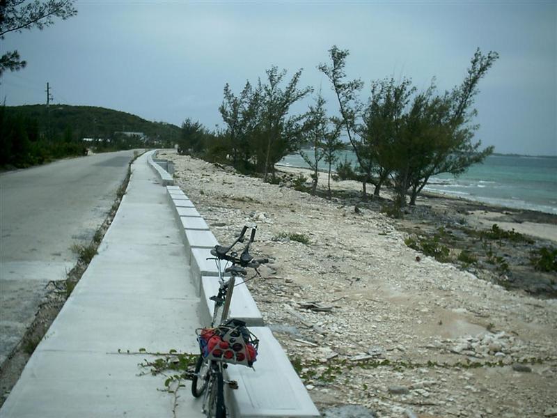
Cycling Notes.
I visited Central Eleuthera from the anchorage at Harbour Island when
we went ashore on North Eleuthera. I rode across the Glass Window and to
Gregory Town to check out the status of the Pineapple Festival. The layout of
Eleuthera made scouting the next couple anchorages easy by cycling down to
them. Karin and I rode out to The Current to see that before sailing through. A
procedure common when whitewater canoeing, this scouting reinforced my ability
to �read� the charts and envision the harbors and anchorages, giving me a great
deal of Local Knowledge, an important, if not THE most important sailing
information.
Besides the much needed exercise and the ability to scout future ports,
cycling has been the absolute best way to actually SEE
these islands. The slow pace and exposed nature of bicycling through towns
puts me in the same class as people walking or even sitting near the road and
encourages communication. Making time between cities along the highway allows
me to be �traffic� and interact with other traffic. By the time we actually
anchor somewhere, everyone in town know our names and where we are coming from
� physically and mentally. Friendships are easily made and quickly reinforced
through multiple encounters on the road, in town, and on the water.
In Eleuthera, there was no way to see the Cape Eleuthera Institute and
Island School without staying in an expensive marina or renting a car to drive questionable roads WITHOUT the bike! Cycling
has allowed us to be in the right place at the right time and enjoy remote and
interesting destinations without trying to get Windigo�s seven-foot draught
into difficult or uncomfortable places.
The landscape of central and south Eleuthera
reminded me of Wisconsin just as north Eleuthera had. The long tours I took
in Eleuthera allowed me to absorb and fully understand and appreciate the Silos of Eleuthera. Rather than an oddity, European estates,
or strange navigation aid, I saw each one as a
hopeful business endeavor; now a testimony to the tough life on these islands
and the willingness of a few to challenge the status quo.
After raking up 600 miles bicycling
Eleuthera (plus 140 miles on Spanish Wells and Harbour Island) my Bahamian
total is now 1540 miles. We will be passing through Nassau on the way to
receive my daughters family on Andros, so I will rack up some more miles and
experiences there. Then my friend and fellow ultramarathon cycler Cliff
Philpott is visiting and I�m sure we will tour many settlements there [but no
marathons are planned, ultra or otherwise!].
Cruising Notes.
Now the last breath of the seasonal change
weather was passing us - fronts moving off the US colliding with westward
moving lows attempting to become tropical. Way too early for the latter, but it
stirs things up and we were �warned� not to be along the
"unprotected" Bight of Eleuthera at this time of year (we always were
finding plenty of protection, although we have had a couple of bumpy nights).
The first place we attempted to anchor was
Rotten Bay off Upper Bogue. Although a beautiful spot and a decent resting
place in settled weather, is was �rotten� for us in the passing blow, so we
moved on to the Glass Window which
was just fine when we tucked in real close to shore, 2000� south of the bridge.
The voyage down to Alabaster Bay was
accomplished in the ENE wind by hugging the cliffs of the shore. Although only
about 30� high, they provided enough protection to accommodate calming the seas
and taming the wind. Anchoring in the extreme eastern portion just off Coco
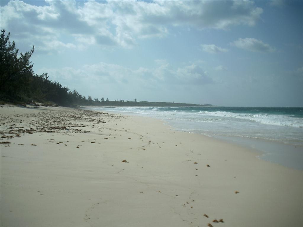
DeMama�s Resort we lay very peacefully just a short hike from the US Navy base (good exercise!). The beach
there is very fine for just walking, lounging or snorkeling and there is
abandoned oil depot for exploring (interesting lack of security concerns, even at
this commercial installation).
We tried two places in James Cistern: the
east end by the jetty, and the north end by the Eleuthera Bible Training
Center. Both were a bit uncomfortable even with considerable northern component
in the wind. It would be untenable in a strong SE wind. We found peaceful
refuge just west of Rainbow Cay where even
Windigo could tuck close in to shore. This is another nice beach for just
walking or snorkeling and the tiny ironshore Cay
is nice for exercise and exploring.
By far the best protection was in Hatchet
Bay Pond with its 90� wide
entrance and deep waters. The anchorage is closer in to shore than the
moorings, just off the boat ramp and marine RR (a good place to lock your
dinghy). We actually made our second entry with quite a swell from the SW, and
it wasn�t too treacherous. . .
Annie Bight is just north of Gregory Town
and the walk to town is short if you walk south along the beach then go up the
trail rather than going immediately inland up the big hill.
Levi Island has room around the back side
to offer protection from SW wind and swells that you can�t find in Governor�s
Harbour (unless you block up the main dock!). It is a short dinghy ride to the
dinghy dock right in front of the clinic, which is a great place to anchor in Governor�s Harbour. You can get less than
200� from shore just 300� north of the
sturdy dock. Stores, expensive fuel, historic
churches, and a great library are all between the dock and the end of
Cupid�s Cay. [Free wireless i-net in the gazebo outside the government
building.]
Tarpum Bay and Tarpum Head do not offer
much for anchoring deep draught vessels, but in calm weather, we anchored off
the Head until daylight allowed us to work the reef into Rock Sound. Do not
navigate through known or suspected coral reefs or heads without the requisite
skills of knowing what to expect from an area from just seeing the chart
[special perception is good]; sailing by the color and texture of the surface
of the water; being aware and compensating for tidal currents; and timing the
angle and heights of sun and tides, respectively. These skills are not learnt
from a book, but must be studied and examined from the deck and rigging of your
moving vessel. [When my son performed in Carnegie Hall, I asked him on the
phone for directions on how to get there, and his most correct and clever
answer was, �Practice, practice, practice.� Smartass 13-year-old took after his
dad . . . ]
Rock Sound is deeper than the charts say,
and I couldn�t find the elusive �Submerged coral reef� noted on some older
charts. Anchor as close as you can get to the very
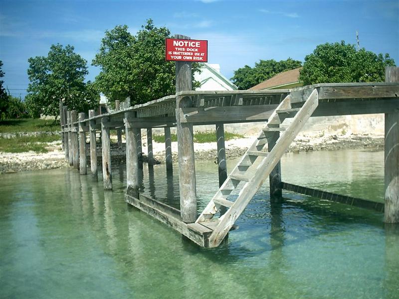
tall dinghy dock opposite Dingle Motors; they built it there just for you!
How different than many places in America, and MOST places in Florida = instead
of discouraging, outlawing, or overcharging cruisers for docking their
dinghies, here in The Bahamas every place welcomes you, and some go out of
their way to provide beautiful docks, quays, and beaches for our use. [Be sure
to thank them and try to patronize the store (great ice cream!).]
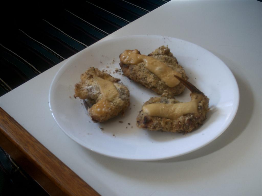
So just like these conch steaks, I hope you�ve enjoyed this
eletter, but now it�s all gone!
See where Windigo
has been:
http://shiptrak.org/
Enter Windigo's
callsign: W3IGO
Where we are right
now:
Our permanent and
EXACT address:
Capt.KL &
Karin Hughes
S/V WindigoIII �
PMB 365
88005 Overseas
Hwy. #9
Islamorada,
FL� 36033-3087
Text-only Email
addresses aboard Windigo, checked daily:
[reliable
communication]
Email addresses
checked when at a land-based computer
(infrequently, but
good for attachments):
And of course, the
Windigo Travelogue Catalogue: