Hi All~
This Eletter, THE GREATEST OF
ALL IN SCOPE AND VOLUME, and all the fantastic photos of storms, critters,
& vast varieties of vogue, vivid verdant and virid vistas for voyeurs of
varying valetudinary vanities; the voluminous vanguard of voyaging vagabond
valkyries vindicating visceral viewpoints of viable value; and venues
vouchsafed vivaciously for vacationing and visual vestige of virtuous vitality:
<http://www.ciekurzis.org/Family%20Islands/Family%20Islands%20Part
I.htm>
Family Islands - Part I
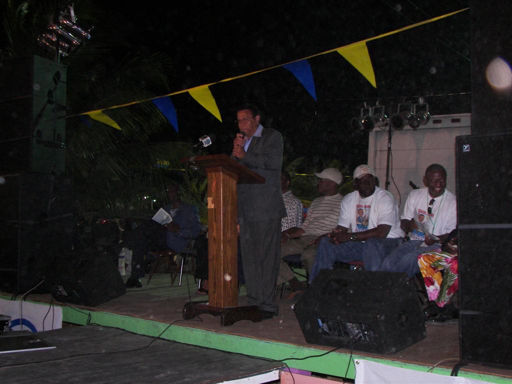
While
in the Bahamas, many times political
speakers have referred to an area as the "Family Islands". They
have done this in Andros, Eleuthera, Abaco, and elsewhere; trying to make the
places sound quaint, local, and friendly. I have not seen a distinction for the
term, as many of the places, albeit remote, were obviously set up for tourism
and commercial activities. I have now seen the origination of the term and its
true applicability. The cruising guides (US or UK produced) and the weathermen
call them the "SE Bahamas" - simply describing their relative
location. Others refer to them as the "Out Islands" (again, a term
thrown about loosely - businesses in Nassau are named that, also), but these
places are truly islands of the family. Not completely 'untouristed' but where
a tourist is still a valued novelty; islands where the economy is dependant on
the family business of fishing, farming, construction, government affairs, and
various other local activities. [The Government actually defines ALL Bahamian
islands other than New Providence (& Paradise?) as the "Family
Islands"!]
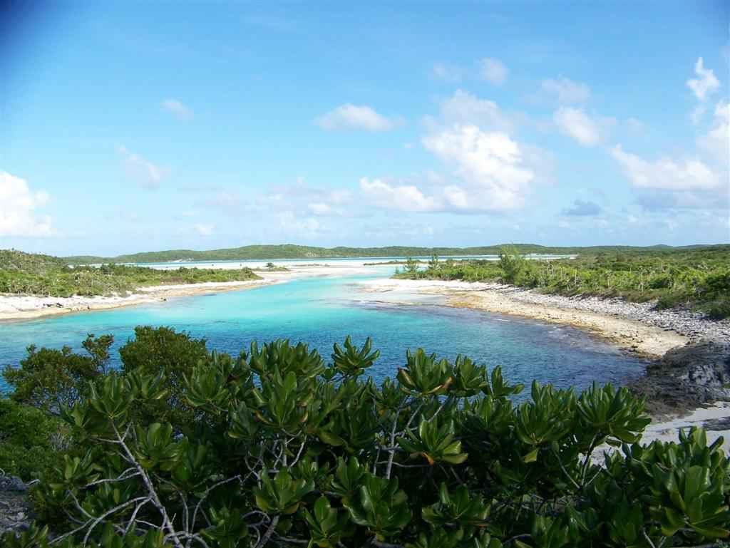
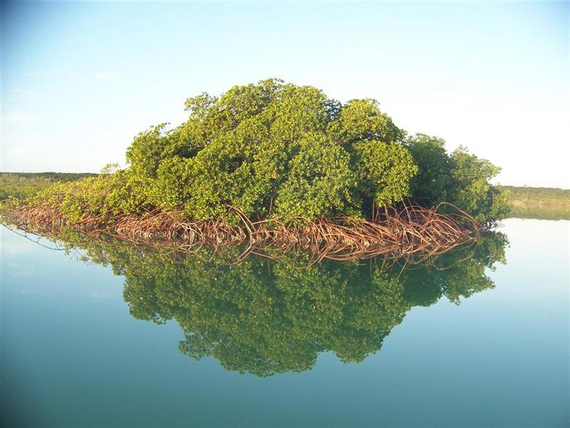
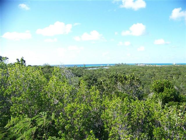
As
I mentioned in the last eletter, the Family Islands of the southeast Bahamas
stand alone in the Atlantic Ocean; they have aragonite, stromatolite, and coral
reefs near them, but no extensive bank surrounding them. The ocean plummets to
over a thousand meters deep just a few miles from their shores, with a few
exceptions.
The
Acklins group is a kind of circle formed by Acklins & Crooked Island and
Long Cay. The inside of this area resembles a bank and is called the Bight of
Acklins. Cat Island also has a bight that measures 30 nautical miles along its
SW shore, out 6 or 7 miles. Long Island is unique as it is actually joined to
the Great Bahama Bank and has a protected bight navigable to Windigo about the
same size as Cat Island. Good thing too, for that is where we experienced the
persistent Tropical Storm Noel.
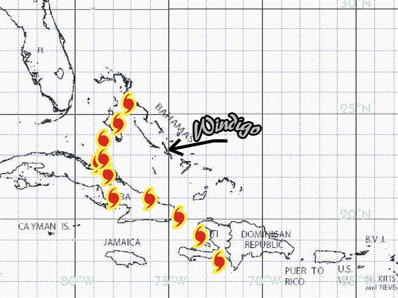
Hurricane Noel.
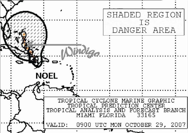
Noel
quickly formed directly south of us and the
"official" forecasts drew Noel's track to be directly across us on
the 29th of October. The next day, they suddenly changed the
forecast and arced Noel around
Windigo's location, and closer to the US. So
we stayed put and thought we would enjoy some rain to fill our water tank.
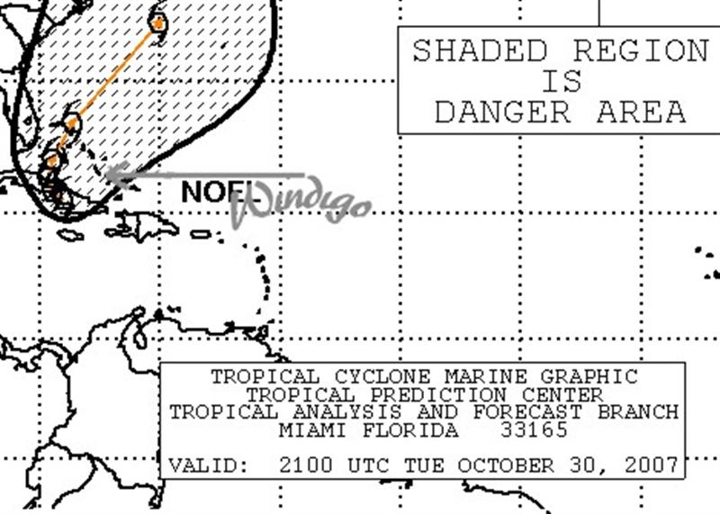
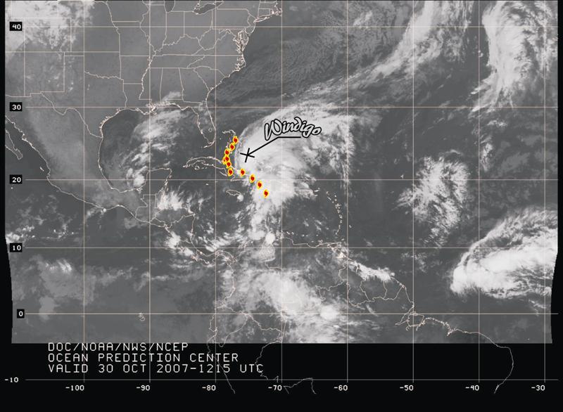
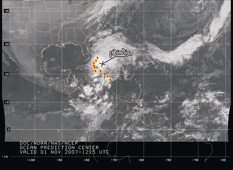
As
I made the "official" track from position
reports released by the US Government, it followed this second
"unusual" forecast (disputed by other global models). Position
reports issued during the next days [30
OCT and another from 01 NOV]
had NO clouds on the satellite photo in those spots. If one looks at satellite
photos from each day, it appeared to have barely moved for much of the early
days, and was centered well away from the "official" track, with no
clouds whatsoever at the "official" coordinates they spewed forth. Do
I not know enough about weather to figure out how a named Tropical Storm can
have no clouds around its declared position? Compare the photos from the two
dates and you figure it out!
But
there were more problems with the "official" reports. Having access
to raw satellite photos, raw weather data from Nassau and other Bahamian
stations, and the evaluation the weather of Chris Parker, a weather-router for
the Caribbean Weather Center & THE weather guru for cruisers in the
Atlantic - we realized that the National Weather Service was relaying
incomplete [read: wrong] data. (Chris said, "There is NO WAY the storm is
where the NWS says it is.")
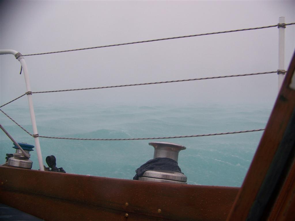
We
were at Long Island, and Noel's
"official" track was never within 150 miles of us. We had 25-knot
winds for three days, gusting to 30 knots. Then a day of 35- knot winds. The day
it passed Nassau (160 miles from us), we
experienced 40-knot winds with gusts to 50 knots. These winds continued
well past the calm time in Nassau, when Noel was over 200 miles away from us.
So we took a beating by staying far from the 'reported' storm and having the
worst conditions cross directly over us.
What
about reporting the conditions well away from the "center" of a
storm? Can the NWS not see that winds much greater than the center of 'their'
storm have consequences? It seems once they name it, they can say whatever they
wish. [Note: Did you know New Orleans NEVER experienced hurricane force
wind in Katrina? In fact, it was not even steady tropical storm force; The only
disaster there was the decades of refusal of the administration to allow the
Army Corps of Engineers the money to do their job. Other things(war?) were more
important than the failing levee system . . .]
I
have great respect for the individual forecasters at the NWS. They actually
"sign" each report, discussion, and analysis they produce, and over
the years I have chosen favorites. But they do work for the government, and
must comply with 'orders'. Why would the government 'order' forecasts AND
actual tracks to be misleading? Well, my friend Jim on Dianji has a
(conspiracy) theory that involves the threat of Hurricane Watches and Warnings
that cause sales to dramatically increase at say, Home Depot in Florida
(batteries, plywood, generators, etc.). Home Depot happens to be MAJOR sponsor
of The Weather Channel.
FEMAs
budget is dependant on need and it is the end of the hurricane season and the
US has not taken a hit. Seems that the Terror? that keeps the sheep in line can
come from a lot of made-up sources.
Once
again, we are reminded that we are on our own. Knowing this fact is preferred
than believing that there is support, until a situation arises that proves
otherwise. My advice is that we should ALL check our resources so none of us
are stranded when the next "storm" arises.
Four
days of steady rain DID fill our water tank, thank you.
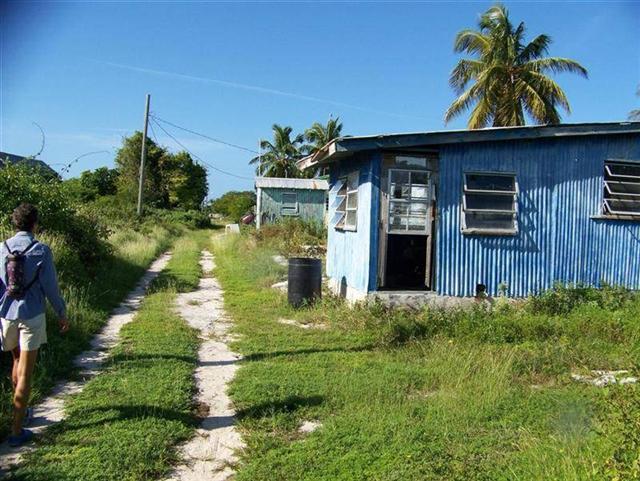
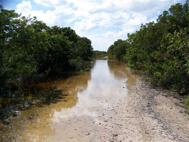
The Character Of The Land.
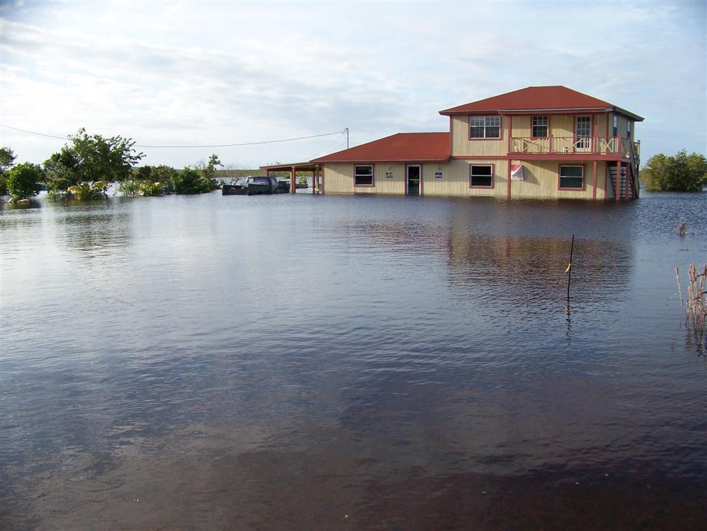
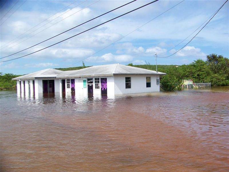
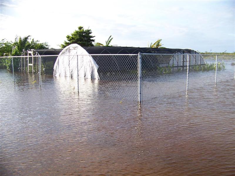
Right
after Noel, "flooded" would be a good description.
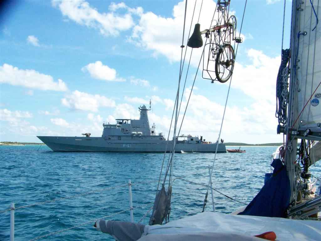
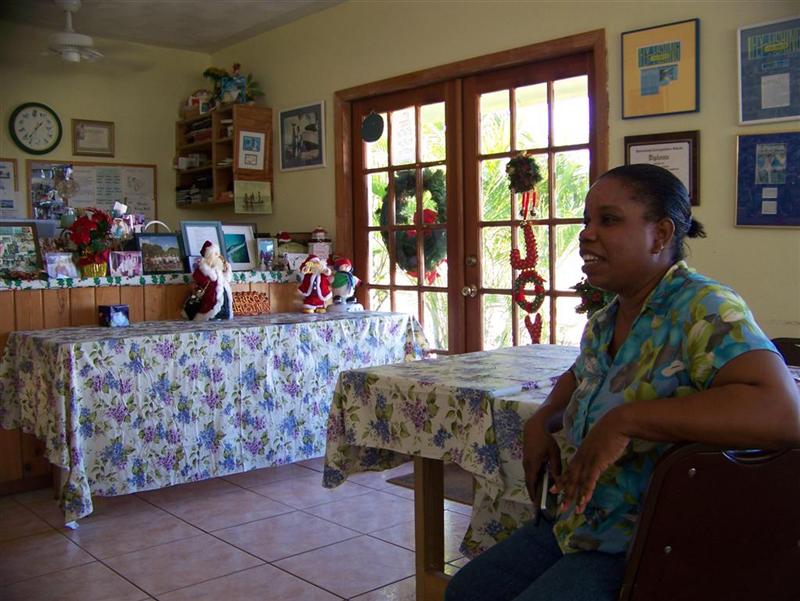
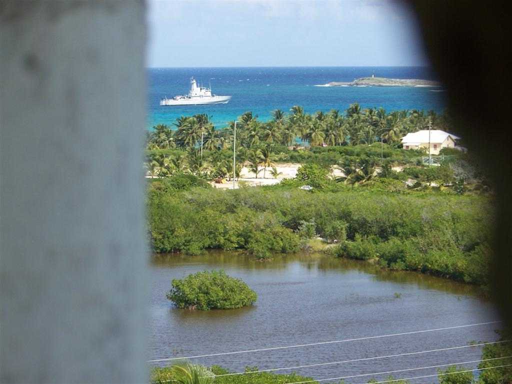
The Good Peoples.
The
HMBS NASSAU was anchored across the entrance of
the Clarence Town Harbour when we arrived. The first thing Karin says is,
"Do you think they are blocking us from coming in because our visa is
expired?" [We had applied for an extension in George Town, but were
refused, so our last few months in The Bahamas were spent running from the law
. . .] They were actually at Long Island to assist in the aftermath of Noel,
mostly transporting supplies to flooded settlements.
We
found people in the Family Islands to be generally more sincere and engaging,
perhaps because of the cruiser being a less encountered entity and welcome as a
true visitor to their remote homes.
In
addition to seeking out the older folks with their family and island history
stories, I found it interesting (and easy) to engage the community leaders on
the smaller islands = the businessmen that keep each island going in a good
direction. On Long Cay there was Mr. Rose; and Copland Rolle on Acklins. The
Gibsons and Scavellas keep north Crooked moving.
When
Ansil Pratt told me of the Lucayan descendants living in Cartwrights, Long
Island, and other stories were told how some of the Indians evaded the Spanish
enslavers in the depths of the Family Islands, I commenced a search for a
living Lucayan.
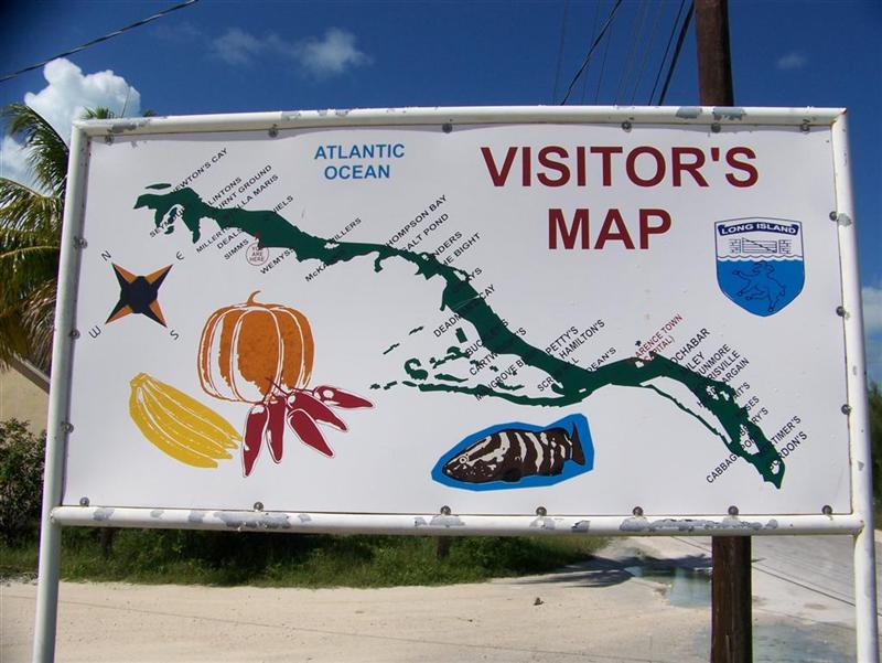
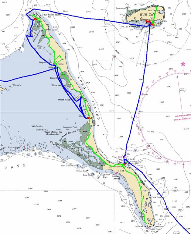
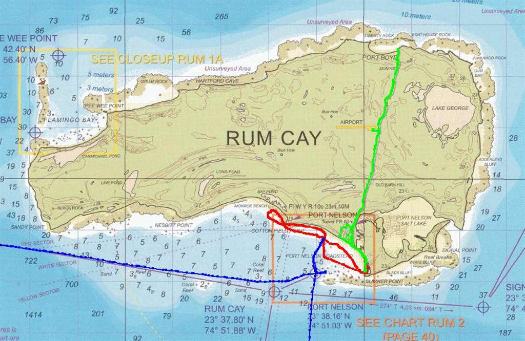
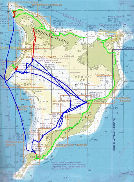
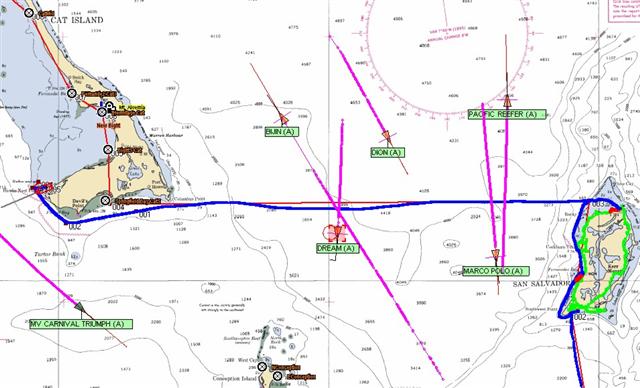
The Trip. [MAP]
![[MAP]](part1%20voyage.jpg)
Sailing
between these islands could not be done on a calendar schedule, but only with a
'weather schedule'. The trips crossed sections of open ocean approaching 10,000
feet deep. Swells felt here are created as far away as Europe & Africa, and
local wind conditions can whip up nasty chop in the unprotected seas. To
traverse safely, with minimum discomfort and strain on gear and rigging,
destinations must be chosen with the pattern of weather given first priority.
[Weather details in Cruising Notes.]
Population Of The SE Bahamas
These
'Family' Islands are approaching the verge of development; only one has hosted
projects which has caused an increase in population since the 1963 census. The
remainder have initially lost a large number of people, and then a few have
shown recent growth. Compare the following census numbers of these traditional communities
based on fishing, basic subsistence farming, and one industrial town with the
insane tourism results of the larger central and northern islands.
TOURISM
ABOUNDS IN THE NORTHERN ISLANDS:
Abaco population from 1963 to
2000 increased from 6,490 to 13,170. Today's estimate is 18,000, nearly triple
the original census (and may indeed miss many thousands of Haitian immigrant
workers, some legal, some not).
Grand
Bahama Island, including the city of Freeport, grew from 8,230 in 1963, to 46,994 in
2000. Today we find well over 50,000 residents, over six times the 1963 number.
(Windigo has no where to anchor there, so we have skipped this landlubbers
domain.)
New
Providence
& Nassau had 80,907 in 1963, growing to 210,832 in 2000. Today you will
count well over quarter-million people living there, soon to be quadruple the
1963 census. [Many thousands of illegal aliens dwell there undetected, whereas
in the Family Islands, the crew of Windigo was recognized and known ahead if
time in each new place, as we anchored!]
______________________________________
A
SLOWER PACE IN THE FAMILY ISLANDS:
Long Island, 2000 census = 2,945
A
decrease from over 4,000 inhabitants in 1963; with recent development the
population has stabilized, and may increase due to the islands proximity to the
Exumas.
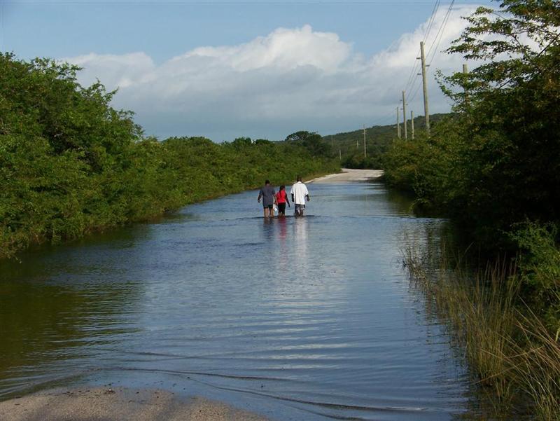
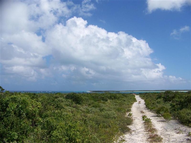
Besides
weathering Noel here, we walked and cycled the entire island, from the Columbus Monument on Cape Santa Maria and Newton Cay
in the northeast, to Gordon's at the southern tip. Roads were flooded,
especially in the central-south section, and would not have been passable if
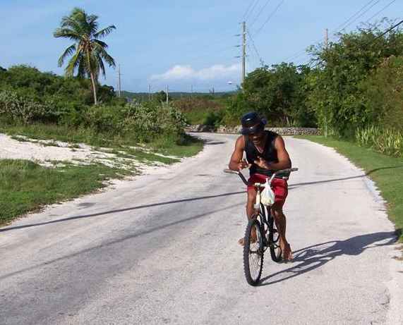
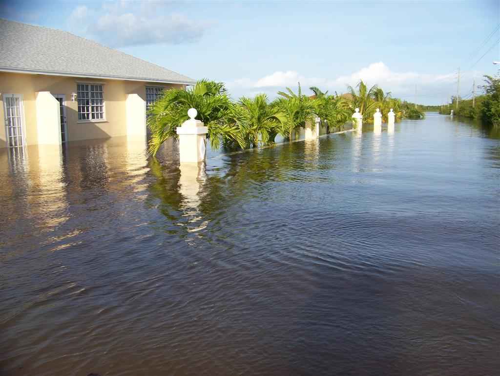
attempted the previous day. This family (going for
a walk/wade?) told me that two days previous my entire bike would have been
under water; right after Noel, there was 5 to 6 feet of water on the road. The
yards of many homes and businesses will remain flooded for weeks.
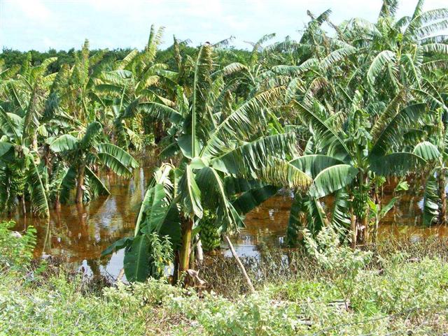
The
owner of this greenhouse says he only
lost "one or two" plants; that they may survive under [fresh] water
for several days (that they can somewhat 'breath' the oxygen in the water). But
he was moving them later, as the water receded, to a drier and sunnier place.
He was skeptical of any government assistance to compensate for damage from the
storm. (Although The Bahamian government has a widespread, established Nation
Insurance Board, there is no insurance available for agricultural concerns, but
they are currently working on it - which means expect something in a decade or
two.)
My cycling partner and farmer, Ambrose, has another
opinion that rang more true as the days progressed. He also expected minimal
damage from the flooding (these people really prepare for these things) and
only lost a few banana trees. He
fully expected the government to recompense him for new plants and provide
support such as fertilizer to recover from the storm. When we stopped by
Clarence Town on the other side of Long Island, traveling from Rum Cay to the
Acklins Group, we first saw the Bahamian Defense Force ship, the HMBS Nassau,
anchored there. [In fact, the large navy vessel was directly across the
entrance channel to Clarence Town! So much for 'security zones'.] The ship was
there delivering fertilizer(!) and providing basic needs and transportation for
Long Island. [They also assisted Karin in the recovery of her personal cockpit
beanbag when it blew off Windigo and headed for shore prior to our assembling
Pedigo. They weren't even curious if it was a bag of money or drugs as they simply
brought it back for her uninspected.]
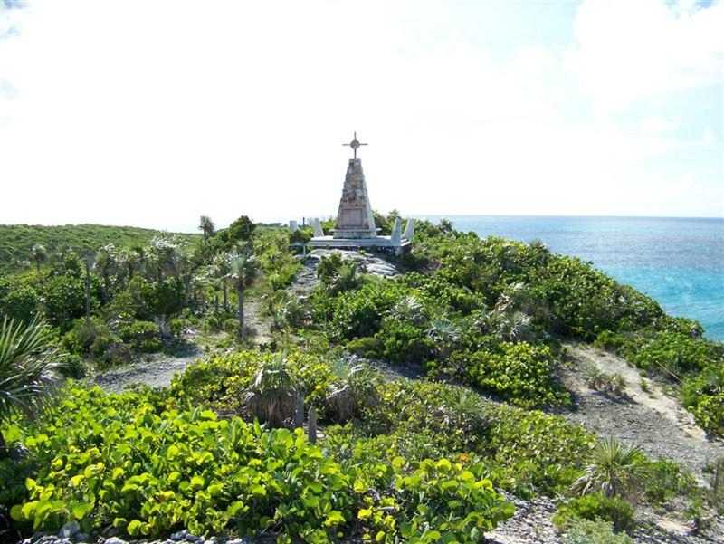
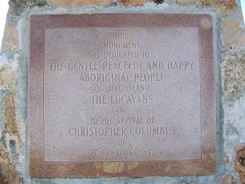
The
Columbus Monument at the north tip of Long Island is an ironic
celebration of the arrival of the Europeans. Although I believe Columbus was
basically a pretty good guy on his first voyage - fair with his crew and honest
with the natives - his reports back home led to the invasion of the Americas by
the Spanish conquistadors; and the devastation of entire races and tribes of
peoples including the Lucayans in The Bahamas, and the Aztecs, Incas, and
Mayans of Central & South America, and other countless Taino and Caribe
tribes. On his subsequent voyages, however, Columbus began the enforcement of
requiring 'tribute' from any adult Indian [14 or older]. Initially this was a
small quantity of gold, but then evolved into other things = 25 pounds of
cotton, indentured servitude, etc. Failure to pay was usually met with death.
No
group succumbed to the Spanish bastards faster than the gentle, peaceful
Lucayan farmers and fishermen. In no more than 25 years, after enslavement and
relocation, there was no trace of the original Bahamian Indian' society. Unable
to cope under imprisonment of slavery in Cuba and Haiti, the men perished from
punishment or suicide; and the women and children left behind couldn't sustain
their civilization alone. So the plaque dedicated to the arrival of this
onslaught is disturbing. Read more about the original Indians of the islands in
the concise article at: http://en.wikipedia.org/wiki/Taino
But
wait, there is a tiny glimmer of survival at the end of the story. Although I
have searched in vain for any remnants of Lucayan society in The Bahamas so far
(other than 'touristy' museums of Lucayan lore), here in the Out Islands there
are said to be traces of the lost peoples. Some surviving Indians hid away for
generations, and today their ancestors may carry a bit of their DNA into the
future. The first such place I found said to contain ancestral Lucayans is
Cartwrights, a settlement between Clarence Town and Deadmans Cay. The outward
appearance of the residents would suggest this to be possible, and is
demonstrated by their easy living in a difficult environment.
The
naming conventions mentioned in the previous eletter continue on Long Island,
if not oversimplified. The towns are not only named after the founders, they
ARE the names of the founders. Austerely: Gordon's,
Mortimer's, Gray's, Cartwright's, Rose's, Berry's, Tait's, Bain's, Seymour's,
Simm's and so forth. For the capitol city, they got fancy, and called it
Clarence TOWN.
Rum
Cay, 2000
census = 100? (official numbers combined with San Salvador)
The
population numbers experienced a sharp decrease in the 80's to the 1963
number. currently, about 60 people live in Port Nelson, and perhaps a couple
dozen are in Sumner Point and scattered on the island. Developments may hold
population steady as much of the desirable island is available and is fairly
close to the end of the Exumas.
Weather
caused us to take a circuitous route to the Acklins Group, stopping at Rum Cay
in the way; actually we didn't even plan on going to the Acklins now, but had
great conditions to go from the north tip of Long Island to Rum Cay, through
Clarence Town back on Long Island, and on to the Acklins.
Excellent
snorkeling here. A five-mile hike across the island from Port Nelson to the north coast past abandoned
cattle roaming through mostly untouched land. A modern marina and waterway
system extending somewhat inland to a giant salt pond (actually named a
"salt LAKE") and enjoyable to explore. Another anchorage at the NW
corner of the cay provides another magnificent vista both above and below the
water.
Rum
Cay must be rather peaceful for their police station is actually a "police station wagon"!
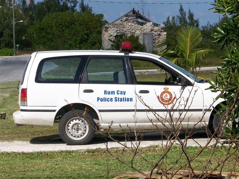
THE BIGHT OF ACKLINS
Another
area supposedly inaccessible to sailboats drawing seven feet, the Acklins Group
proved to be a magnificent cruising grounds. Beautiful, protected anchorages;
friendly, accommodating people; and TONS of bonefish, if you are into the
fishing thing. We entered the Bight of Acklins from the west, traveled the
shallow waters inside, and departed through a path for vessels drawing under
five feet. It all can be done if you pay attention!
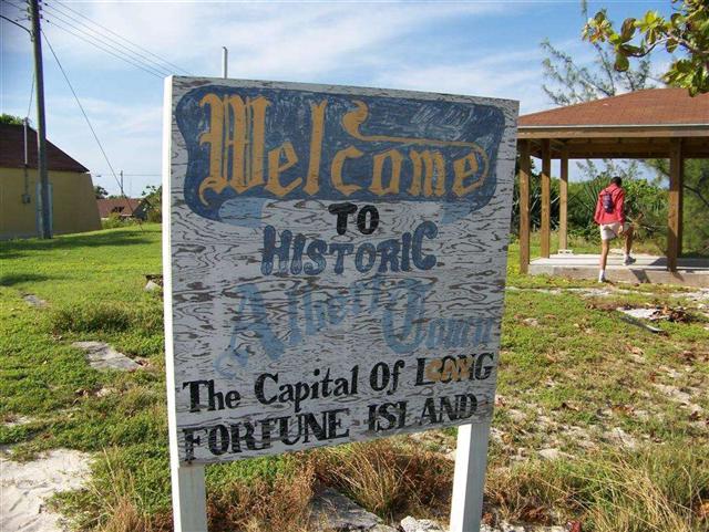
Long Cay, 2007 population = 20
adults, 7 children
1975
estimate, from resident Hilroy Knowles = 60. At the turn of the 19th
Century, there were over 2,000 souls living in Albert Town! Long Cay is likely
to remain barely populated for the foreseeable future.
The
westernmost island of the Acklins group, it bridges the gap from Crooked
Island, on it's north tip, to a string of cays that extend to the south tip of
Acklins Island, closing the Bight of Acklins. The main entrance to the Bight is
around the south tip of Long Cay.
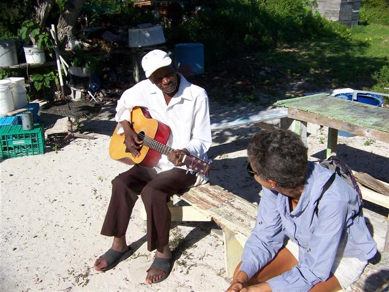
We
found out all about the cay from Hilroy Knowles, a now permanent resident that
has lived elsewhere in The Bahamas on-and-off for his 42 years. He has returned
to live with his father, Bruce Knowles,
the greatest guitarist in Albert Town, and continue the island traditional
forms of subsistence: fishing and small-scale farming. He raises goats and is
able to "scoop" wahoo from the ocean at will [the advice he offered
will be used - I hope it is enough to change my fishing (mis) fortune].
Hilroy
has spent periods of a time living in Nassau and working as a charter fishing
guide. In fact, we were instantly recognized as those "crazy boaters with
the pedal dinghy" from his seeing us in Nassau in April. How crazy are we
when he proceeded to take detailed notes of Pedigo's construction for possible
replication [something done no less than a half-dozen times during our travels
here].
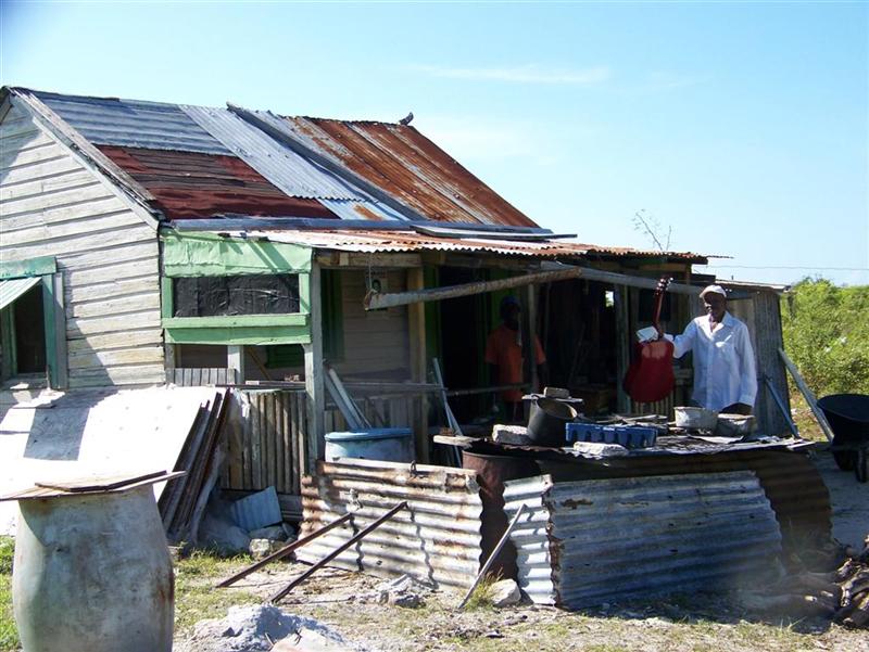
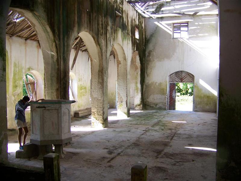
Welcoming us into his patio, Bruce Knowles
regaled us with stories of a crowded, bustling Long Cay of long ago. A time
when the largest church south of Nassau was full of parishioners, and the local
farming of cotton, sisal, madeira bark, and cascarilla bark and the herding of
goats and chickens was large-scale. Today, the bark of the cascarilla is still
sent to Italy from here and Acklins Island for the production of Campari.
We
also met Stephen Rose, a former mailboat captain and now the Bahamas Electric
Corporation manager on Long Cay, he is the financial and philanthropic leader
of the island today. He runs the tiny Ready Money grocery store and has several
construction projects under his belt and underway, which have provided quality
housing for some Albert Town residents. He also owns most of the 2,000 goats on
the island, but Hilroy is starting his own herd that he says will rival Mr.
Rose's in short order.
Our
tour here is photo-detailed below, in Karin Takes A Hike.
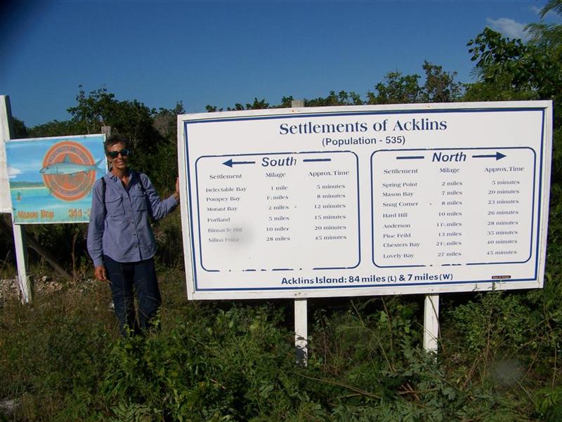
Acklins Island, 2000 census = 423
The
number of residents has plummeted during the 70's & 80's from over 1200 in
1963. Seems stabilized for now.
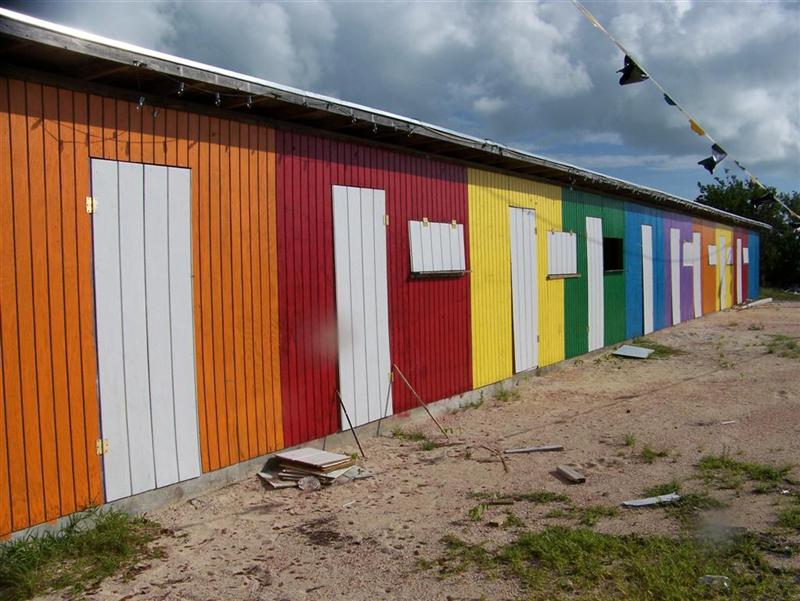
On
Acklins, we found the prettiest,
most colorful, and best maintained "straw market" buildings so
far in The Bahamas. These groups of small vending shacks exist in every major
settlement on every island. Only the one in George Town is used daily, the
remainder are used only for special holiday dates and parties, such as Regatta
or Independence Day.
Hanging
out on Acklins for a few days, one has a chance to personally view a majority
of the entire population! Upon interacting with them, a true sense of the
Family Islands develops. Many older residents, although well- traveled, have
always lived here. Some middle-aged folks have returned, after education and
employment elsewhere, such as Hilroy Knowles from Long Cay has done.
The
first Acklinite we came upon was Mr. Heastie, the patriarch of Spring Point. He
gave me a colorful description of the route to Atwood Harbour for my cycling
trip that day, only after telling me there was no way I could bike there. Upon
my return from the 80-mile trip there, I was gathered onto the deck of the
local bar for regurgitation of the details of my adventure.
The
story was heard by a few men, including the owner of the fine drinking
establishment, Copland Rolle, who was named after a US judge that briefly
incarcerated his father just before he was born. The name had an effect, as
Copland ("Coby") lead a very interesting career as a Bahamian Police
Officer; first moving up the ranks quickly and serving on almost every island
in the capacity of chief or senior officer. Then, in 1981, he was assigned to
be the personal bodyguard for Sir Lynden O. Pindling, the first Prime Minister
of The (Independent) Bahamas; a post which he stayed at until Sir Pindling's
death in 2001. Now "retired" and living back in his birthplace of
Acklins Island, Coby runs his tavern/store/bakery/social center, which happens
to be immediately adjacent to the police station . . .
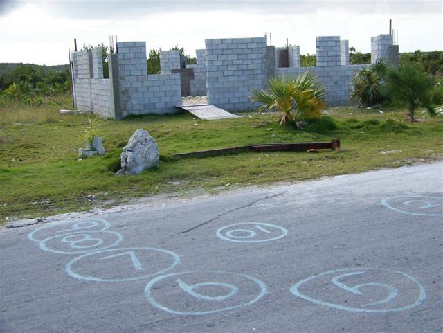
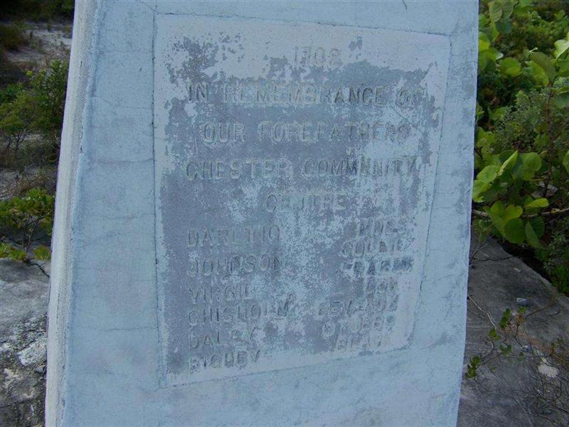
We
encountered more friendly Acklinders (perhaps some with a trace of Lucayan
ancestry) throughout the island, just not very many at a time, with less than
400 people spread across 70 miles of island. Civilization is concentrated at
Spring Point, with tiny settlements scattered about, such as Chesters and it's
slowly progressing Community
Center (I hope construction
didn't really start in 1702!).
There
are the bone fishing lodges in the north: Chisholm's in Chesters on Lovely Bay
and Garron's in Pinefield; and traditional Bahamian settlements all the way
down to Salina
Point, where we stopped as we sneaked out of The Bight of Acklins along
route recommended only for vessels of less than five-feet of draft. Windigo
once again negotiated the shallows without incident.
Crooked Island, 2000 census = 341
People
have fled Crooked Island in a steady flow since the 1963 census counted a
populace of 788. The trend continues.
We
explored Crooked Island from both inside the Bight, and from an anchorage at
Landrail Point, on the northwest tip of the island.
To
access the western end of the island, we anchored as far north as possible with
our draft, and left very early
to ride Pedigo 8 miles
further up to Turtle Sound and
to the dock at Church Grove Landing. From there, Karin took another LONG hike,
and I rode the 37 miles to the eastern extremity of the island and back.
On
the 8-mile Pedigo ride back to Windigo, we chatted with an American couple on a
charter bone fishing boat. The charter guide was none other than Shaky
McKinney, an acquaintance of our friend Mark, and who showed great interest in
Pedigo as a design for a more efficient bone fishing vessel.
Whew
- a non-stop day, starting at 0400hrs. to coincide with the tidal current, and
collapsing back aboard Windigo ten hours later. We certainly slept well that
night.
Upon
leaving The Bight of Acklins through the shallow southern route, we sailed up
to Landrail Point at the northwest tip of Crooked Island to explore the western
half of the island. It turns out that this is area of the most 'action' in the
Acklins Group. Andy Gibson, the local BASRA
coordinator and his son Niko greeted us from their fishing boat as we
arrived and welcomed us to the hospitality of the Mormon city (EVERYthing is
closed in Landrail on Saturday!).
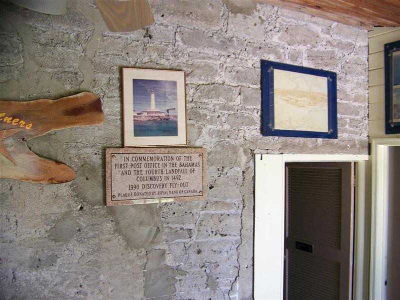
Pittstown Point Landing (a mile north
of Landrail), a brand new, well-managed, growing resort at the very tip of the
island promises to attract many types of tourists. They have 'preserved' the first Post Office of The Bahamas at this
resort by building a restaurant/bar AROUND the old building! We met up with
Shaky McKinney again, who is based out of The Landing, and the purveyor of a
local exotic-drink: Mark once saw dozens of his famous "shakes" sold
to tourists in one sitting at the airport. An amazing feat on sparsely
populated Crooked Island!
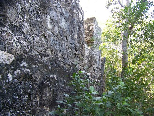
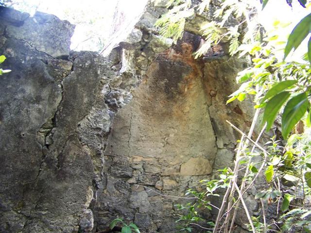
Shaky
introduced us to David, the manager of the Pittstown Landing, and David showed
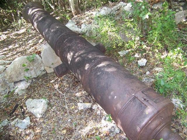
us the trailhead to the 16th century British fort called
"Marine Farm". The ruins
are at the top of a densely-wooded hill across the long curve of the Marine
Farm Salt Pond (named for the Marines that once manned the fort). The fort
protected the north end of the Crooked Island Passage, that provides access to
Cuba, during the active piracy years of the Spanish Main. The fort has three
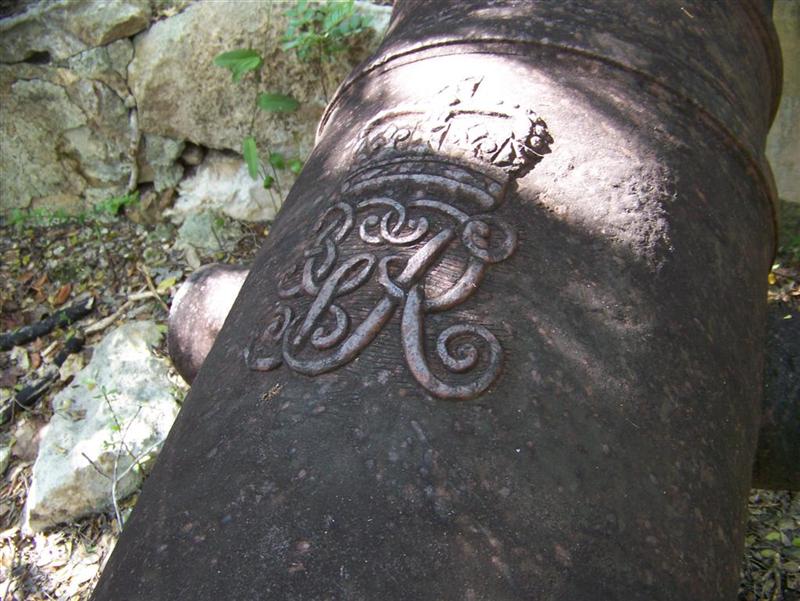
hundred years of growth in the ruins, but I found 4 of the 6 four-ton cannons that are scattered about the
encampment, and they still bear the markings of
the Royal Marines. [See Cruising Notes for exact
positions for the trailhead and fort]
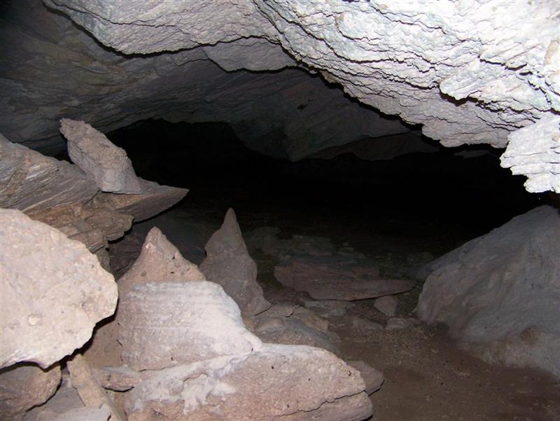
We
also went exploring for the fabulous local caves, but after two days of
searching using vague directions, all I could find were the group of "lesser" caves. So if you go
looking for caves on the north shore of Crooked
Island, the ones at | N22?49.960'
W074?18.150' | are unimpressive
and mosquito infested (although the rest of the hike was bug- free!).
I
met Reggie Moss cycling to a cemetery on the central north shore of the island
to cut the grass there. Reggie also works at the Pittstown Point Landing. It
turns out he is Andy's half-brother and told us of his sister's restaurant,
Gibson's. We went to eat there, and it turns out "Willie"
Gibson is a tremendous cook! She has had professional training, but first
learned her way around a kitchen from her mother, Marina Gibson.
Marina
is actually named after the fort and Marine Farm Salt Pond and is just as much
of a landmark here. She has been a businesswoman in Landrail for 40 years, and
although she says she only wanted to contribute to the community, has become no
less than world-famous. She still cooks for Willie, although says she is
"semi-retired"; between her businesses, community work, and
traveling, is more active than most. She delighted us with stories of her
history, including her connection with
Evans Cottman, the out-island doctor of the 40's & 50's. Dr. Cottman
lived with her family for a few years while practicing medicine on Crooked
Island. The remoteness was too much for his Abaconian wife, so eventually they
moved back to Abaco where he built his 'Castle in the
Air' that we saw in Marsh Harbour.
Another
Landrail family are the Scavellas, who run the best store, gas station, and
fuel & water delivery. Started by Daisy and now run mostly by her son,
Kenny, these are clean, well-run and fair establishments. [See Cruising
Notes for a description and photos of how we filled our tank with free
water carried from their gas station.]
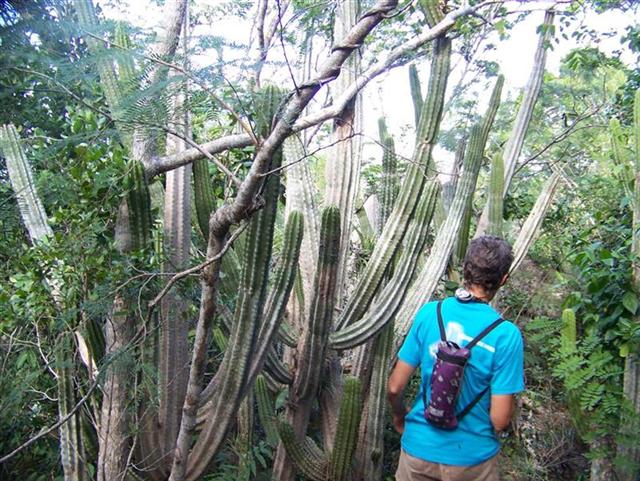
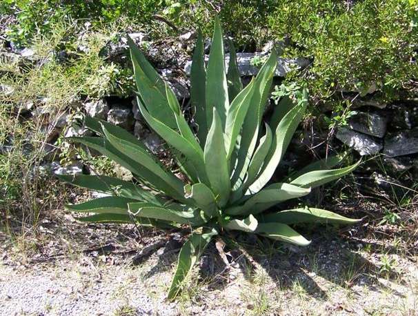
Wildlife.
The
majority of these islands are below the Tropic of Cancer, so joining the full
variety of lizards and larger
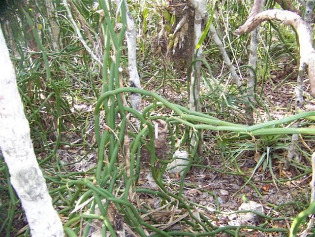
mammals are creatures and flora of the tropical desert. Desert cacti are not only present, but abundant,
along with true desert dwellers such as the giant
yucca. Thick, meaty vines now accompany the
thinner, tenacious ones that make our hikes through
the bush so wonderfully abusive.
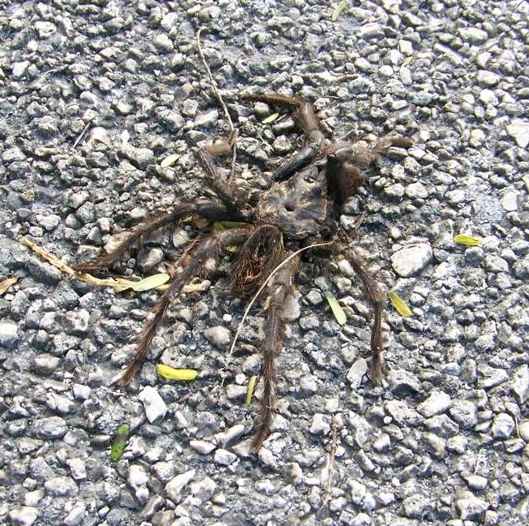
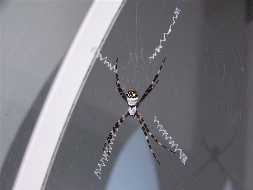
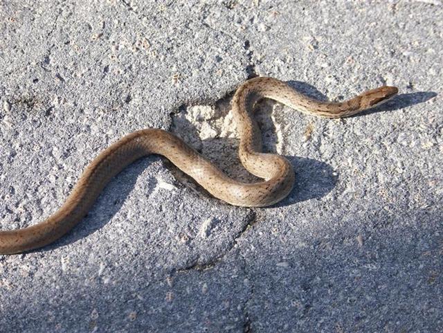
I
found a few tarantulas washed onto the road
on Long Island, and Karin found a larger
spider on Rum Cay which alerted me to their presence here. [Generally,
small critters are first discovered as roadkill prior to seeing them living in
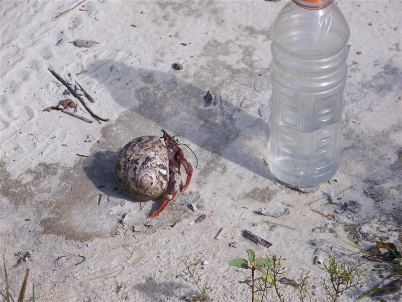
their habitat.] The number of snakes and crabs
increased, as does their size.
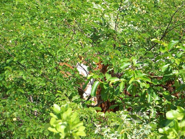
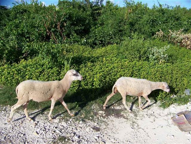
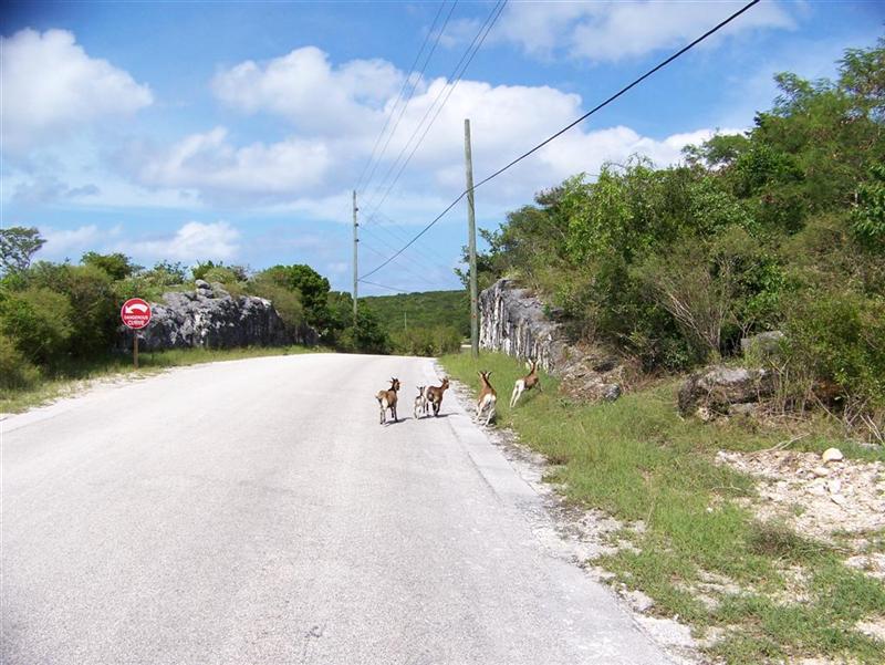
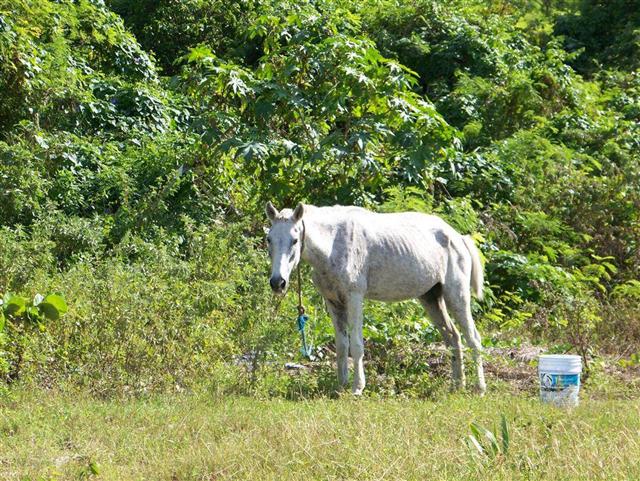
Cattle, sheep, and goats left from abandoned ranches were seen on
many islands and are said to be on every Family Island. A few wild horses hid
out here and there, but are rarely seen directly like their kept brothers.
Besides
the Greater
Flamingo, which we saw along Long Cay after Karin's Hike,
other birds spotted in the Acklins group were:
White Tailed
Tropicbird, White
Cheeked Pintail, Zenaida Dove,
Bahama
Woodstar, Bahama
Mockingbird, Pearly-Eyed Thrasher, Thick
Billed Vireo, Bananaquit,
Stripe
Headed Tanager, Black Faced
Grassquit, Greater
Antillean Bullfinch, many types of Egrets,
and of course, the ubiquitous Magnificent
Frigatebird.
Other Activities.
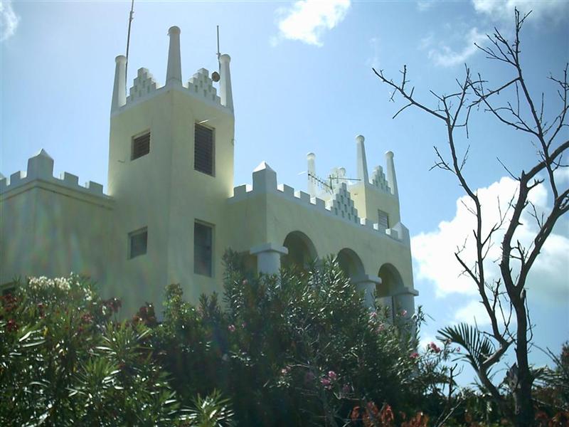
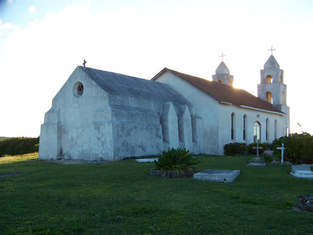
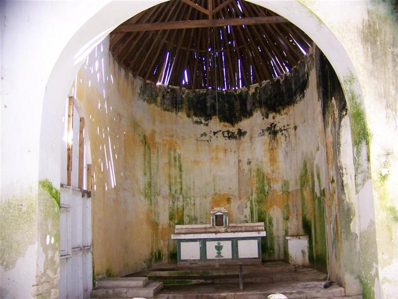
The Architecture Of Father Jerome
John
Hawes was a diverse and productive man that did not stand still for any of his
youth. And when he did finally "retire" in The Bahamas he shone as a
prolific designer and builder.
In
an age and place when communication and transportation were limited and
productivity was slow to match, Englishman John Hawes, who lived from 1876 to
1956, showed a unique drive an ambition from his start. Born of an affluent
family, he began schooling as an architect, but suddenly switched to theology
and was ordained in the Church of England and traveled to The Bahamas in 1908.
He went from island to island repairing Anglican (and other) church buildings
and administered a flavor of religion that showed no distinction between black
or white, rich or poor, and shook things up a bit I am sure.
He
must have taken to sailing, also, and traveled to Canada with his unique
missionary skills. In 1911, he went to Rome and converted to Catholicism. As
'Father Jerome', he went to Australia where he spent 25 years practicing his St
Francis of Assisi flavor of religion to the bush peoples.
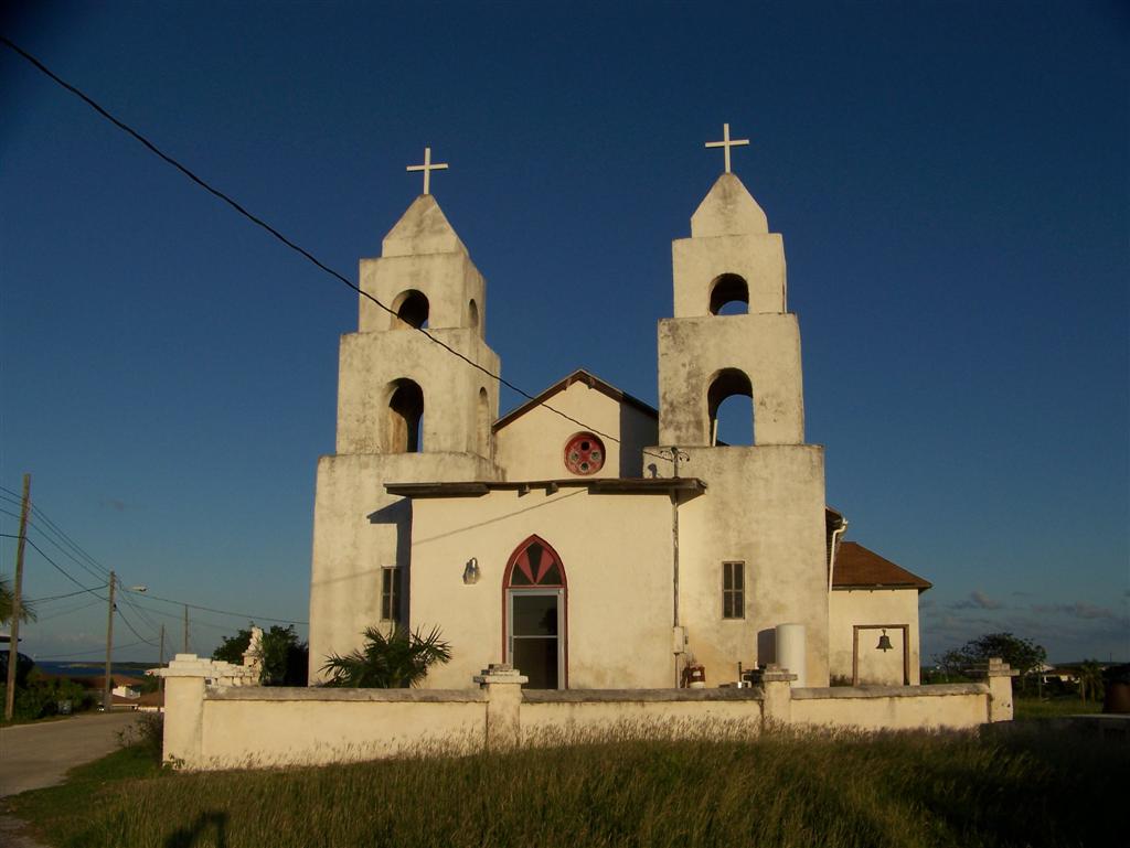
In
1939 he returned to his favorite place, Cat Island. From there he directed
building projects for four other churches on Cat Island and five
churches on Long Island, both Anglican
and Catholic.
Well known in the area, as noted in the Abaco eletter, Father Jerome was
consulted by Evan
Cottmann for the construction of his "castle-home" in Marsh Harbour.
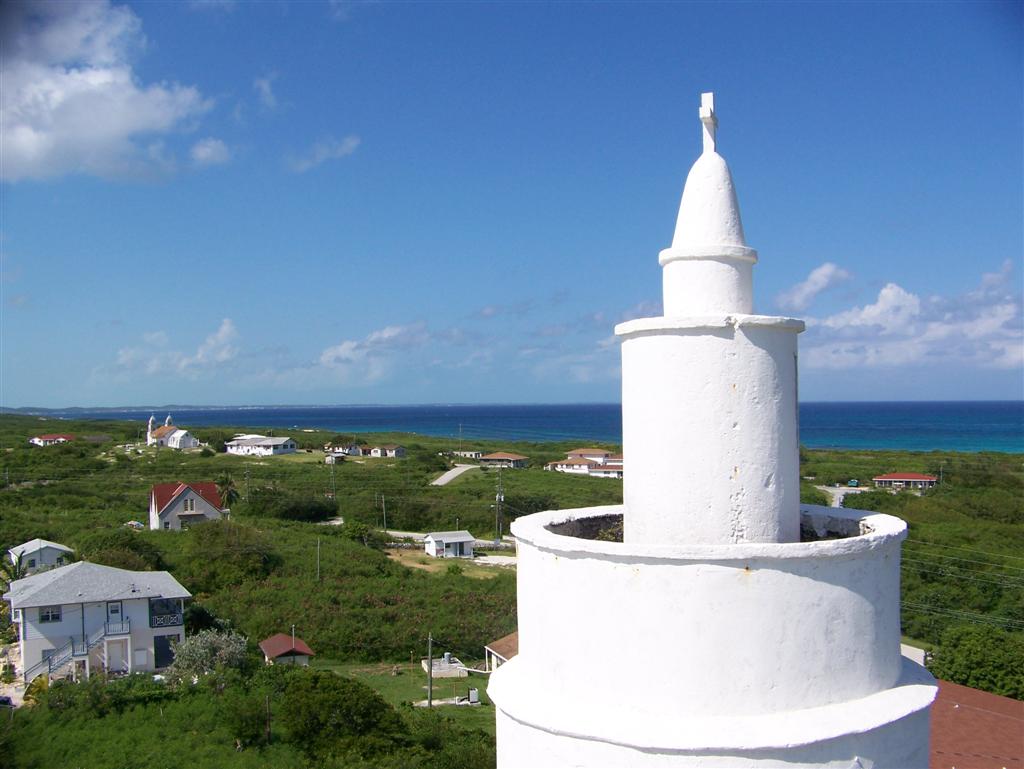
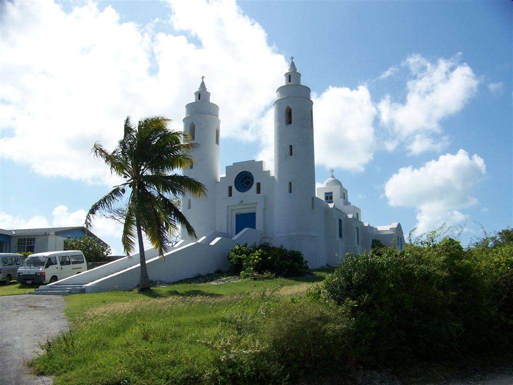
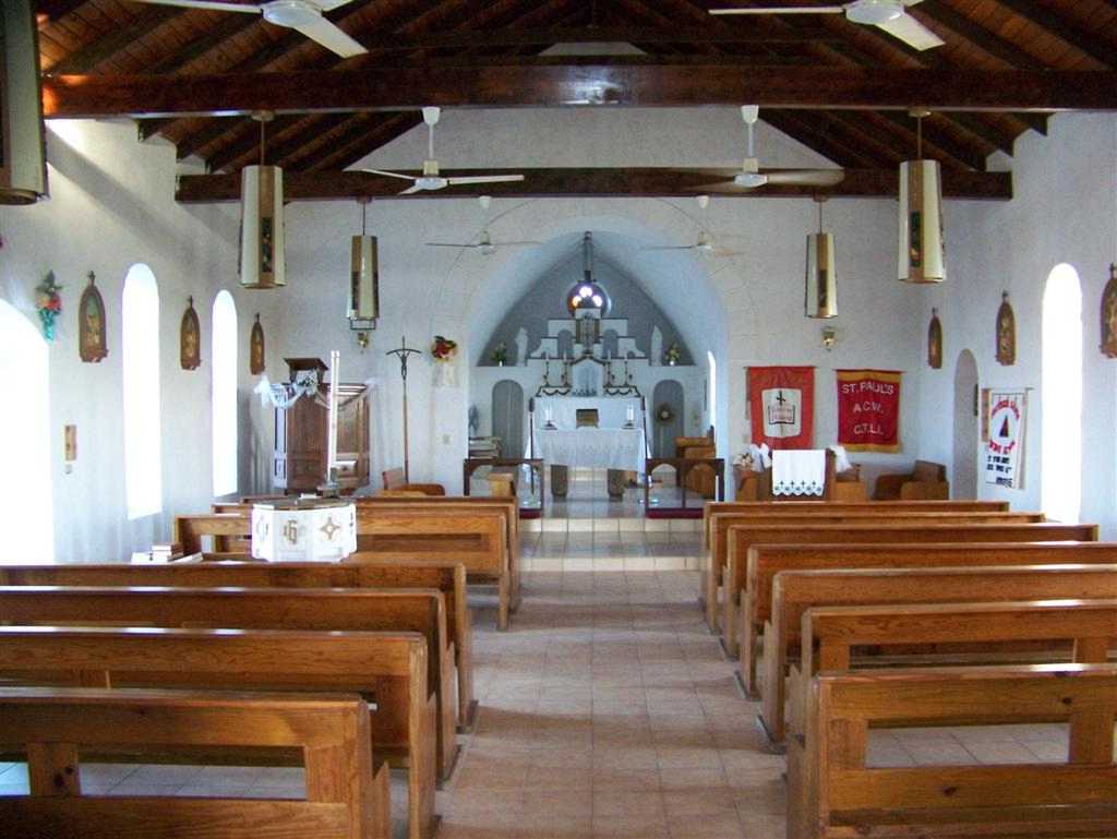
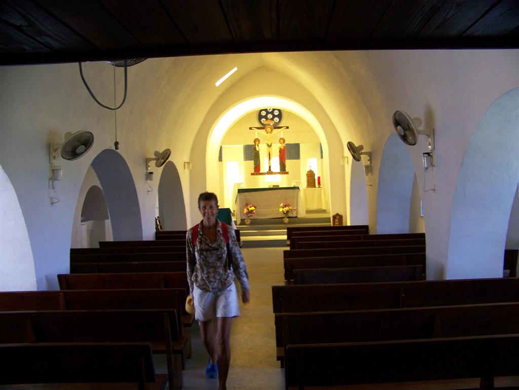
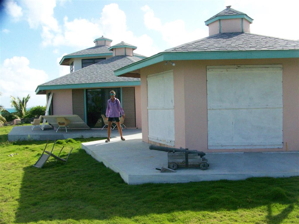
His
sturdy designs appreciated the force of the storms and featured thick-walled
masonry buildings that are in pristine condition today after decades of
pounding from hurricanes. The beauty
of the structures come from an interesting
blending of the simplicities of Romanesque, Celtic, and Greek Isle
architecture.
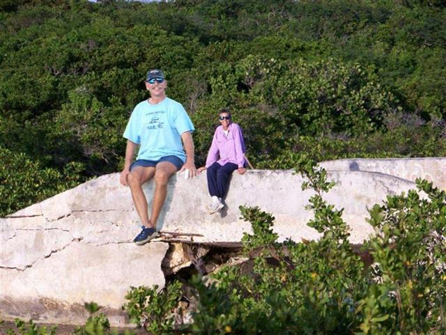
Karin Takes A Hike
Not
as in, "Karin, TAKE A HIKE", or going for a long walk on a short
pier; closer to taking a short walk on a Long Cay - necessitated by the fact
that although it might be 'long' (over 9 miles, tip-to-tip), the only path goes
across it's skinny width and runs about a mile end-to-end. So what do you do on
an island with a total population of 27 and one road? Take a hike!
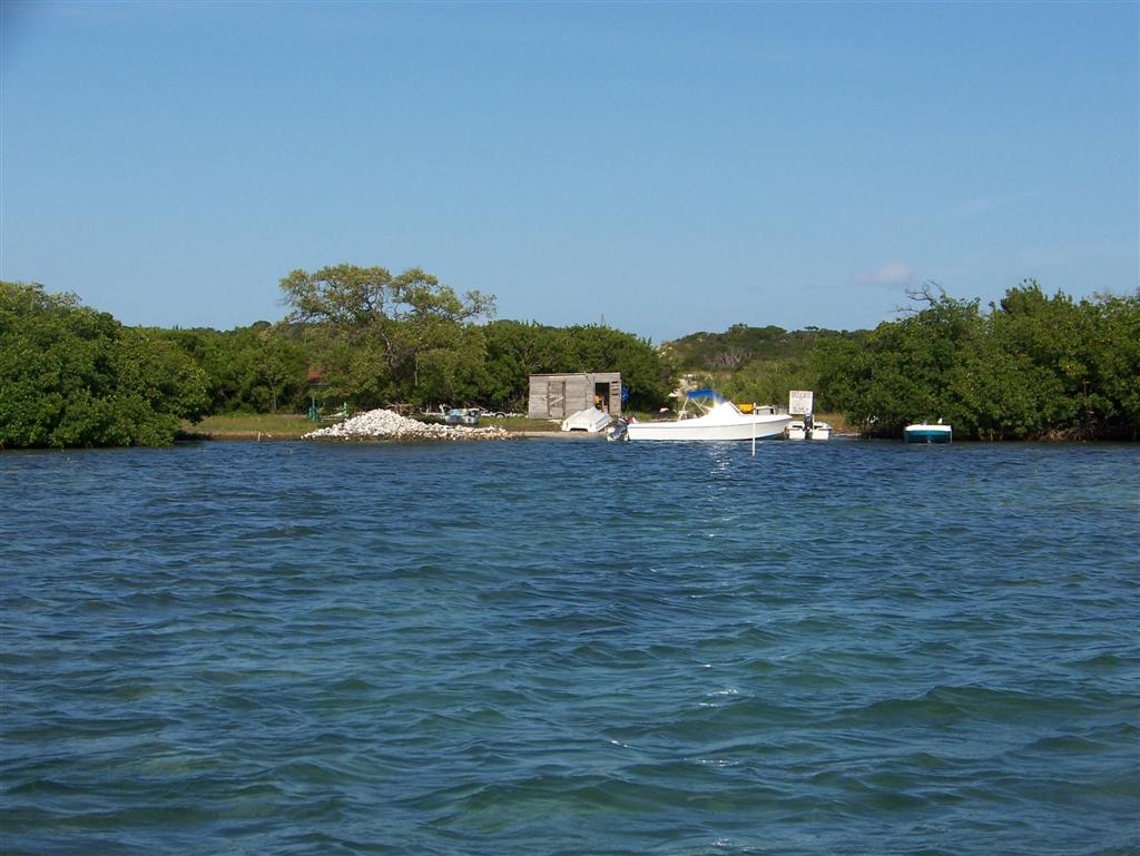
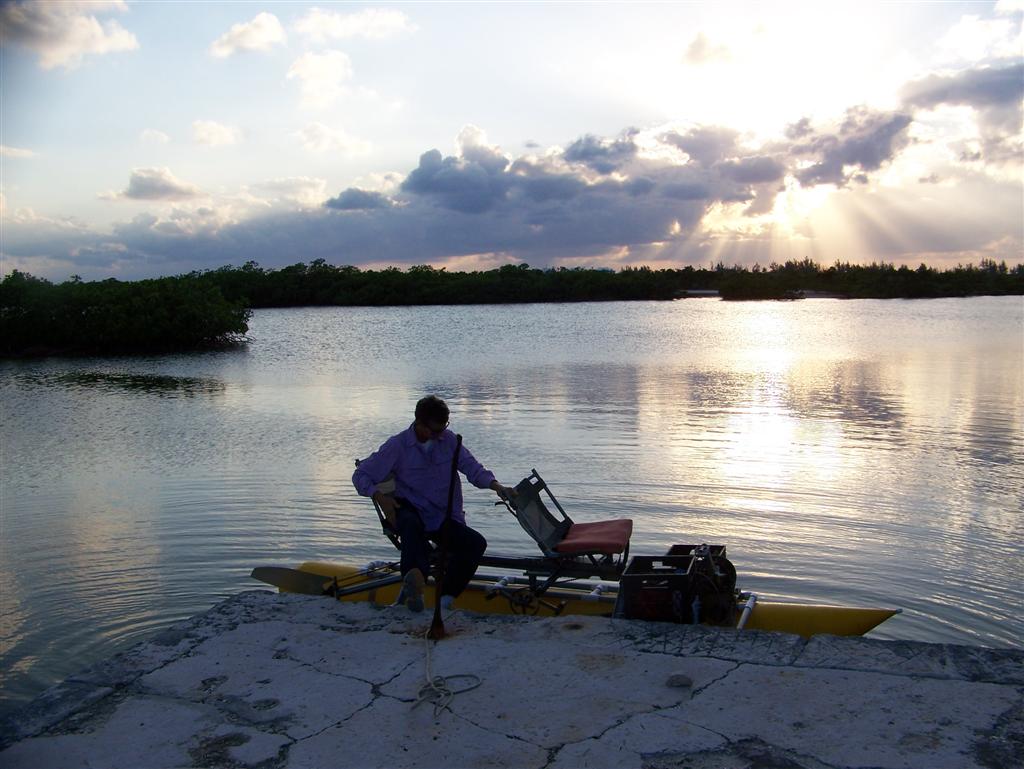
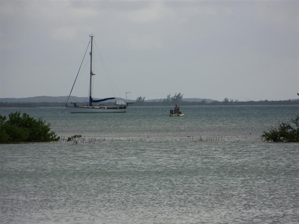
It
was quite a Pedigo ride as the shallow water kept Windigo
anchored 3/4 of a mile off shore. Then the 'channel' was very narrow and
shallow even by Pedigo standards! Once ashore, a large block of concrete serves
as a dock from which a 'ferry', which
is actually a 17' runabout, makes biweekly trips to Crooked Island, 12
miles up the Bight. This is the
"South Side" of Long Cay, and used to host a large settlement.
The ancient jail building along the
road [in the center of this picture] is one of the few ruins left - now
they don't even have a "police station wagon"
like Rum Cay!
![ancient jail building along the road [in the center of this picture]](road%20to%20Albert%20Town2.jpg)
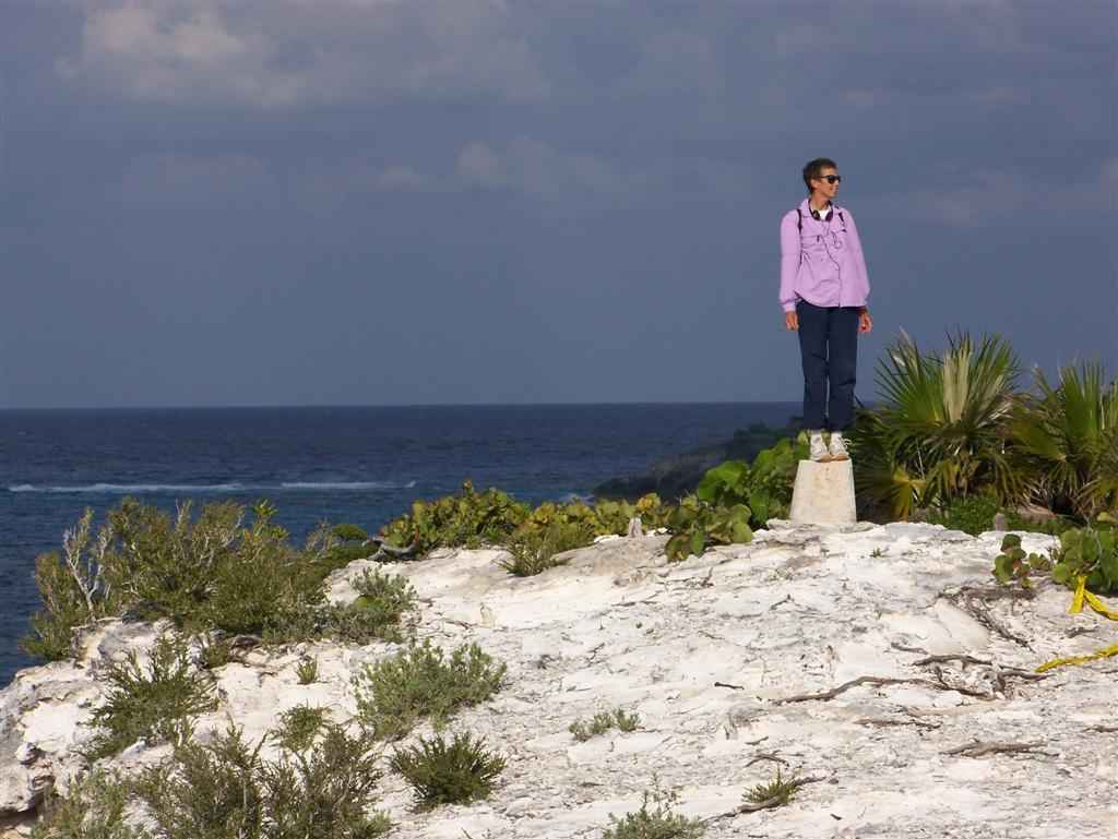
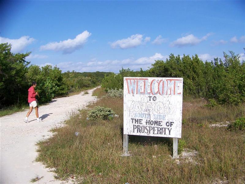
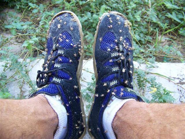
The unimproved 'road' [I seem to be
using these marks a lot to show loose interpretation!] runs fairly straight
across the cay from the dock on the east, inside the Bight, to Albert Town on
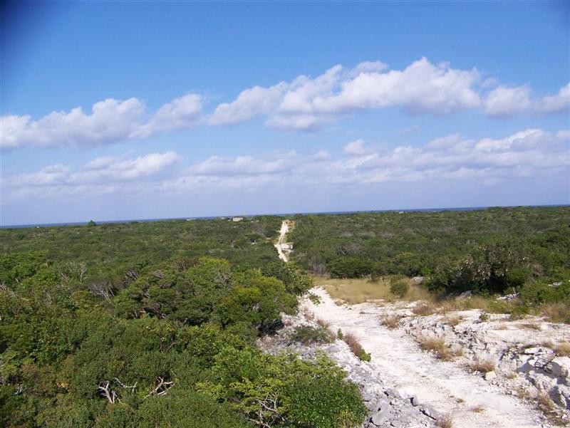
the west, on the ocean coast. There are rolling hills making
the way interesting and the vistas breathtaking; but along with the beauty
laid a patch of thorny
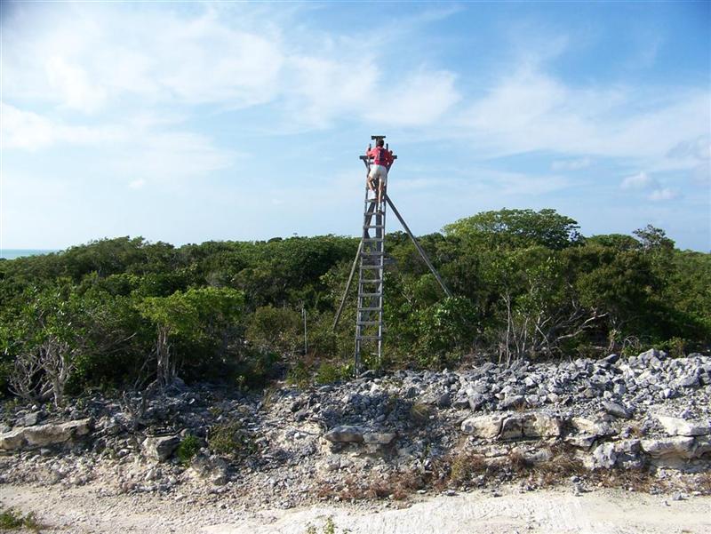
goatsheads! A rickety platform that once supported a light stands on the
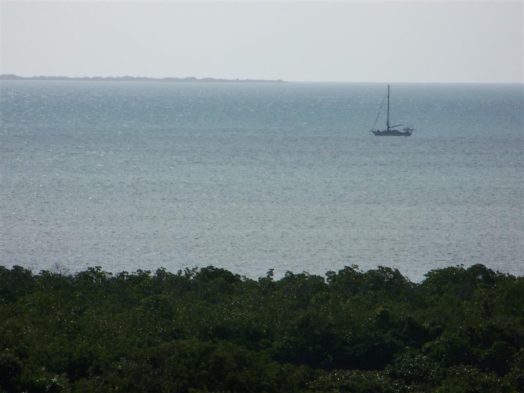
highest point along the road. Climbing to the
top allowed Karin to view Windigo anchored off in The Bight.
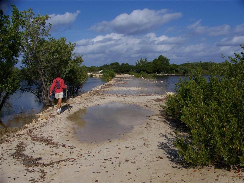
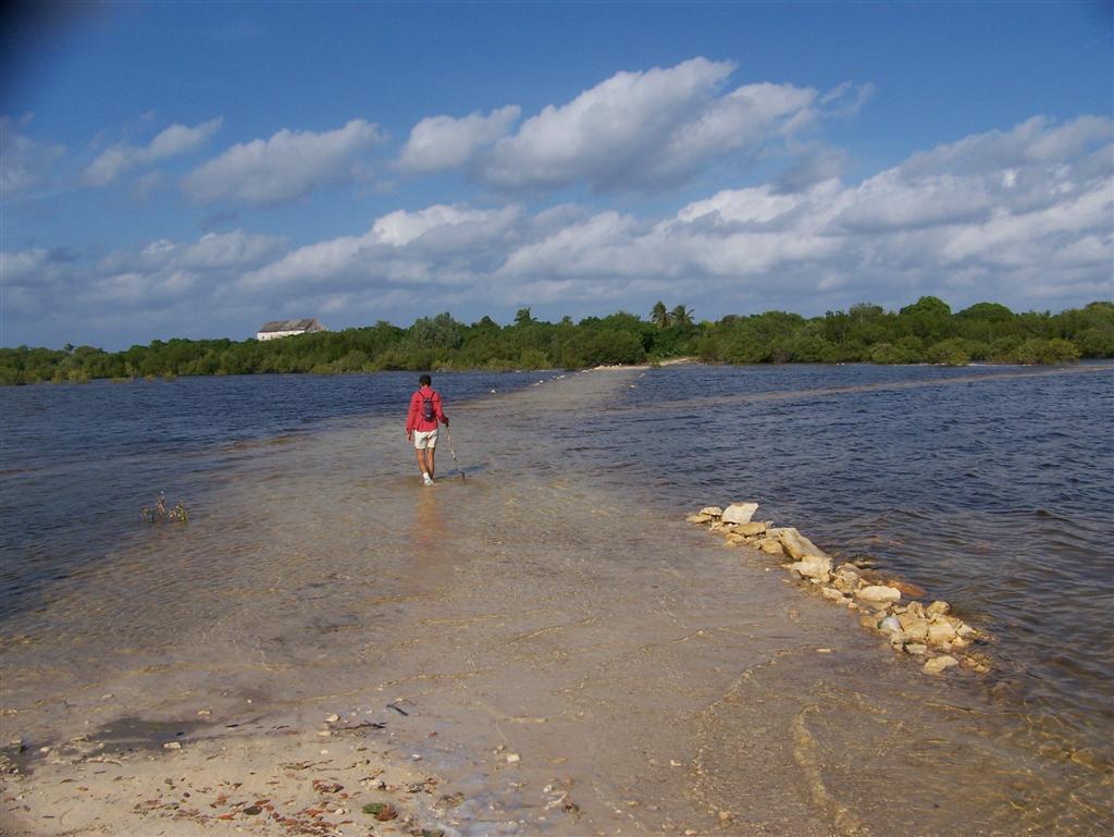
The
path was wet, from what I assumed was the rain from Noel, but Karin carefully navigated the high ground,
keeping her shoes dry. Further along it was outright
flooded, and her previous efforts were for naught. We found out later from
our friend here, Hilroy Knowles, that Noel caused the first flooding of this
road here since 1976. I guess it was an event more major that even we imagined!
(Even with the severity of the storm and extent of the flooding, not one life
was lost in The Bahamas, a testament to their preparedness and ability to take
care of themselves - how different than the massive whining one hears from
minor inconveniences cause by storms in the US.)
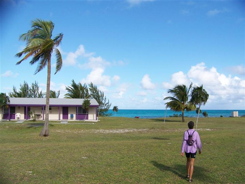
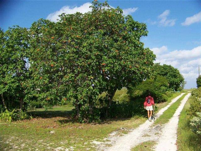
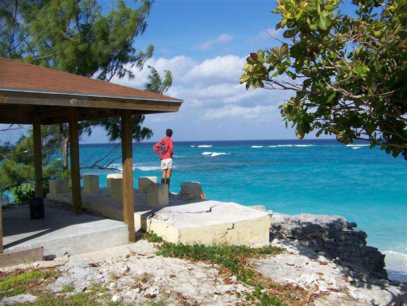
Once
in Albert Town, Karin walked among the widely
spaces homes and along the beach
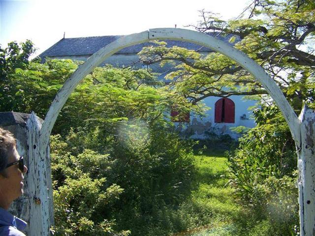
that we had sailed along just the day before. Also in Albert Town, are the remains of
the largest Bahamian church
south of Nassau, now much too large
to be supported by the 27 residents. Bruce Knowles
played his music for her, and told stories. On the return trip, details are
noticed that were overlooked on the first pass, and the trip passes quicker as
she chatted with Hilroy, who walked with her.
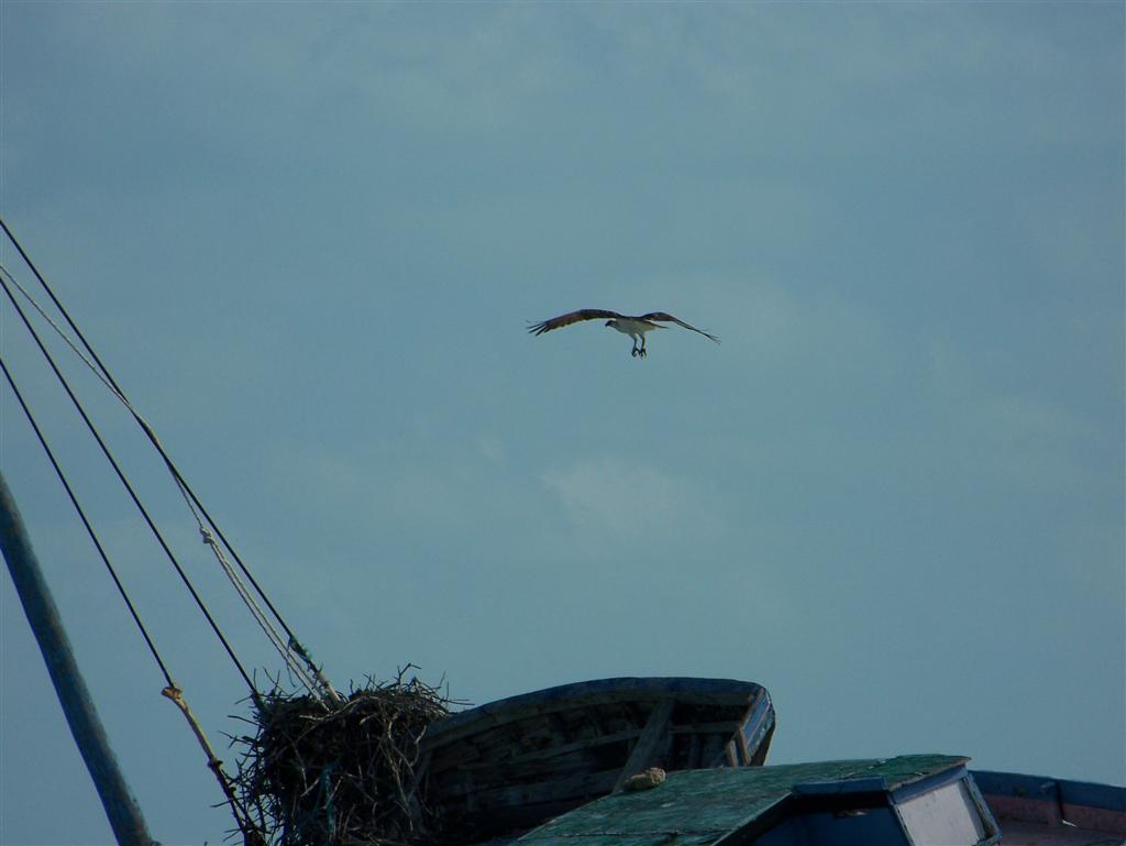
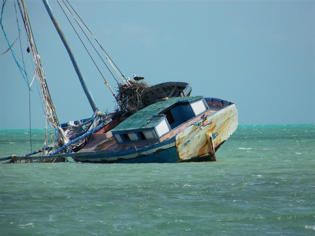
So
after returning to Pedigo, we were inspired to pedal north along the coast to
investigate an osprey nest on
a wrecked Haitian boat.
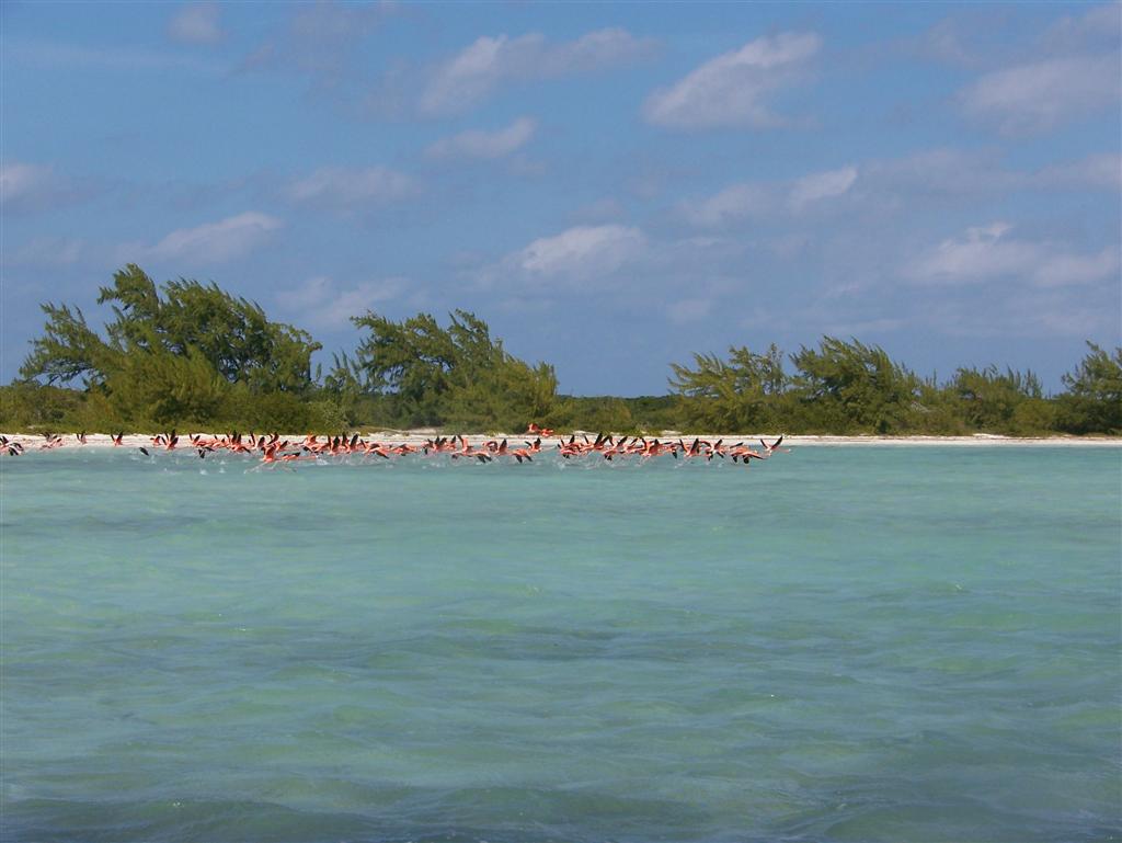
Further north, we encountered a flock of flamingos
wading in the shallows. Even our nearly silent Pedigo caused them to take flight briefly so we
could see the contrast of their black wings with their pink bodies.
Such
is the usual activities at a small place we visit, a bit of exercise,
sightseeing, socializing, and interaction with nature.
Girlie Stuff.
Dealing
with a nice time in the smaller islands has it's ups/downs/ins/outs and many,
many challenges. My first requirement when approaching a new anchorage was we
had to be as close to land as possible and secondly doing whatever was possible
to keep the boat rockin' in only ONE direction [fore & aft] and thirdly,
see if there was any water available on the island.
Because
these islands were small it was very easy to walk the whole thing or least make
it to one of the small communities. But after all the hiking and exploring
there was always the challenge of keeping the boat in tip top shape or in
"bristle fashion". I never wanted to divide the chores up according
to gender because we started our journey working together on most projects and
both just doing what needed to be done to live comfortably in a small space.
After watching Kevin do dishes, wash clothes and do a basic clean up job . . .
well, lets just say that I think I'll stick to doing the traditional
"women" chores aboard Windigo.
Let
me tell of the challenges of just the normal everyday stuff like washing
dishes. Remember that having/using water is always an issue. The less fresh
water you use the longer you can go without having to beg, borrow, and steal
some. So doing the dishes goes like this:
- Pre -dunk all dishes
in the ocean to get all crumbs off.
- Get a bucket of sea
water for the initial wash. [You have to make sure that your dish soap is
conducive to dissolving in seawater; Joy and Palmolive do the job nicely.
We don't have hot water on tap so a little extra dish soap helps get rid
of the grease residue sometimes apparent.]
- Add a small bit of
bleach to water then wash dishes.
- Have another
container of sea water to do the first rinse.
- Then a bit of fresh
water for the final rinse. Some say that if you dry your dishes right away
than you can just use seawater and the towel will wipe off the salt. I let
mine drip dry outside so I use the fresh water so they dry better.
Washing
clothes is another drawn out process. The only laundry facilities I found on
these islands were at the marinas and if they let you in you will be paying at
least $3 to wash a load and another $3 to dry. I'm sorry, but washing our
undies would have us looking for jobs sooner than later. So what I do is use
one of our blue storage/rain barrels which we carry on the bow of the boat. I
used to use our Igloo cooler but found the barrel to be more stationary and
holds a bigger load. I use regular Tide as the other ones with bleach or
softeners added don't dissolve in the seawater as well. I've also tried other
brands but they didn't dissolve at all. Anyways, use a little less than 1/4 cup
in a half barrel of seawater (add bleach for whites) and let clothes soak in
that overnight. During this time if we are not sailing then I step on the
clothes to simulate agitation. Empty water off clothes and use sea water for
two rinses. Use fresh water for the third rinse and you can even put in a
little softener but they usually come out fairly soft without. I found if you
hang your clothes out at sunset, they are usually dry a short time after sunrise
the next day. There have been other times when we've pulled into a rather
exclusive looking area and I've found great joy in hanging out our laundry
during the day. We look like total trailer trash and don't expect to get
welcoming looks from the neighbors.
Taking a shower also takes
some consideration. Kevin has very oily skin so just a dip in the salt water is
good enough for him but with my baby-sensitive skin, I need to take extra care
. We found a body wash that works great in salt water called Gel?Vitabath.
Then I use a fresh water rinse, condition my hair and realize that all is well
with the world - again!
Mold
and wetness is a constant battle but I seem to have gotten a pretty good handle
on it. I use a mixture of fresh water, bleach and dish soap. I keep it in a
spray bottle and when I see a problem area, just spray it on and wipe off. It
works great on the wood but you should lemon oil the wood after it dries. It's
so important to get ALL of the mildew out of the boat because it spreads so fast.
On sunny warm days I open closet doors for airing and take the contents outside
to dry out. Our closets and drawers are all lined with cedar; we also have many
bags of volcanic rock and containers of calcium carbonate for sucking up the
moisture in closed areas, but these must be maintained also.
There's
also the issue of keeping everything in their place which seems to be the
biggest problem we have on Windigo. When we are sailing we have to have
everything secured so no matter how far we heel over nothing is flying around.
Now when you are anchored you want to be free to use "your stuff" and
even let it lay about for awhile but because we are moving around a lot now
this last part tends to cause problems. It never fails as soon as we are
underway all of a sudden we hear a crash inside the cabin. Oh no! The oven door
just flew open and hundreds of batteries are now on the floor along with
plates, glasses and pans. Oops! There goes the Waterpik out into the hallway.
Darn! The welder just put another dent in the wood floor. I finally made a list
of last minute "to do's" and make myself adhere to this ritual before
pulling up anchor, but it seems I always miss SOMETHING (so much for lists!).
These
are just a few daily chores but there's also the cooking, sewing jobs, keeping
metal polished (green is really an ugly color on metal) and all the sanding and
sealing of wood, dealing with the extraction of sand and salt, etc. I wondered
why I was never this busy with household chores when living in suburbia. I finally
realized that we live 100% of the time in ALL areas of the boat. I can't just
shut a door and forget about it because it's right in your face everywhere you
turn.
I
love this life with Kevin, our boat and the adventures we have and wouldn't
change it for anything right now. Putting it all in perspective makes me
realize that these "chores" keep me, an overly energetic person, busy
when the Captain just wants to rest and relax. I think it makes him tired just
watching me flit around doing my girlie stuff but he knows that I'm also
willing to join him on bike rides, hiking, and checking out the local scene.
There's always time to rest when your dead so I'm going to live life to the
fullest while I'm still alive and kickin'!
Cycling Notes.
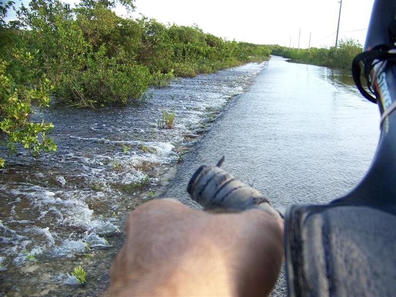
I
ventured out onto Long Island from two anchorages: to the north from Simms
(before Noel) and south from Grays Bight three days after Noel. If I would have gone one day earlier, the water would
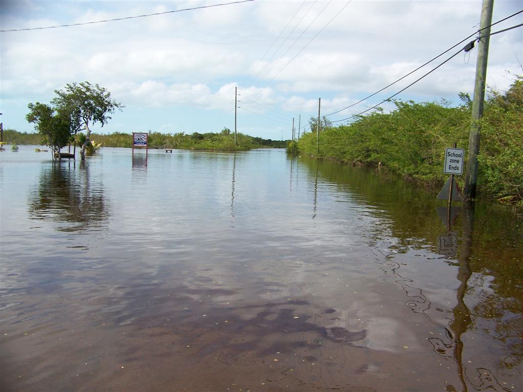
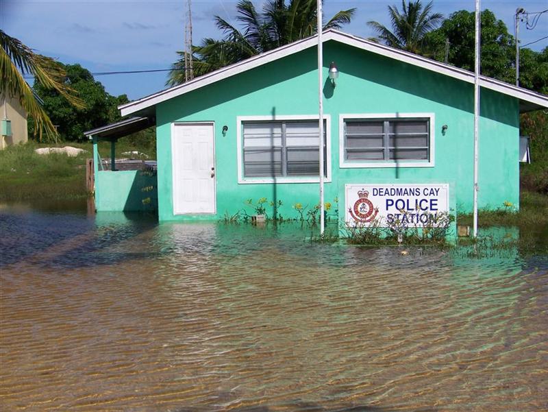
have been over my entire bicycle. (Two days earlier, this family told me I would have needed my
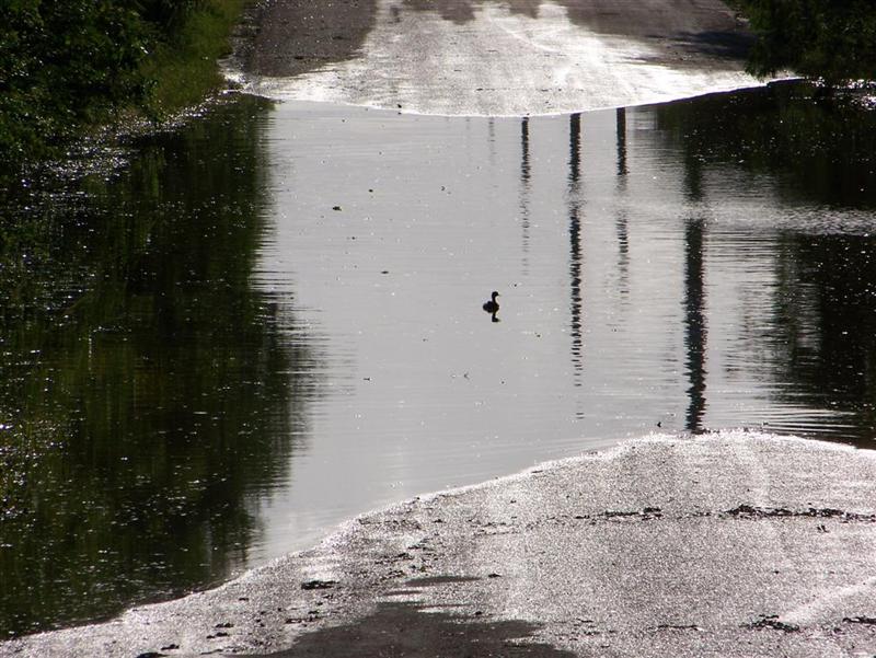
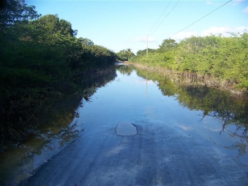
snorkel!) As it was, the water covered the road
in dozens of places, sometimes running across
like a rapids, sometimes flowing down the road like a river. Then there
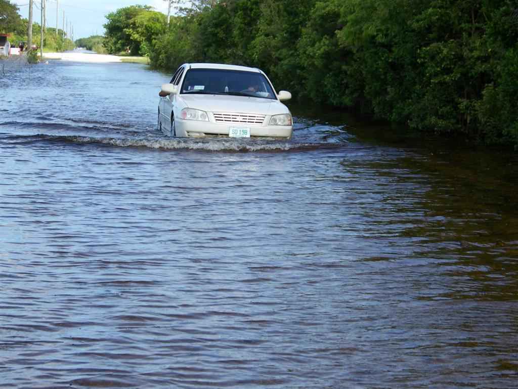
were places it just was there forming a lake extending over roadside properties and far into the bush. Even the land-based police became 'marine' cops!
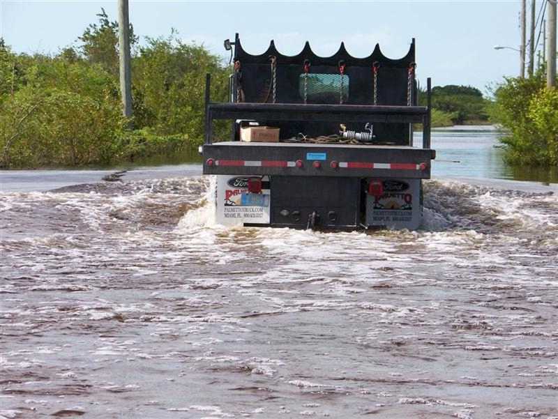
This was the first day the road was passable by larger vehicles, although some
cars attempted the shallower areas.
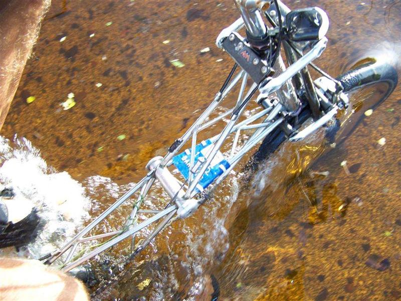
When
sailing The Bahamas, a boat skipper must 'read' the water for it's depth and
bottom conditions. On this cycling trip, reading the water was an important
skill to have, along with knowing
right-of-way rules and how to deal with the wake
of a larger vessel. There were also floating hazards, and the occasional
fish [which I didn't try to catch with my horrible fishing luck ;-].
After
this incredible ride, I maintained each bearing on the bike with penetrating
oil without disassembly, patiently and carefully saturating each mechanism with
first a thin, then medium oil. {Note: my land-based bikes were usually
maintained with dry lubricants, but this is totally ineffective for our
sea-going rides. ALL metal surfaces are treated with an oil or grease as a
barrier to the seawater and salt air. This usually causes more wear for
land-based bikes because of the abrasion of collected dust and dirt particles
adhering to the oil. At sea, the parts would rust away long before any dust
could wear then out!}
There
was some flooding remaining on Rum Cay,
and with the extra time it had sat there, it had mixed with the salt ponds on
the island making it a bit briny. Unwilling to subject my bike to that, I
needed to portage my bike across dozens of "road ponds". The 15 mile
ride took quite a while and was a strenuous workout!
The
next place to haul the bike ashore was Acklins Island. As with every other
island, there are plenty of "white
roads" in addition to the main thoroughfare; these are best ridden on
a mountain bike, although my Moulton negotiates them adequately. The giant road
improvement project began in 1998 was funded partially by the EU; the island
was paved tip-to-tip, but the specification details were a bit underestimated
so some sections of roadway have succumbed to heavy rainfalls and have been
eradicated. They are planning to fix it . . .
Crooked
Island was a blast to ride, but the 16-mile round trip on Pedigo from the bight
for the eastern tour made for a long day! The main road is just as new as the
one on Acklins, but is in better shape with less use and better drainage (there were still flooded sections).
Quite hilly for The Bahamas (as Acklins was) with breathtaking vistas of the
ocean and vast tropical island scenery. We rode several miles of the unimproved
roads to explore less-traveled sections of the
island.
Accessing
the roads from Landrail was much easier, with a very nice unused boat ramp
immediately to the north of the boat basin. The primary roads are nicely paved,
and with a bicycle able to negotiate the rougher roads, it is possible to cycle
all the way up to Gun Bluff on the north shore.
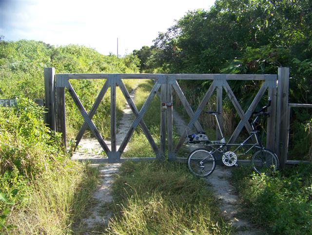
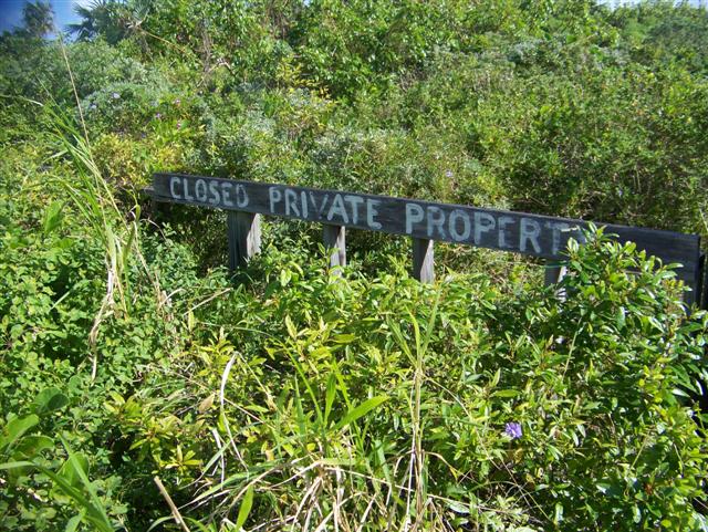
Locals told me to ignore the gate and
ominous sign, so just push
you bike through the south end of the fence and enjoy. (From the house on Gun
Bluff, the beach is right down the stairs and there is a few miles of scenery
and exercise to get to the caves mentioned above = be sure to get EXACT
directions to the "good" caves!)
Cruising Notes.
A Word On Weather Information
Coastal
cruising can usually be done on your schedule, with only the worst days
preventing an intended trip. I once continued a novice sailing course in Tampa
Bay straight through two days of 40-knot winds caused by Tropical Storm Dennis;
it was very doable in the protection of Tampa Bay and a great learning
experience for my sailing students in controlled conditions. Out in the ocean
it can be deadly at worst and very, very annoying at best. Everything is
amplified out here, so doing everything properly is important on the best days
and absolutely essential in days of adverse conditions.
To
avoid adverse conditions, the perfect policy is to be very patient. A complete
understanding of your vessel is imperative to predict the outcome of it's
interaction with existing conditions. Once the limits of your tolerance are
discovered, the detection of where existing conditions lie with reference to
those limits is necessary. In most cases, the boundaries of your limits will be
narrower than those of your vessel, if you have chosen and maintained it
suitably. The best weather information to this end, that is readily available
for this area, is the National Weather Service "OFFSHORE
WATERS FORECAST".
The study of these reports, over time, will give you an understanding of what
you and your crew can tolerate. [Note: although highly accurate, these reports
WILL NOT tell you the exact conditions at your location, but you can certainly
learn to get a feeling for what it is like and what is coming.]
Besides
relaying the current conditions, the "OFFSHORE WATERS FORECAST" will paint
the picture of future conditions. Again, not perfectly forecasting the weather
for 'You', but trying to give you a notion of what will happen. Listening to,
or reading, the "SYNOPSIS" and the "DISCUSSION" every day
will teach you what to expect as you observe the actual situation around you.
These weather products are distributed in many ways. Although many marinas and
agencies rebroadcast these products throughout The Bahamas, the Wx frequencies
on the VHF radio only work for inland and coastal cruising. Out here you will
need a SSB radio to get the original reports. IT IS ESSENTIAL.
The
best cheap equipment is the Grundig Yacht Boy 400PE radio, available at West
Marine and Radio Shack, among others. $150 will allow you to tune in to these
NWS products and hundreds of other useful programs.
I
have a comprehensive updated list of
useful SSB frequencies for the Atlantic & Caribbean that I will share,
or the Wx frequencies are published at: ![]() www.nws.noaa.gov.
www.nws.noaa.gov.
[On
SSB radio everyday is THE cruiser's weatherman for the Atlantic,
Bahamas, and Caribbean = Chris Parker. Listen to him for free, or sign up for
his personalized program at http://www.caribwx.com/.]
Equipment
on the more expensive end of the spectrum involves a SSB transceiver, antenna
& automatic tuner, and packet modem all interfaced together and into an
onboard computer. The acquisition of a HAM operator license would put you in
the most advantageous position to send and receive email from your vessel at
sea, request and receive not only weather information, but actually access the
text on any known URL, and do this anywhere, anytime, for free.
There
is one more source that I would consider essential to help you to understand
weather, and that is Bruce Van Sant's The Gentleman's Guide to Passages
South: The Thornless Path to Windward. More of a cruiser's 'Operator's
Manual' than a cruising guide, the methods described in this book are
what work not only in this area, but anywhere people sail small boats to and
fro. [It is also and excellent cruising guide for the Dominican Republic,
Puerto Rico, and the Spanish Virgin Islands.]
The Harbours Of The SE Bahamas.
Here
is a synopsis of the places to stay:
Alligator
Bay, Simms, Long Island, Bahamas
N23o28.460' W075o14.106'
Even
Windigo could get fairly close to shore here, unlike the other anchorages in
the bight of long island.
Tucked
in close with moderate east wind, there was a barely detectable swell. Great
holding sand bottom in the two locations we stayed despite what it says on the
chart. Excellent access to shore at landings, beaches, and old docks. Very
small town, but has a store.
Thompson
Bay, Salt Pond, Long Island, Bahamas
N23o21.589' W075o82.310'
This
is where we withstood Tropical Storm Noel for four days. Actually felt quite
secure until the wind went west of south; then there was a bummer of a swell.
Outstanding holding in sand. Again, excellent access to shore. Larger town with
some services; no marina.
Grays
Bight, Long Island, Bahamas
N23o16.644' W075o06.909'
A
bit shallow for Windigo, but with a normal draft, one could get in close to the
boat ramp / dinghy landing. In closer, the protection would seem to surround
you on three sides, but completely useless for west winds. Holding a notch
below the previous two anchorages, but still good sand. It seems that a
restaurant bar has just closed at this location. Not much here except great
access to the road.
Hog
Cay, Long Island, Bahamas N23o35.598'
W075o20.563'
An
open anchorage subject to swell, even though we tucked in quite close to the
south edge of Hog Cay. The swell goes right to shore with a north-to-northeast
wind; probably slightly better in calmer southeast wind and untenable in SE to
NW wind. Nice holding in sand. Great access to Hog Cay at a dock.
Calabash Bay, Long Island, Bahamas N23o39.436'
W075o20.426'
An
anchorage protected to the west by some coral, but an open anchorage
nonetheless with swell. A boat able to get closer than our 7' draft allows
could be more comfortable. Again, it is probably fine in calmer southeast wind
but totally nasty in SE to NW wind. Great holding in sand. A short dinghy ride
into Hoosie Harbour which is totally protected and very shallow and a great
ride around the mangroves and sand bars. Down towards the bridge on Galliot Cay
is a very nice dinghy dock right into
Seymours, not exactly a teeming metropolis, but is does have a bar and nice
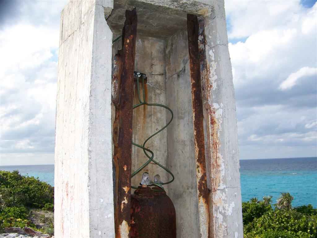
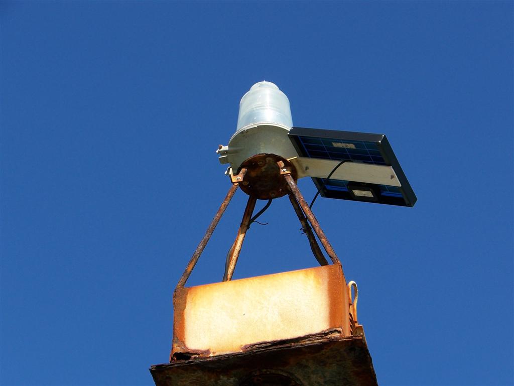
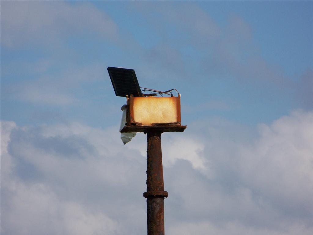
streets to walk around on. The road to the north takes you to the
mile-and-a-half to the Columbus Monument and a navaid that once was
gas-powered, but now is a self-contained
solar-powered unit; it sustained damage in
Noel. The road to the east takes you a little over a half -mile to the secret bridge to the
Newton Cay beach.
Port Nelson, Rum Cay, Bahamas N23o38.822'
W074o50.815'
You
can get closer here than most people try, probably because they are scared by
all the coral on the chart = it ain't that bad, just do it in good overhead
light. Lots of sand to lay your anchor away from the coral heads [which make
for AWESOME snorkeling ? check out the stuff between Cotton field Point and
Monroe Beach]. There is a swell here, but it was almost gone in the north wind
we experienced; Might be worse in south winds. Rum Cay has stores and
restaurants, but it is a small, remote settlement. The small marina (trying to
be upscale & expensive) is modern and was expanding and dredging when we
were there. There are dinghy beaches, a Government Dock with room for your
dinghy, or do what we did and take it into the marina and up the canal and tie
up at the first low bridge (you can get under at low tide, but watch out when
it rises!).
Paved
roads along the shore by the settlement, but the one that goes across the
island to the north beach is mostly dirt (& mosquitos!). It is over four
miles to the other side, so bring water and a bite to eat.
Clarence Town,
Long Island, Bahamas N23o06.277'
W074o57.054'
Interesting
access to the east shore of Long Island at Great Harbour (the name might be a
little generous). The best anchorage is up under Strachan Cay which keeps you
out of the way of the traffic to the Government Dock (or do what the BDF ship
did and anchor
right in the middle of the entrance!). Lots of coral here, but also lots of
thin grass patches on sand = use good light to anchor and you can get close to
shore and be about 1000' feet from the gorgeous raging ocean breaking on the
reefs, without a tremendous amount of swell (but some). Clarence Town is the
capitol of Long Island, but does not have running water yet; the packing house
on the west end of the harbour has good cistern water and a hose that nearly
reaches the beach. Nice dinghy landings, little stores, restaurants, and a
really cool church building designed and built by Father Jerome you can see
from anywhere in the harbour.
Long
Cay, Acklins Group N22o34.729' W074o19.810'
Windigo
had to anchor ? of a mile from the shore off the jetty and dock at the end of
the road that runs to Albert Town, but with a normal draft, one could anchor
half as close. The "dinghy channel" leading to the dock is VERY
narrow and VERY shallow. There are stakes marking it, and it is mostly a soft,
sandy bottom; but the tidal range here is less than half of the normal
difference in The Bahamas. Depending on wind, the tide changes little more than
a foot in the Bight of Acklins.
Camel
Point, Acklins Island N22o26.607'
W074o00.213'
We
tucked under the abandoned government dock at the tip of Camel Point for
protection of the strong north-to-east winds the fronts were delivering at the
time. Although only a couple hundred feet from the shore, it was a 1/3 mile Pedigo ride to the
jetty and the road for the dock. Nice private dinghy landing. A healthy walk to
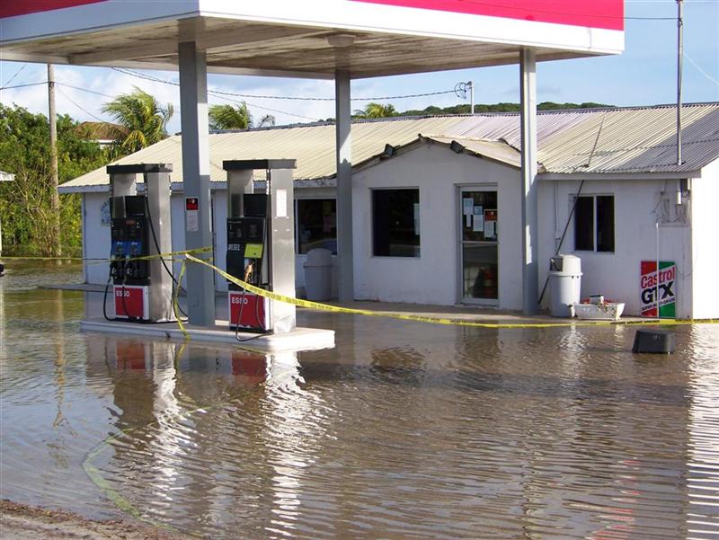
Spring Point at 2+ miles, the gas station where we purchased the cheapest fuel
since Marsh Harbour is less than 2 miles from the dock. A long way to walk, but
a very short jaunt on a bike!
Jamaica
Cay, Acklins Island N22o22.975' W074o06.771'
We
spent a night here in this open-water anchorage with protection from the east
in moderate weather [up to 20-25 knots]
Cotton
Bay Cay, Acklins Island N22o12.716'
W074o12.440'
We
needed to play the tides as we worked our way down to the southern end of
Acklins, so we anchored here one night to have the highest water possible for
sailing around Rokers Cay on our way to Salina Point. An anchorage similar to
Jamaica Cay, we tucked in to the reef [which is shallower than the charts say]
which provided excellent protection in steady easterlies.
Salina
Point, Acklins Island N22o13.797'
W074o14.558'
We
found a "hole" very close to shore that was subject to a little
wind-chop from the east wind, but afforded as good of protection as we could
expect on the east-west shore. Although there are coral heads everywhere
between Jamaica Bay and Rokers Cay, and they extend far to the north, this tiny
area is very clear and we had no problem exiting the Bight by sailing directly
out, a little north of west.
Landrail
Point, Crooked Island N22o48.451' W074o20.622'
Although
I didn't get as close to shore as I predicted [a little game I play with myself
= try to pick the EXACT anchoring spot from scouring the charts ahead of time]
this was convenient enough to make many trips to shore and carry over 700
pounds of water and the bicycles (twice). I used an anchor bridle to point
Windigo into the (major) swells from the north, and the anchor held us sideways
on the marl in 20+ knot wind for several days.
There
is coral everywhere here, but the ocean floor plummets a couple hundred feet
les than a mile from land, so most of it is harmless. The ones close in are NOT
harmless. There is one marked on the chart that I thought ahead of time I could
actually get in behind; but the swell is still prevalent close in, and the
chance of dragging into it did not seem worth the challenge of getting in
there. We just had to avoid the breaking waves during certain tidal flow as we
dinghied ashore past it.
If
you happen to anchor closer to Pittstown Point Landing, or take a walk up
there, you may find a wireless signal for the i-net. There were four keys in use
when we were there; try them and connect.
Access
to Marine Farm Salt Pond is right across the road from the boat ramp just
outside and to the north of the basin. We portaged Pedigo across the road and up the very shallow
slough into the Salt Pond. The tides in the Salt Pond run SEVERAL hours
behind the ocean tides = very weird {I think it has to do with rain water
runoff supplying the Salt Pond}. If you wish to explore the Marine Farm fort,
head north to the dinghy landing / trailhead = N22o49.2923' W074o20.3866'. It is a short
hike up the hill on a easily negotiable rock path [some overgrowth]. The bugs
weren't bad. A 1000' up and you will happen upon a
cannon or two. These are in excellent shape, with forged
markings and engraved numbering completely legible. The remains of a fort structure is at
= N22o49.2746' W074o20.1666', with another a couple hundred
feet to the north. More fun than a geocache! Trying to imagine what it was like
300 years ago; trying to get a
view of the Crooked Island Passage they were guarding.
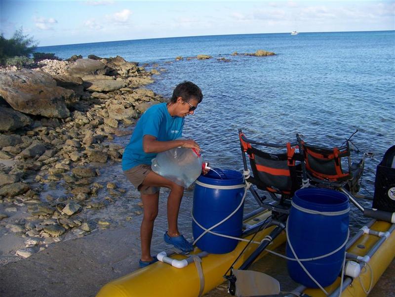
There
hasn't been free running water, or even readily available cistern water since
we left Clarence Town. We filled our tanks during Noel, but the usage of
drinking, laundry, boat maintenance, and showering has drained our tank to a
minimum level. With the remote islands of San Salvador and Conception ahead
before we get to Cat Island, the need to resupply was upon us. The girl in
Scavella's store offered access to the UNpotable water from a faucet at the gas station. With stress on the
non-drinkable part, we treated the water fully with iodine
and chorine,
and we used a two-stage particle filter prior to filling our tank. [ALL our
drinking water is drawn at the sink through a sediment / activated charcoal
filter that removes particle down to 5 microns, cleanses it of Giardia &
Cryptosporidium, and any foul taste or odor.]
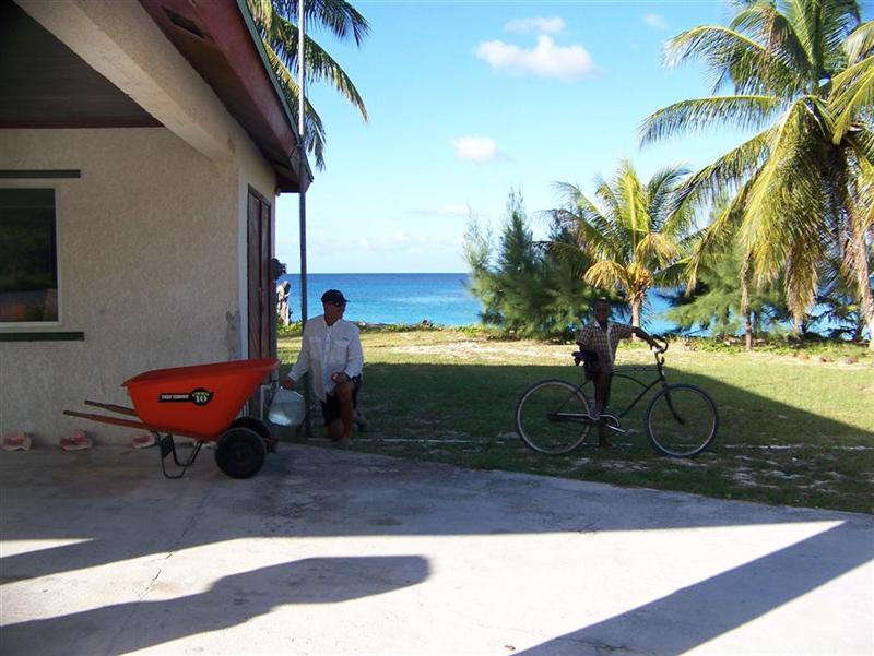
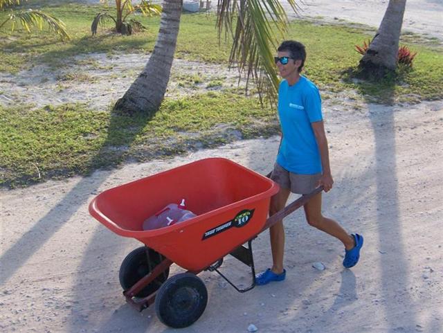
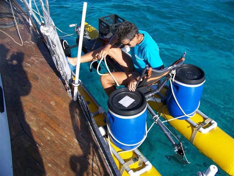
But
the processing wasn't nearly as involved as was transportation. The gas station
was a couple 'blocks' down from the marina basin, and the free boat ramp we use
is just on the other side of the basin. Kenny Scavella was gracious in allowing
us to borrow his wheelbarrow to cart our 2
five-gallon jugs to Pedigo. We had our 2
thirteen-gallon barrels lashed on, so four round trips to the faucet fills
the barrels and leaves the jugs full, enabling us to bring over 35 gallons of water each Pedigo trip.
So
a dozen round trips to the faucet and three round trips with Pedigo brought
over 100 gallons water to Windigo for free. The alternative would be to weigh
our anchor; negotiate the coral heads into the basin; tie up to the dock wall
in the basin (with LOTS of fenders as the surge is strong even in the basin);
have Kenny truck potable water (which we treat with chlorine and filter in any
case) to Windigo; pay Kenny for the water and trucking AND pay for the use of
the basin; cast off and negotiate our way out of the tiny basin and around the
coral heads back to reanchor. Considering the cost and effort in doing that, it
was an easy decision for us to spend the time dinghying the water.
Don't neglect to stand a
diligent watch in the Crooked Island Passage;
?between Long Island & the Acklins Group past Rum Cay &
Conception Island to San Salvador & Cat Island.
We had typical crossings, encountering six vessels in our vicinity.
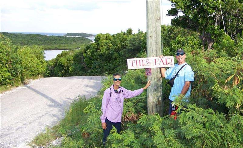
Now
that you have followed us THIS FAR, you will enjoy
reading about the remaining Family Islands are covered in the next Eletter, the
last report from The Bahamas.
See
where Windigo has been:
http://shiptrak.org/
Enter
Windigo's callsign: W3IGO
(and
zoom in when it starts tracking)
Where
we are right now:
http://map.findu.com/W3IGO
Our
permanent and EXACT address:
Capt.KL
& Karin Hughes
S/V
WindigoIII - PMB 365
88005
Overseas Hwy. #9
Islamorada,
FL 36033-3087
Text-only
Email addresses aboard Windigo, checked daily:
[reliable
communication]
Email
addresses checked when at a land-based computer
(infrequently,
but good for attachments):
And
of course, the Windigo Travelogue Catalogue:
http://www.ciekurzis.org