--------------------------------------------------------------------------------------------------------
THIS ELETTER IS BROUGHT TO YOU
BY:
Climate Change 2007 - The Physical Science Basis
The IPCC was set up
jointly by the World Meteorological Organization and the United Nations
Environment Programme to provide an authoritative international statement of
scientific understanding of climate change. It consists of hundreds of
scientists from dozens of countries around the world, so all points-of-view and
agendas are addressed.
All the unabridged reports are available for
free download or viewing at:
<http://www.ipcc.ch/ipccreports/ar4-syr.htm>
The IPCC's periodic
assessments of the causes, impacts and possible response strategies to climate
change are the most comprehensive and up-to-date reports available on the
subject, and form the standard reference for all concerned with climate change
in academia, government and industry worldwide.
--------------------------------------------------------------------------------------------------------
And now, the eLetter:
2009,
So Far
Global
Warming.
The IPCC continuously examines data from
countless methods and sources, and makes periodic assessments of the causes,
impacts and possible response strategies to climate change. These are the most
comprehensive and up-to-date reports available on the subject, and form the
standard reference for all concerned with climate change in academia,
government and industry worldwide. This information, albeit mighty complex and
deeply detailed, is of course interesting to every person on earth; but a solid
science background is necessary just to read the damn thing. I pride myself in
having learned much about science starting at an early age; keeping up with new
developments; and deepening my understanding of obtuse subjects when I can find
the time. �
Through three
working groups, many hundreds [thousands!] of international experts assess
climate change in this Fourth Assessment Report. The Report consists of three
main volumes under the umbrella title Climate Change 2007. I carefully read the
THOUSAND PAGES of the scientific volume, "2007 Climate Change 2007 - The
Physical Science Basis" word-for-word, studying the graphs and diagrams
until I achieved an adequate modicum of understanding of each issue presented. This
took a year & a half!
I will present a
few items that should interest you. I am not sensationalizing the facts, but
only mention stuff that is pretty impressive, some of which is happening, or
going to happen "soon". Although I express the opinion that remedial
action is required right now, nothing "totally catastrophic" is
expected in the 21st Century. We haven't "destroyed our
grandchildren's world"; but they will be called to the task of working to
rectify what we and our ancestors have set in motion.
� (I have been reading Feynman, Penrose, Einstein,
Thorne, Weinberg, Dyson, and their ilk for a few years to grasp the deeper
theories of physics and math - don't worry, there will be NO eLetter about
hyperbolic space or relativity!)
What is Happening
During "Global Warming"?
...from the current
knowledge of individual forcing mechanisms the combined Anthropogenic [human-caused]
Radiative Forcing is both positive and substantial (Best estimate: Annual
increase of 1.6 Watts onto every square meter, per second).
The global mean
surface air temperature has been forced to rise almost 2o Fahrenheit since the
19th Century; this during a time when evidence indicated a natural temperature
cooling trend. The predictions for the 21st Century include another 3o to 7o F.
increase. This would be a catastrophe for global climate.
Observed changes
include the accelerated destruction of the cryosphere (ice covering both land and
water) which resulted in a rise of mean ocean levels. The rate of increase of
ocean height doubled in the second half of the 20th Century, over the rate
during the first half.
500,000 Pounds
Every Second!
Here's the kicker:
Man's fossil fuel burning (and cement production) activity on this planet
produces and expels over a half-million pounds of carbon dioxide into
the Earth's atmosphere EVERY SECOND. Right now. Today. And it is only
increasing at 3%/year. At this rate, the amount of carbon we pump into the
atmosphere in the next twenty years will exceed the amount we have polluted it
with since the beginning of time. Wow.
Carbon dioxide is a
devastating reflector of long-wave radiation (infrared radiation) that is
emitted by the Earth's surface [which is distinctly different than the
short-wave radiation (UV) emitted by the sun, because the Sun is hotter].
This is a major
cause of "global warming", along with increased water vapor,
aerosols, methane, nitrous oxide, and CFC's caused by our activities.
Most of these
effects are irreversible because man has also destroyed, or drastically
altered, the "sinks" for these bad substances that cause the
'greenhouse effect' [through deforestation, over fishing, terraforming, etc.].
The domino effect
is increasing the speed to our doom = as the glaciers melt, they reflect less
heat back out into space so it gets even warmer and more glaciers melt . . .
among other things.
[St. Mary's
Glacier, where I once skied in Colorado every July, IS GONE FOREVER!]
We are slowly
cookin' the planet, and there is no way to turn off the BBQ.
Everyone Doesn't
Get Warmer
Changes in the
circulation of the atmosphere and ocean are an integral part of climate
variability and change. Accordingly, regional variations in climate can be complex
and sometimes counter-intuitive. For example, a rise in global mean
temperatures does not mean warming everywhere, but can result in cooling in
some places, due to circulation changes.
For example,
scientists understand the mechanisms of the Atlantic Gulf Stream [known
scientifically as the MOC (Meridional Overturning Circulation)]:
It is a warm-water
"river" flowing on the surface through the Caribbean, Gulf of Mexico,
up the eastern Atlantic and across to the North Sea. The Gulf Stream is a heat
conveyor of humongous proportions; it equalizes temperature differences due to
the angle of the surface of the earth to the sun. It transfers excessive heat
from the tropics to the east coast of the US and over to the UK.
It is entirely
possible that as the polar ice caps continues to melt, the fresh water released
will float out on top of the more-dense saltwater of the Atlantic Ocean,
subjugating the Gulf Stream, forcing it down to mix with colder water and
eventually stopping its flow. This cessation of heat transfer would cause the
buildup of energy in the tropics, extending the length of the hurricane season
and increasing its severity, and create 'ice age conditions' in normally
temperate Ireland.
Although the
shutdown of the MOC may take several centuries, the cessation of convection in
the Labrador Sea in the next few decades, due to warmer and hence less dense
waters that inflow from the Greenland-Iceland-Norwegian Sea, has been predicted
in several computer models.
There has always
been constant change in the earth's environment, but some of the rapid changes
that have been forced by man's activities in our atmosphere and oceans over the
past two centuries have exceeded the changes believed to have occurred over the
past half-million to two million years.
We have disturbed
the delicate balance of the world in grave ways.
Natural Cycles
But all recent
climate anomalies are not the result of global warming (Anthropogenic [human-caused]
Radiative Forcing):
"While changes
in Atlantic SSTs (sea surface temperatures) have been linked in part to the AMO
(Atlantic Multi-decadal Oscillation), the recent warming appears to be mainly
associated with increasing global temperatures. [Warm SST is a major factor in
tropical cyclone development.]
Tropical cyclone
development is also strongly influenced by vertical wind shear and static
stability. While increasing greenhouse gas concentrations have likely
contributed to a warming of SSTs, effects on static stability and wind shear
may have partly opposed this influence on tropical cyclone formation.
Thus, detection and
attribution of observed changes in hurricane intensity or frequency due to
external influences remains difficult because of deficiencies in theoretical
understanding of tropical cyclones, their modeling and their long-term
monitoring. These deficiencies preclude a stronger conclusion than an
assessment that anthropogenic factors more likely than not have contributed to
an increase in tropical cyclone intensity."
Directly Harming
Entire Classes of Species
Multi-model
projections give 21st century reductions in ocean pH three-times the
amount of the decrease experienced since pre-industrial times. This ocean
acidification leads to dissolution of shallow-water carbonate sediments and
could adversely affect marine calcifying organisms. Shellfish of the 21st
century will have problems growing their shells.
Unknown Scary
Possibilities
By disturbing the
balance of nature, certain currently unknown "thresholds" could be
crossed causing "abrupt" climate changes as opposed to the normal,
progressive development of climate conditions usually experienced on the
planet. These abrupt changes could trigger cascading effects across the entire
climate system and result in enduring harsh conditions inhospitable to many
forms of life.
One possible
outcome is that several types of flora and fauna would endure the harsh weather
conditions and increased radiation for the next 30,000 years; at about this
epoch, the natural orbit changes and tilt of the earth will
have moved into a cyclic oscillation that will herald the next ice age and
"reset" the balance. Hopefully the human species can be one of
the survivors.
How Do We Know All
This Stuff?
Thousands of
scientists are working in every country in the world gathering and analyzing
data related to global warming. So it just isn't John Holdren, President
Obama's Science Advisor, who is considering drastic measures to abate the
adverse effects we have had on our environment.
Read all about it:
<http://news.yahoo.com/s/ap/20090408/ap_on_sc/sci_obama_science_adviser>
Being the
"superpower", the US can afford sophisticated methods of data
acquisition and has utilized many, many satellites over the years to monitor
changes in conditions on our planet. These missions continue with evermore
precise measurements and details. Later this year the most sophisticated device
will be placed in orbit solely for the purpose of analyzing aerosols in the
atmosphere and their effect on the energy balance of the Earth.
<http://glory.gsfc.nasa.gov/index.html>
But these missions
are not without risk, and earlier this year a failure of a simple component =
the cover concealing and protecting the Orbiting Carbon Observatory satellite
during launch failed to separate, causing the entire unit to fall back to Earth
and crash in Antarctica. Bummer.
<http://www.tgdaily.com/content/view/41527/184/>
Speaking of
Antarctica, this just in from the European Space Agency [good thing NASA isn't
the only game in town]:
After hovering in the
balance for months, an area the size of New York City has broken off the
Wilkins Ice Shelf in Antarctica.
"The retreat
of Wilkins Ice Shelf is the latest and the largest of its kind. Eight separate
ice shelves along the Antarctic Peninsula have shown signs of retreat over the
last few decades," said David Vaughan of the British Antarctic Survey.
"There is little doubt that these changes are the result of atmospheric
warming on the Antarctic Peninsula, which has been the most rapid in the southern
hemisphere."
In the past 50
years, temperatures in the Antarctic have risen by 2.5 degrees Celsius, about
six times the global average. In the last 20 years, seven complete ice shelves
have been lost. Wow!
Read all about it:
<http://www.esa.int/esaCP/SEMRAVANJTF_index_0.html>
The scientists
realize how important it is to understand the balance of energy of our world,
and will continue to examine our effects on the health of the planet. Please
pay attention to what the knowledgeable truth-seekers have to say and do not be
influenced by the money-grubbing corporations in the government's
military/industrial complex in their quest for personal gain. Historically,
information has been both ignored and greatly exaggerated(!); this trend will
surely continue, so you must be personally knowledgeable because you are
ultimately personally responsible for your fate and that of your progeny.
The
Trips.
I shall denote some of my activities in this section under headings organized by the movements of Windigo.
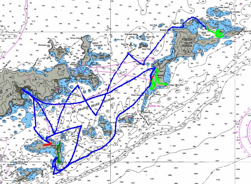
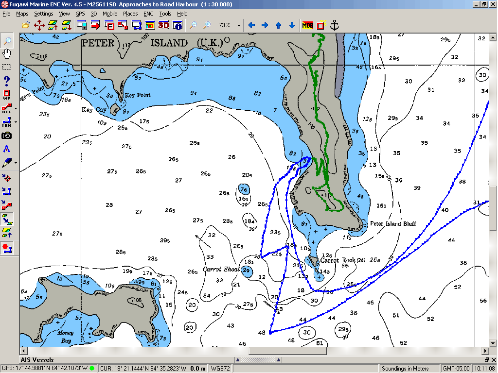
1- Hangin' in the
BVI [MAP1]
Around the middle of January, things began to slow down at the Sunsail / Moorings charter
base in Tortola where I have been teaching. The economic trends had caused
"common people" to stop booking sailing classes here in 2008, so my
schedule was empty. The charter base also laid-off some local workers which in
turn affects the work permit situation in the Department of Labour. I found my
visa expiring without provisions to extend it.
So I went sailing with Klaus
& Martha on the SwanVictoria out of Tortola to Peter Island and
Virgin Gorda. We cleaned our bottoms and went hiking, did boat projects and
went sailboarding. We were productive and had a good time. A highlight of our
journeys was the sharing of our anchorage at Jost Van Dyke with the Maltese Falcon.
It is a 290-foot, 1,240-ton, three-masted sailboat, one of the largest
privately-owned sailing yachts in the world, that perform all its functions via
computer. It requires a crew of ONE, and all she has to do is push buttons. Check out the website = it is
quite amazing (and it's for sale!)
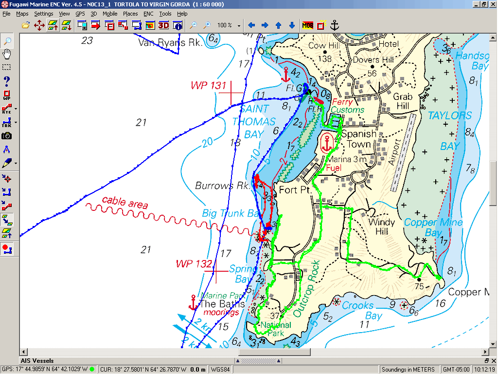
2- BVI to St.
Croix [MAP2]
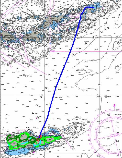
The SwanVictoria is a luxury charter vessel, and in
February Klaus & Martha had to work, so I sailed down to St. Croix to be
legal in the US and hang with Dan & Kimberly on Snark. Last year,
you may remember that Dan & Kim were house-sitting, but the owners had
returned and they were back onboard their sailboat - with Dan's daughter and
fiance - 4 people living on a 31' boat.
I spent the month of February entertaining the kids during the week, and
tagging along on family outings on the
weekends. Sometimes, the family tagged along with me on geocache adventures. It was a good month in St.
Croix as the weather was perfect and there was a steady schedule of festivals
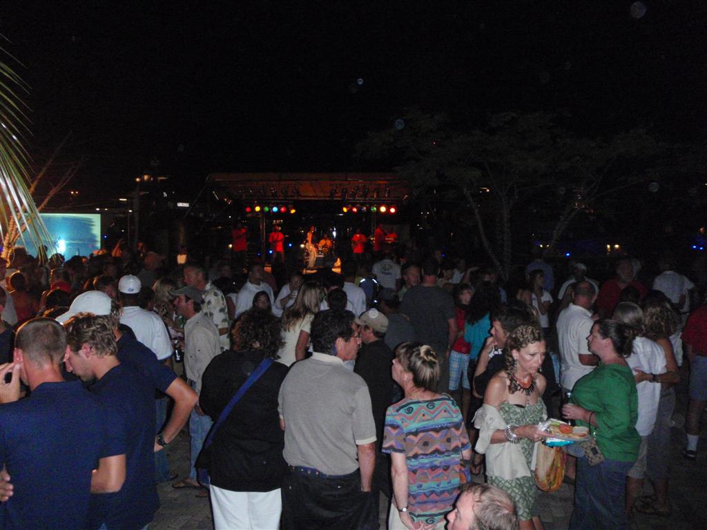
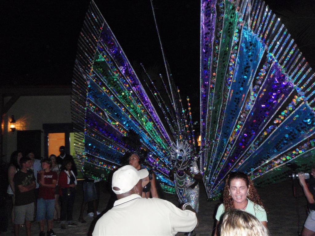
and events. Jump Up! is
a quarterly Caribbean celebration in Christiansted that was quite large by
island standards. Literally thousands of people spent the evening on the
streets of town enjoying music,
food, dancing, and all manner of social entertainment.
My friends Dave & April sailed the Shannon Glyn into Christiansted just in time for
the 2009 St. Croix Agricultural Fair, the largest food fair in the Caribbean!
It had elements of the typical State Fair, and was very impressive for an
island affair.
Dave needed some electrical engineering on his boat, so kept me busy for
a couple days and I made some $$$ ;-]
I scoped out many places on St. Croix = it is a great island to cycle
around, has many historic sites and structures, a rum distillery, a botanical
garden, lots of nice beaches, a mountainous rain forest, and great wind for
sailing. I'll save the presentation of all this stuff for later when Karin
& I return for a proper exploration of this very beautiful and interesting
island (more on that at the end of the letter!).
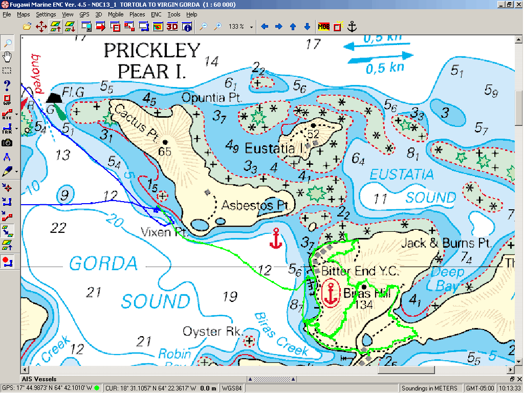
3- Sailing North
from St. Croix [MAP3]
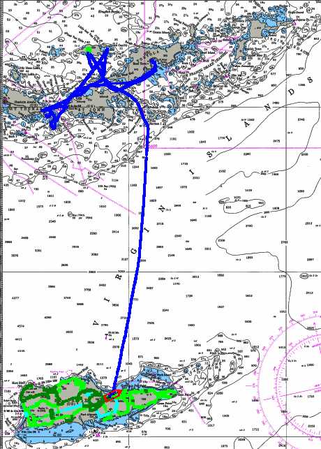
When the kids got jobs during their extended island stay, things soon
got boring for me! So I headed back to the Virgin Islands. I sailed directly to
a tiny islet in the BVI to become the First-To-Find on a new geocache there,
then proceeded to the USVI. This was Windigo's first visit to these anchorages
on St. John and St. Thomas (I had visited while captaining charter boats), and
it was fun exploring the nooks and crannies with the seven-foot draft.
Eventually, the SwanVictoria met up with me at the east end of
St. Thomas, but the weather was turning nasty for that anchorage so I left them
to their business and scampered off the safety of Road Harbour. While in Road
Town, I had the chance to pick up my Christmas box from the Post Office (better
late than never). Now I had a camera, so the pix will begin to flow once again!
After the weather settled, Windigo and the SwanVictoria met up
once again at Jost Van Dyke for hiking and socializing. We must have had too
much fun one night (and none of us drink!), for Klaus had come to the decision
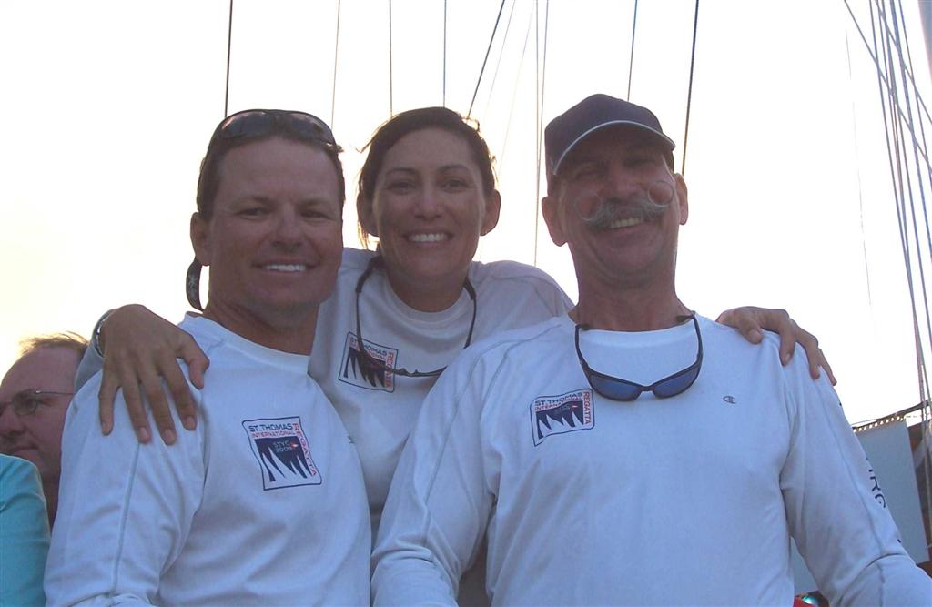
to enter the 2009 St.
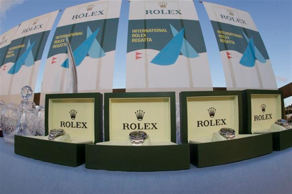
Thomas International Rolex Regatta, which began in a little more than a
week. He told me he would only do it if I would crew on the SwanVictoria.
I agreed, and race practice began immediately.
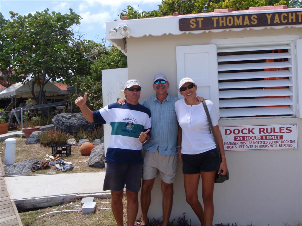
We spent a long day sailing the SwanVictoria, then relocated both
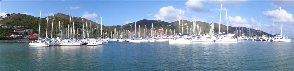
boats to Cowpet Bay, the home of the crew of the raceboat
SwanVictoria.JPG and the center of activity for the Rolex Regatta.
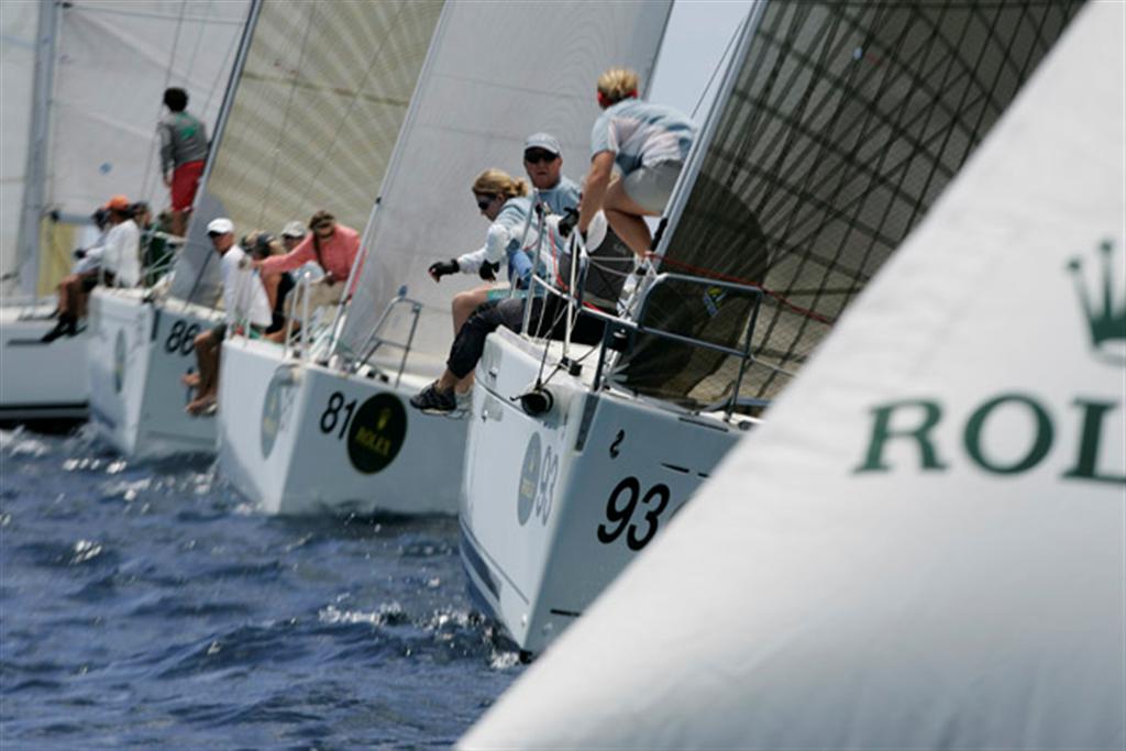
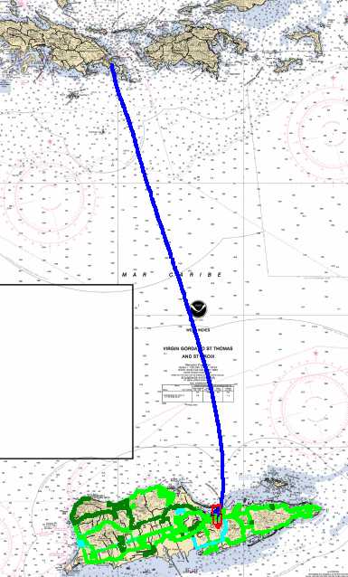
4- 2009 St. Thomas
International Rolex Regatta [MAP4] (black was practice tracks;
purple was the races)
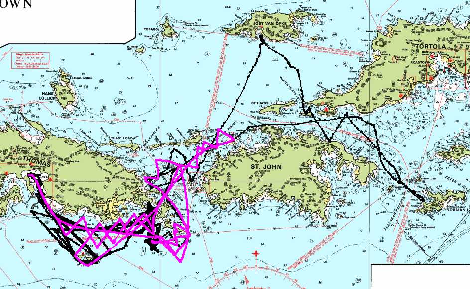
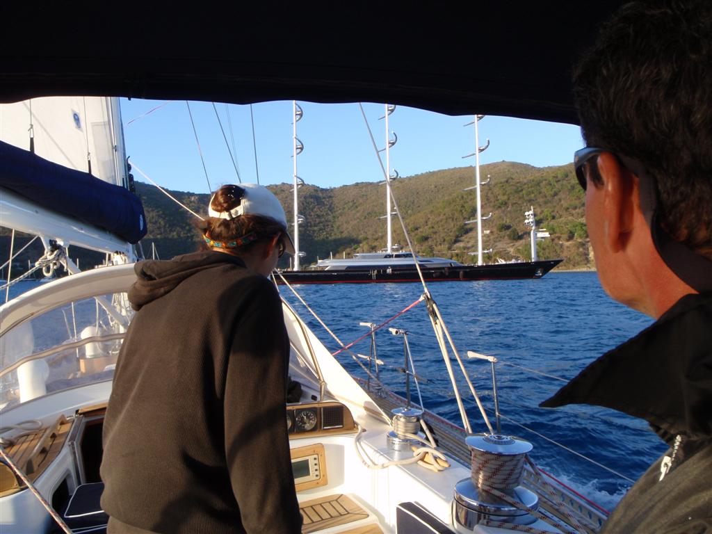
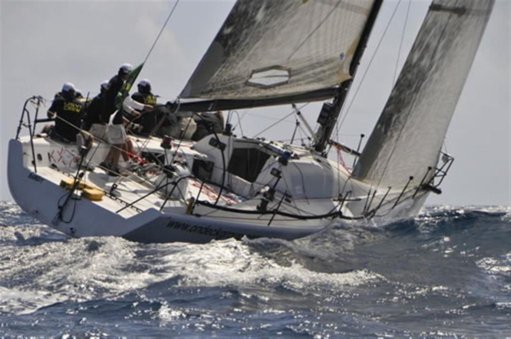
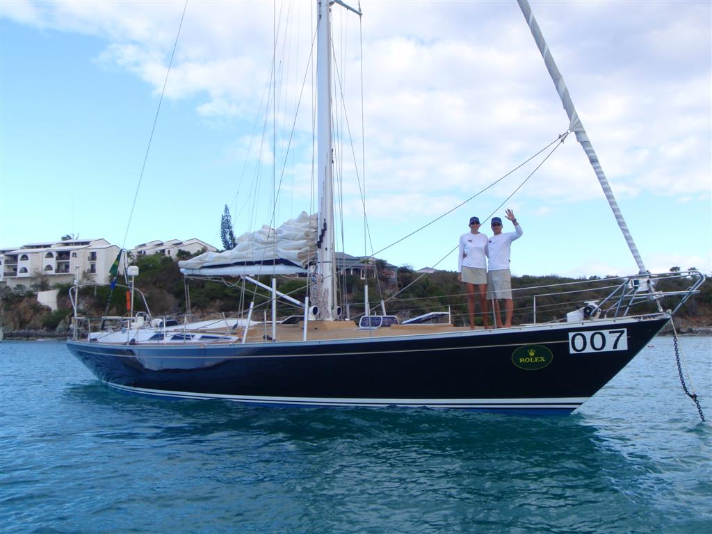
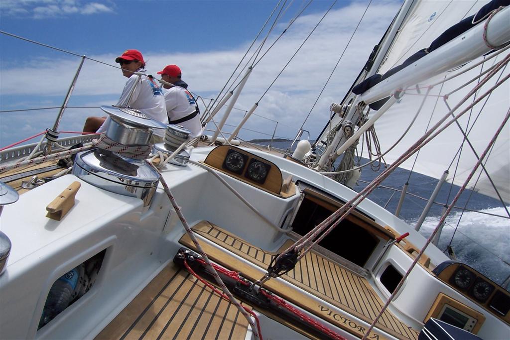
You must understand that although a Swan 48 is a marvelously sailing
boat; but the SwanVictoria is 34 years old and Klaus & Martha have
it fit out for luxury charters, not racing. It is one of the most beautiful
boats I have ever seen, and does sail very efficiently, but we would be facing international competitors in the Rolex
Regatta, some of them professional sailors. Their boats are sleek and modern,
one of the boats in our class was a German
Frers-designed 80-foot racing machine with THIRTY-TWO CREW! If we
intended to be at all competitive there would have to be serious changes aboard
the SwanVictoria. And so there was . . .
We unloaded almost 4,000 pounds of gear into a storage unit on Tortola,
including removing two GIANT winches on the mid-deck used for a sail we
wouldn't need for the race. Then once in Cowpet Bay, we stowed hundreds of
pounds of additional gear on Windigo for the race. The SwanVictoria now at least
looked as if she was a racing boat.
With three crew, we all had to pretty much be responsible for all
aspects of crewing, but I took it upon myself to be navigator & tactician.
I examined the racing rules and courses (CLICKING THIS WILL DOWNLOAD THE COMPLETE RACING RULES)
for hours, and worked up the waypoints and routes for the 21 race courses they
could possibly have us use (there were several other courses for the smaller
racing cats and one-design boats). I reviewed the courses with Klaus &
Martha, entered them on all the electronic aids, and these are what we
practiced for the week leading up to the race. We roughly determined our
sailplan polar charts; studied sea currents and island effects on wind; and
made modifications to the SwanVictoria's running rigging to accommodate
a short-handed racing crew.
The night before the first race day, we attended the captain's meeting
and party ashore. Yeah, we partied about ten minutes, and then it was back to
the boat to apply race numbers, decals and flags. There were last minute
changes to the racing rules concerning courses, but it seemed that they just
exchanged the possible courses to be used between Friday & Sunday [there
were three days of racing, and each course would be announced moments before
the starting gun]. We were anxious and ready!
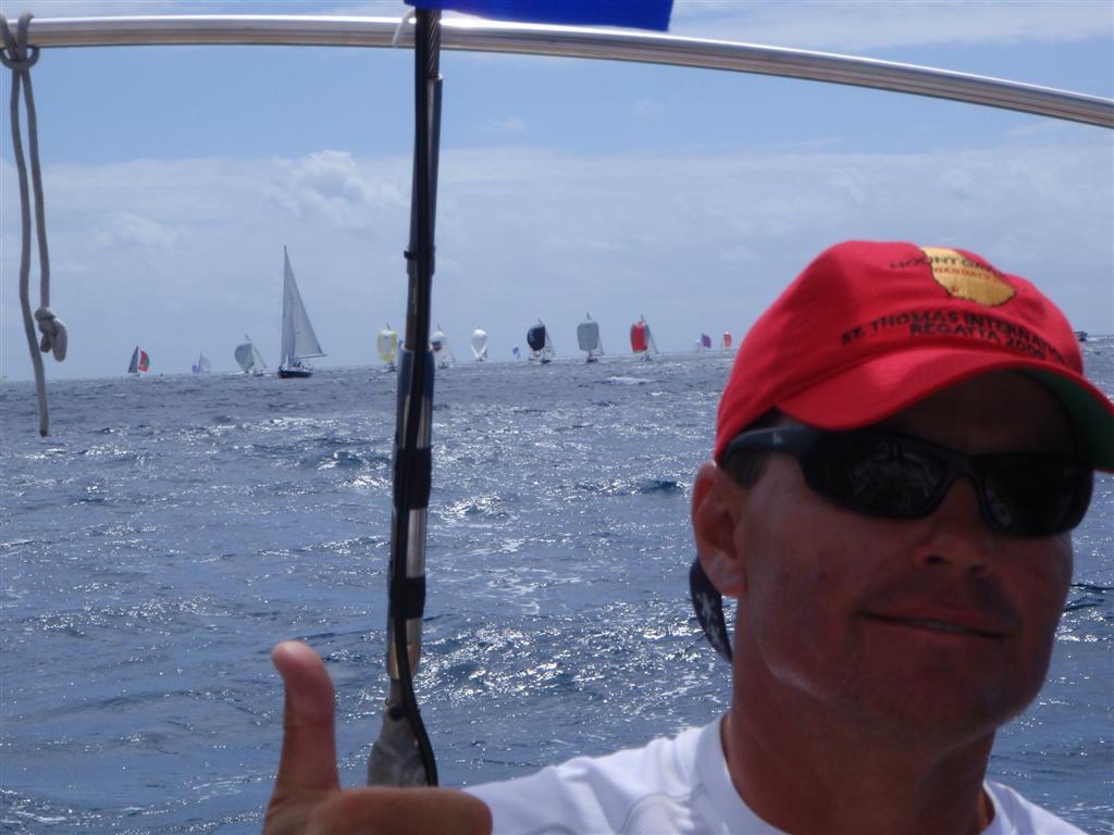
Friday morning found us milling around the starting area with the 63
other boats in the Regatta. Everything was rather cool after a hectic week from
hell. Then they announced the first race course for each class,
"Non-Spinnaker Racing will follow the Dog Island - Six course". Klaus
& Martha saw the blood drain from my face = PURE TERROR! They had announced
a course that was to be used only by the beach cats! It was in a different area
than we had practiced, and involved paths we were totally unfamiliar with. I
had ten minutes to learn the course, program the electronic aids and formulate
a strategy.
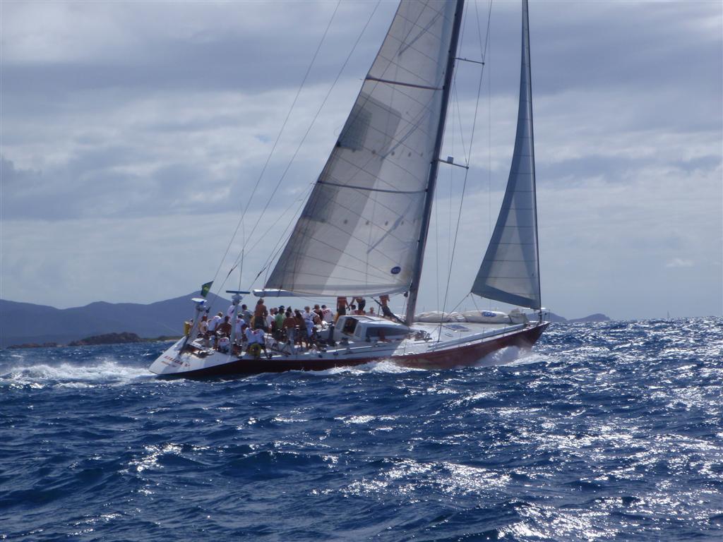
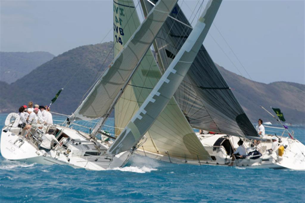
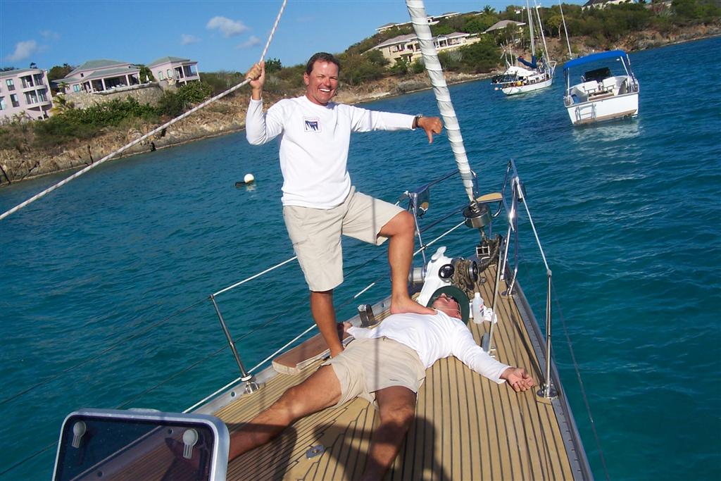
Looking back on those ten minutes, and the 'race' that followed, I realize that there is no other three people in the world that could have survived that scenario as well as we did. Oh, in the end, we DNFed (Did Not Finish) because of a graver error on my part as to the number of loops we were to make around the course. It turned out that we adjusted so well and sailed so fast, that we were ahead of anyone we could possibly follow to learn the proper completion route of the race. So we would have beaten several other boats [would've, should've, could've].
I was so upset at the time - I thought all was lost. But with unbelievable teamwork, we not only finished every succeeding race, we improved our average speed significantly EVERY TIME, sometimes developing unorthodox methods. At the end of the race series we bested FOUR other boats in our class; and even beat that 80-foot boat in TWO races, despite her THIRTY-TWO CREW!
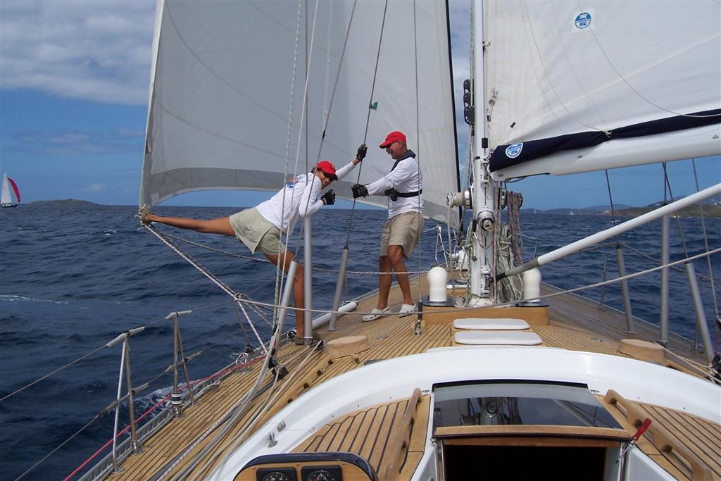
So we didn't win any trophies or watches, but they were the most amazing days of sailing I have ever worked for. I was POOPED at the end, but we needed to change the SwanVictoria from a racing machine into that luxury cruiser again because Klaus & Martha had a charter - IN TWO DAYS!
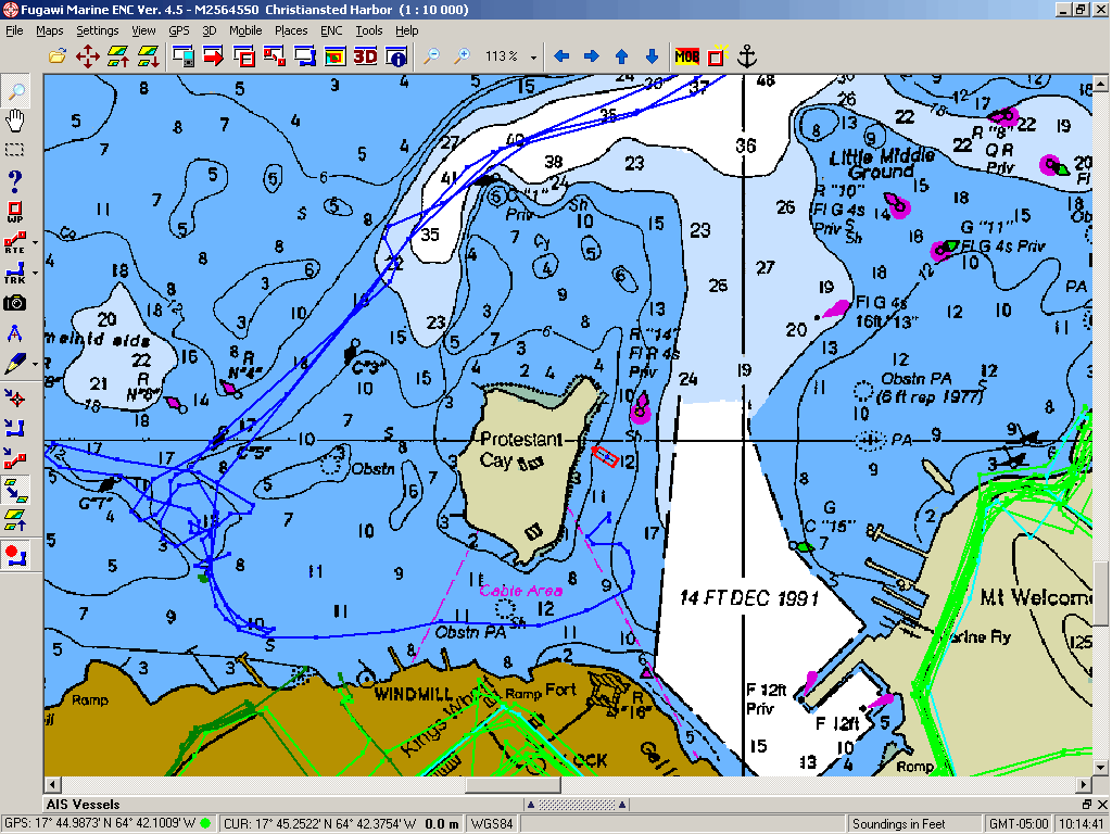
5- Back to
Christiansted [MAP5]
The wind was a little too far south for me to make a run out of Cowpet
Bay to St. Croix, so I waited a few days (I was exhausted and needed the rest,
anyway!). Let me just say here that Cowpet Bay may be a nice place to stage for
the Rolex Regatta, but it is the most God-Awful anchorage in the western
hemisphere! The St. Thomas ferries to Tortola and St. John run past every fifteen
minutes, generating ENORMOUS wakes that come broadside to the anchored boats.
There is not enough wind to use my bridle trick, so the boat is rolled on her
beam ends, continuously, all day. If the swell is a little south-of-east, the
rolling continues all night. IF I ever need to stay there again, I will go
through the hassle of anchoring bow & stern to eliminate the rolling [the
pitching is easier to take when anchored that way, but I will avoid staying in
that bay regardless!].
Finally, the wind
backed to the east and I departed for St. Croix. I have made the run to St.
Croix three times, and always depart and island to the north at midnight to
make a comfortable mid-morning arrival in Christiansted. The nighttime seas are
friendly, and I have sailed to my anchoring spot without the use of the engine
each time.
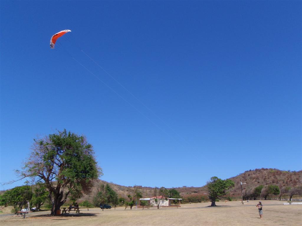
Upon arriving and
cleaning up Windigo, I visited the Snark and learned the kids
were flying back to Oregon in a few days time. They were eager to fill their
last days on the island with fun and adventure, so off we went on several expeditions and an afternoon of kite-flying.
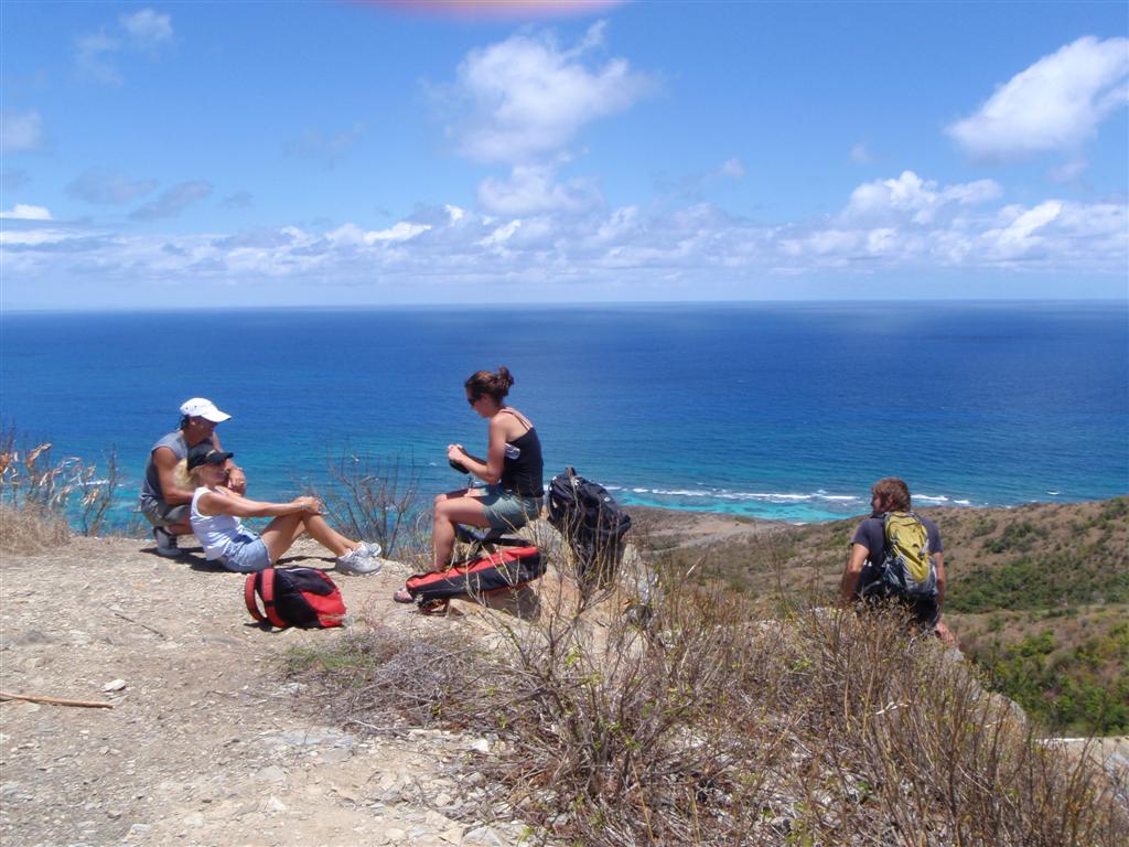
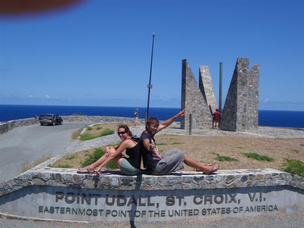
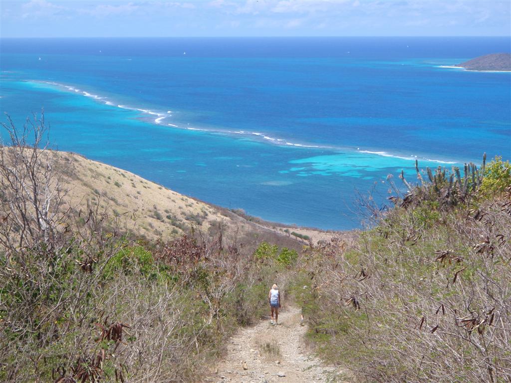
During the weekend,
we all hiked up the highest point on the east
end of the island, above the VLBA
telescope site I had discovered on my first trip here. On the opposite end
of the island from the rain forest, the flatter east end is more desert-like,
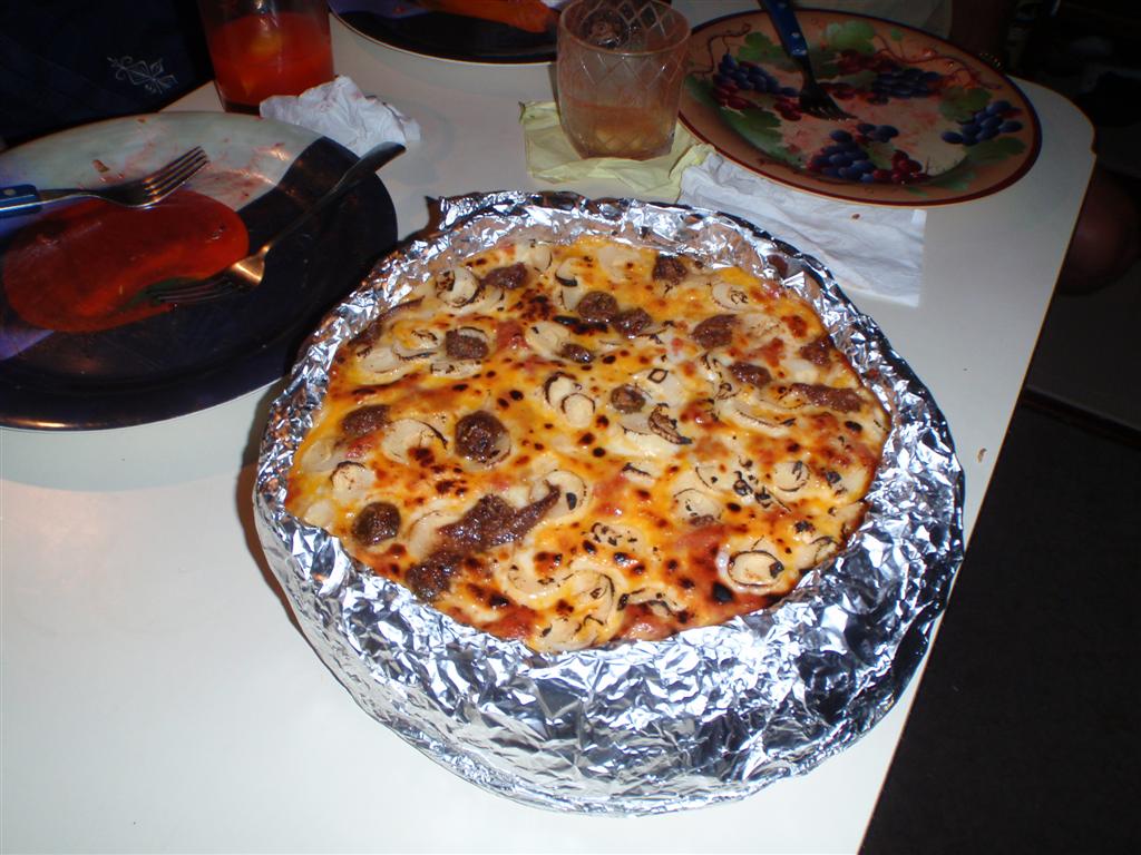
akin to the average islands in the neighborhood. I gave Vanessa & Adam a
going away treat by creating two of my famous
pizzas [an event soon to be repeated in Colorado . . . stay tuned].
The following
Saturday, Dan & Kimberly also flew to Oregon for a 10-day visit to see
grandbabies and Dan planned to increase his credentials at the US Coast Guard
testing center and achieve his 200-ton license. He hopes to soon move up to the
position of tugboat captain at HOVENSA where he currently works as a seaman.
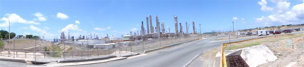
The refinery at HOVENSA is one of the
largest in the western hemisphere, producing fuels from crude oil delivered
from Venezuela. It is an impressive site, and employs a huge percentage of the
islands residents; but I cannot look upon it without recalling all the facts
from the IPCC report, and I will continue to endeavor to reduce the percentage
of time I run the engine aboard Windigo. [Calculating the engine-run
time compared to total time underway, I am currently under 15% for this year,
the best I have ever achieved since moving aboard. I will work at reducing that
figure to below 10% for 2009.]
After Dan &
Kimber left, I spent most of my aboard, reading, organizing computer files,
cleaning Windigo's bottom, performing boat projects, writing this eLetter, and
the like. I attempted to be First-to-Find on a couple geocaches, but was unable
to discover them. There has been a couple island events here, including the St. Croix Half Ironman
Triathlon, considered one of the most famous venues in the sport. It
includes "The Beast", a 27% uphill grade that I have cycled and photographed in
the last eLetter.
Having a great
i-net connection, I was able to communicate with Karin often. She was now
absent from Windigo for almost a year (except for her October visit) and had
accomplished all she had set out to do in the States. She was ready to return
to the cruising life, probably influenced by the Wisconsin weather during the
winter. (To
think this is a street I often cycled along on the shore of Lake Geneva . . .
WOW!)
She began shipping
necessary belongings to our friend Bill
Butler in San Juan . . .
Cruising
Notes.
Here are the anchorages used with coordinates and wireless i-net used.
Conditions of each anchorage are apparent on the chart; i.e., if it looks like
a well-protected, quiet place, then it is -- if you think it may be a bit rolly
when swells are present, you are probably right. But each place was used in
comfort for the time spent there, except as mentioned.
inner harbour mooring, Road Harbour, Road
Town, Tortola, BVI - N18o 25.576' W064o 36.993'
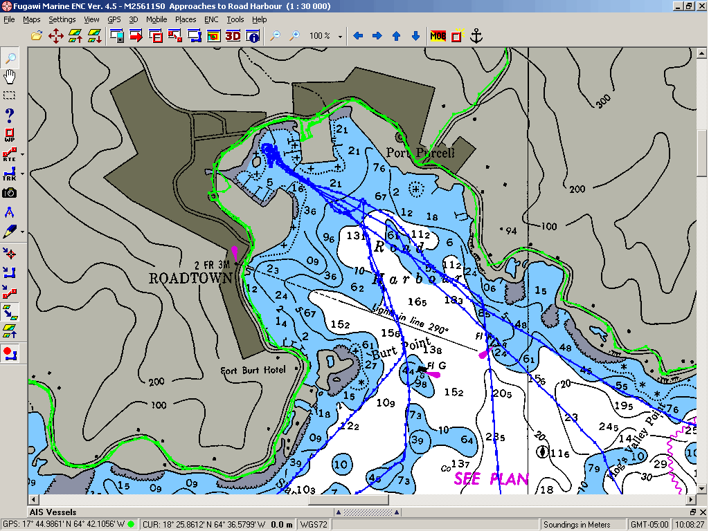
the new wireless
system of the charter base [TUI]
Security and protection nearly all-around. Crowded.
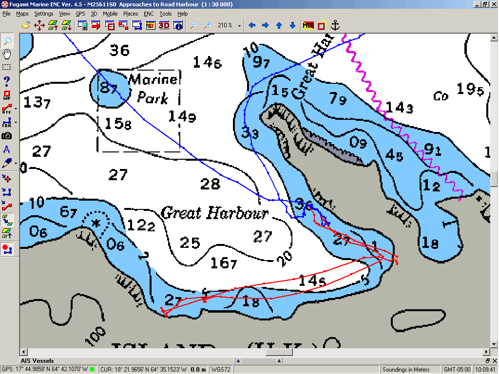
Great Harbour, Peter Island,
BVI - N18o 21.537' W064o 34.947' no apparent wireless
South Bay, Peter Island, BVI -
N18o 20.318' W064o 34.254' no apparent wireless
Big Trunk Bay near The Baths,
Virgin Gorda, BVI - N18o 26.298' W064o 26.665' no apparent wireless
St. Thomas Bay, Spanish Town,
Virgin Gorda, BVI - N18o 27.261' W064o 26.412' no apparent wireless
inner harbour mooring, Road Harbour,
Road Town, Tortola, BVI - N18o 25.576' W064o 36.993'
the new wireless
system of the charter base [TUI]
Security and protection nearly all-around. Crowded.
Prickly Pear Island,
Gorda Sound, BVI - N18o 30.273' W064o 22.257'
the green bench in front of the Reeftique at
the BEYC [Almond] is the best spot.
Christiansted
Harbour, Protestant Cay moorage, St. Croix, USVI - N17o 44.916' W064o
42.383'
[linksys] at Anna's Cafe in Gallows Bay, but
you must go inland a few blocks to get there. [King's Alley Hotel], at Pleasant's
picnic table right in King's Alley north of the ice cream shop.
Sandy Spit, BVI - N18o 27.021' W064o
42.645' no apparent wireless
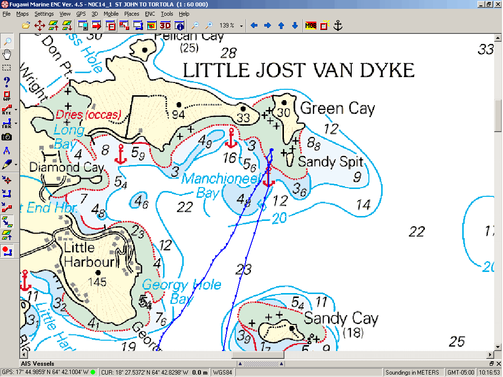
Swells present when large seas running.
Cruz Bay, St. John, USVI - N18o
19.963' W064o 47.772' no apparent wireless
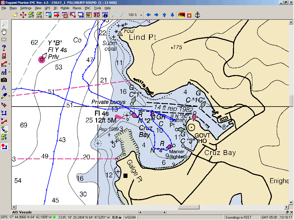
Very crowded, but
there are places depending on your draft.
Red Hook
[Muller Bay], St.Thomas, USVI - N18o 19.490' W064o 50.747'
![Red Hook [Muller Bay], St.Thomas, USVI](Red%20Hook%20%5BMuller%20Bay%5D%20&%20Cowpet%20Bay.gif)
[Tom Starkey], if
you are deep into the bay. No protection from the NE, and it can blow pretty
hard from the NE!
inner harbour mooring, Road Harbour,
Road Town, Tortola, BVI - N18o 25.572' W064o 36.991'
the new wireless
system of the charter base [TUI]
Security and
protection nearly all-around. Crowded.
Great Harbour, Jost Van
Dyke, BVI - N18o 26.576' W064o 45.119' no apparent wireless
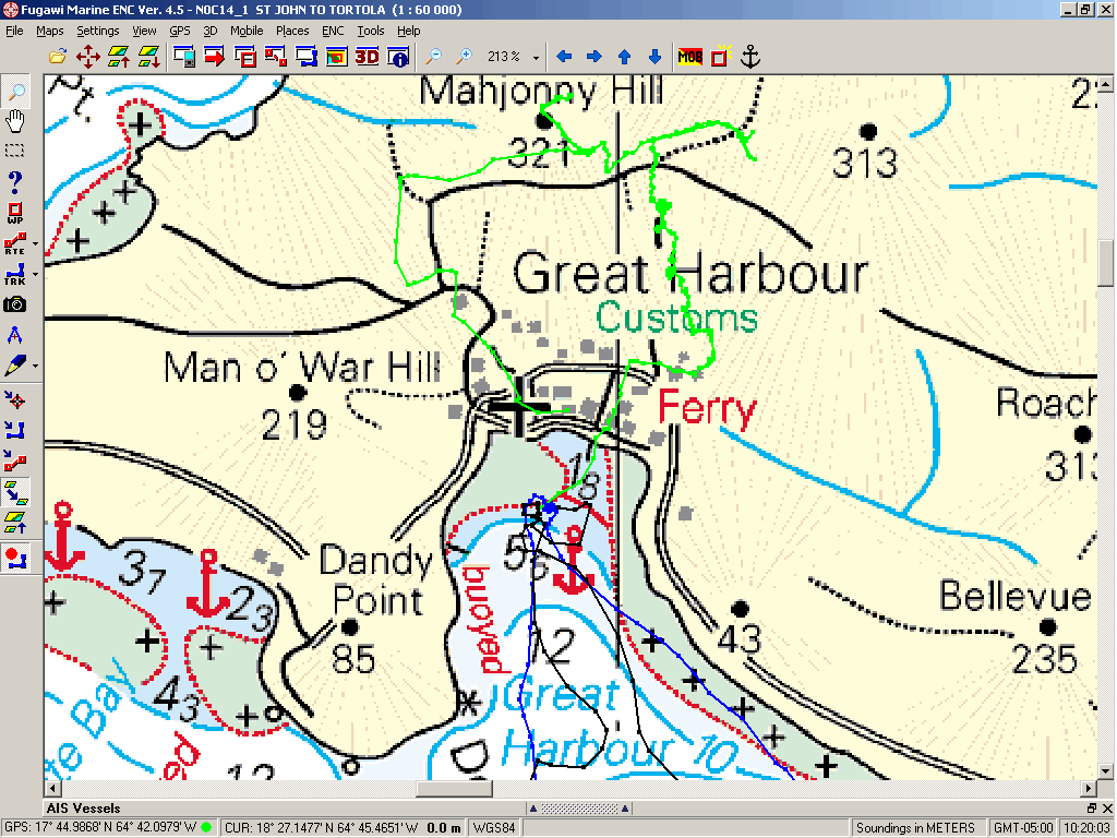
Red Hook
[Muller Bay], St.Thomas, USVI - N18o 18.460' W064o 50.683'
[Tom Starkey], if
you are deep into the bay & [linksys]. No protection from the NE, and it
can blow pretty hard from the NE!
Cowpet
Bay, St.Thomas, USVI - N18o 18.967' W064o 50.445'
[linksys] rules
when close to the houses on east end, St.Thomas Yacht Club has wireless over on
the west end.
One of the most
uncomfortable anchorages I have ever experienced. HUGE SWELLS NEARLY ALL THE
TIME.
Christiansted
Harbour, Protestant Cay anchorage, St. Croix, USVI - N18o 45.943' W065o
43.103'
[Hotel Guest
Network] has SUPERB, Hi-Speed signal, also [linksys]
A new anchoring
spot for Windigo, isolated from most other boats. Adjacent to the
mooring for the tall-ship Roseway. During this stay, all sea conditions
were comfortable, including when the wind piped up to 20+ knots. Definitely
preferred to dealing with all the assholes in the mooring field or being
exposed in Gallows Bay. DO NOT ANCHOR TO THE SOUTH IN THE CABLE AREA OR TO THE
EAST IN THE CHANNEL.
Stay tuned for "The Return of
Karin" and more Caribbean sailing adventure aboard Windigo.
See where Windigo has been since Puerto Rico:
<http://shiptrak.org/>
Enter Windigo's callsign: W3ooo
(and zoom in when it starts tracking)
[to see Windigo's anchorages from St. Pete to Puerto Rico, Enter the
callsign: W3igo]
Where we are right now:
My permanent and EXACT address:
Capt.KL Hughes
S/V WindigoIII - PMB 365
88005 Overseas Hwy. #9
Islamorada, FL 36033-3087
Text-only emailio addresses aboard Windigo, checked daily:
[reliable communication]
Karin's emailio address in Wisconsin:
emailio addresses checked when at a land-based computer
(infrequently, but good for attachments):
And of course, the Windigo Travelogue Catalogue:
<http://www.ciekurzis.org>