Hi All~
This Eletter with
all the links to fabulous high-resolution photographs taken with the new
camera, which my daughter brought to me, and then it promptly stopped working:
http://www.ciekurzis.org/The%20Bight%20of%20Abaco/The%20Bight%20of%20Abaco.htm
Either cut &
paste this URL into your address bar or just click on it.
The Bight of Abaco
To start the
narrative in this eletter, and to comply with many requests, I kept a log for
all the activities of a single day. So, a day in the life of Windigo:
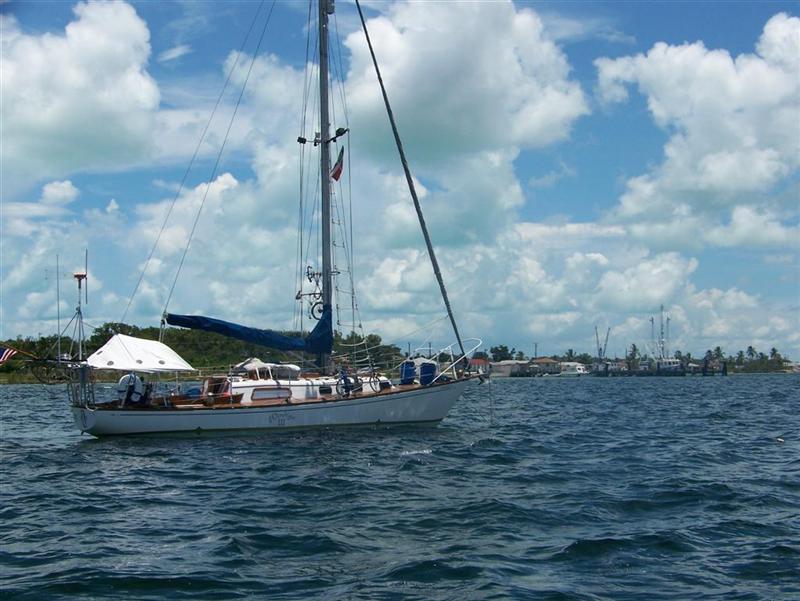
18JUL2007~
Arrived at Gorda Cay in the Bight of Abaco after a calm 30nm sail from White Cay in the Berry Islands. (Had left Morgan’s Bluff, Andros with a 35nm sail the day before.)
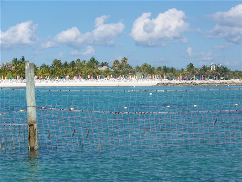
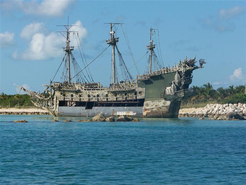
Anchored in an open bay protected from the mild east breeze predicted for the next days. Gorda Cay is also known as “Castaway Cay” and is a private island destination for Disney Cruise Lines. Our anchorage faces the main swim beach with dozens of beach chairs, umbrellas, little shacks, and a fake wreck. But with not a person in sight as a cruise ship only comes one or two days a week.
After sleeping under the bright Milky Way in the cockpit, I got up at 0615 and sent a ham radio request for weather and emails, and then tuned to Chris Parker at 0635, the SSB weather Bahamas guru. Karin woke up to hear the placid forecast. After Chris was done blessing the area with 10 knots of the winds for the foreseeable future, I retrieved my ham weather emails and Karin lay in the cockpit bed doing a word search.
I then updated the Windigo sailing log with data collected over the last couple weeks and rejoined Karin, to read Wired magazine (to find out how much monthly fees have become for all the wireless crap in America).
By 0900 the sun became a bit warm to continue our laziness so we disassembled and stowed the bed and started breakfast. Karin wanted cream of wheat, but there was no milk, so being the milk magician: I mixed water, non-fat milk powder, whole milk powder and condensed canned milk to create our version of 1%. Karin then worked on the cream of wheat in the microwave while we snacked on leftover spicy nachos from last night (Mmmmmmm).
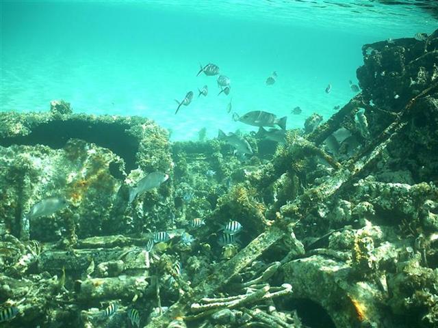
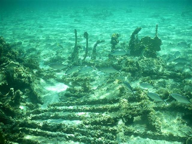
We enjoyed breakfast while I thrashed Karin at a game of backgammon. By 0930 I was assembling Pedigo and Karin was cleaning up from the meal. Then Karin helped me finish up with Pedigo and at 1000 we headed out on Pedigo with snorkel gear and the pole spear to investigate a nearby wreck. We swam around the reef the wreck had made and through the tall grass surrounding it. I shot many photographs of many types of fishes, but made only one unsuccessful attempt at spearing a good-sized grouper.
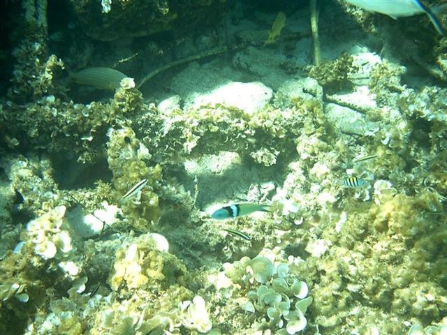
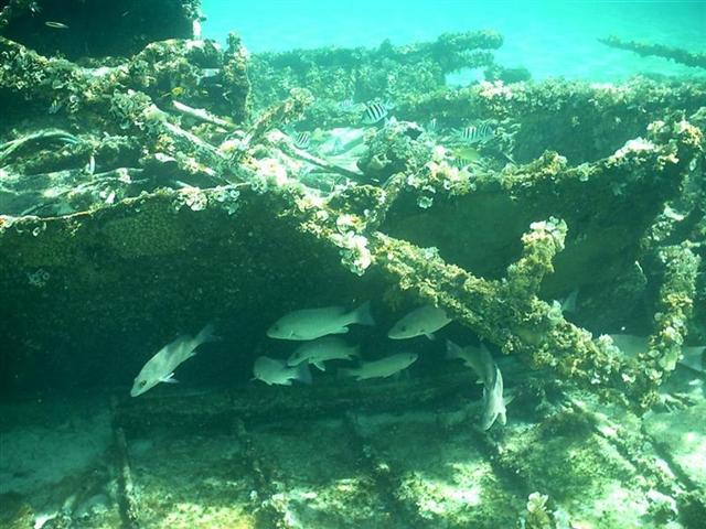
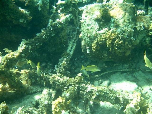
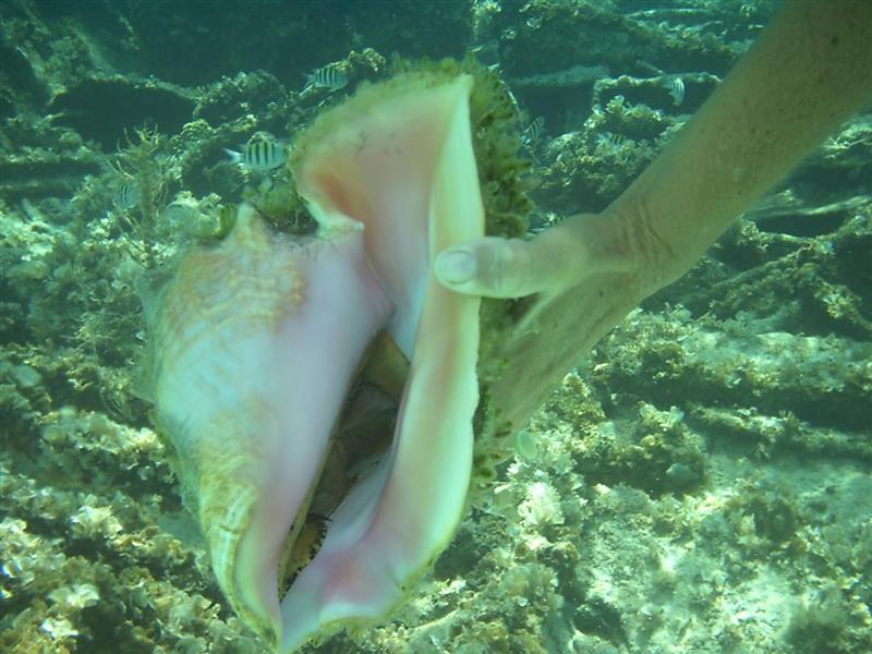
Karin collected three conch by the time we returned to Windigo at 1130. After cleaning and stowing the swim gear, we put up the sun awning. Karin rebuilt a winch that was contaminated with salt water while I rested after a busy morning. Eventually Karin finished her winch, started a book and reheated a leftover Spam tortilla, so I worked on navigation solutions that we would need for the next few weeks.
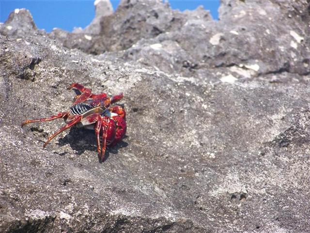
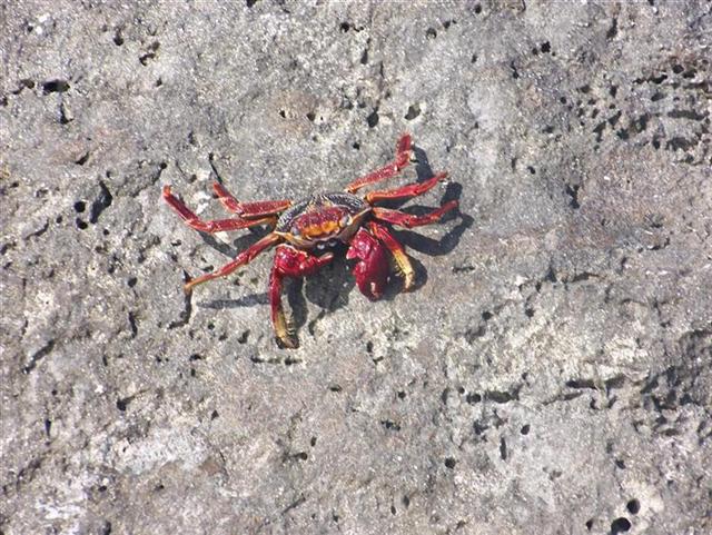
At 1430 Karin went back out on Pedigo for a tour of the nearby beach while I continued to chart, and read about the fish I didn’t spear this morning, and snacked on chocolate frosting & tea biscuits. At 1630 KJ and I went for a 2 hour voyage on Pedigo around the other side of the island to the cruise ship basin; it was such a quiet day on the water we easily took Pedigo out in the ocean to check out other amenities on the island and see thousands of crabs scampering across the rocky shore.
Upon returning Karin restocked canned provisions on the shelf from stores in the bilge area and I fabricated two window props for the salon hatch after one failed a couple of weeks ago. Karin picked out a can of spaghetti for supper and I continued to snack on some salty chips and drink a few quarts of Kool-Aid and water. While I checked the evening email weather, Karin settled into her book. (It is always nice to play a couple games of Hearts and Spider Solitaire as the email reports and maps download.)
We spend the last half hour of daylight discussing the routes, destinations, sailing tactics, etc. of our upcoming tour of the Abacos. Two major decisions was reached when we:
(1) Agreed to ‘trading places’ for the next several weeks in the Abacos, with me running the deck stations while underway and handling the ground tackle [traditionally the “man’s” job, but always done by Karin] and she undertakes the majority of navigational planning and execution and the helm work at the most sensitive times. [THIS SHOULD PROVE TO BE VERY INTERESTING!]
(2) Decided to attempt the passage at Spence Rock. Actually, Karin granted me the opportunity to attempt it. You see, it is something I have been considering for some time, and have discussed the passage with every Bahamian I came across with knowledge of the area. The fishermen of the Bight of Abaco transit the area with their vessels that draw up to five-and-a-half feet, and they always go through at high tide. When I tell them Windigo draws seven feet they raise their eyebrows, and comment (maybe tongue-in-cheek?) about my navigation prowess and say that THEY wouldn’t try it; but IF I had good charts, and IF I was there at full moon high tide, and IF I was very lucky, I could possibly make it. I obviously have more confidence in me than they did, so I interpreted the conclusion to be “go for it!”. [ANOTHER THING THAT SHOULD PROVE TO BE VERY INTERESTING!]
After we put these objectives in our brains and making no other plans, only vague intentions, we assembled the cockpit bed and Karin digs deeper into her new book. I putz around getting small things ready for sailing the next day, then lie down in bed at 2100 and am immediately asleep.
Whew, what a day!
The Character Of
The Land.
The Bight of Abaco is mostly water (just kidding), with rocky keys,
islands and islets scattered along the edge of Great Abaco Island and the bank
itself. The bottom is predominately hard marl and hard sand. The coral heads
are amongst the islets and rocks, and very few remote hazards present
themselves.
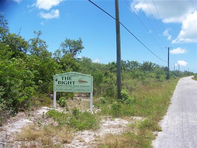
The Good Peoples.
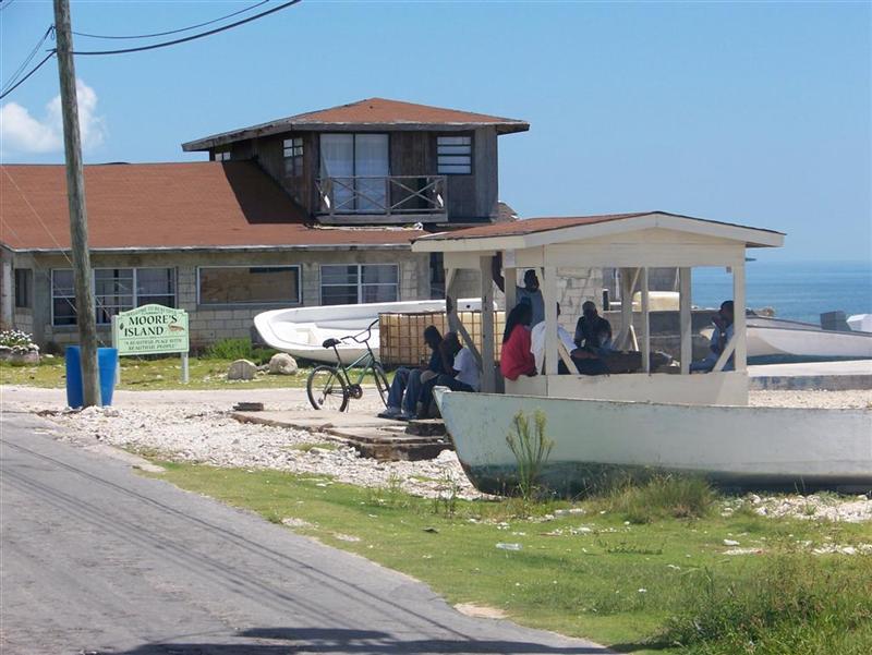
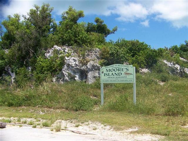
Again, each person we spoke with on Moores
Island demonstrated a completely wonderful disposition, with kind words,
engaging conversation, genuine interest and thoughtful information. At Moores
Island, we encountered the typical range of individuals we seek out and
encounter in all the settlements of the islands:
Mrs. Walker, the matriarch of the island, is an elderly woman who
spends her day on the porch of her house and the house across the street
(switching at mid-day to stay in the shade) greeting passersby and inviting
those who wish to sit a while to have a soda or beer. She lived real close to
our anchorage on a water front home; the structure would be worth $2000 to
$3000 in the US, and it has a million-dollar view.
Mr. Dean is the oldest man we engaged on Moores Island, and is a
retired boat builder and fisherman. [note: EVERY man, woman, & child* on
Moores Island is a fisherman. The lobster fleet stays out for the entire
eight-month season, and they run thousands of crab traps, gather tons of conch,
and catch countless fish with the traditional hand line.] He showed keen
interest in Pedigo, and studied it carefully with the intent of recreating one
for himself.
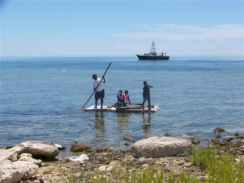
*speaking of Bahamian children, they are incredible examples of
patience and imagination. They use their summer vacation to explore the world
of adults; some crew on fishing boats, some discover opportunities closer to
home. One tiny girl, about nine-years-old [in the pink
shirt], played all day with a couple dozen friends on the ‘boat’ she made.
It was basically a wrecked door with some improvements.
The kids all took turns aboard, as the USCG capacity plate of the vessel was
barely legible ;-]. The next day, she went out before mid-morning, and returned
before noon with six HUGE fish! I did not see the fishing gear she used, but
the propulsion unit was the same long stick in the
photo.
Nigel runs the Bahamas Electric generation plant on the island; he has
worked for BE for twenty-five years, but is new to the island, marrying Mr.
Dean’s daughter last year and relocating here. He was impressed with Pedigo
when Mr. Dean took him over to show him, and said he’s going to help him build
one. It just might happen, as Nigel is quite the entrepreneur = he is clearing
some waterfront property adjacent to the generator plant with the intent of
building a restaurant/bar that exploits a cave there as an attraction. Although
he runs the plant AND fishes (of course), he has enormous energy to push his
grand plans to completion.
Ozzie Stuart was in the yard of his home on Farm Road as I cycled past,
readying his 17-foot Whaler [the lobster boat of choice] for the upcoming
season. I stopped and chatted about politics, fishing, weather, travel, family,
careers, education, environmentalism, and the chemistry of long-chain
molecules. No shit, just because a guy has lived his entire life as a lobster
fisherman on a remote Bahamian island, don’t think he doesn’t get round and pay
attention.
I always spend time in the gazebo
of the settlements we visit. I learned about this hub of social activity
right away on Bimini. The quality and quantity of discussions and discussers
varies, but the gazebo is always the heart of the place and the guys (and
occasional girl) that hang out there know the score. On Moores Island, I got
excellent information from Lorenzo, who seemed like the Rosco of the gazebo =
intelligent but a level of witticism that colors his personality vividly. The kind
of guy you need to have ask YOU the questions to find out the best information,
rather than query him and perhaps get “colorful” responses.
Winston McBride was another retired fisherman, with great knowledge of
the entirety of the Bahamian waters.
Edgar Davis, the fishing vessel Captain I had met in Bimini in February
who invited us to Moores Island, was away from the island for entire visit. but
we did speak with Thomas Heild, his father-in-law aboard BushMaster. Thomas was
getting his boat ready for the season that started in a week, just as everyone
else was doing on the island (and every other island in the Abacos).
[Thomas was the person who informed me that I had been on Bahamian
National TV, bobbing for apples at the Pineapple Festival back
on Eleuthera.]
It was interesting to note that young Ozzie was toiling to strengthen
the structure of his boat, rebuild the engine for top performance and otherwise
make it WORK 100%; while older Thomas was painting & polishing the
BushMaster, making it LOOK 100%. I’m sure it worked great, but the differing
priorities were interesting.
The Trip.
[click for simple map]
![The Trip. [click for simple map]](Bight%20of%20Abaco.jpg)
So, we are cruising in the Bight of Abaco -
the shallow waters between Little & Great Abaco Islands and Grand Bahama
Island. I have never heard of a sailboat cruising here and the cruising guides
do not include it in any specific ways. It is only mentioned in one guide as a
lonely, desolate place that no one would like(?); and on one chart as an area
unnavigable by vessels drawing more than 3 or 4 feet. But we were invited to a
fishing village on good-sized Moores Island on the Bight, and we were able to
navigate into its shores without incident, so we continued on throughout the Bight.
All week we have been checking out
uninhabited cays, rocks and islands without seeing another vessel, person, or
settlement since leaving Moores Island. At night, we see signs of life on Grand
Bahama and the Abacos Islands such as BeTelCo towers, the glow from Marsh
Harbour, and a few other lights in the distance. The anchorages are mostly
open, simply sitting in the lee of and island, trying to be opposite the wind.
With the limited choices, it is best to be here in settled weather.
The weather has been completely settled all
week with barely enough to sail by; with thunderstorms in the afternoon to keep
Windigo clean and the water tank full. The open-sea anchorages go completely
calm at night as we sleep under the canopy of stars, galaxies, and satellites.
(Did you know there are a continuous flow of man-made objects across any
portion of the sky? I used to need the Heavens-Above website to get information
on where the visible satellites would be, but now I just look - and see dozens
every night.)
A front is coming off the US coast and
meeting up with the tropical ridge/trough pattern to cause more gradient wind
at the beginning of next week. We wish to continue exploring the Sea of Abaco
around the other side of the islands [by Marsh Harbour]. To get off the Bight
of Abaco and find protection, we would need to exit where we entered at Moores
Island, but that is in the EXACT center of the OPPOSITE of the Little Bahamas
Bank from where we want to be and it would entail a long ocean voyage to get to
the Sea of Abaco. We could exit just north of Moores Island through shifting
"sand bores" that form miles long shallow ridges with barely deep
trenches between them. these suckers are nearly invisible when under 10'
difference in depth, and Windigo would surely get trapped deep into the wrong
"alley" miles along the route. This exit would allow us into the Sea
of Abaco only by sailing around Grand Bahama Island, a long way!
Another channel exists right along the
southern tip of Great Abaco Island to the east of Moores Island, but this is indicated only for
shallow draught vessels AND still leads to an overnight open-water passage. So
I studied the route taken by fishing boats to the north, around Little Abaco
Island. This route does not leave the bank, and is less than 10 miles from
several destinations we would want to visit. Trouble is, this passage [next to
Spence Rock] is used by fishing vessels drawing 4 to 5.5 feet at high tide
only. The lack of interest by everyone else has left it poorly charted with no
local knowledge amongst cruisers.
We Came, We Saw, We Sounded Depths - [Vedi,
Vinci, Measuri?].
Karin & I took Pedigo on a 10-mile
journey through the pass, sounding the bottom every 50 feet. We found a path,
but needed a FULL MOON tide at the height of its cycle. Luckily for us, the
full moon is coming up, just days ahead of the predicted increased winds. There
is protection immediately upon successfully transiting the passage.
The Devil's Backbone was well-documented;
the channel around the south end of Harbour Island was often transited by
fishing boats, so high tide allowed us to trace their route; we circled the
Hens & Chickens reef with the grandbabies and my friend Cliff, and that was
a visual thing looking for big ol' coral heads. Spence Rock has none of those
things going for it, and we will attempt it a 2300 hrs. The moon will be very
pretty!
So after scouting Spence Rock, we headed
over to the cays, islands, rocks, and islets along the western shore of Great
Abaco Island to spend a couple days until the full moon high tide. We returned
to Spence Rock at 1630 = approximate low tide of the full moon night, to watch
the tide rise and time our departure. You see, there is no reference station
(or even a subordinate station) anywhere close to our position; so the only way
to determine the time of the highest tide is to do what the Indians did:
measure it!
We calculated high tide for 2300 hrs., so
we started out at 2200 hrs. to give us rising water in case we needed it. But
alas, our extensive preparation allowed us to complete the passage under a
dazzlingly bright moon (we could see the bottom structures!) and be anchored by
2330. A sweet success.
Captain Bahamas continues to accept each
challenge, expand his working knowledge of piloting, and will soon be able to
navigate a cardboard box full of syrup through a field of anthills without
losing a drop.
Wildlife.
Fish. Some birds, more fish. Bugs, most
notably mosquitoes [albeit not plentiful] and no-see-ums, sometimes referred to
as sunrise- or sunset- bugs, although they did not adhere to that schedule.
More fish and thousands of crabs. Lizards were abundant on every island.
We noticed, for the first time, a lot of
dolphin activity; more than we have seen since leaving the Gulf Stream. Large,
healthy animals with less scarring than the poor abused Florida creatures.
Other Activities.
Much time was spent on the boat studying
the weather and observing tides & currents for the upcoming Spence Rock
passage. We had no outside assistance to prepare or actually complete it, and
none could be expected if we ran into difficulty in its remoteness. There was
hours of time spent in the water and playing games, but the topic of
conversation was always around navigation & piloting. [Although this was MY
deal, and I would take Windigo through Spence Rock, what a good time to have
Karin immersed in this field of study.]
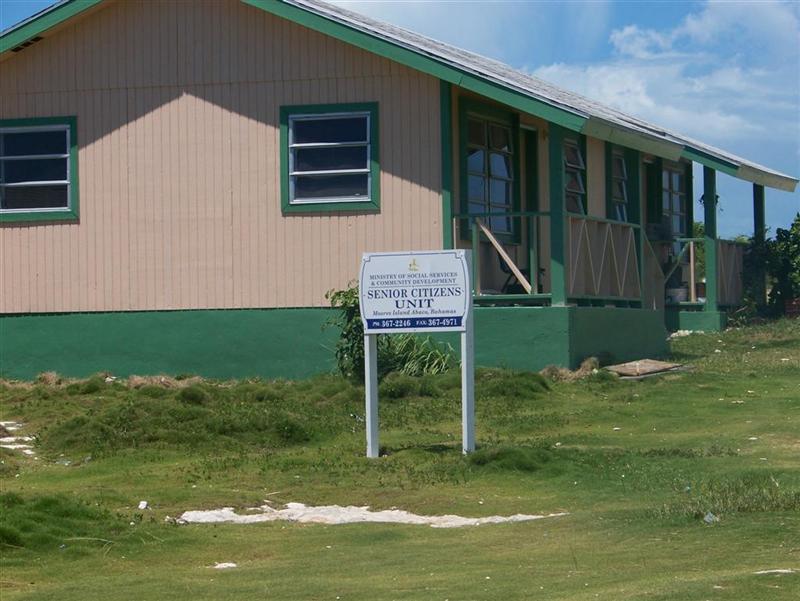
A couple observations:
- The settlements always have some sort
of government housing
for the old folks – they take care of them no matter how small the
communities are!
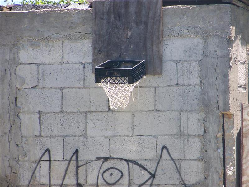
- Basketball is definitely the most
watched major league sport from the States, ad therefore, it is present n
some form on every island. Yes, there is lots of attention give to football;
and if the Sailing Regatta was not their national sport it would be
fast-pitch softball - whose stars are treated as local heroes, but
basketball is king in the bars and streets.
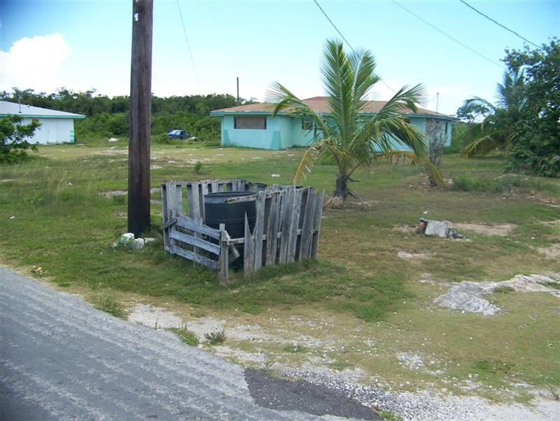
- Because building materials are
expensive, the creative citizens utilize shipping pallets for many uses.
The Regatta Village in Morgan’s Bluff was constructed mostly of these, and
lately I’ve seen many interesting trash
can corrals.
Girlie Stuff.
This again was a very
uninhabited part of our journey, as was Eleuthera, but being that I was
determined to be the main pilot and navigator of this ship, I was pumped up and
didn’t care if I saw another person or not. I just wanted to be able to leave
our last anchorage, sail the shortest distance to our next anchorage and arrive
close enough to land to anchor proficiently. But the best feeling was being
able to yell to Kevin “NOW” which means that he should drop that 70# anchor on
command. Another thing that happens when you are the big cheese is that the
other person has to wait on you hand & foot because the theory is that you
can’t leave the helm unless you brief the other person and that just seemed
like too much work especially when I didn’t even know what the heck I was doing
much less try explaining that to someone else.
So, needless to say, you get very hungry and thirsty when your at the
helm, and the charts just seems to be a little bit out of reach and those darn
sails, always becoming mistrimmed. I
know that I was tired at the end of a day but can’t imagine why Kevin was –
hmmmm?
I have so much confidence
in Kevin and his sailing skills that I sometimes take that for granted and know
that if I had to “take over” in case of an emergency that it would be quite
difficult in an emotionally charged situation. That’s probably the main reason
for my decision to finally learn the whole shebang. Sometimes I can be lazy but
I never want to feel useless because of my failure to learn the ropes. Now don’t
get me wrong, I’m not ready to learn how to fix the engine but one step at a
time…
I hope to continue these
skill building exercises but we are getting into some tricky parts so I’ll
probably chicken out and just watch from the next seat over. Also my mind is just a bit busy right now as
I think about the health and safety of my son Nicholas who is over in Iraq, for
the second time. I am so proud of him but wish him home as soon as possible. He
has grown into such a fine man and now serving his country is yet another
reason I admire him so much.
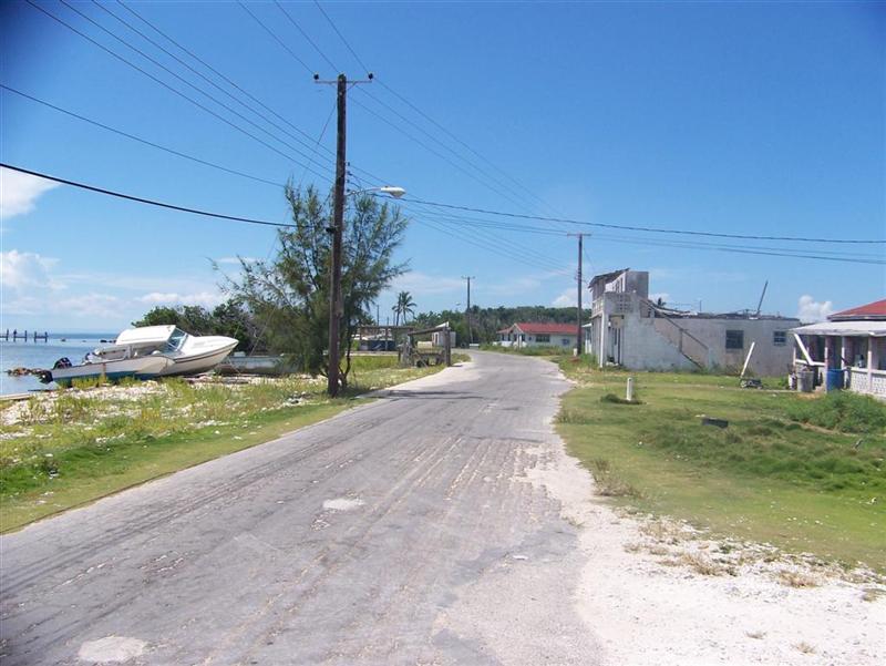
Cycling Notes.
I rode every path on Moores
Island, sometimes three or four times. It was interesting to find the
cemeteries at each end of the island, and the long, rocky path leading to the
reverse-osmosis plant and dump. [This was the last island for a while where
water was free and widely distributed.]
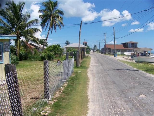
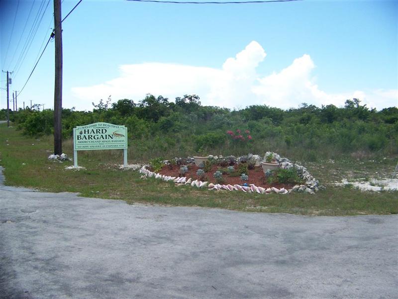
The main road was “Farm Road” NOT the Queens Highway(!), but the road along the waterfront was Bay Street, just as every other island. Karin
walked the same roads I cycled, and it was sparsely populated between the two
towns of Hard Bargain and The Bight, so there just wasn’t
enough interesting roadway to arrange a decent ride.
Other than 30 miles ridden on Moores Island, the bikes stayed in the rigging. This was definitely
a ‘sailing’ portion of our journey, and we enjoyed the remote seclusion offered
in The Bight of Abaco.
Cruising Notes.
The anchorages are as follows, and to get
to them the Explorer Charts by Monty Lewis are necessary. They are necessary if
you plan on sailing anywhere in The Bahamas. There are three chartbooks, each
about $50 and worth ten-times more. When in a tricky area, or without any local
knowledge, or in trouble they are priceless. They will save you questions,
headaches, inconvenience, and perhaps your entire vessel if not just an
expensive repair.
Gorda Cay, a.k.a. "Castaway Cay, a
Disney production" –
You can tuck in as close to the swim area
on the western side of the island above Western Point in Western Bay (how
creative!). protected from weather to the east only, but could be quite
interesting when a cruise ship is in port. Take a dinghy trip to the basin on
the south side of the island to see more of this facility.
Moores Island –
Anchorages
on the west and north side of the island. Just as in many other places in
The Bahamas, you must actively take part in your anchoring experience,
anticipating and reacting to changes in wind & swells to move to a more
comfortable and safer location. There is water from faucets on the street, the
last place for a long time with free water, other than rain.
Mastic Point –
We only got within 2500 feet of the land
here, although one could expect to get maybe twice as close with a reasonable
draught. Still, it would only be fun in settled weather.
Woolendean Cay –
Again, we were a couple thousand feet from
the shore, but it seemed better protection because of the curved shape of the
island. The beach looked inviting, but we were unable to visit due to concerns
about the Spence Rock passage = we had to go take a look.
Spence Rock –
[Remember Vedi, Vidi, Measuri?]
The Pedigo trip assured me that I could do
it. Karin was skeptical at this point. Studying the tide charts and weather
lead me to schedule an transit near midnight on the full moon. Karin was less
than enthused.
Norman's Castle –
A delightful description in a guide of
cliffs, town ruins, and the remains of a dock got us eager for a land
exploration. We walked up & down the ironshore beach, but alas, could not
find an entry path. The cliffs were cool, the dock disappointing, and the
ancient city of Norman remains a secret. At least we got the heck off the boat
for some exercise!
Rocky Harbour Cay –
The most protection we had see in a harbour
in a long time. Even with Windigo, we could tuck in close to the dozens of
rocks and islets here. It surely reminded me of Great Lakes sailing in Lake
Huron and the North Channel, albeit on a smaller scale. Snorkeling along the
rocky underwater clefts revealed a wealth of spearable fish. HUGE thunderstorm
with the brightest lightning we had ever seen in the middle of the night. It
was blinding even when we were looking the other way!
Spence Rock –
Back at Spence Rock at the low tide
preceding the full moon high tide which was to be our ticket outta here. Karin
realized she did not wish to jinx the operation, so went through major attitude
adjustment and now was psyched for the passage. She wanted to do it NOW!
Restraining her and waiting for the highest tide (which we could only determine
by observation as there were no tide stations or even subordinate references
anywhere near here), we set out on the passage. I had determined that the chart
was in fact off by 300 to 800 feet, so had devised a corrected track with allowances
for the humps and obstacles we had found on our exploratory Pedigo trip.
Slowly at first, through the shallowest
part, but then guided by the research and intuition, we made it to Cave Cay
with scrubbing only one sand mound with the stainless steel shoe mounted on the
keel. A perfect transit, again attributed not to the actual execution, but to
exhaustive preparation. “Train hard, so the battle is easy.”
Cave Cay –
A beautiful anchorage = not any different
than the unprotected places we have been staying at, but this one was only four
miles from the Sea of Abaco!
The next eletter will contain the continued
travels in Abaco, the inhabited part, where other people actually visit!
See where Windigo
has been:
http://shiptrak.org/
Enter Windigo's
callsign: W3IGO
Where we are right
now:
Our permanent and
EXACT address:
Capt.KL &
Karin Hughes
S/V WindigoIII •
PMB 365
88005 Overseas
Hwy. #9
Islamorada,
FL 36033-3087
Text-only Email
addresses aboard Windigo, checked daily:
[reliable
communication]
Email addresses
checked when at a land-based computer
(infrequently, but
good for attachments):
And of course, the
Windigo Travelogue Catalogue: