Hi all ~
This Eletter with all the
links to fabulous photos is at:
http://www.ciekurzis.org/Circumnavigation%20of%20Tampa%20Bay/Circumnavigation%20of%20Tampa%20Bay.htm
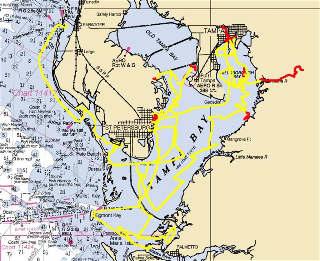
Here's a real cool bunch of
dots! See where Windigo has been:
Enter
Windigo's callsign: W3IGO
June / July 2006
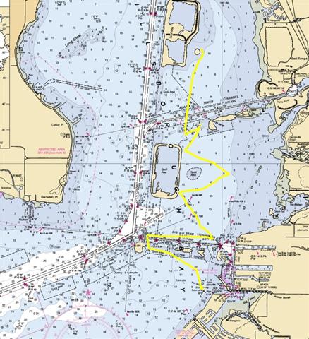
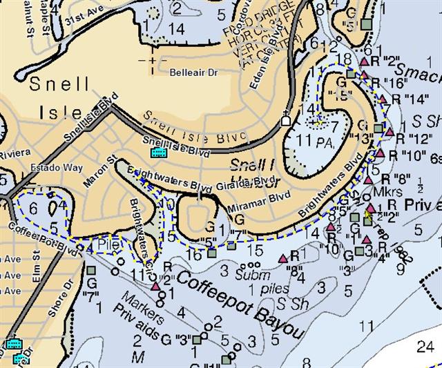
Circumnavigation of Tampa Bay
cir?cum?nav?i?gate (s?;/span>?k?m-n?v??-g?t?)
??? v. tr.? cir?cum?nav?i?gat?ed, cir?cum?nav?i?gat?ing, cir?cum?nav?i?gates
1. To proceed completely
around
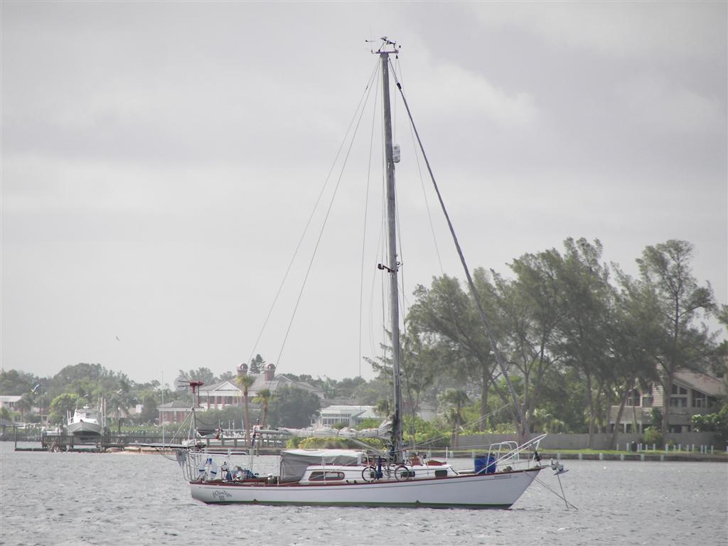
Living on a boat affords one to live anywhere in the
world where the water is deep enough and is affected by tidal change (Check out
the letter to the editor from my friend in Alabama, JoAn Day).
International law affords anyone access to these waters. Some sailboat cruising
liveaboards venture forth with expectations of seeing every continent, stopping
at dozens of countries, and encircling the globe with their track. There are
now several races that finish at the exact point at which they start; the only
requirement being that one only travels in one basic direction for the entirety
of the race.
Whilst Karin and I hope to
travel to exotic places aboard Windigo, we learned long ago that all these
places are not distant from one's current position. Sure, we will leave the
country and learn to speak other languages and adapt to alternative customs and
meet a huge variety of peoples. But traveling slowly across the country on the
inland waterway system, and spending a good deal of time in Mobile Bay, Corpus
Christi and then in Tampa Bay, has taught us to seek the unexpected and enjoy
it. (Actually, my pre-Windigo life of mountain biking through industrial parks,
canoeing past huge manufacturing areas and practicing urban spelunking along
the underground rivers and streams of SE Wisconsin was pretty demonstrative of
finding beauty and enjoyment anywhere!)
So in order to say goodbye
to all our friends in the area; and to hang loose in the area until all of
Karin's prepaid dental work is completed; to test every part of every
interconnected and fairly complex system aboard Windigo prior to leaving an
area rich with resources well-known to us; but mostly to adhere to our
philosophy and policy to go very slow and leave no shore unexplored- we have
completed a thorough circumnavigation
of Tampa Bay.
Not quite as demanding as
circumnavigating the earth, we embarked on several navigational challenges,
lived completely aboard and utilizing all the resources Windigo has to offer.
Several problems surfaced, all handled with great aplomb by the crew, giving us
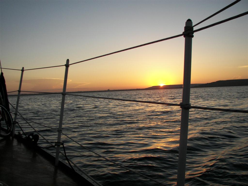
greater confidence in the voyages ahead. By and large, the last few weeks have
been very relaxing and enjoyable, with fantastic sunsets and sunrises,
interesting trips ashore, time spent in/and on the water recreating,
exercising, and performing routine maintenance of the boat.
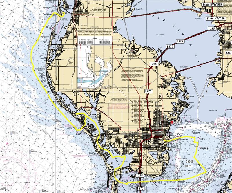
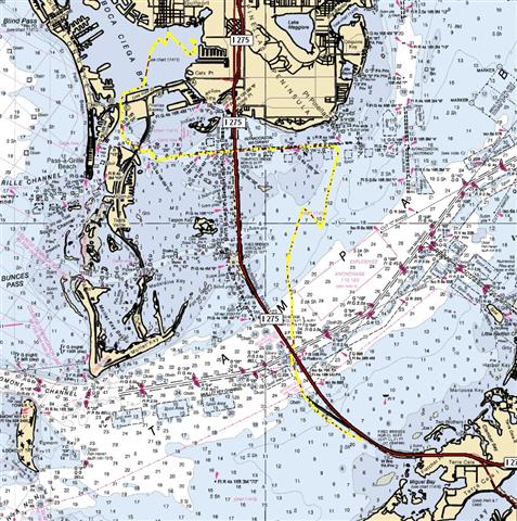
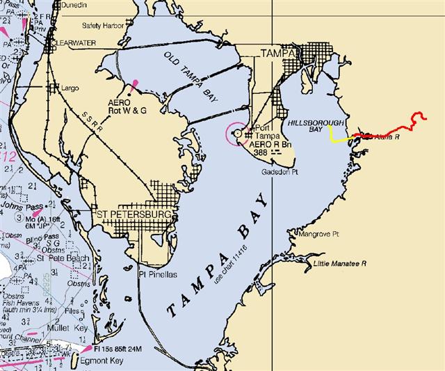
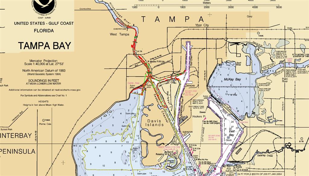
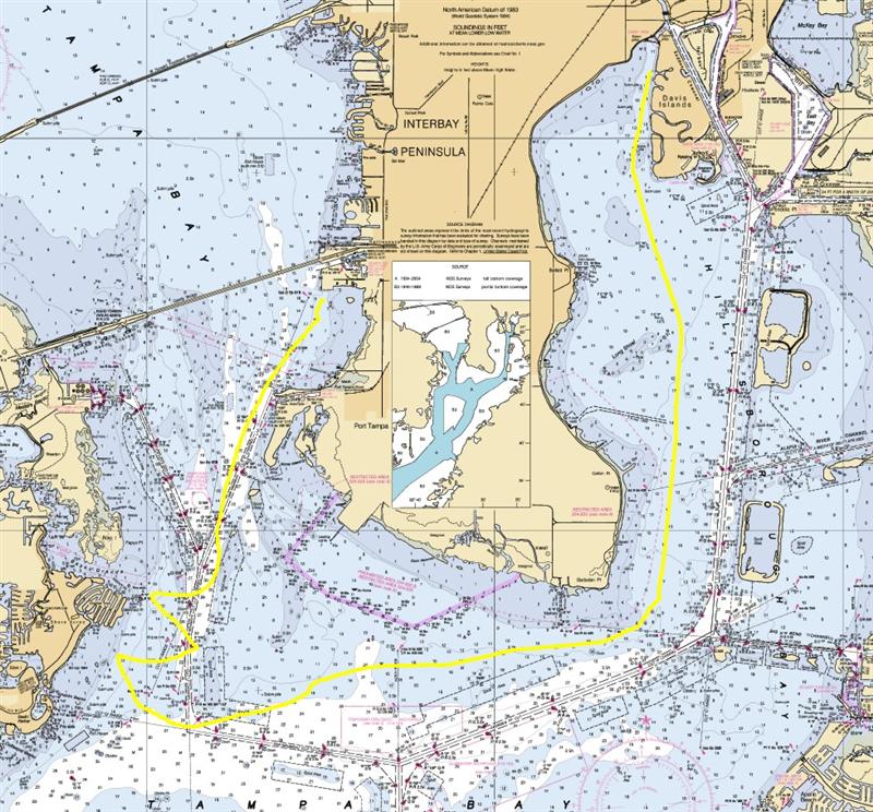
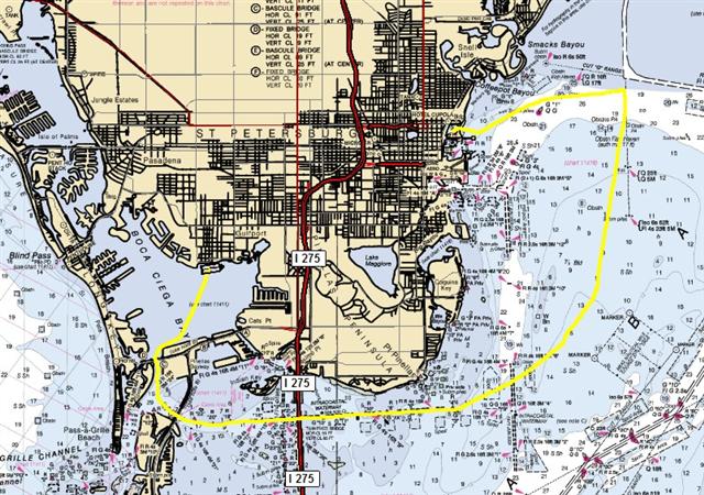
We left the marina in
Clearwater {BIGMAP} with a mission - I had a
class scheduled to teach the first four days of June for Sunsail Tampa Bay. We
stopped the first afternoon in Madeira Beach {MAP}
and had supper aboard No More Mondays with our friends Dave & Gail.
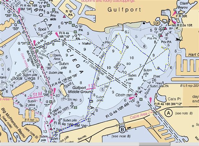
The second night we spent at our old stomping grounds in Gulfport, {MAP}
visiting our friend Gene Lucky. Finally we anchored in Bayboro Harbor {MAP} the night before my class started. After my class,
we spent a few days preparing, including performing my first welding project at
anchor using only battery power and the inverter to power the welder. It is
nice to be completely self-contained.
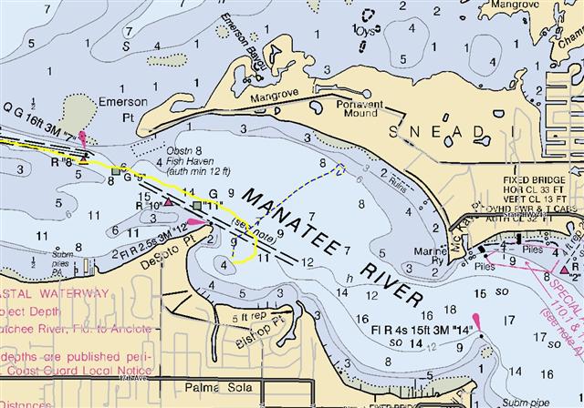
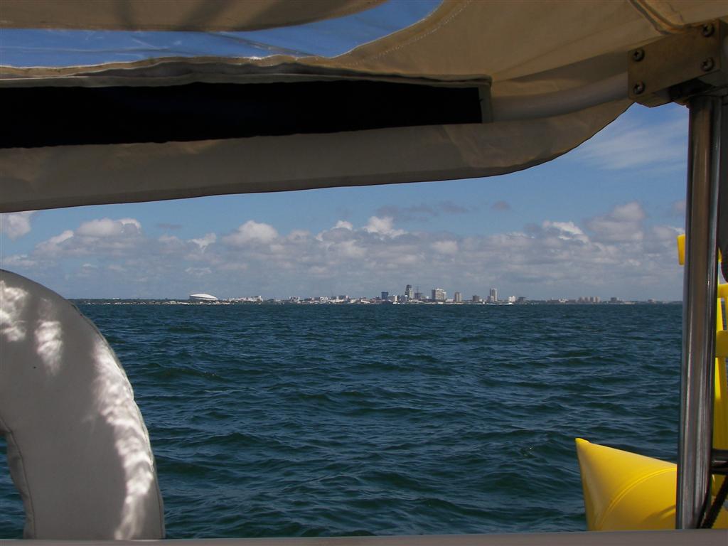
From Bayboro Harbor, {BIGMAP} we headed out to Egmont Key at the
entrance of Tampa Bay. We met No More Mondays there and I actually
cooked dinner for them for a change! Egmont Key is across from Mullet Key, home
of Fort DeSoto. We
have visited the park there before, and there is no good anchorages for
Windigo, so we will skip this most worthy stop on our circumnavigation. [The
coolest things at the fort are the 12-inch rifled
mortars that could launch 1/2-ton projectiles almost 7 miles! In the 19th
century!]
The open-water anchorage at
Egmont Key was affecting Karin, so we scooted into the Manatee River {MAP} at dusk. Gail served breakfast in the
morning (they have the LARGEST refrigerator AND the LARGEST freezer I have ever
seem aboard a sailboat!) and then left us with Alberto. Actually it was just
the outer edge of the first named tropical storm of the year, but for three
days it rained on and off and blew 20 to 25 knots at times. Rinsed all the salt
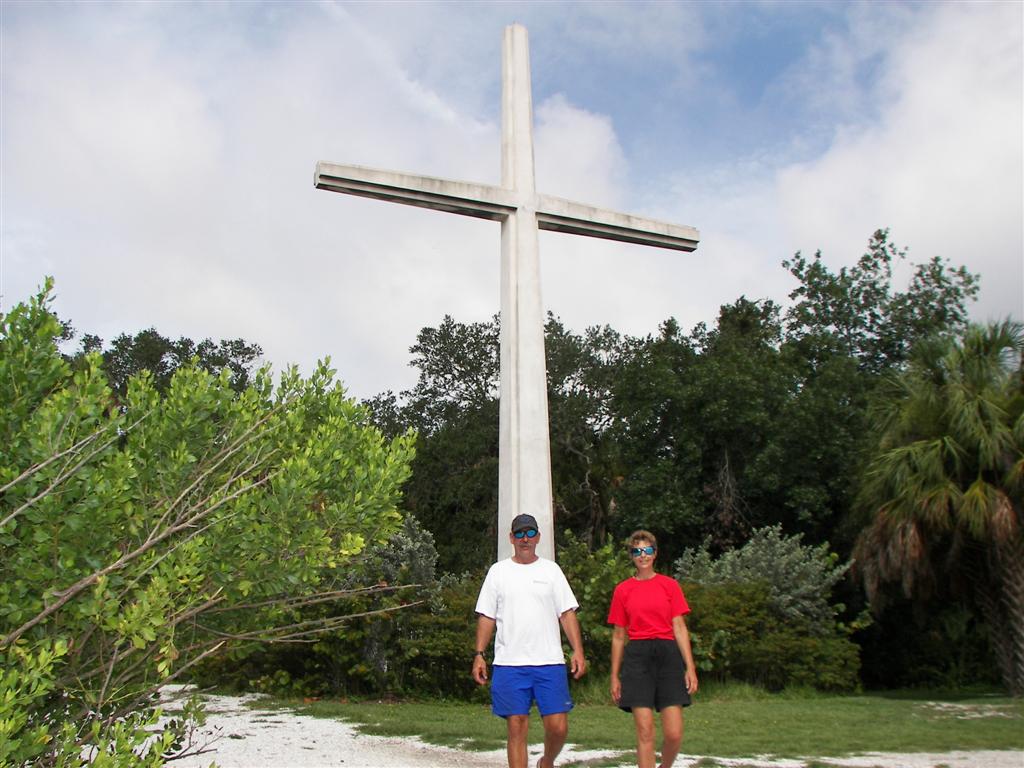
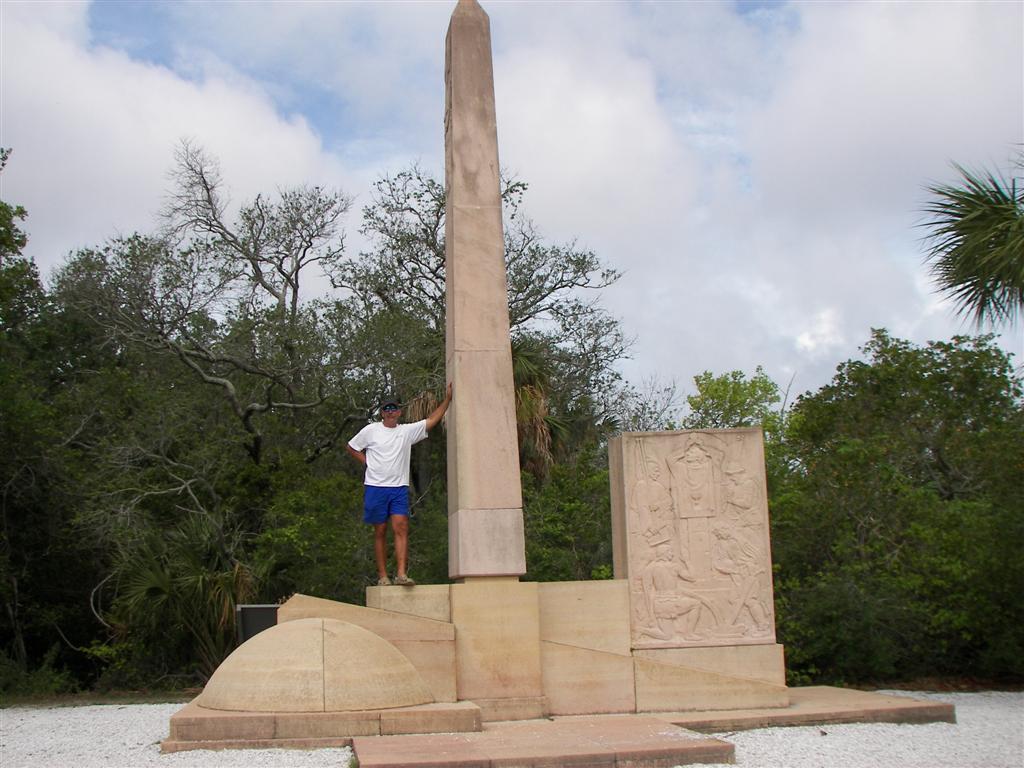
residue from the decks! The last day there we visited DeSoto National Memorial, which pretty much
describes how Spaniards came to Tampa Bay in the 16th century, converted the Indians to Christianity, then enslaved and slaughtered them all. Nice.
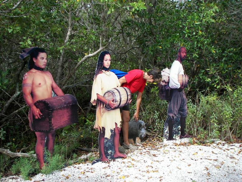
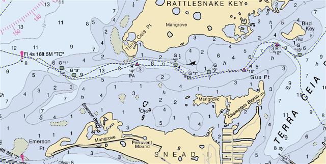
We crossed the river and
spent a couple days off Emerson Point and visited the Portavant Mound
where the Spaniards buried a bunch of Indians they slaughtered. Pretty much
makes a White-Anglo-Saxon-Protestant dude like me wish our ancestors never came
here and messed up what the Native Americans had going. But referring back to
the condo developments of the last eletter, it seems we have a penchant for
"improving" our environment with change, thus a greatly diminished Indian
culture in North America and no more scallops in Tampa Bay.
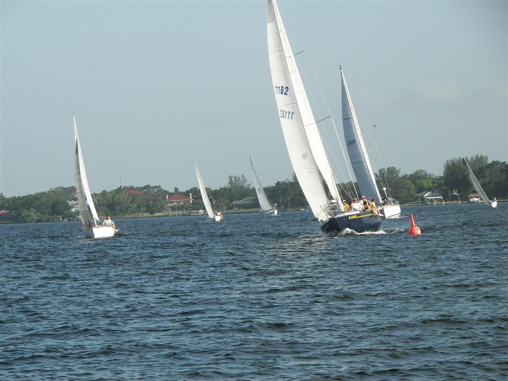
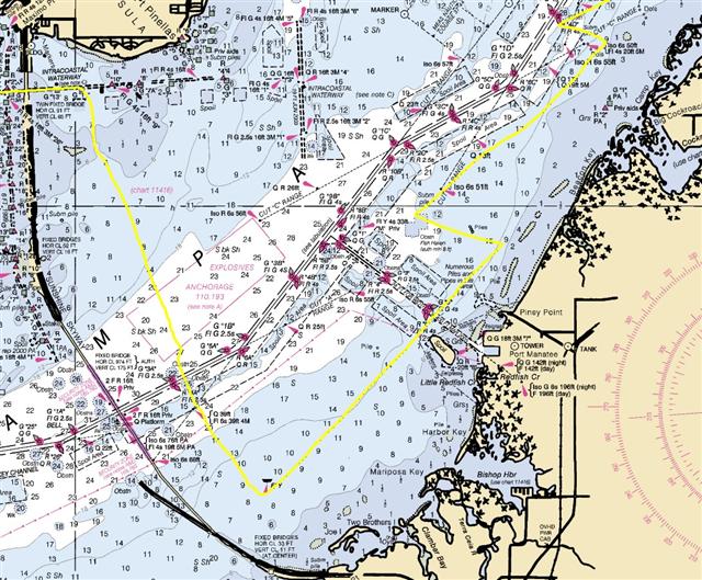
We took on a very difficult
navigational challenge upon leaving the Manatee River {BIGMAP}.
We entered Terra Ceia Bay and did a little circumnavigation and popped back out
into Tampa Bay. It was a challenge because the entrance channel has a charted
depth of less than five feet, and there is an expansive area to cross to get
into the bay at less than six feet charted depth. Windigo draws a full seven
feet and not an inch less. We were able to enter, circle and leave Terra Ceia
Bay {MAP} only by timing the tidal change with our
passage. Very interesting to sail a deep-draught vessel in a place like that.
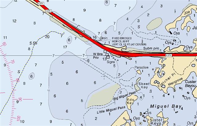
Next we stayed at the SE
end of the Sunshine Skyway Bridge {MAP}. It is a toll bridge on I-275, and I counted an
average of 80 cars/minute. That's $100,000 a day. I don't think that money goes
for "bridges" . . .
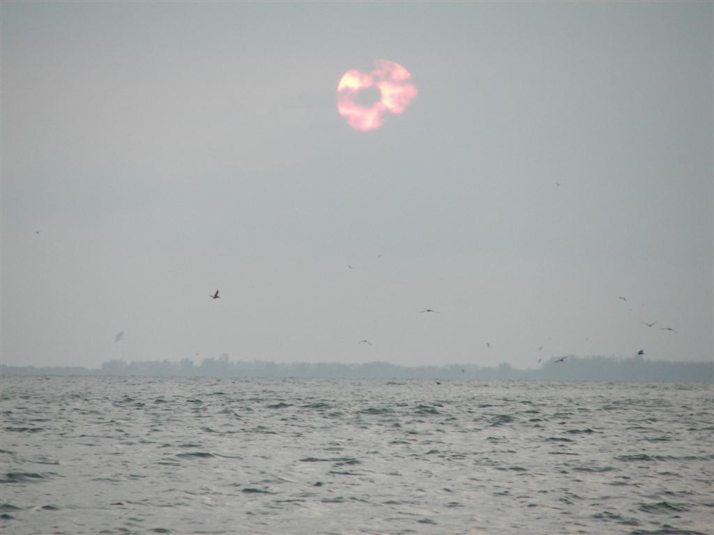
The island next to our
anchorage is called Paradise Island. Didn't
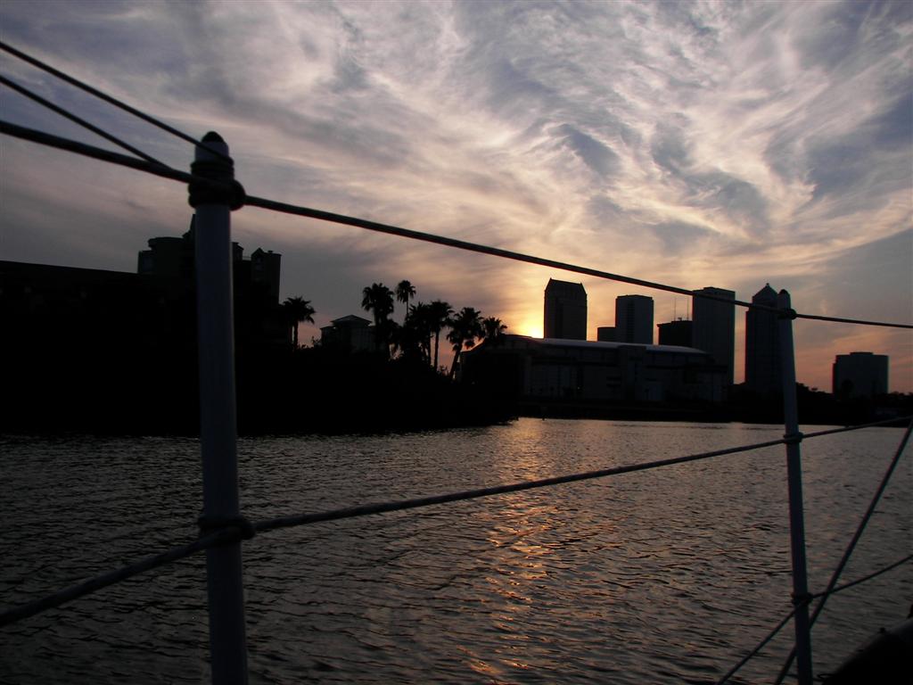
go there - too soon for Paradise for me! The sunrises
and sunsets are
not quite as consistently beautiful as the desert ones in Arizona, but there
are just as many!
We attempted to continue
our counter-clockwise circumnavigation the next day, but the winds were not cooperative
{BIGMAP}. We slipped into Gulfport again {MAP}. We like Gulfport. We went
shopping to get parts for projects and some food items for our ships stores and
visited with Gene Lucky. It was here that I was able to connect to the WWW and
upload the last eletter & pix.
When the wind was right, we
passed through three familiar bridges and performed another intense
navigational feat. There is a very narrow channel traversing Pinellas Point
under the Meisner Bridge {MAP}, with a very shallow
area to the south. The charts give an indication of an unmarked passage with a
charted depth of 5 to 6 feet of depth. It was high tide and the wind was right
so I negotiated this half-mile of shallows without touching bottom once. Cheap
thrills.
After checking out Port
Manatee {MAP} and some spoil areas (where the
Engineers dumped the dredgings from the ship channel) we anchored off Bahia
Beach {MAP} near the Little Manatee River. Used to
be several nice marinas ashore, now just condos . . .
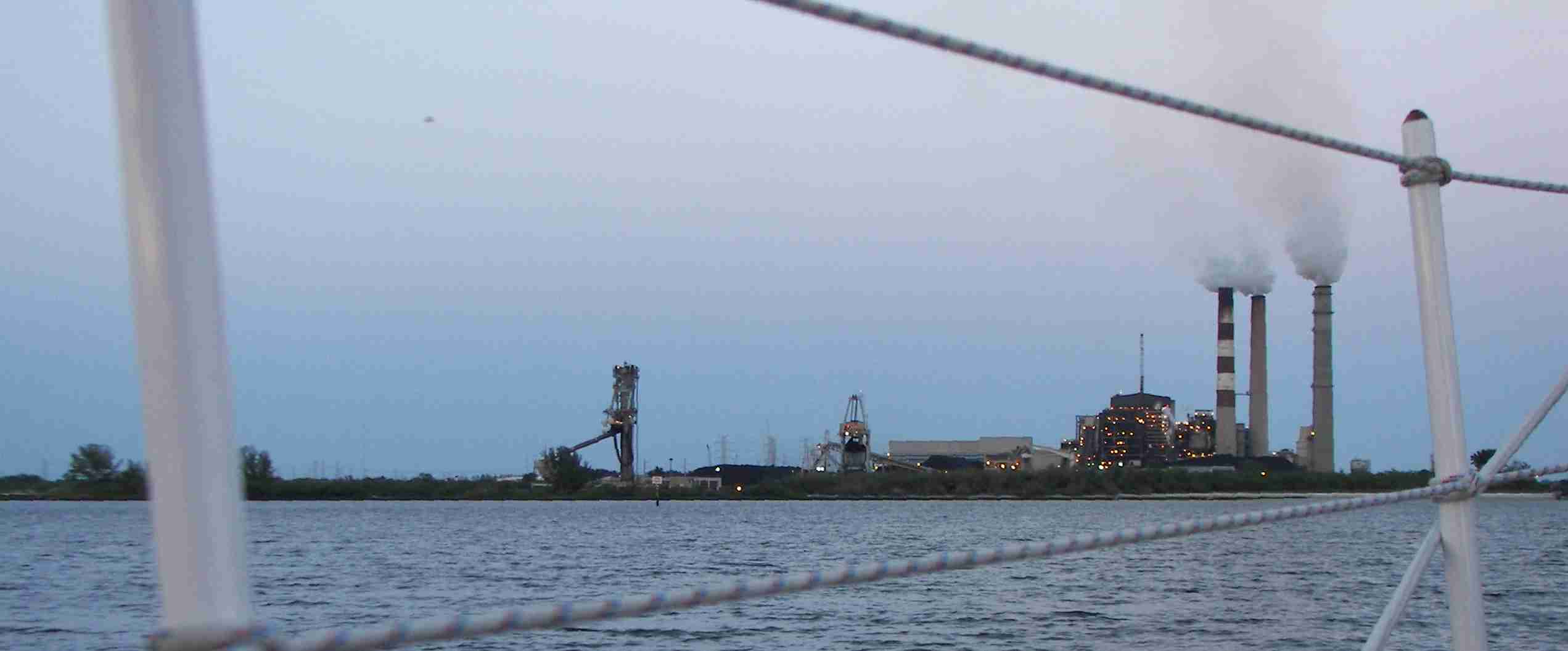
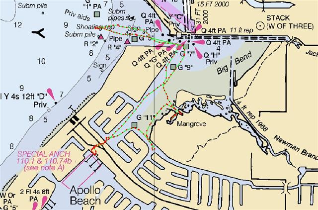
Next stop: Apollo Beach {MAP} just off Tampa
Electric's Big Bend 2,000MW Power Station. Do any of you remember my
previous life as an Electrical Engineer and Master Electrician? One of my
former crusades was the case
against coal-fired power plants. Amongst the factual data:
- Americans living
near coal-tired power plants are exposed to higher radiation doses than
those living near nuclear power plants that meet government regulations.
- The population effective
dose equivalent from coal plants is 100 times that from nuclear plants.
- The energy content
of nuclear fuel released in coal combustion is greater than that of the
coal consumed.
- The amount of
uranium-235 alone dispersed by coal combustion is the equivalent of dozens
of nuclear reactor fuel loadings; And uranium-235 isn't even the most
dangerous of the radioactive byproducts of coal-fired plants- don't get me
started on thorium!
- Americans killed on
site at mining operations pales in comparison with the deaths instigated
by the air pollution, water contamination and cancers caused by coal.
Even more controversial and
of greater interest here in Tampa Bay is the Tampa
Bay Seawater Reverse Osmosis Plant right next door to the Apollo Beach
power plant. Construction began in August 2001 and the first 20,000m2 of water
was produced in March 2003. However, subsequently the plant has run
sporadically, producing far short of its intended output. Three of the
companies involved in the project have filed for bankruptcy and on 2 December
2003 the dispute over control and ownership went before a Federal Judge. This
hearing determined nothing, and Jim Davis
(our 'Representative' in Washington) said just six months ago in a speech how
marvelous the water-making facility is. (?) No significant amount of water is
being made there. If it's not
propaganda, why a whole webpage trumpeting its safety?
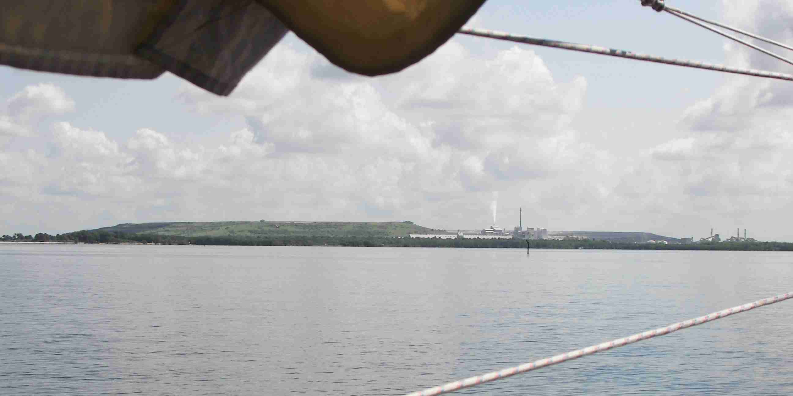
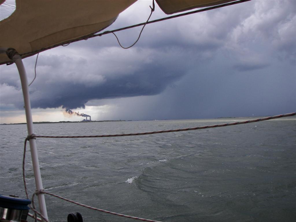
Oh well, Apollo Beach
offered cool terraformed shoreline with tons of waterfront real estate and a
few marinas. A several mile ride on Pedigo {MAP}
revealed many natural and manmade wonders. The view of Tampa Bay is absolutely
panoramic, and the evening
thunderstorm activity was marvelous to watch.
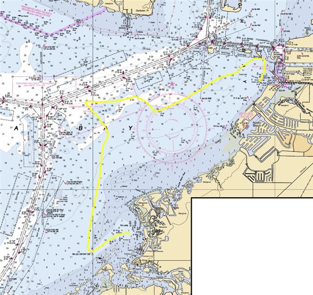
The voyage from Apollo
Beach {BIGMAP} proved to be quite challenging,
working our way around and between various spoil areas, mostly submerged.
Bumped one quite firmly, but with wind and tide it was a preplanned touch, and
we sailed off without the engine (this was the third day since running the
engine AT ALL). After skimming past some larger spoil islands, we anchored 70
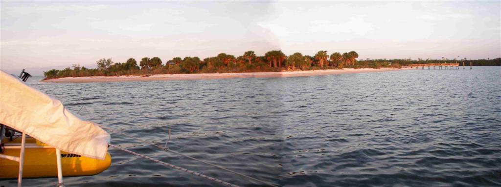
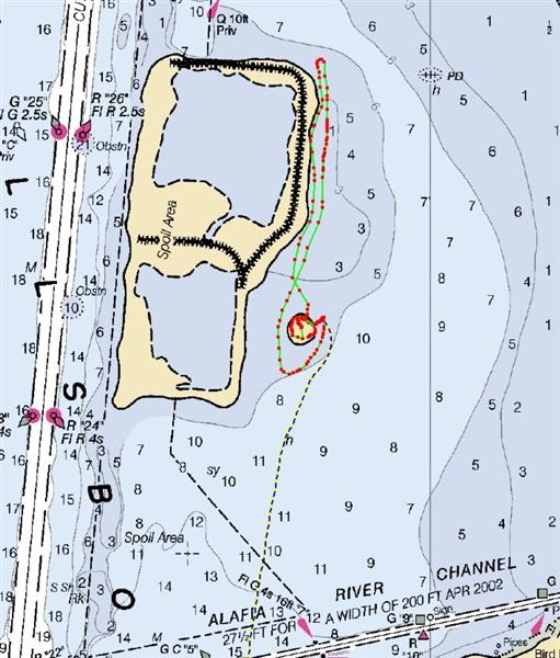
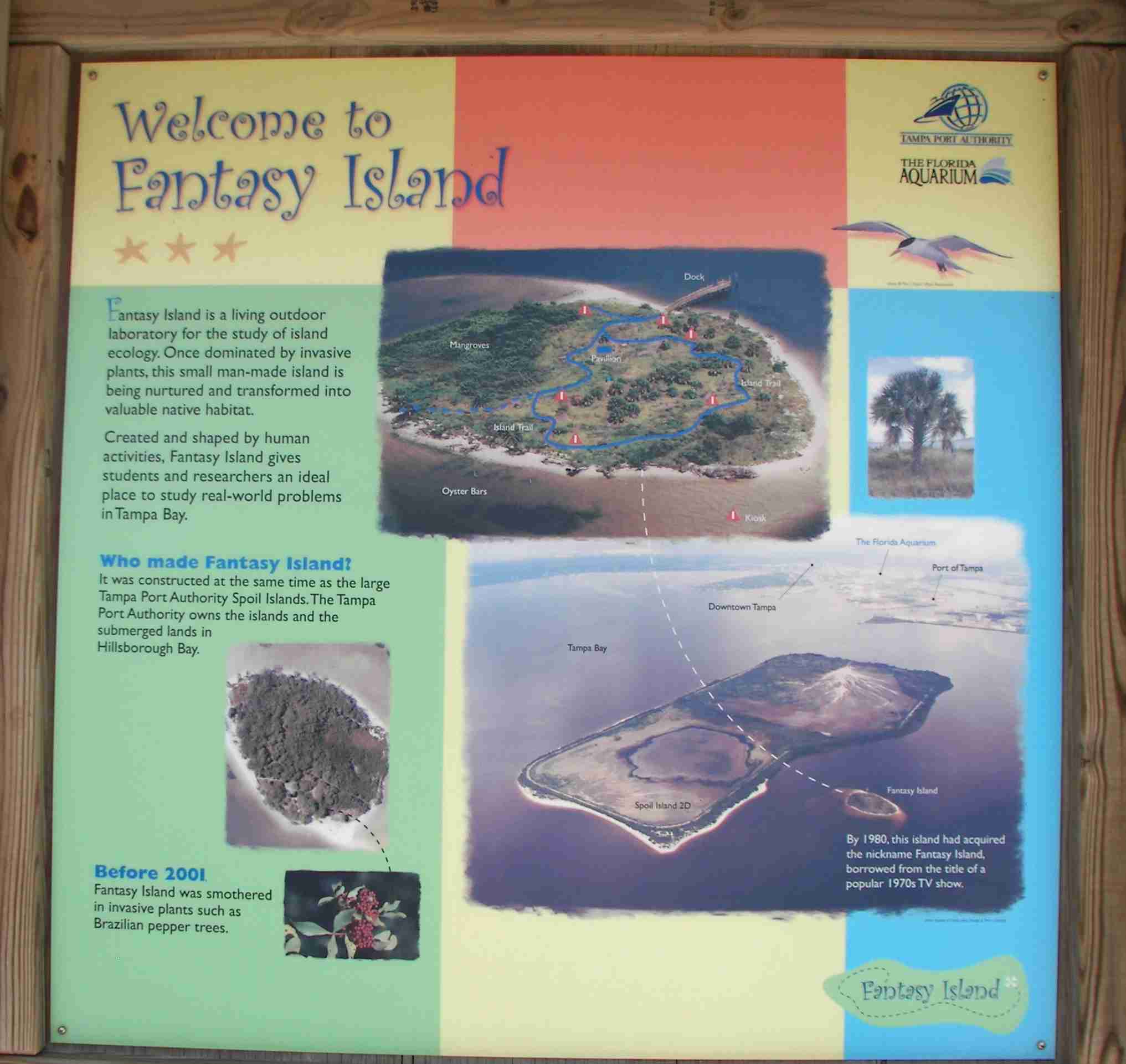
yards from one of the more interesting spoil islands on the Bay. Fantasy Island {MAP}
was stripped of all the invasive species and replanted with native Floridian
flora. Birds and animals abound [even saw a bunny rabbit!] and this educational
center is studied for the effects of human visitation. (Most other spoil
islands are off limits to people - a small attempt at letting nature recover
some land from the destructive hand of developers.)
Fantasy Island is right
across from one of the largest Cargill
phosphate plants. Phosphate is used for fertilizer, and to make phosphoric
acid to make anhydrous ammonia, another fertilizer. Trouble is, for every TON
of phosphates produced from the mined substrate, FIVE TONS of highly toxic,
unprocessable waste is left behind. The solution? To big gigantic dikes and
leave ponds containing BILLIONS of gallons of this poison right where they mine
and process the phosphate. Which, for 75% of the phosphate used in America, and
25% of the world's supply, it is right here in central Florida. It's safe to mine
and use this stuff . . . . according to the peoples that get rich from it.
But what happens when tropical
storms and hurricanes come visiting?
Tampa Bay was once one of
the most important estuaries in the WORLD. Now they have an annual event
called 'The Great Scallop Hunt'; scallops, which only 25 years ago could be
scooped off seagrasses by the handful. Now they get excited when they find more
than one during the hunt. (2 years ago, they didn't!) Scallops are
not the only targets of this pollution. And not just the waters of Tampa
Bay. Along with 25% of the world's phosphates, is Florida taking responsibility
for 25% of the world's
phosphate problems?
Back on Fantasy Island, it was quiet and
relaxing on Friday, but became a people-watching Mecca on Saturday after
sunrise, with dozens of small powerboats full of all types of visitors
descended on that mound of earth in the Bay. The afternoon thunderstorms and plentiful
mosquitoes sent most of them home early.
Sunday had us drifting east
into the Alafia River {MAP} for more
people-watching; A popular boat ramp disgorges hundreds of weekend watersport
wranglers, whipping wildly westward while washing weenies . . . down with beer.
{couldn't think of a "W" word for brewskis}
We finished off our stay
there with a 15-mile Pedigo journey up the Alafia
River {MAP}. Very quiet, very rural Florida; Nice long ride.
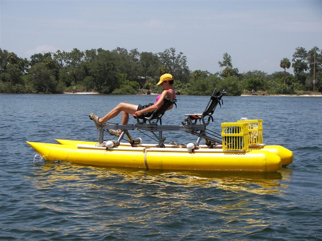
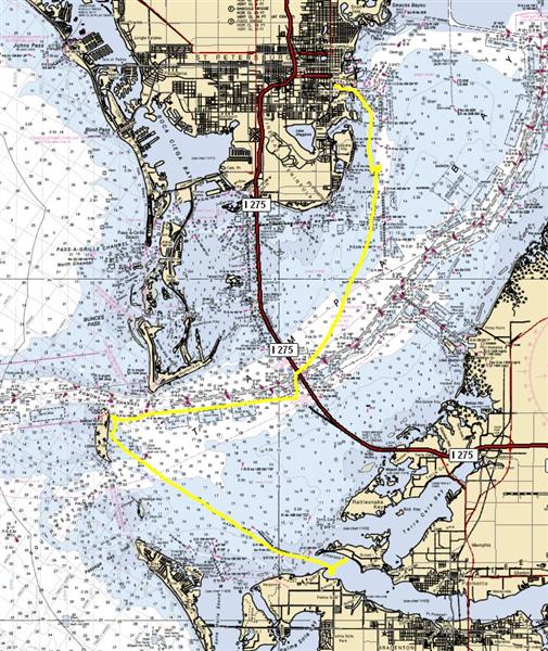
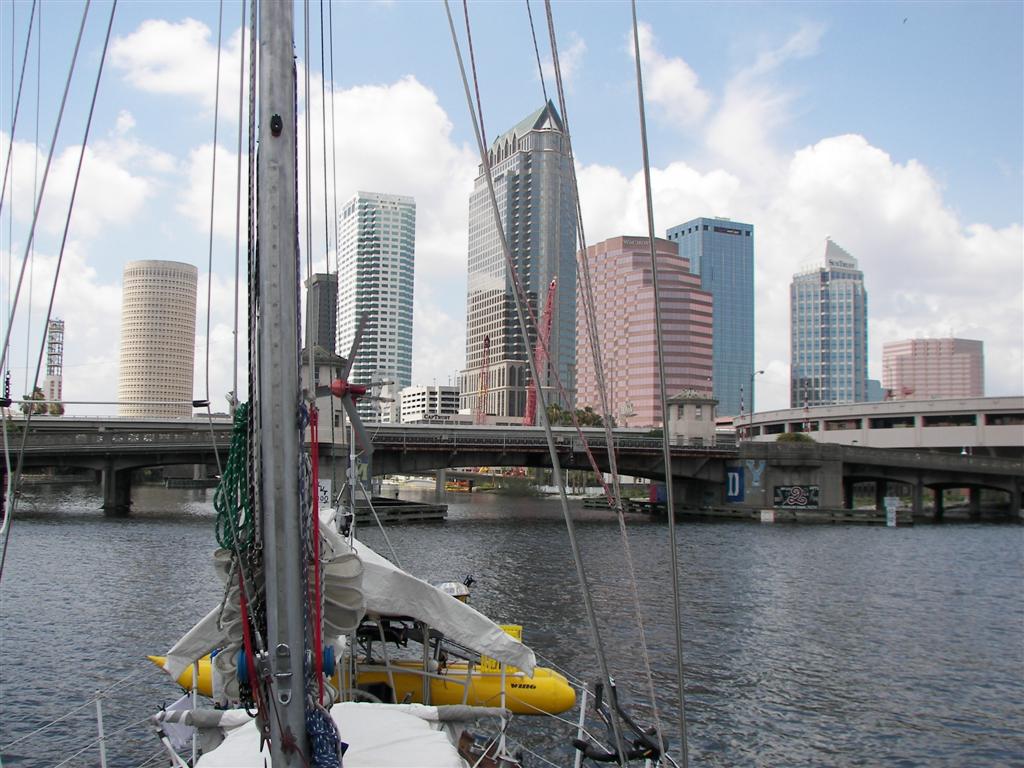
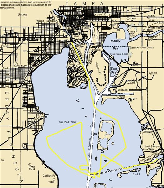
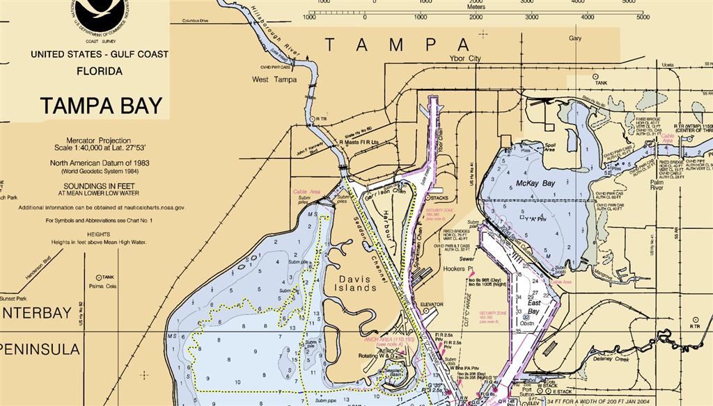
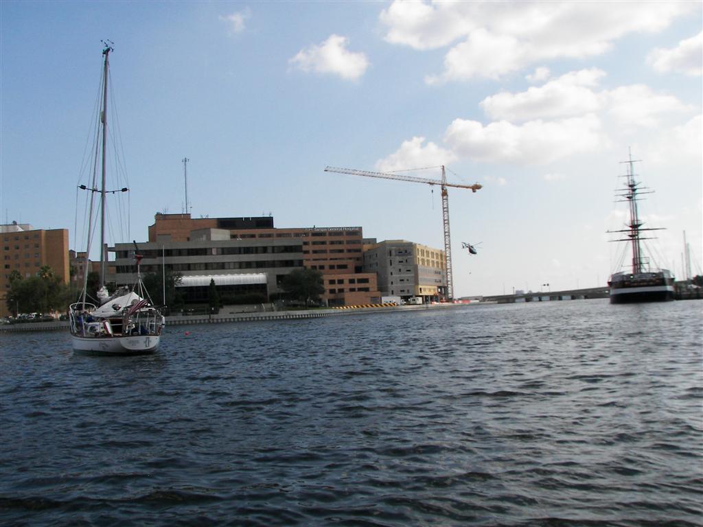
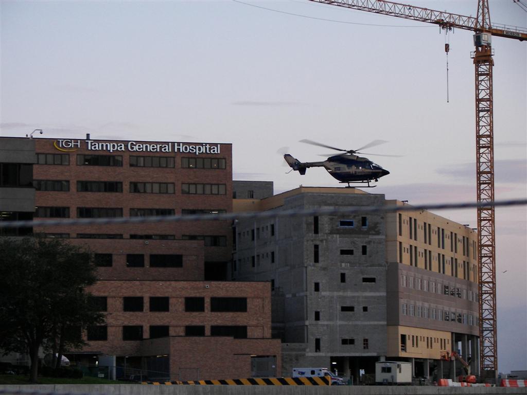
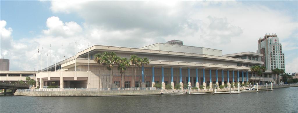
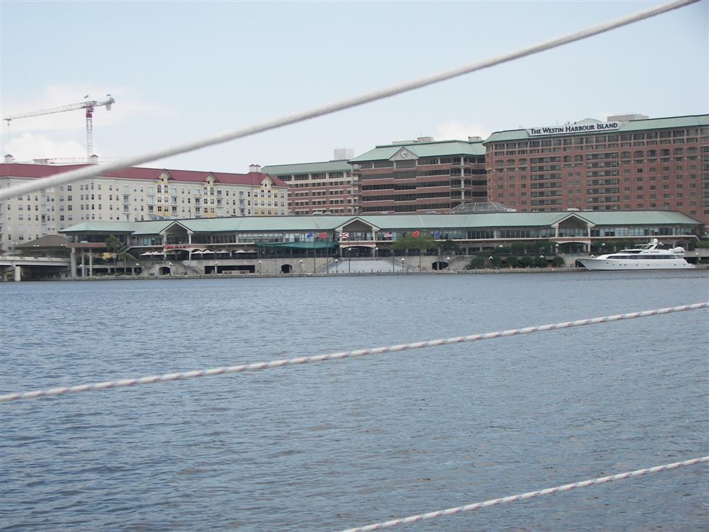
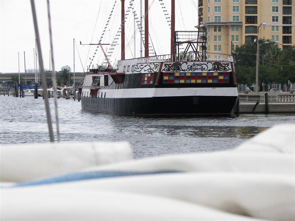
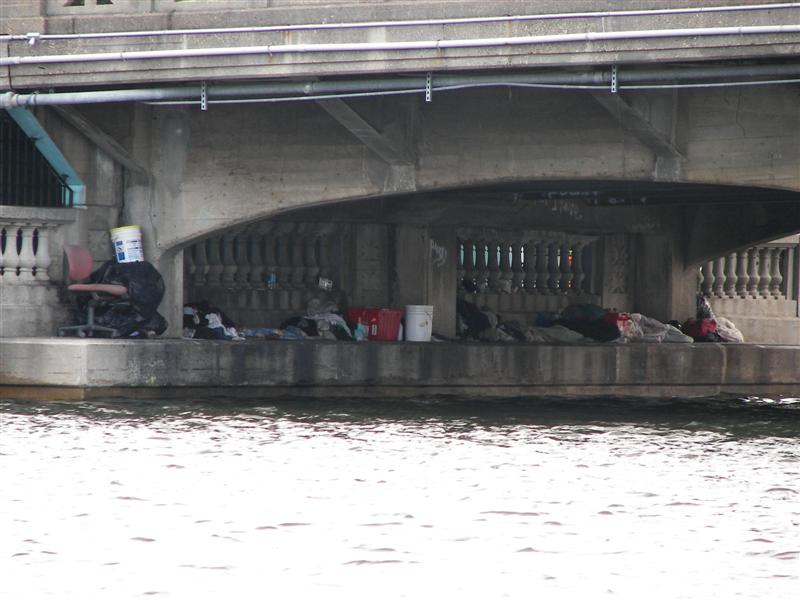
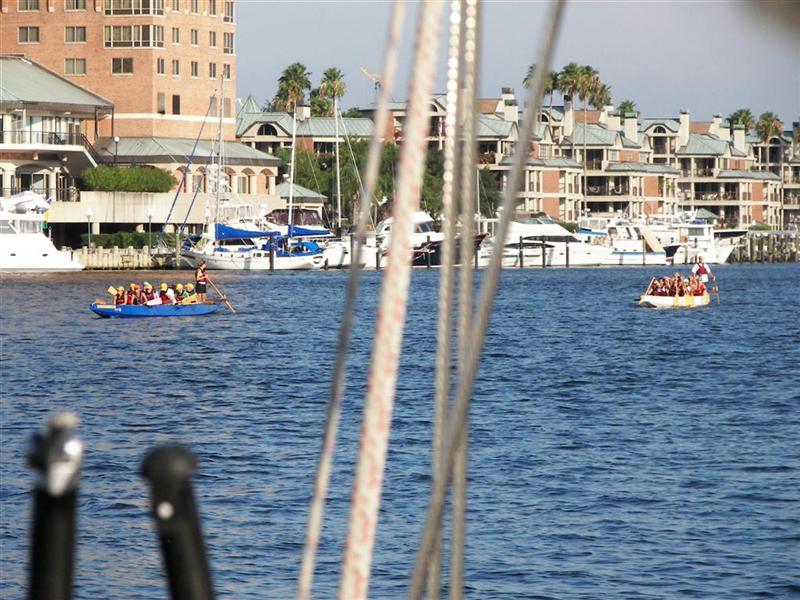
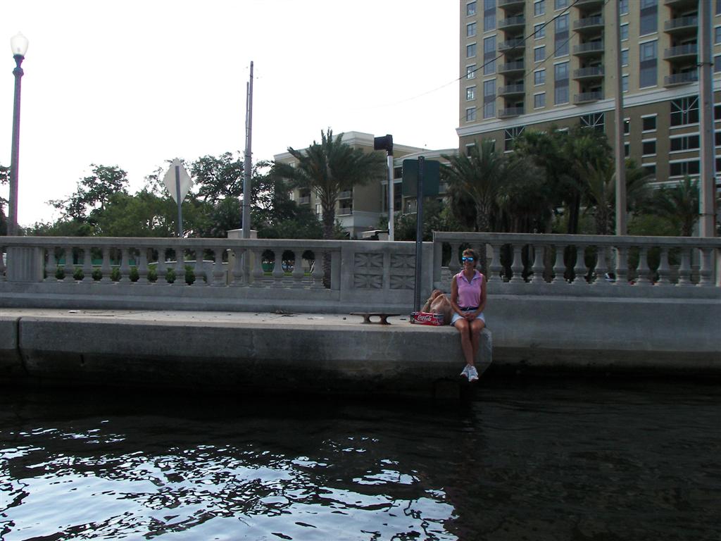
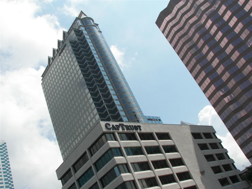
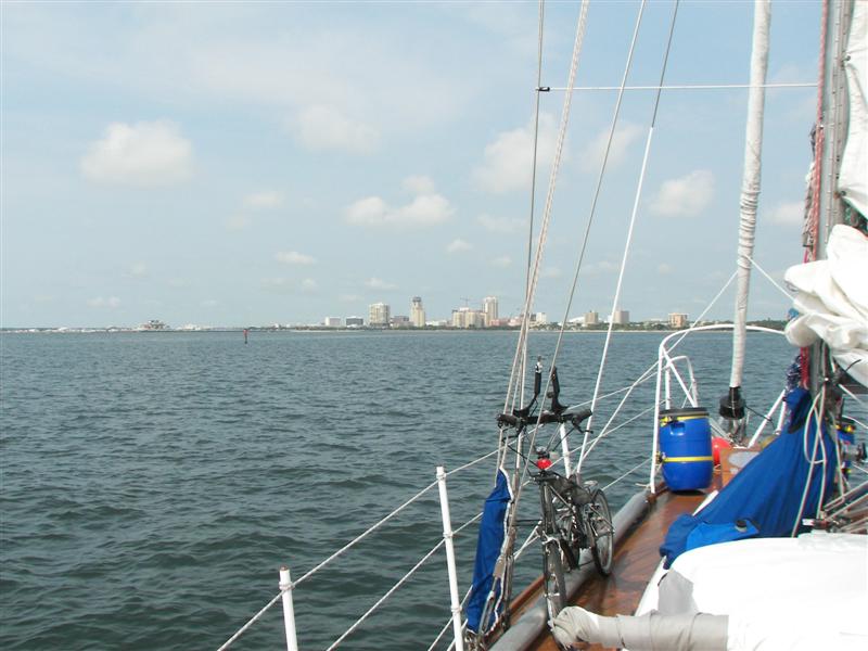
From the peaceful rural
river we sailed right to the heart of downtown
Tampa {BIGMAP}! At the junction {MAP} of the Seddon
Channel, Garrison Channel and Hillsborough River we were adjacent to Tampa General Hospital, Tampa Convention Center, The Westin Hotel complex, the pirate ship Jose Gasparilla, right under the
Tampa skyline and a stone's throw from the homeless
storage unit (why would anyone be 'homeless' in Wisconsin when the
weather's so nice in Florida?).
The pirate ship only gets
used once a year, but it is the grand festival of Tampa, reenacting the triumph
over a local notorious pirate.
[Another pirate whose main address is said to have been New Orleans actually
had a few families
in Gulfport. I hope his descendants have recovered the buried treasure . .
]
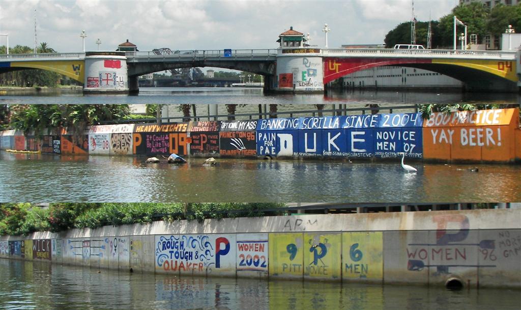
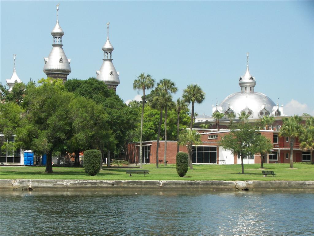
The Pedigo voyage up the
Hillsborough River {MAP} to West Tampa
revealed the tradition of crewing
here. Team spirit was evident along the river. A
view of the Henry Plant Museum from
the river is very picturesque. A stop
ashore for a few groceries;
also, who is Captain Rust?
How did we top staying in
the hub of downtown? By anchoring at the junction of the Garrison and Sparkman
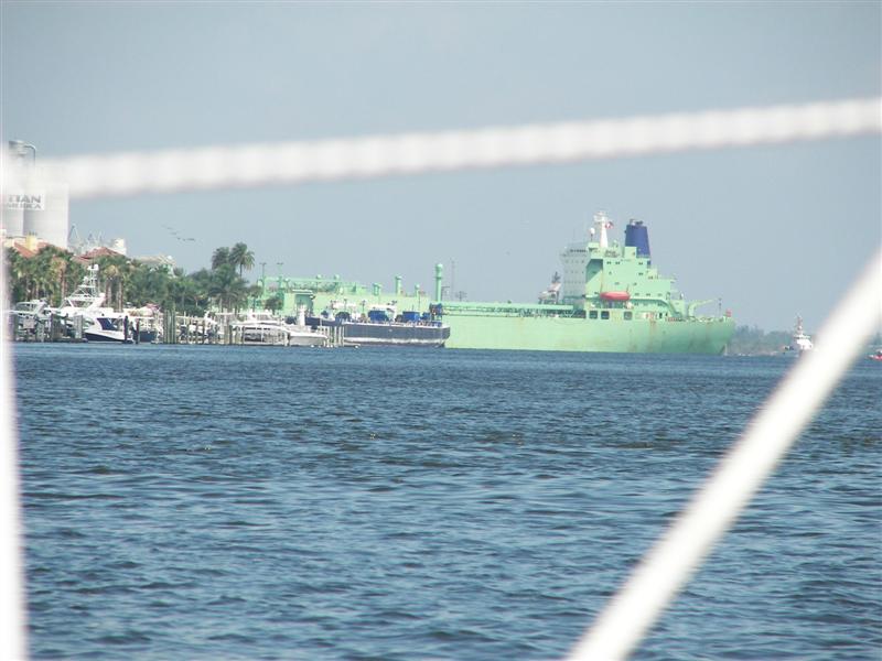
Channels {MAP} directly across from the Port of Tampa. With
excessive security in major ports for Liquefied Natural Gas & Anhydrous
Ammonia tankers and cruise ships, all of which are plentiful in Tampa, it took
the latest charts, attention to detail and knowledge of the regulations to find
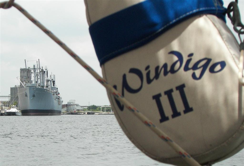
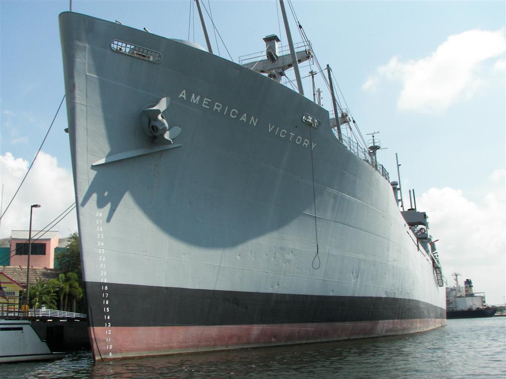
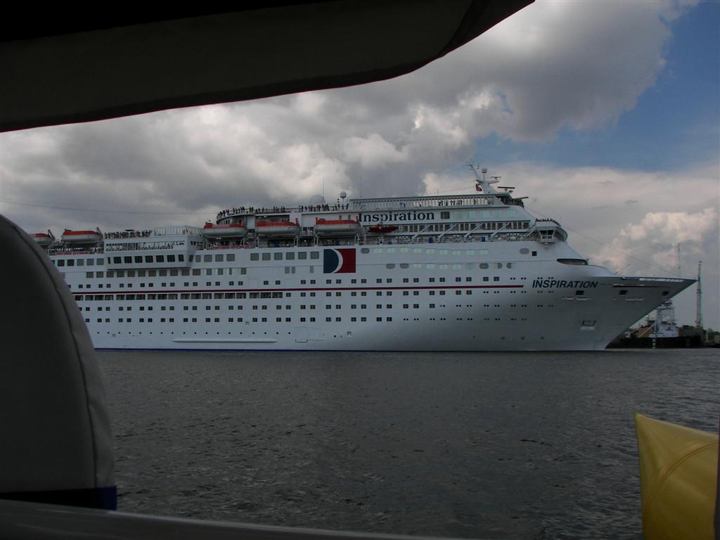
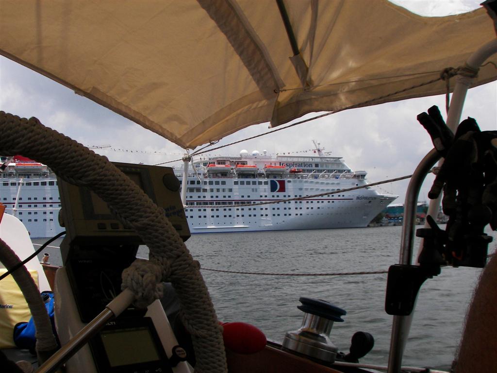
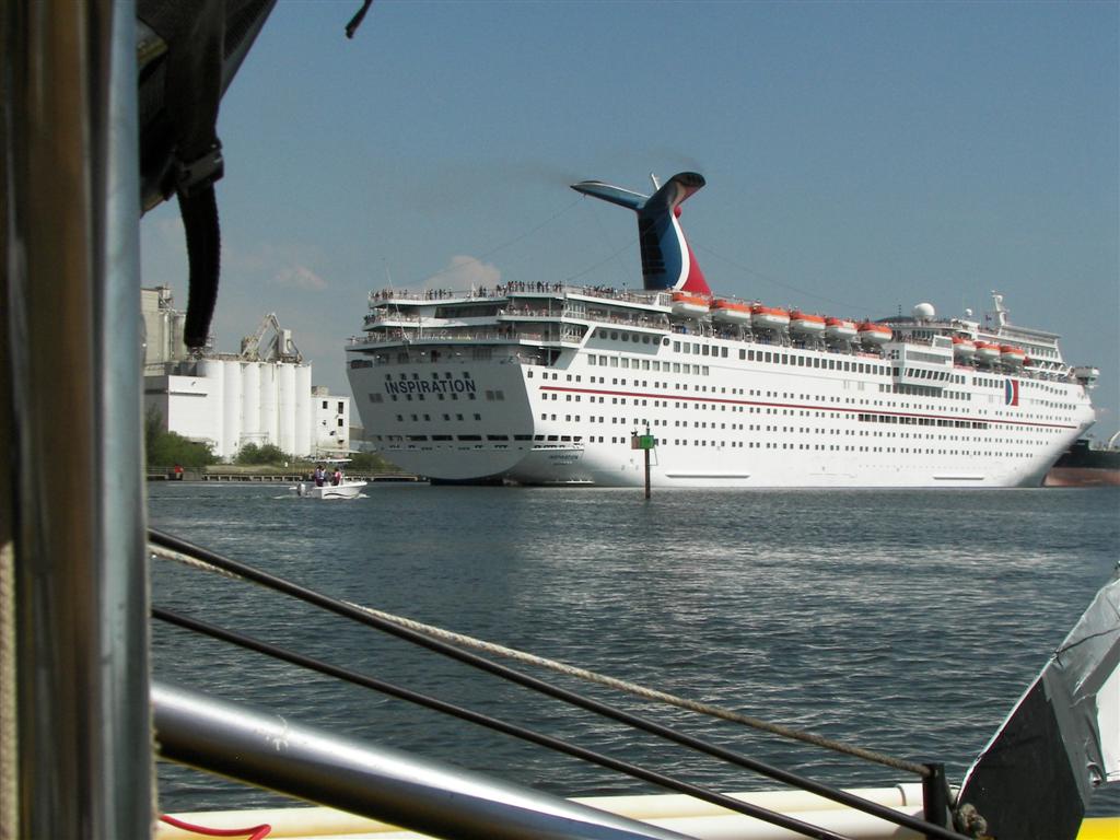
a viewing spot outside the Security Zones. The American Victory watched over us for our
two-day stay, but the USGC Auxiliary still made a call on us and reported
in to USCG Sector when the Inspiration left for its
trip to Mexico. The 500-yard zone around the Inspiration expanded to
1000-yards as it pulled away from the dock, but
we were anchored safely away from the channel, but with a great view of the action. Other ships bringing and taking cargo moved
constantly.
From the Port of Tampa, we
headed around Harbour Island and Davis Islands {MAP}
to the northernmost point of Hillsborough Bay, which is on the other side of
the Davis Islands Bridge and 600 yards away from our downtown anchorage. I used
this opportunity to give Karin a lesson in navigation; she piloted the whole
voyage nearly blindfolded - allowed only to use limited aids and her God-given
senses. There is a huge learning curve to this type of sailing, and she climbed
a good portion of it that day.
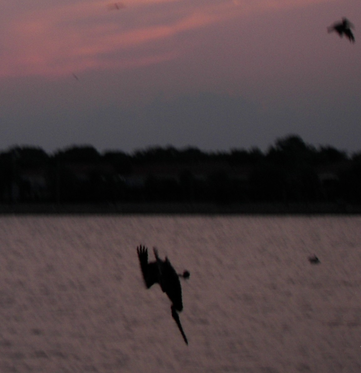
This anchorage was alive with waterfowl,
mostly pelicans with their diving antics.
They drop top-speed from 20-to-50 feet above the water for their dinner. Wow.
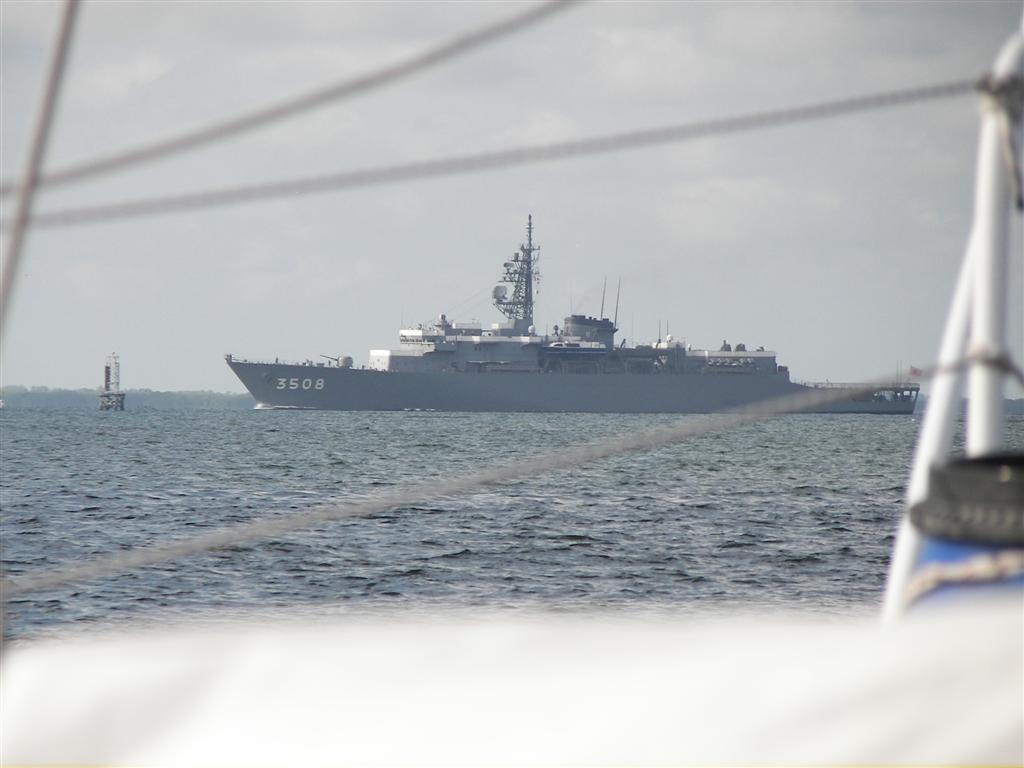
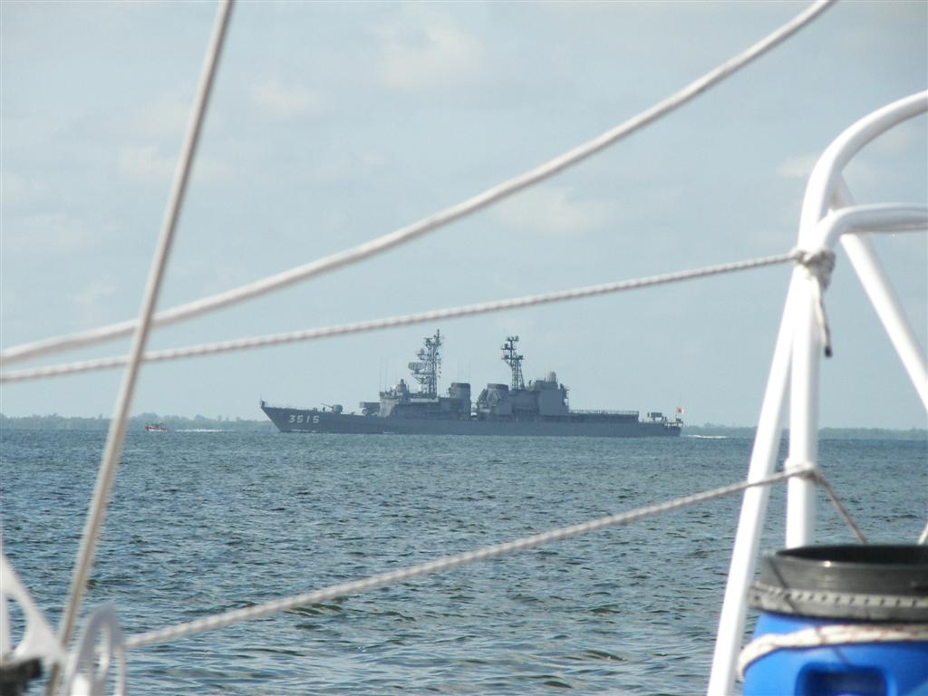
The next stop was around
the interbay peninsula {BIGMAP}, which is the home
of McDill AFB and Command Central for the Iraqi War operation. As we skirted
the Security Zone for the Air Force Base, the USCG found yet another reason for
to establish a Security Zone. This time it was three huge Japanese warships. The Japanese Navy wasn't too threatened by
Windigo, but remember the last time we had a dispute with them? I stayed nicely
1000-yards from all three naval vessels
[check out the flag]. (When I was in school, Japan wasn't even allowed to
have a Navy . . .)
![naval vessels [check out the flag]](Japanese%20warship%20154.jpg)
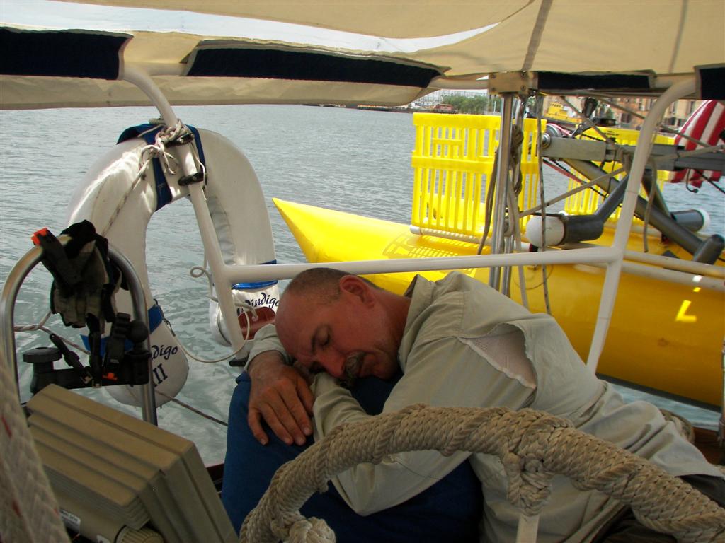
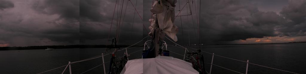
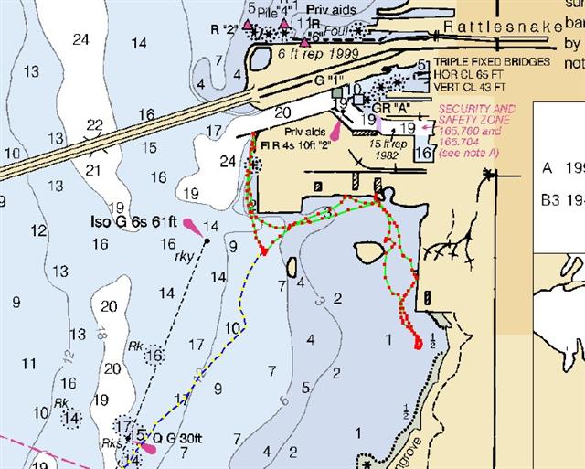
We had sailed a bit later
that day, and spent the hour prior to anchoring at the east end of the Gandy
Bridge {MAP} in a bit of a thunderstorm. The 20+
knots of gusty wind made anchoring a good experience for Karin. We had just
finished the rain-catching awning for the bow of Windigo, and had a great time
testing it out. (It gathers 10 - 30 gallons of water during the typical Tampa Bay
thunderstorm.)
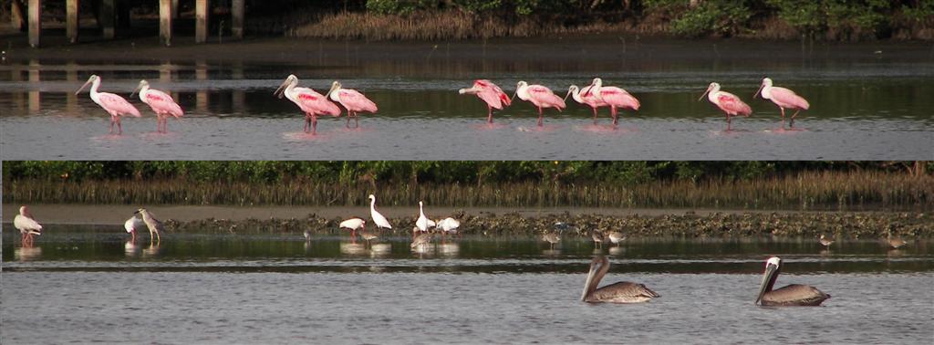
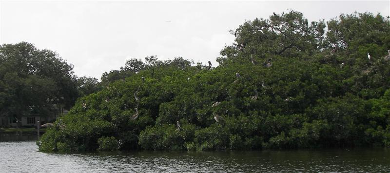
The Pedigo journey {MAP} the next day revealed a large number of waterfowl hanging around the mangrove
shoreline.
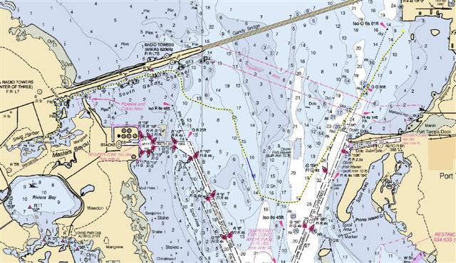
Many reefs and shoals in
Old Tampa Bay complicated moving Windigo and its seven-foot draft to the other
end of the Gandy Bridge {BIGMAP}, and I took on
yet another navigation challenge. Negotiating unmarked narrow channels in Tampa
Bay {MAP} with its relatively soft bottom is
great practice for the coral reefs we will encounter in the Caribbean.
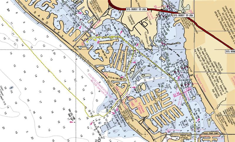
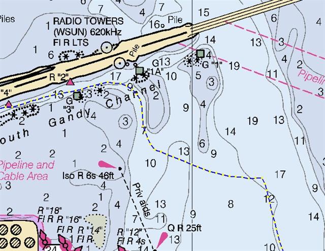
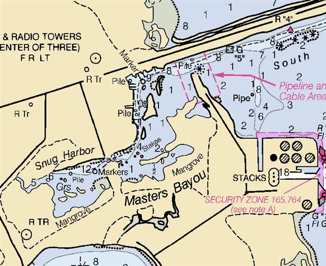
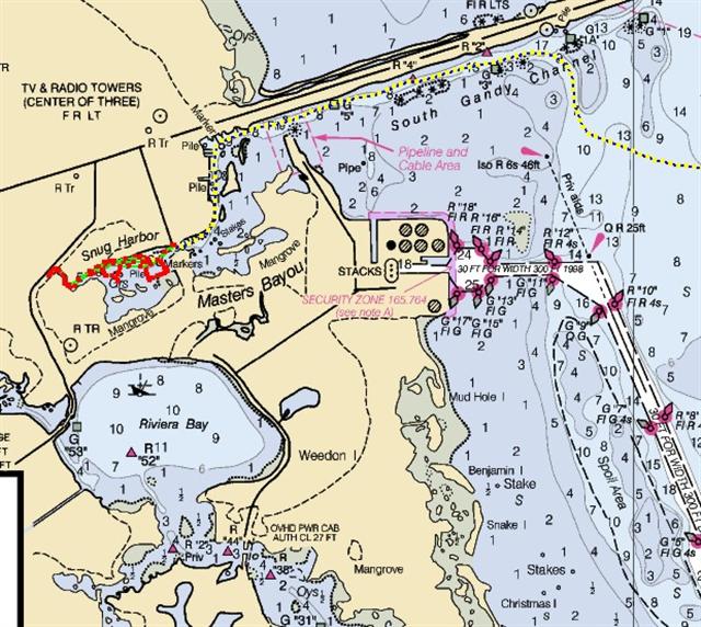
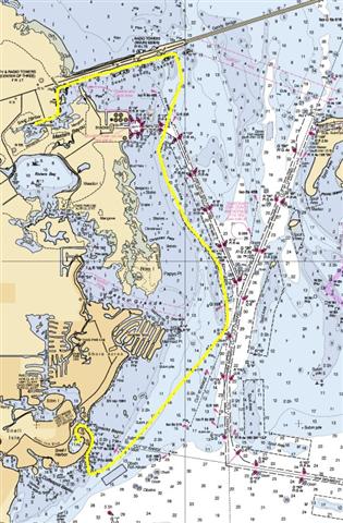
We nestled into Snug Harbor
{MAP} inside Weedon Island. Although this was one
of the most remote and natural anchorages in Tampa Bay, we had easy access to
Pinellas County where we used to live. This anchorage allowed us access to GE
Polymershapes, Wal-Mart, Walgreens and other familiar places we needed for one
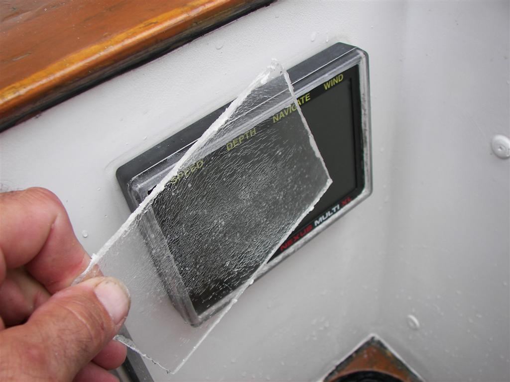
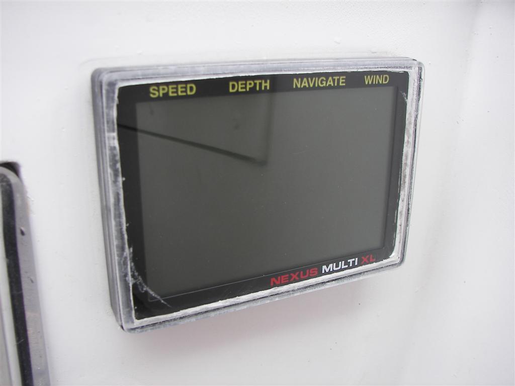
last shopping trip here. One of the projects completed here was the replacement
of an instrument lens that had gone crazed and hazy
from UV damage. Just like new!
We are continuing the
completion of the netting enclosure for the cockpit where we will sleep most of
the time.
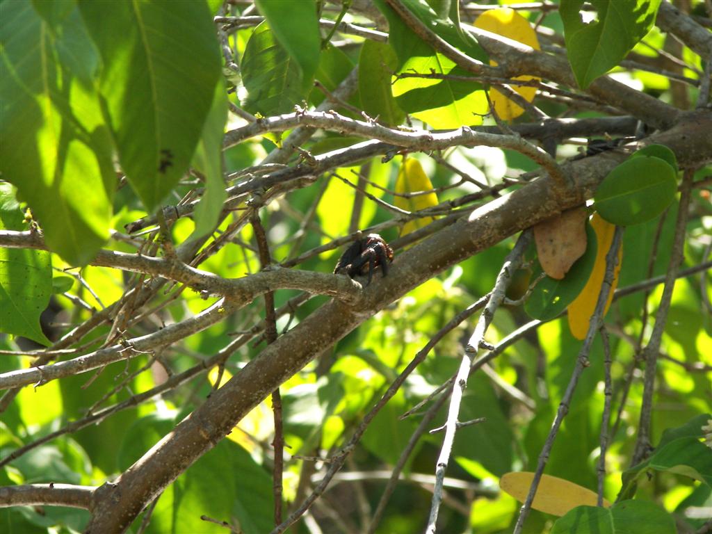
A Pedigo trip {MAP} through the mangrove alleys of Weedon Island revealed a vast
amount of wildlife, one of which allowed his photograph
to be taken.
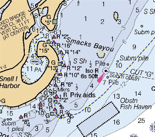
From Snug Harbor {BIGMAP} we worked our way around several shallow
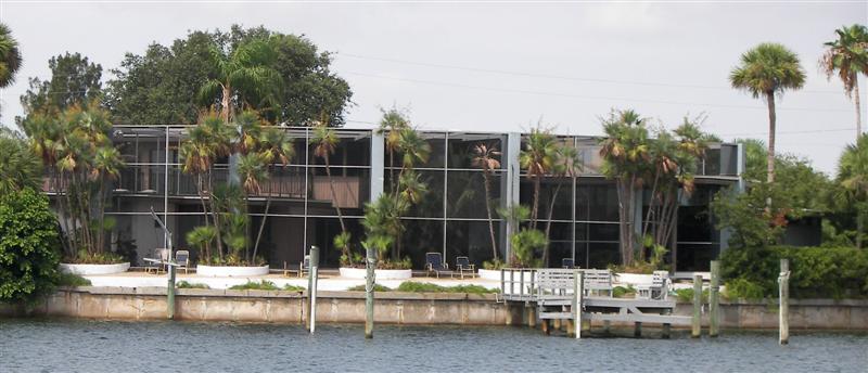
areas and into Snell Island Harbor {MAP}, an
upscale community (they screen-in their whole
house!) just north of St. Pete. The harbor is only accessible to Windigo at
the highest of tides, so we came in one day, left the next at the exact same
tide height during a full moon. (Did you know the tides progress about one hour
ahead each consecutive day, as the moon's orbit makes it pass overhead 55
minutes later each day?)
Here we scraped the prop
and waterline of the light growth that accumulates. Cleaning these surfaces a
couple times a month keeps Windigo looking
good, sailing well, and helps my swimming skills . . . (I pluralize as an
exaggeration.)
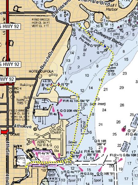
The next day we moved
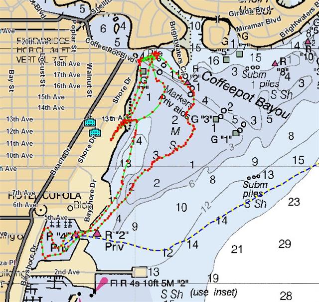
around the end of Snell Island to Coffeepot Bayou {MAP}
without making our way across the shallow reef around the area. We may stay
inside the shallows for only a few days during the full moon, as the tide will
not reach enough height for us to leave during the waxing moon. Coffeepot Bayou
was a wonderful surprise stop. It provided protection from the seas, but
allowed a nice breeze to keep us cool, bug-free and power our wind generator.
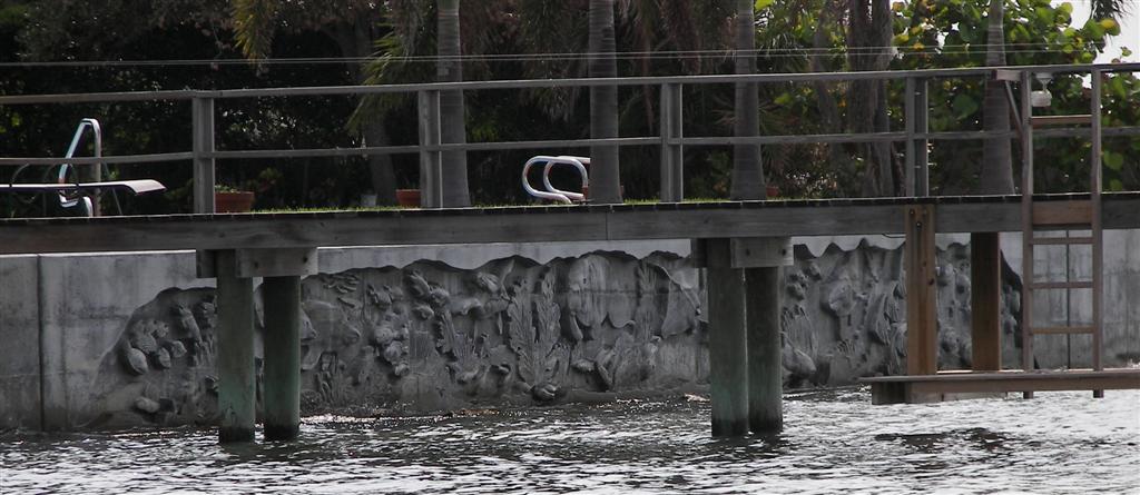
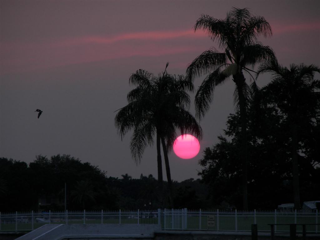
It is very pretty, with
nice houses and tree-lined parks
and beaches as far as you can see. It allows access to cycling with a clean
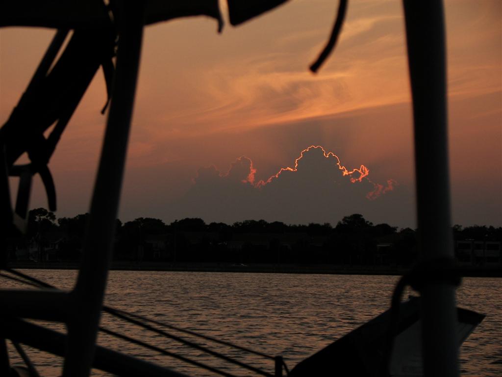
seawall for disembarking from Pedigo, which we also took for a ride to the North Yacht Basin. Nice sunsets, too.
Moving along brought us
into the North Yacht Basin of St. Pete, by way
of perhaps the most shallow area we've crossed yet in Tampa Bay and the pumpout
dock at the Harborage Marina {MAP}. The North
Yacht Basin is the site of the former Vinoy Yacht Harbor. I say former because
it was completely
destroyed in a storm two years ago, WHILE I was teaching a class there!
We also lived here three
years ago for an extended period, and it was here that I returned from my bike crash in Mobile
when Windigo and Karin were ready to leave Tampa Bay. My, how the course of
history gets diverted at times . . .
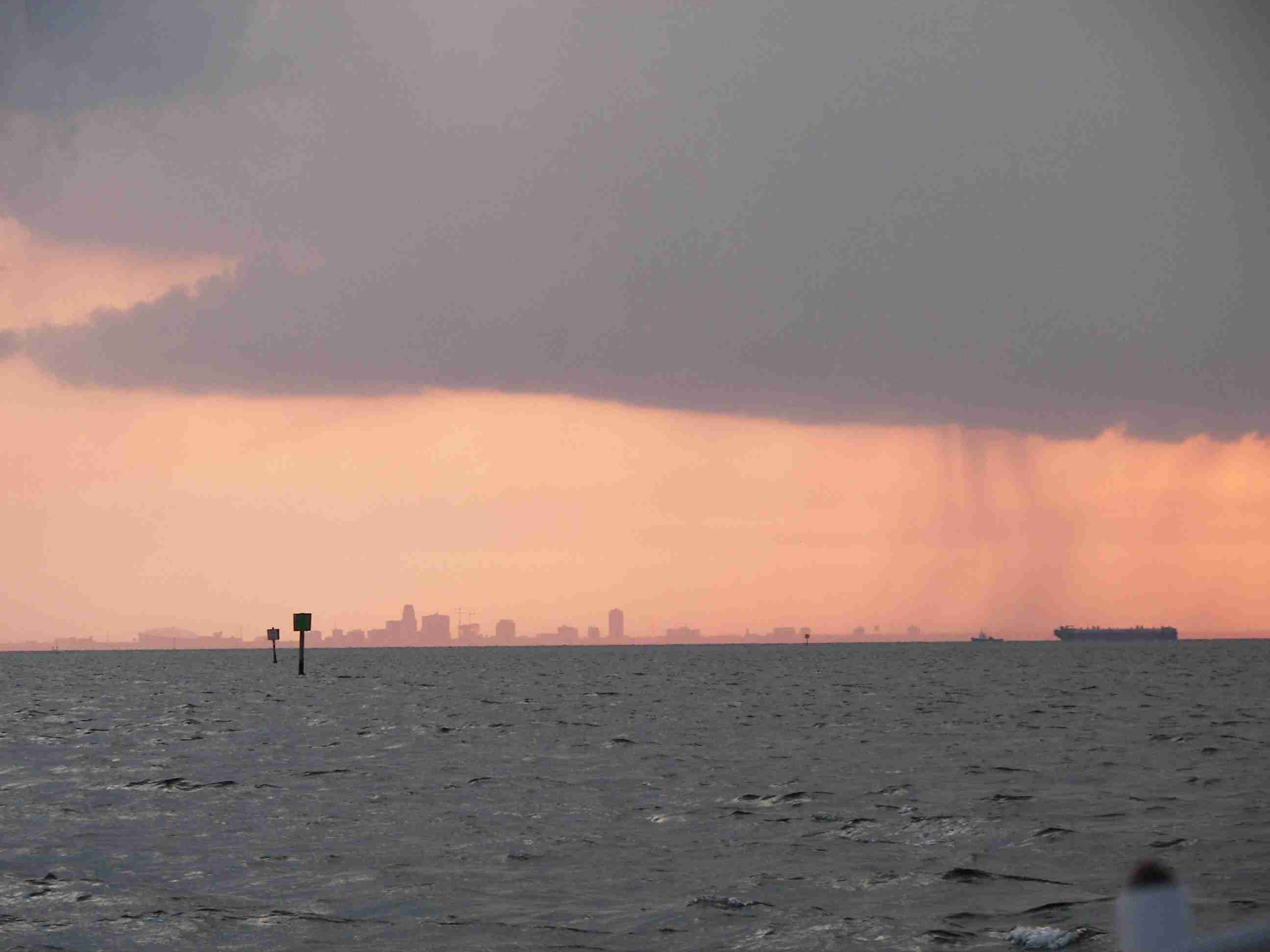
The most prominent feature
of the waterfront of St. Pete is The Pier.
Its many restaurants, shops, and even an aquarium makes it more than just a
tourist trap. Heck, the bar on the top floor invites you to stroll through to
see the great view even if you're not buying anything!
Today we left the North
Yacht Basin in St. Pete, and headed for
Gulfport {MAP} (we really like Gulfport) to
tune up a few provisions, make a new rudder for Pedigo, and a little welding on
my bike rack. We will take a few days before we head out for our next voyage, "Windigo's Return to the Dry Tortugas"
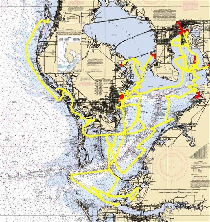
I hope you have found the
circumnavigation of Tampa Bay {BIGMAP}
interesting and enjoyable. There are beautiful and wondrous sights here, as
well as the problems I felt obligated to discuss with you. Please don't take
the negative comments as pure whining or bitching; I merely felt obligated to
enlighten as many people as possible with some facts, observations [and
opinions] of current events that have, or WILL affect you very soon. Educate yourself
additionally concerning these issues and you will find your own heart and your
own opinion.
(I really enjoy the
charting/navigation stuff!) {BIGMAP}
Where we are right now:
(Mom, save this link as a
bookmark- then you can be one click away from not worrying about me . . .)
Our permanent and EXACT
address:
Capt. KL & Karin Hughes
S/V WindigoIII - PMB 365
88005 Overseas Hwy. #9
Islamorada, FL 36033-3087
Text-only Email addresses
aboard Windigo, checked daily:
Email addresses checked
when at a land-based computer:
And of course, the Windigo Travelogue Catalogue:
http://www.ciekurzis.org