Hi All~
This Eletter has
links to the final photos from The Bahamas:
<http://www.ciekurzis.org/Family%20Islands/Family%20Islands%20(Part
II).htm>
Family Islands ? Part II
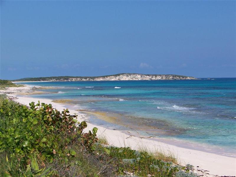
A continuation of
the last eletter, the Family Islands of the southeast Bahamas stand alone in
the Atlantic Ocean; they have aragonite, stromatolite, and coral reefs near
them, but no extensive bank surrounding them. The ocean plummets to over a
thousand meters deep just a few miles from their shores, with a few exceptions.
This Eletter also
has a surprise: the achievement of the quest adopted in the last Eletter ? the
discovery of a living Lucayan descendant!
The Character Of The Land.
Noel turned out to
be a significant event throughout these islands and flooding lingered for weeks.
Primary roads may have been damp, but accessible, some white roads stayed a
foot? or more under water for a couple
months.
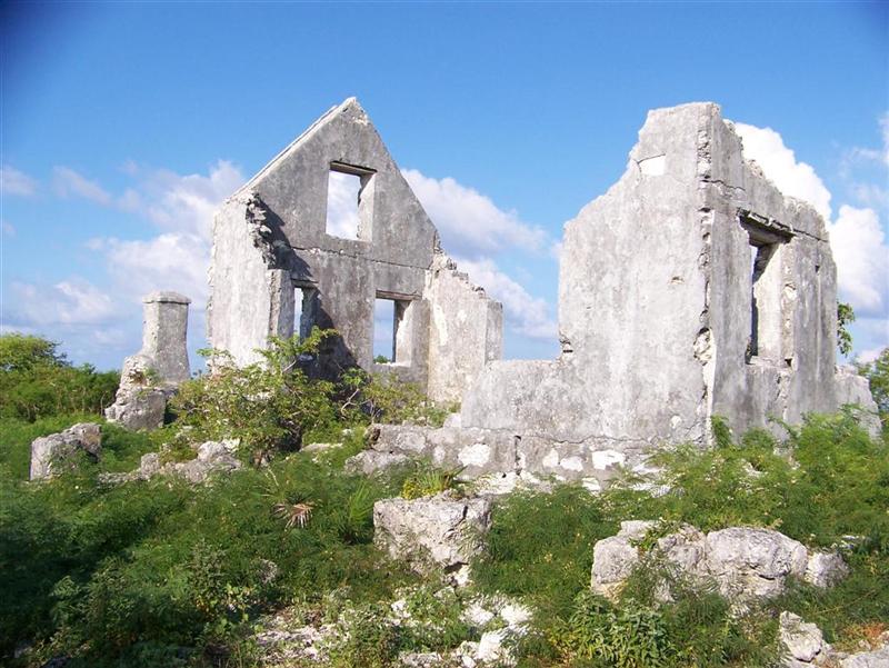
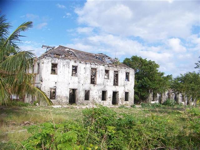
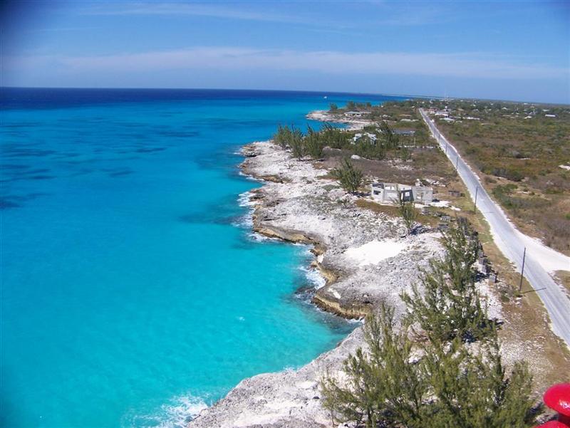
Cat Island is highly
touted as the supporting the highest ground in The Bahamas. It is as hilly as
Eleuthera or Crooked Island, and has some incredible
vistas, but did not seem 'mountainous' with it's 200 foot hills.
The last of the
islands we visited here are all alone in the ocean and anchoring is done with a
bridle to minimize swells. Once on the hills, across the salt ponds, and in
town, it is the same Bahamas we have found throughout the country.
The Good Peoples.
We found people in
the Family Islands to be generally more sincere and engaging, perhaps because
of the cruiser being a less encountered entity and welcomed as a true visitor
to their remote homes.
In addition to
seeking out the older folks with their family and island history stories, I
found it interesting (and easy) to engage the community leaders on the smaller
islands = the businessmen that keep each island going in a good direction.
Raymond Russell is all over San Salvador with his heavy equipment, shopping
mall and grocery store. Mr. Russell is well-known in all the Family Islands as
THE expert in roadway and runway construction, as he has decades of experience
building the roadway infrastructure in The Bahamas.
I realized my quest
for a living Lucayan when I met
Isaiah Lightfoot, one of the kerosene lighthouse operators for the Dixon
Hill lighthouse on San Salvador. Born on San Salvador, 'Lightfoot' served on
the Bahamian Police Force prior to being wounded during a bank robbery in the
70's, when he transferred to the Port Authority. He has since traveled
throughout the islands performing various duties, including Nassau Harbour
Control and lighthouse keeper at all three of the kerosene lighthouses.
Lightfoot now lives
on the island of his ancestors, and tells how they hid from white people for
hundreds of years, until is was safe to have an open community. His
great-great-grandfather was a Lucayan Indian! So some of the gentle and
peace-loving people survived the onslaught and invasion of their homeland.
Lightfoot intends on remaining atop Dixon Hill from now on [and why not? = WHAT A VIEW!].
The Turnquests in
Exuma and other families on Rum, Mayaguana, Inagua and the Acklins Group have
Lucayan blood in their veins. The Lucayans?
survived the onslaught of the European invasion by obfuscating their
existence - staying one step ahead of the conquistadors and pirates, living in
caves and staying mostly in the interior of the larger islands. That's how
Isaiah got his family name!
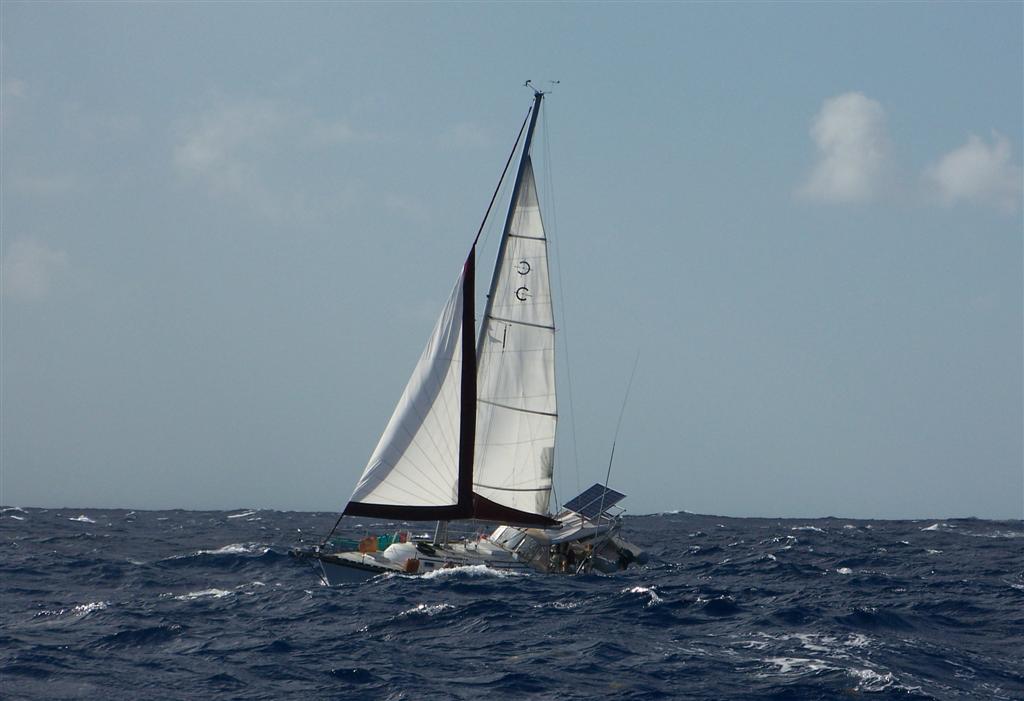
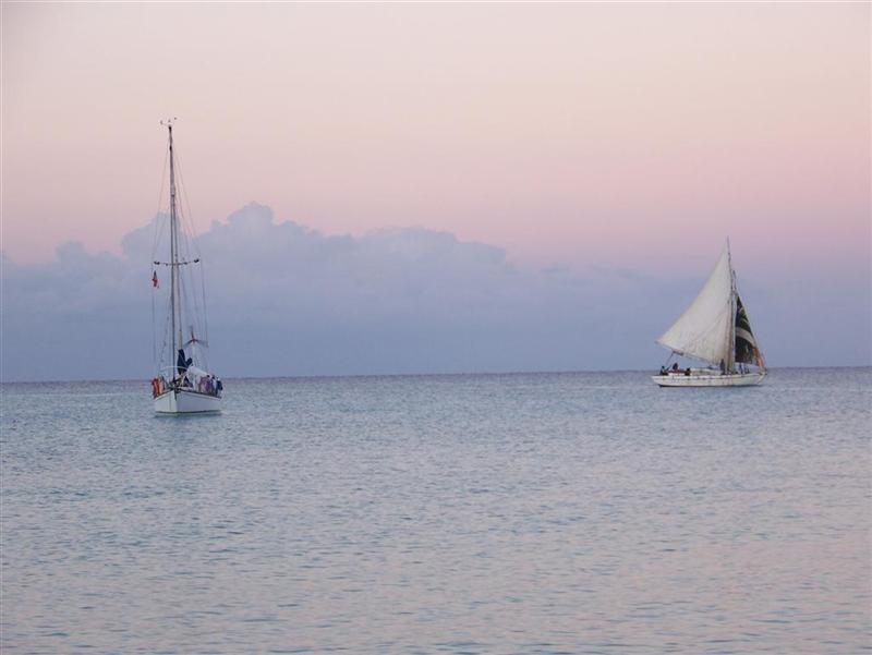
While riding our
bikes to Lovely Bay, a quaint settlement in the northwest corner of Acklins
Island, I noticed a sailboat heading north between Crooked & Acklins
Islands -- which piqued my interest because the water depth there is measured
in inches instead of feet. Inquiring in town, I was told [by 'Super K'] that it
was "Dick's boat", as if everyone knew Dick Chase, a frequent visitor
from New England that stayed with Auntie Maude in Pestel Beach. Already
intrigued, we rode around to the other side of the bay to find out more . . .
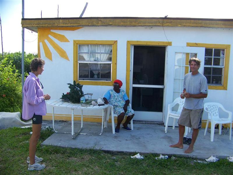
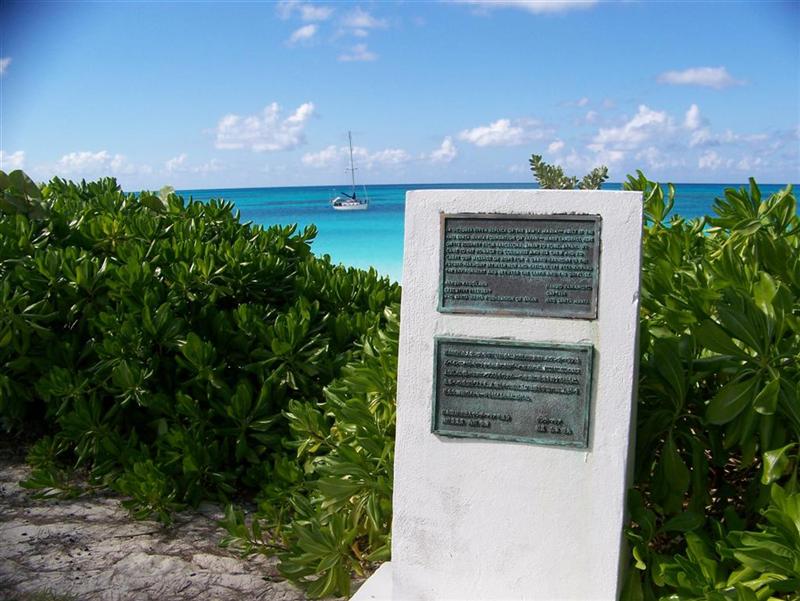
A most unexpected
and delightful afternoon was spent in Pestel
Beach at Auntie Maude's "resort". The number of stories and
interesting characters we encountered?
were amazing considering this place is so small as to not be on any of
my charts. Auntie Maude, now in her 80's, runs a beach-front motel with the
help of her brother Leo on the very land upon which they were born and raised .
. . with nineteen siblings . . in a one-room house built by her daddy over 100
years ago. This
photo shows the remains of that house, shown to us by Dick Chase, in the
house with us; and there's his boat, Lucille, in the background (named after
his wife . . . get it = Ricky & Lucy!). Asked how they managed, Auntie Maude
told us they never ate in the house; in fact, most of their daytime was spent
outside growing food or getting it from the ocean (Dick maintains a couple
acres of gardens here with all manner of veggies). Most nights they slept
outdoors, also. To give us an idea of how much more primitive their life was
from even the life on Windigo, she recalled the tragic story of the day she
lost her father and eight brothers to a single accident at sea while fishing.
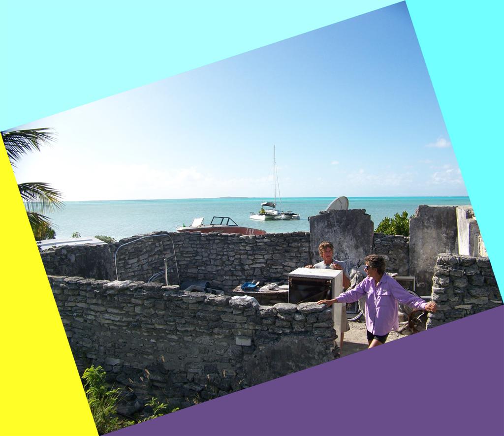
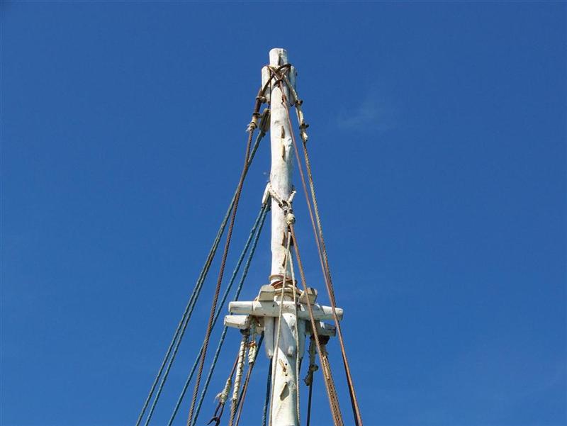
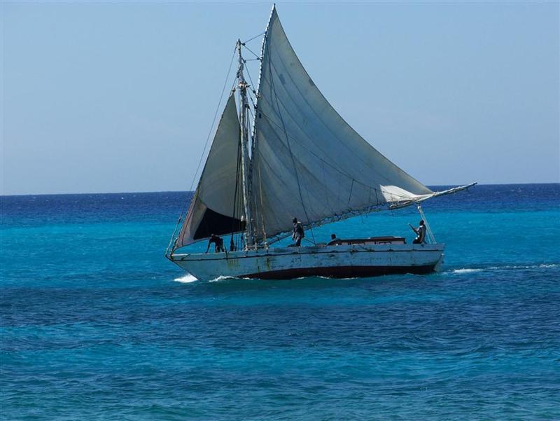
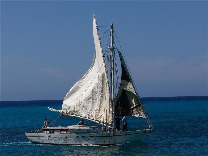
Dick sailed that
little catamaran from Boston last February - a pretty amazing single-handed
feat; made all the more amazing by the fact that in the first week of the
previous August, he had NO boat. In five months time he designed and built
Lucille and sailed it to Acklins Island - all by himself. Turns out that Dick
is friends with Dave Calvert, a world-class sailor and part-time resident of
The Bahamas. [see Atwood Harbour in 'The Trip' section]
Every island has
their "special individuals": whether it be Mr. Rose, the
philanthropist-businessman on Long Cay, Nathaniel Clement ?Piccolo Pete? Saunders, the oldest living resident
and former mayor of Bimini, or Pastor Edward St.Fleur, the Haitian leader of
FIVE churches on Eleuthera, each island presents varying problems that require
solutions from unique individuals. Inagua has such a character in the person of
Captain C.
Stephen Fawkes, a former mayor of Matthew Town that thinks outside the
traditional Bahamian box.
.jpg)
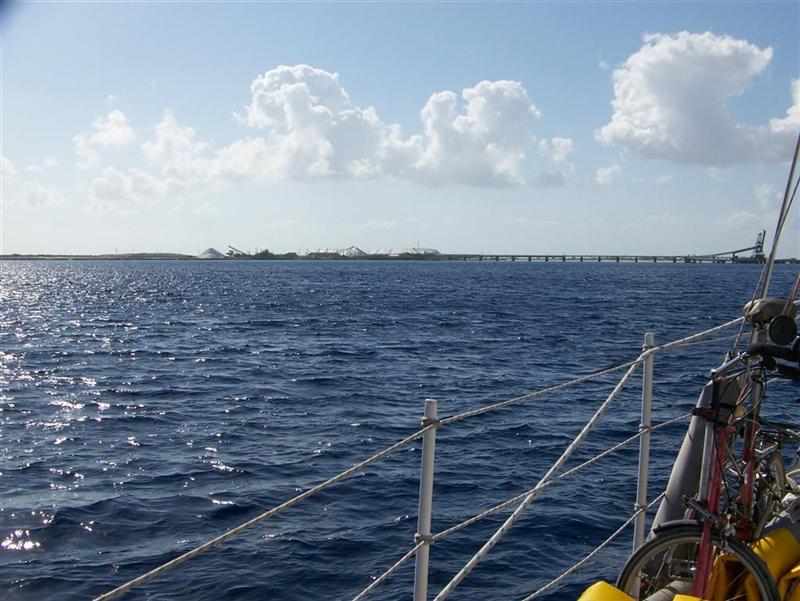
Capt. Fawkes is
the dock supervisor for Morton Salt Bahamas and the island's Cruise Ship Agent,
representing the government in the growing number of visits of tourists by sea.
He has plans to build an international container port on Inagua, coordinating
shipping activity for the entire region. And, as his wife retires from her
lifelong nursing career in the near future, he sees a need to occupy their time
with a destination resort the family will erect here = the first on the island.
Quite ambitious and innovative, his ideas may well be forced into existence by
his high energy and superior oratory skills.
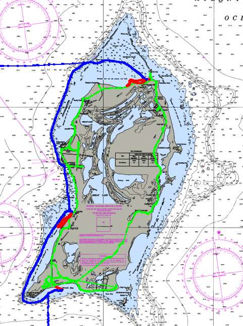
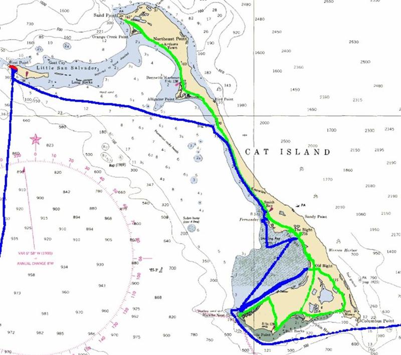
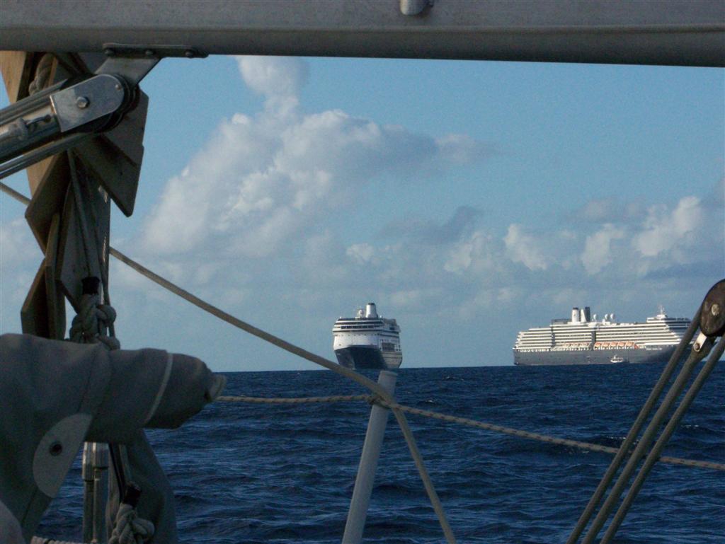
The Trip. [MAP]
![The Trip. [MAP]](part2%20.jpg)
Sailing between
these islands could not be done on a calendar schedule, but only with a
'weather schedule'. The trips crossed sections of open ocean approaching 10,000
feet deep. Swells felt here are created as far away as Europe & Africa, and
local wind conditions can whip up nasty chop in the unprotected seas. To
traverse safely, with minimum discomfort and strain on gear and rigging, destinations
must be chosen with the pattern of weather given first priority. [Weather
details in Cruising Notes in Part I]
Population Of The SE Bahamas
These 'Family'
Islands are approaching the verge of development; only one has hosted projects
which has caused an increase in population since the 1963 census. The remainder
have initially lost a large number of people, and then a few have shown recent
growth. Compare the following census numbers of these traditional communities
based on fishing, basic subsistence farming, and one industrial town with the
insane tourism results of the larger central and northern islands.
TOURISM ABOUNDS IN
THE NORTHERN ISLANDS:
Abaco population from 1963 to 2000 increased from
6,490 to 13,170. Today's estimate is 18,000, nearly triple the original census
(and may indeed miss many thousands of Haitian immigrant workers, some legal,
some not).
Grand Bahama
Island, including the city
of Freeport, grew from 8,230 in 1963, to 46,994 in 2000. Today we find well
over 50,000 residents, over six times the 1963 number. (Windigo has no where to
anchor there, so we have skipped this landlubbers domain.)
New Providence & Nassau had 80,907 in 1963, growing to
210,832 in 2000. Today you will count well over? quarter-million people living there, soon to be quadruple the
1963 census. [Many thousands of illegal aliens dwell there undetected, whereas
in the Family Islands, the crew of Windigo was recognized and known ahead if
time in each new place, as we anchored!]
______________________________________
A SLOWER PACE IN THE
FAMILY ISLANDS:
San Salvador, 2000 census = 900 (official numbers combined with Rum Cay.)
Saw a dramatic
decrease in the late 20th century. Some fishing charters, community
development by US and European investors,?
and the Club Med provide an active airport and sound infrastructure base
to tie a small population to the island. Just as many foreigner's homes as
Bahamian-born residences.
Prior to
undisputedly reaching Hispanola and Cuba, Christopher Columbus traveled among
Bahamian Islands. For many reasons, the exact islands he visited remain in
deliberation as to their identity. It is here that I will again state my
conclusion concerning the "Columbus Debate", in more detail than I
briefly mentioned in the
first Eleuthera eletter.
The Columbus Debate
Columbus was a paid
explorer, and the information he gathered on his voyages was to be only for his
boss, who happened to be the Queen of Spain. Also, because of his fear of
alarming his mostly Spanish crew by revealing how far from Spain they really
were, he maintained his log cryptically. As far as describing Haiti or Cuba,
there is no doubt, but the sheer number of Bahamian islands and their
similarities have confused the location of the initial landings.
The first island he
landed at in the New World was named Guanahani by the inhabitants,
unfortunately there are no substantial remains of the Lucayan culture to
indicate where this was; it was believed the European invaders made them
extinct in just a few decades. Columbus did what all Spanish explorers and
conquistadors did, and renamed each island he visited; the four Bahamian
islands were renamed by him to:
San Salvador
Santa Maria
Fernandina
Isabella
The conquistadors
stripped the land of it's peoples and largely ignored it for the next hundred
years. Then, in 1625, interest began stirring as to which islands he went to.
By the early twentieth century, no less than nine island were serious
contenders for the first landfall of Columbus, now a sought after tourist
attraction. These islands were (and still are!):
Cat Island
Conception Island
East Caicos Island
Egg Island / Royal
Island
Grand Turk Island
Mayaguana Island
Plana Cays
Samana Cay
Watling Island
To put an end to the
debate, in 1926 the Bahamian/British government renamed Watling Island
"San Salvador". [John Watling was the pirate that had his
"castle" on the island, and used as his base of operations in the 17th
century.] End of discussion? Hardly. It seems that more analysis of the log
revealed that although the descriptions 'could' be twisted to fit Watling
Island, certain details were dead wrong. You see, when Columbus anchored his
big boat offshore, he sent small boats in to scout the area. The first landfall
had the small boats circumnavigating the entire island and retuning in seven
hours. Impossible without a powerboat (in 1492?) at Watling Island, now
incorrectly named San Salvador.
Details of
vegetation; descriptions of cliffs, shallows, reefs and fish; recording of
distances and directions; measuring of island's shorelines . . . all factors in
his original log that cannot be disputed and do not fit the accepted theory of
his route. So Samana Cay was brought forward, after first being suggested in
1880, and now has a majority of believers. But the only factor it really
resolved was the smaller necessary size of the?
island of the initial landing; the rest of the trip has to be twisted
and distorted beyond my imagination (and I have a weird imagination!) to fit
the log's description.
So to settle this
thing in my mind, I simply sailed the places he was to have sailed and dinghied
to the places the small boats were to have gone and walked the islands he was
said to 'discover'. Comparing the places with the log [the 1987 translation of Columbus's
Log of his first Voyage by Robert Fuson is a good one] making my own
observations, I have to agree with the situation presented by Arne Molander, a
fellow engineer and sailor that has studied the route of Columbus for 30 years.
Mr. Molander has pegged Egg Island of North Eleuthera as the first landfall of
Columbus. His log also contains a vivid description of the approach and passing
of the Devil's Backbone and the rest of the roadstead between North Eleuthera,
Spanish Wells, Royal & Egg Island that can not match up with ANY of the
other choices offered.
Mr. Molander has
also effectively disputed alternative routes by using resources such as French
charts from 1780 he personally discovered in the Library of Congress, satellite
photos, modern charts and electronic measuring equipment. Check it out for
yourself (Google & Google Earth?) and see if you don't
enjoy entering the "Columbus Debate" and being one of the few who
actually know where he sailed.
(Another interesting tidbit before I leave this subject = Eleuthera was
called "San Salvador" prior to 1800.)
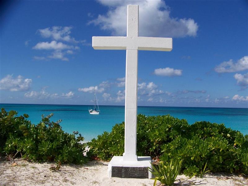
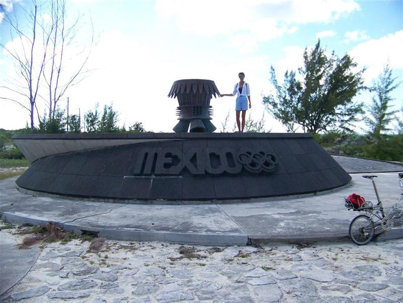
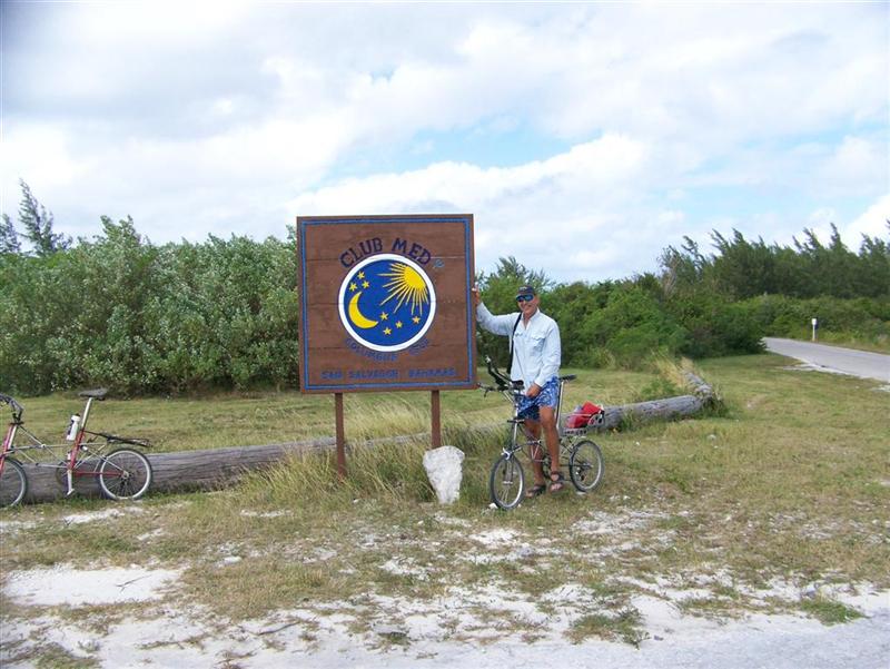
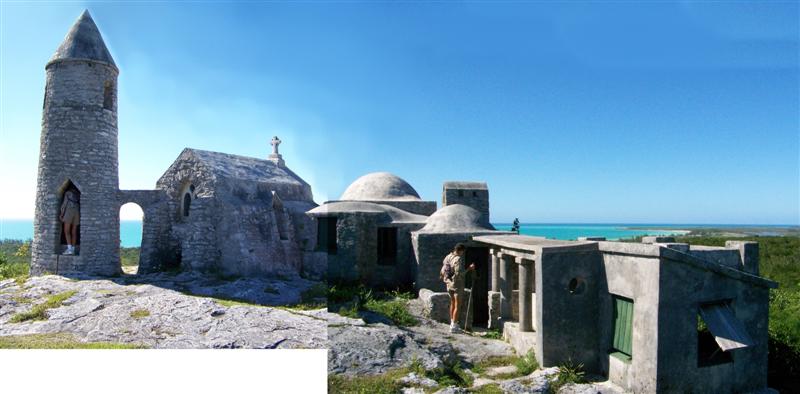
San Salvador [I call
it this under protest ;-] is a great, big out island with lots to see and
explore. A modern marina, a many settlements, developed
"neighborhoods", ruins from loyalist,
military
and pirate presence, and monuments
galore = Columbus monuments erected by Americans,
Spaniards, Japanese(?)
and one put up in 1891 by the Chicago Herald(??) on this unprotected, inaccessible east coast [which is obvisously
NOT a good place for explorers to be
landing as the weather is usually unkind], a Mexican
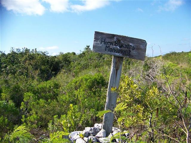
Olympic Flame monument, and a Hornblowers
monument(????) . . . hmmmm - countries OTHER than The Bahamas and the UK
certainly have a thing for monuments here.
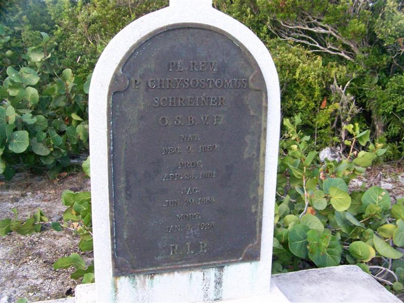
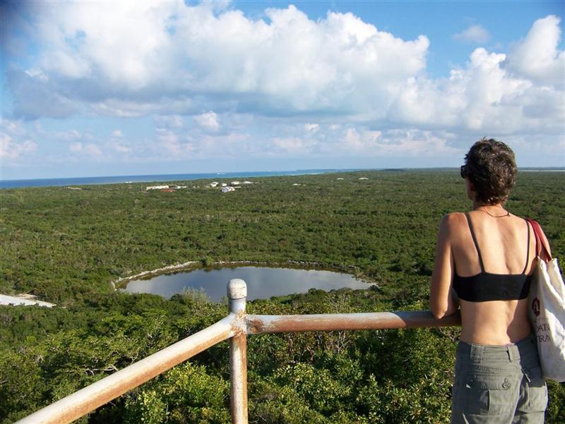
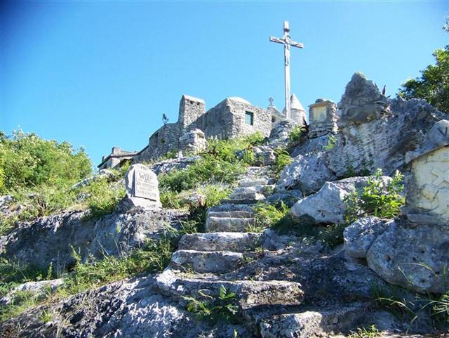
More impressive are
the hilltop grave of pastor
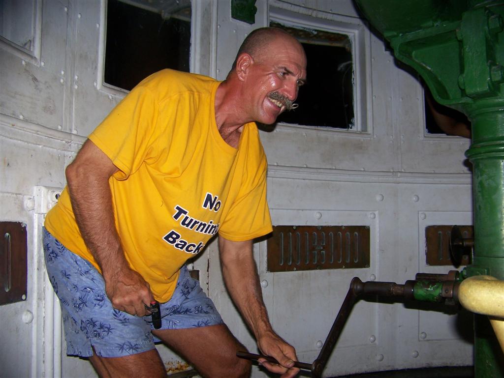
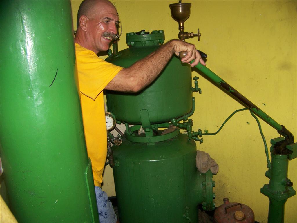
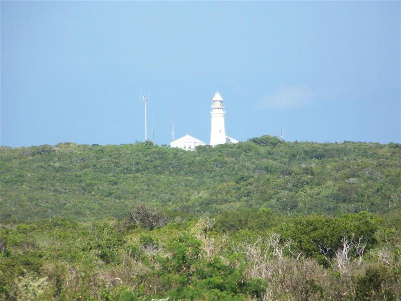
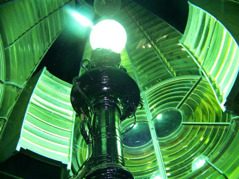
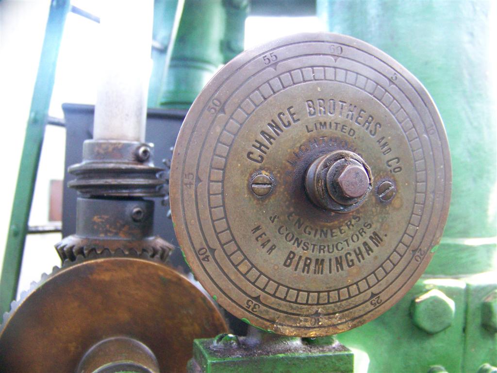
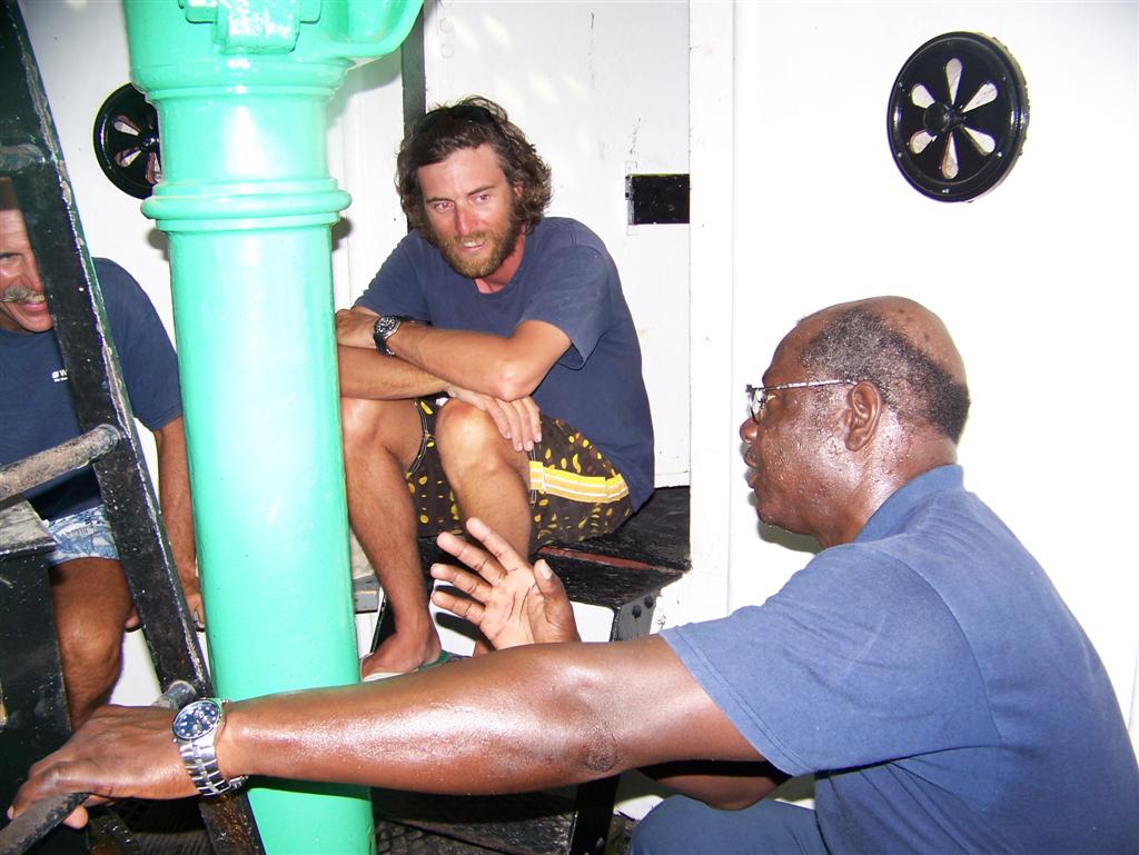
Chrysostomus? and the Dixon Hill Lighthouse, one of the three
remaining original kerosene-powered lighthouses in the world and the second one
we have visited. In fact, Karin & I assisted the operator by cranking up the weight for the rotating mechanism and
pumping up the pressure to deliver fuel up to the
torch.
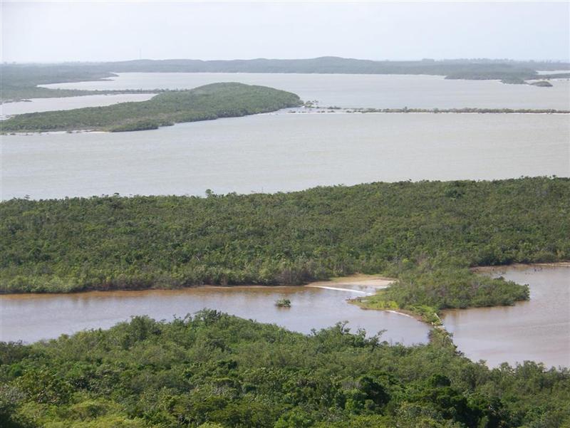
The interior of the
island is wetlands = lakes, salt ponds, creeks, and blue holes. There are houses and ruins
of houses everywhere; this island has evidently gone through many stages of
development from the taking of the native peoples, a base for piracy, attempts
at agriculture and aquaculture, settlements of current native Bahamians,
development by foreigners (mostly from New England), and tourism extraordinaire
with the establishment of a Club Med right in
Cockburn Town (which we invaded, of
course), making the? capitol (pronounced
COburn Town) quite active.
While in our last
anchorage in Graham's Harbour amongst dozens
of coral heads [you don't wanna run into these!], we were invited to the
Bahamian Electrical Corporation's Christmas party, which happened to be 500'
from the boat at the Regatta Park/Straw Market. Completely Bahamian, it
featured free food, open bar, and loud DJ music; there was no reference to
Christmas = the Bahamians use any excuse to party! Since we have been here, we
have celebrated Regatta, opening day of lobster fishing, three different
independence/emancipation days, Thanksgiving, pineapple harvest, snapper
fishing, last-day-of-school & back-to-school, grand openings of established
businesses, and several birthdays.
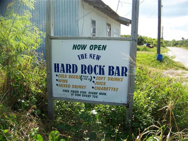
"Party-on
Karin" ? - - "Party-on Kevin." = You can bet we were at the HARD ROCK CAFɠevery Monday!
Cat
Island, 2000 census = 1,548
Has half of the
1963 number of 3,131 people.
The population is
evenly spread down the single 53-mile road along the west coast of the island,
with a loop to Port Howe in the southeast corner. It makes the island seem less
populated than others, but has the same interesting Loyalist ruins as San Salvador, one
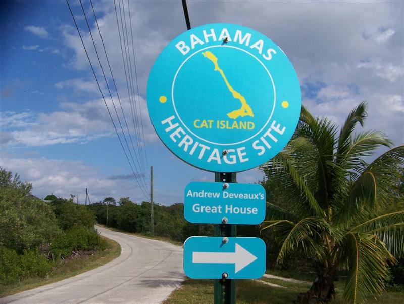
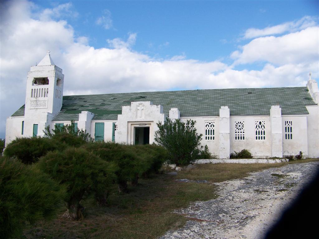
marina/resort on the southwestern tip, three airstrips, picturesque sandy beaches, a couple
larger settlements with a noticeable "downtown", and a few "Bahamas Heritage Site" locations including The Hermitage
of Father Jerome, which we
visited, of course, and
took a redundant photo or two. His
sturdy and pretty architecture is evident in this Catholic church. A more
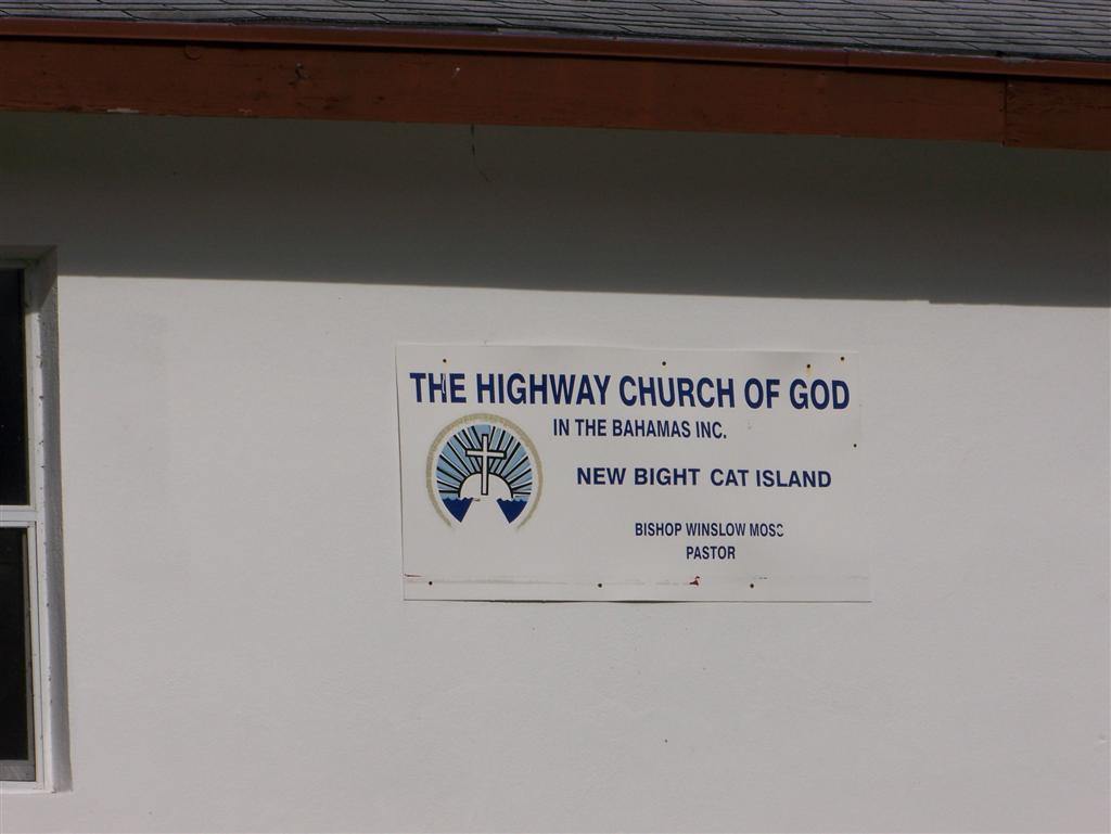
forceful approach is noted in the name
of this church (Hit the Highway for God?).
Little
San Salvador, Uninhabited
Owned
by Holland-America Line-Westours, Inc. and used for their cruise ship patrons.
When the cruise ships are around,
this place is the same as Clearwater = parasailing, horseback riding, jetskis,
thousands of swimmers and sunbathers, and a multitude of small boats ferrying
passengers from the giant cruise ships. When they leave, the place becomes the
vacant paradise it was prior to its development.
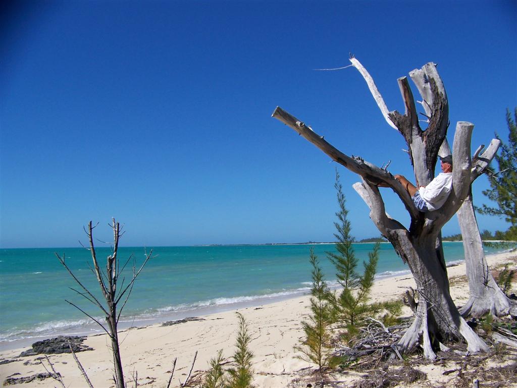
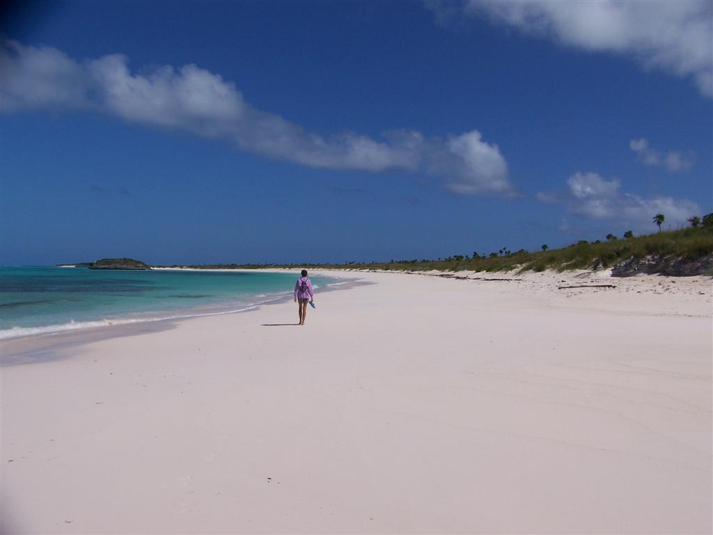
We were ashore in
the twilight to find a geocache (GCHBM4)
and walk the pristine beach. Definitely worth the stop, but you wouldn't wanna
live here.
----------------------------after Cat Island
& Little San Salvador we actually stopped in
George Town, Exuma to pick up mail packages
(and post Eletters!)
before continuing on to the remaining
Bahamian Islands----------------------------
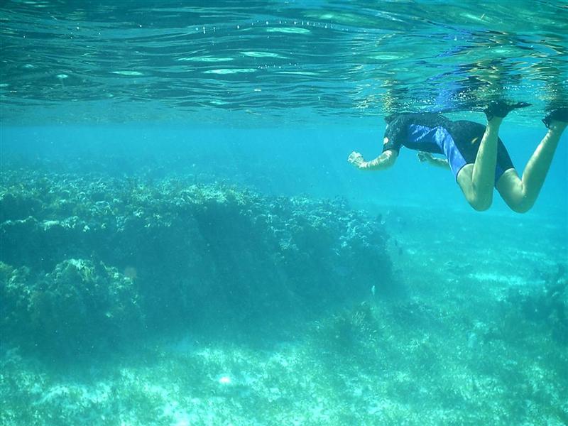
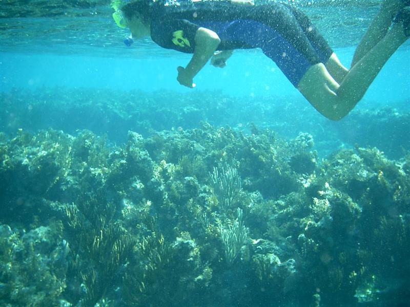
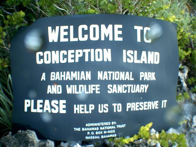
Conception Island, Uninhabited
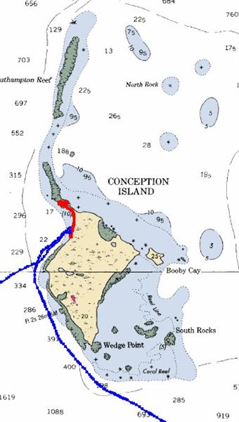
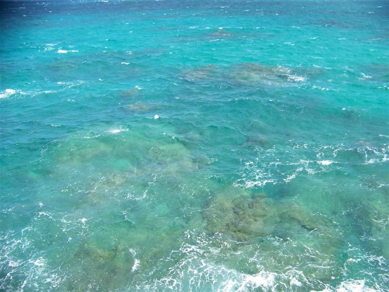
A beautiful small
island, one of the best places in the world to snorkel among the hundreds of coral reefs. We
ventured out into the "Kiddie Park", the area where the Southampton
Reef joins the north tip of the island. Very impressive giant coral heads
scattered about. The water was a bit chilly after consecutive cold fronts, but
we were able to swim for about an hour.
This next link
will show a video that will take only a few seconds to download with a
high-speed connection, but longer if your connection is slower.
This little video shows the typical activity
around the reefs, with hundreds of creatures poking about; it also indicates
the strength of the swells in this ocean reef.
"Real"
divers and hearty snorkelers head up the reef a couple miles for the absolute
best underwater experience. But seeing the park
may be a 'no-take' zone, I waited until I could spear some supper for the
big trips to the reefs. (Which is also the reason I released the beautiful Dorado I hooked just as we were
entering the West Bay anchorage.)
Rum
Cay [Act II], 2000 census =
100? (official numbers combined with San Salvador)
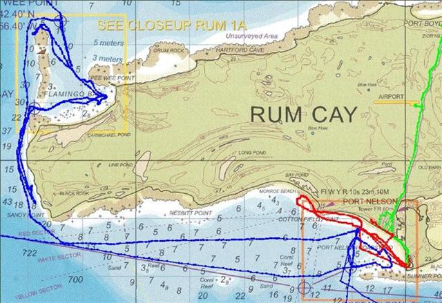
The population numbers experienced a sharp decrease in the 80's to ? the
1963 number. currently, about 60 people live in Port Nelson, and perhaps a
couple dozen are in Sumner Point and scattered on the island. Developments may
hold population steady as much of the desirable island is available and is
fairly close to the end of the Exumas.
In keeping with the tradition of the
shortest, easiest trips between islands, and to visit nearly every major
anchorage in The Bahamas, we stopped at Rum
Cay again, on our way down to Samana Cay.
We had not stayed in Flamingo Bay, on the NW
corner the last time we were here, and this time we also anchored one night
along the west coast above Sandy Point.
We ended up occupying ourselves for two
weeks, until the weather permitted our continued travels. We made many new
friends, and saw some cruisers again, including Dan & Shelly aboard Chinook.
Dan was in one of my advanced sailing classes in Florida, and he caught up to
us in George Town earlier. Now he and his wife (and everyone else) have past us
by on their way south.
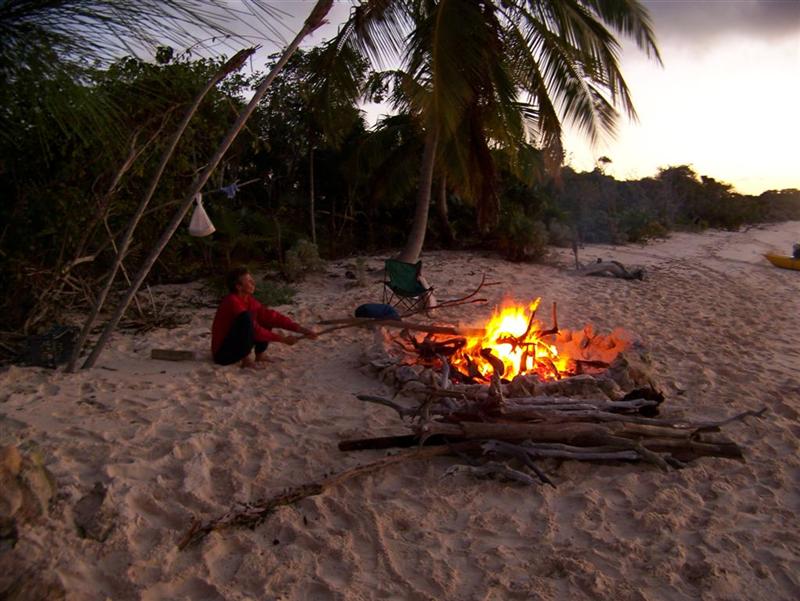
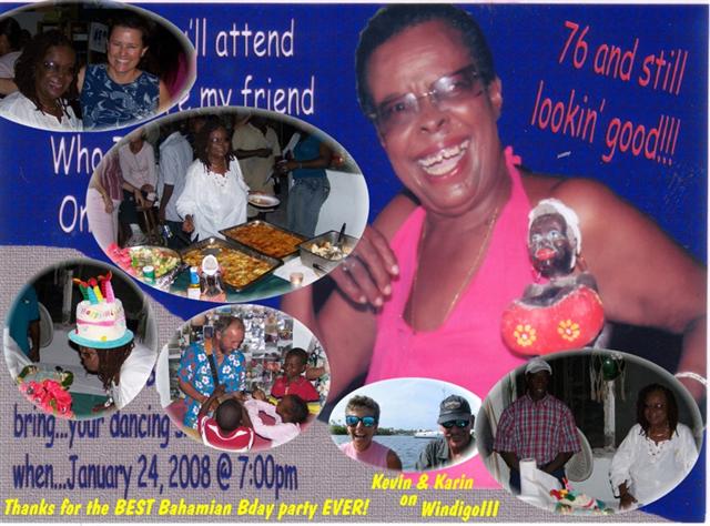
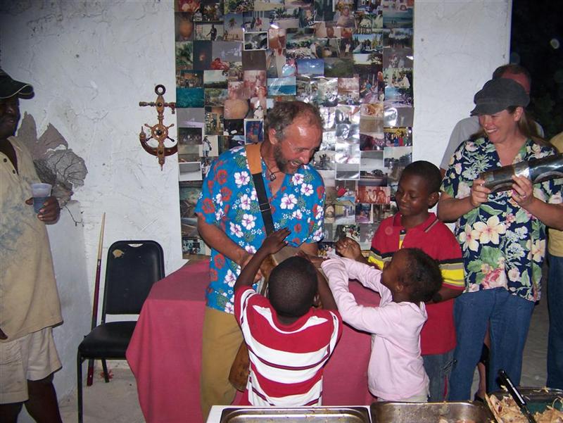
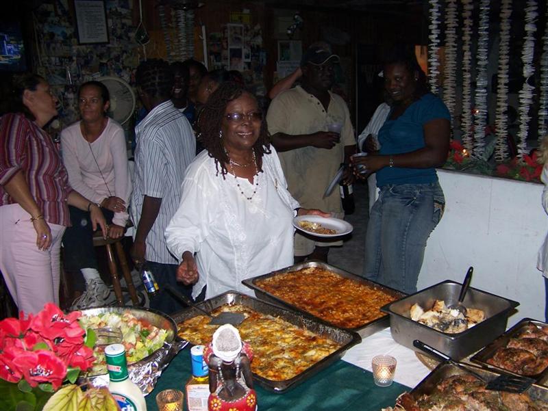
We had a huge
bonfire and snorkeled in beautiful Flamingo Bay. We celebrated Delores' 76th birthday at Kay's Place;
Delores is Kay's mother, she started the world-famous restaurant and bar in
Port Nelson. EVERYONE [all 60 people] on the island attended the party, which offered free food and drinks! We ate grilled
wahoo 'til the cows came home (and there are cows on Rum Cay!)
and had cake & brownies left over to take back to the boat!
We found wireless access - out in the
anchorage!- and made a few Skype calls.
We got a tour of Steve & Molly's "Sand
Castle", a home that earned its name through its construction
method = it
is built with sandbags! A very inexpensive way to put up a tropical home.
We wanted the perfect sailing day to Samana
and the proper winds for the few days following our arrival to afford good
protection there in Columbus Bay. We kept ready at each new day in Rum Cay to
make our break to Samana: but one day brought light headwinds, and another was
rainy, and so on. The last chance before a long stretch of adverse wind and
seas was Sunday night (to arrive at Samana in the morning light); but we
couldn't leave early Sunday night as expected = t-storms and big [west] winds
all night. We need to deal with adversity if is comes upon us, but we don't
wish to go charging into it! So we rocked & rolled in Port Nelson all
night, unprotected from the west . . .
Samana Cay, uninhabited - a few unsavory fisherman stay
for weeks at a time
A
little more than 20nm north of the Acklins Group.
. . . We got ourselves into a bit of a fiasco
on this passage, wanting to sail from Rum Cay to Samana Cay:
So, at 0500hrs, we headed out to complete the
73nm trip. This meant that we had to average over 6 knots to make the entrance
to Columbus Bay at Samana Cay in any light. The entrance is a winding
path through a narrow opening in a continuous reef alongside ocean-deep water.
Normally, one does these things with a high sun on a calm, cloudless day, at
least the first time . . .
Our sailing day was mostly 15-20 knot NE
wind, with an occasional foray into the land of high 20's. The swells were 2.5
meters, and the wind driven seas were 1.5 meters, so over half of the waves
were 3 meters high with wind-driven curl at the tops. SOME of the others were
smaller . . .
Although we made excellent time sailing, we
had to run the engine the last hour to keep our speed over 7 knots, as the wind
dwindled to only 11 knots and we HAD to have SOME light to get into Columbus
Bay. The seas settled down to a nice 2-2.5 meter swell in the lee of Samana Cay
. . .
So, we managed to arrive 5 minutes before
sunset, under cloudy skies, with falling low tide & no prior familiarity
with the area. Under full mainsail to tilt the seven-foot keel up slightly, we
managed to zigzag past Propeller Cay, with the only foul occurring when I
brushed the tip of a coral head just before the first starboard zig. The
starboard-mounted depth sounder did not record the obstruction on the port
side, so I pretended it didn't happen . . .
Although it all turned out fine [and Columbus
Bay is a GREAT anchorage*], I DO NOT plan on repeating THAT trick again anytime
during this life!
*besides the protection afforded in the
anchorage [see Cruising Notes] the snorkeling, conching
and spearfishing is excellent, even I
managed to nab supper!
Atwood Harbour, nestled between the north tip of Acklins
Island and Lady Slipper Cay.
Population
details of Acklins Island in last eletter.
A very remote and
well-protected small anchorage. I had visited the shore months ago when cycling
Acklins Island; it was too out-of-the-way to anchor in during out tour of the
Bight of Acklins, but now it was right on our route south. A great place to
wait for weather to go down to Mayaguana, so we did (but not quite long
enough).
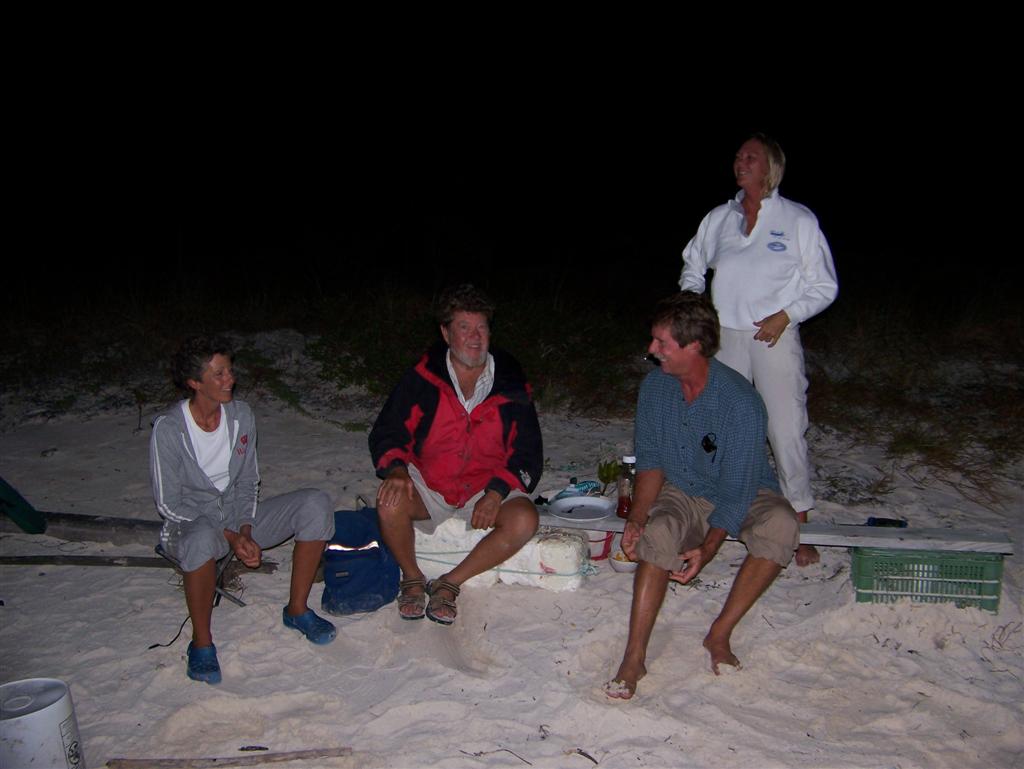
We sat around a beach fire with Trish & Dave Calvert.
His name might sound familiar to those of you following ocean sailing records;
he's a national sailboard champ, Olympic sailor, and most recently the #2 man
on Steve Fossett's 125' Playstation when it crossed the Atlantic in 4
days, 17 hours [26 knots!] and held that record for a while. They stopped on
Acklins on their return to their Cat Island home from cruising in the Caribbean
to visit and sail with Dick Chase, as his knowledge and experience in this area
is second to none and is the perfect guide. (If you sail a shallow-draft
catamaran!)
We also met Ron
sailing on Sans Souci who is also in the bonfire picture. He accompanied Windigo
to the next three ports, sometimes during less-than-calm
seas conditions!
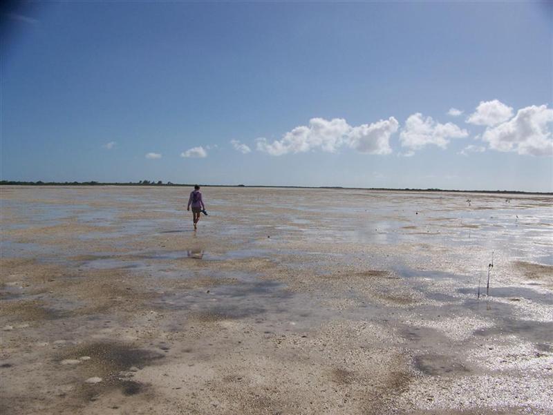
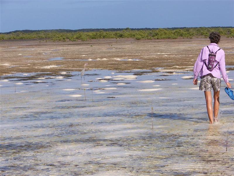
One day, we hiked
around the entirety of Lady Slipper Cay to admire the expansive beaches, muddy
flats, salt ponds, and wildlife.
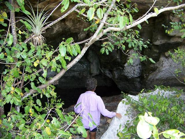
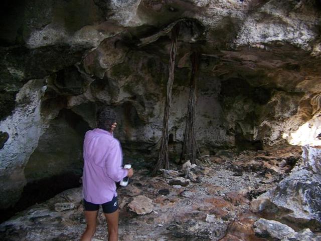
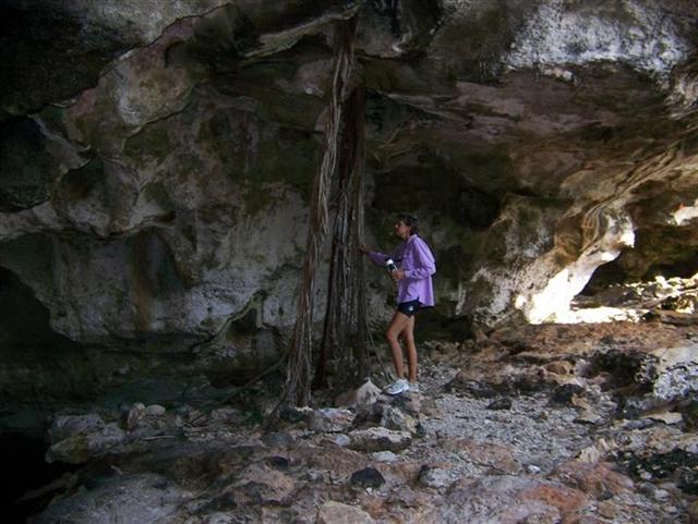
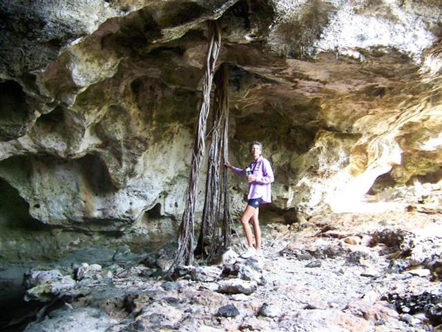
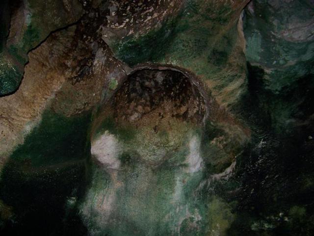
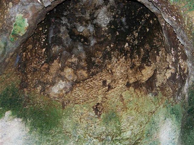
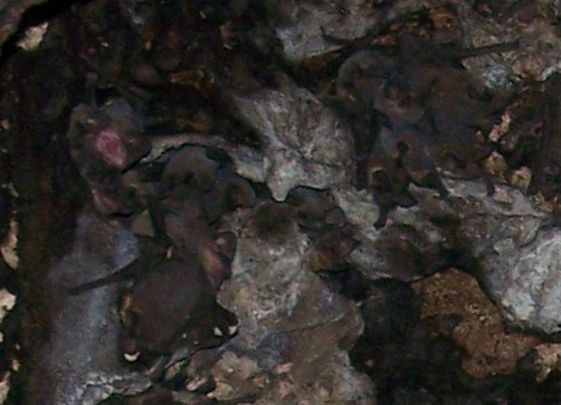
Another adventure was the search for a blue hole which proved to be to
inaccessible without a machete (or Cutlass, as it is known in these parts), but
we stumbled upon a huge cave. Karin is getting more accustomed to occasional spelunking, so we poked around
the features inside. The roots from trees growing above that span the
height of the cave to reach the moisture
on the cave floor. And the dome-shaped
ceiling structures that all Bahamian caves seem to have. But what is that
in the hole? Actually, what are THOSE, because there were thousands of bats up there;
and some did NOT appreciate the camera flash!
West Plana Cay, uninhabited
A
little less than 20nm east of the Acklins Group.
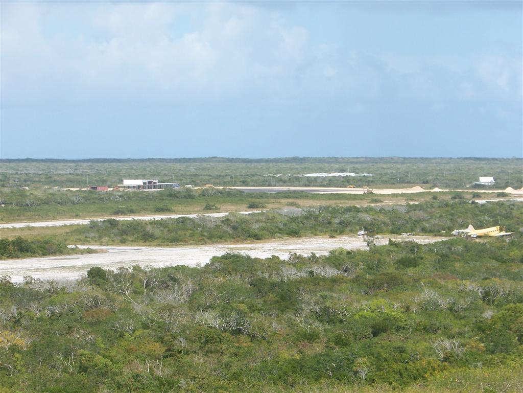
Mayaguana, 2000 census = 262
Population has
steadily decreased from 707 in 1963. a remote and traditional Bahamian Island
that truly lives up to the "family Islands" name = everyone that's
been here a while is family.
Mayaguana has it's
own unique character, as do all Bahamian islands, which at first appears as a
'readiness' to develop. A single company spearheads the development with
current projects being:
- Doubling the length of the runway;
- Pushing extensive roads in
isolated areas;
- Marina construction;
- Lot surveying and preparation;
- Infrastructure improvement.
But after a bit of
investigation, it seems that no less than three other companies had started
this same initiative, only to fail. It also becomes apparent that the current
company is having problems, too. The basic logistics of these islands make
supplying such an effort with labor & materials difficult, and on Mayaguana
the problem could be exasperated by a general resistance to development by many
of the residents.
The current state of
this project is stalled on the first point, with absolutely no progress at the
present time on the latter three items. Even though there is an approaching
government deadline for the runway issue, there
was no activity there during our visit.
So Mayaguana is
poised to expand into the tourist trade, and could do so to it's own benefit;
but the peoples of the island are rightfully cautious of foreigner's
intentions. In the next newsletter, I will present a summary of my observations
of the effects of development on each of the islands.
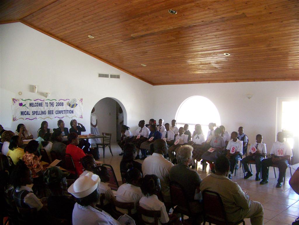
The huge local event
we attended while on Mayaguana was the MICAL
Annual Spelling Bee. [MICAL = Mayaguana, Inagua, Crooked, Acklins, Long
Cay.] 20 students from the 5th to 8th grades participated
in this event to determine which one will go on to Nassau and then to
Washington DC for the National (International??) Spelling Bee. The crowd went
wild when a local girl won, but all the kids were so well prepared and really
put their heart and soul (not to mention there spelling minds!) into this
emotional event.
Little Inagua, the largest uninhabited island in the
Caribbean area
Great Inagua, 2000 census = 1,046
After a large
decrease of residents in the 60's from it's 1963 number of 1,846, the population
will remain near 1,000 as long as Morton Salt continues it's salting operations
here.
A large island with
only one settlement, it is obvious why it is developed = Morton Salt Bahamas
has managed and guided this island since the middle 20th century
[and Erickson Salt before that]. Every family on the island has members on the
Morton payroll; although they still all live a Bahamian Out Island life eating
conch, fish and lobster from the sea, their homes are perhaps a little bigger
and nicer and the economic base of this island is firmly rooted in the salting
operations.
While it appears to
be fashioned after the "company towns" of the old west, one soon
realizes that Inagua has been much better managed and is not prone to folding
as the gold-mining or cattle-trading settlements in the early US. The
conditions required to harvest salt from brine ponds is ideal on Great Inagua;
but an unprecedented amount of rain in 2007 [the most in the last half-century]
caused a slowing in operations. The open & honest policies of running the
company (and town) allowed everyone to weather the reduced salt output for
several months. By utilizing sound management techniques, full-time salt
harvesting will commence later this month, and prosperity will return to normal.
We toured the Morton facilities and were impressed by the sound environmental
practices and simplicity of the salt harvesting procedures. (This is 100,000 tons of salt; normally, 700,000 tons of
salt is piled here!]
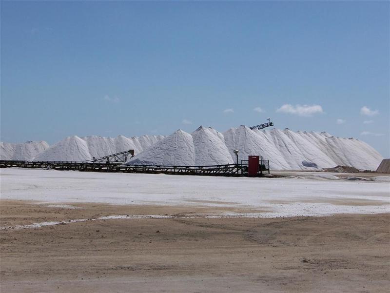
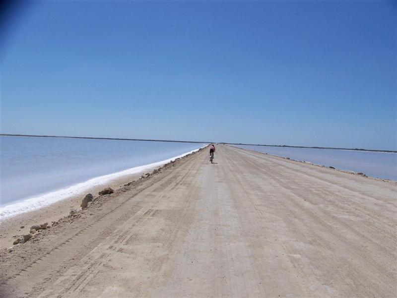
Just an overview: Seawater is pumped into canals
and directed to salt pans,
where the wind and sun evaporate the water, leaving a layer of salt over a
permanent "floor" of highly compressed salt. It had rained more in
the last couple of years than any other similar period in the last 60 years. So
much so, that the permanent salt floors were damaged and needed to be rebuilt.
[NOTE: Morton stocks
the salt pans with brine shrimp, a favorite food of the tens of thousands of
flamingoes living here (the largest flock in the western hemisphere). The
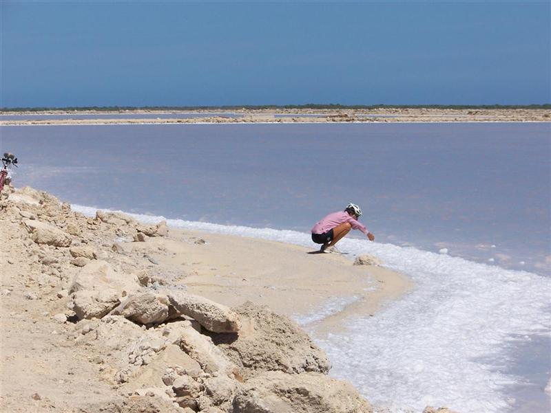
shrimp give the flamingoes their distinctive pink color. Flamingo droppings add
nutrients to the water, which in turn breeds an excess of algae, turning the
water dark. This accelerates the evaporation process by absorbing additional
energy from the sun, increasing salt production. The brine shrimp thrive on the
algae-rich environment, and reproduce providing more food for the flamingoes.
BALANCED ENVIRONMENT =? MORE PRODUCTION,
a true win-win situation.]
'Harvesters' draw
rakes through the layer of salt once the salt pan has been drained, and their
conveyors deposit the salt into giant dump trucks that carry the salt to the
facility where it is rinsed (with highly-concentrated brine) and stored in
giant piles. Ships from around the world call on this port to buy salt for
various uses.
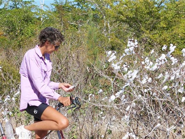
Evidence of past
land uses is evident in more than just old ruins; cotton
still grows wild from 300 years ago when it was introduced as a cash crop.
Evidence of
affluence and a touch of modernization not usually seen in these parts is the BaTelCo sign downtown which also announces local
events.
Evidence of local
pride is displayed at the local park with an artistic rendition of
"Conchman" and a bit of nice landscaping. (Stevie Fawkes' sister,
Jennifer, is the impetus of the beautification effort - she works tirelessly nurturing, improving and MAINTAINING
landscaping all around town.)
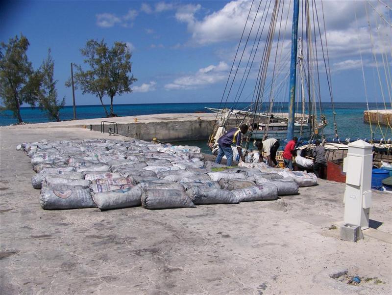
Another interesting
occurrence in Matthew Town is the check-in of the Haitian charcoal boats. As you
may know, Haiti is the poorest country in the Caribbean and its government is
currently in more turmoil than Washington D.C. (ha). Many people there struggle
daily to survive, and illegal Haitian immigrants are a huge problem in Cuba,
The Bahamas, the US, and elsewhere as some Haitians see fleeing their homeland
as their only choice. Others work very, very hard at making ends meet, and some
of these families trade in a most basic commodity = charcoal. Although there
are few trees left in Haiti, there is little organization to protect and
provide for the peoples, so they do what they can, including burning felled
timber underground and bagging up the resulting charcoal for sale in The
Bahamas and US. Charcoal production by hand must be tedious and hard work, but
even more impressive is the skills and daring of the sailors that build and
sail the 800-mile roundtrip to Nassau two or three times a month.
Bahamian rules
demand a check-in by the cargo boats at the first available port, which is
Matthew Town. Having no engines, these boats made mostly of 'found materials'
must be positioned in the sea,
gybed efficiently, and sailed into
the tiny harbour, dropping the
foresail, and then the main to
reduce speed while maintaining enough headway to steer against whatever
conditions prevail at the moment. Once
in port, they are required to unload EVERYTHING
from their holds, including personal items, so Bahamian officials can
search for contraband. After lying out all they have (which ain't much!) they
reload it into the boat and continue on to Nassau. All this for 100-150 bags of charcoal depending on the
size of the boat.
The USCG and Royal
Bahamian Defense Force have stations at the airport, with three Coast Guard
helicopters to perform SAR activities and patrol the high seas for smugglers
and illegal fishing activity. I befriended SrLt Freddy Brown, the commanding
officer for the RBDF on Inagua. He is spending a short tour here, as he is a
superlative career officer and currently serves the Defense Force by traveling
about solving particular issues and maintaining the highest standards for the
Bahamian Military effort. Check in with him if you visit before the end of May!
Ragged Islands
& Jumentos Cays, 2000
census = 69
The number of
people living on these very small and very remote islands has dwindled from 371
in 1963. as long as there is good fishing in the area (called "The Fishing
Grounds"!), someone will always live here, but only very traditional and
rugged individuals.
[Windigo did not
sail to these islands because of very shallow water, limited protected
anchorages, and my general inability to catch fish (the main reason to be
there) ;-]
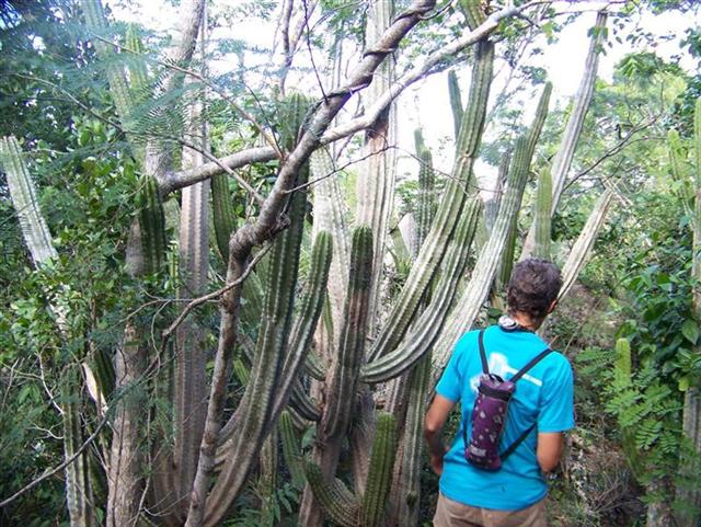
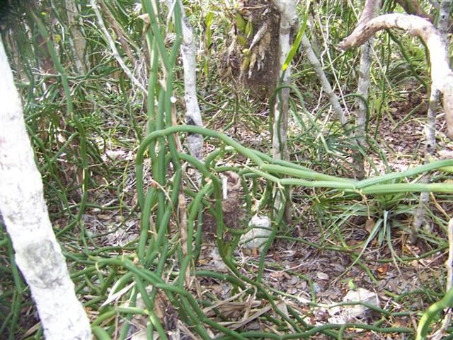
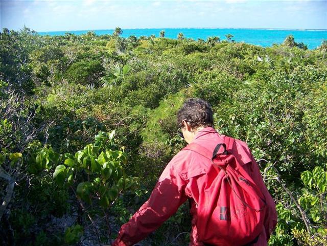
Wildlife.
These islands are
below the Tropic of Cancer, so joining the full variety of lizards and larger
mammals are creatures and flora of the tropical desert. Desert cacti are not only present, but abundant,
along with true desert dwellers such as the giant yucca. Thick, meaty vines now accompany the thinner,
tenacious ones that make our hikes through the bush
so wonderfully abusive.
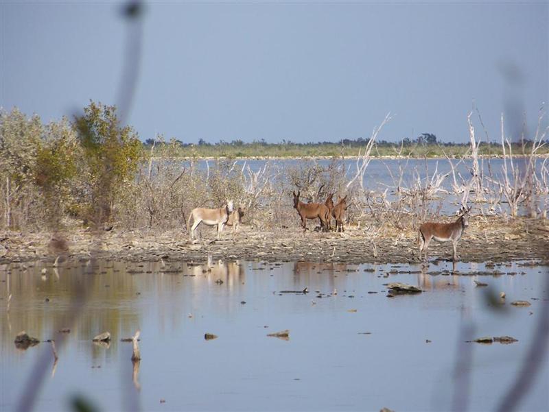
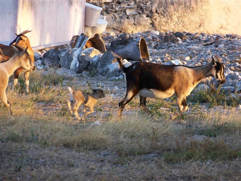
Cattle, sheep, donkeys and goats left from
abandoned ranches were seen on many islands and are said to be on every Family
Island. [On Inagua it is said, "It's not a PARTY unless there's donkey
being served!"]
?
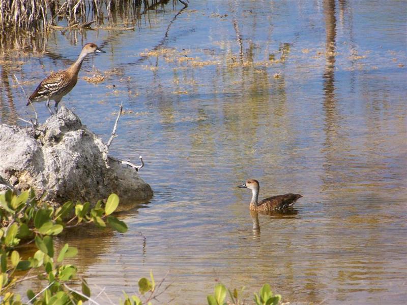
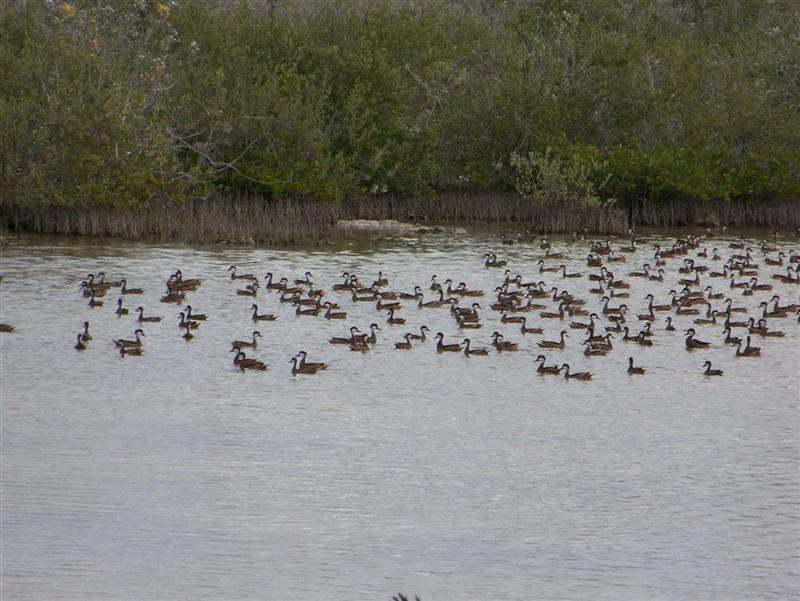
Besides the numerous
sightings of the Greater
Flamingo in the Inaguas, other birds spotted living on the remaining out
islands include:
Cuban Pewee, Red
Legged Thrush, Bahama
Yellowthroat, Burrowing Owl,
Brown Booby, and of
course, the ubiquitous Magnificent
Frigatebird. Henry Nixon, the Inagua Park Warden, said these Bahamian ducks usually do not gather in such large numbers; and this was a
good sign of their health.
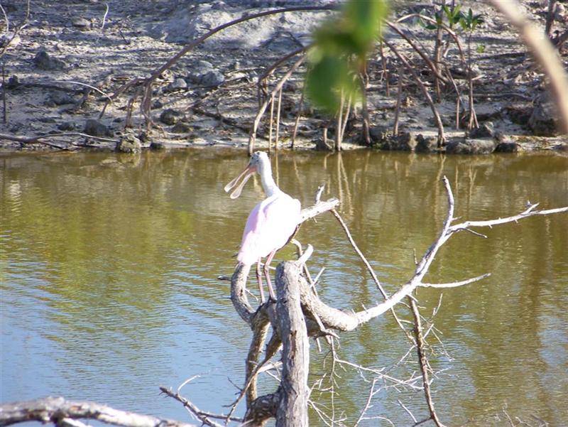
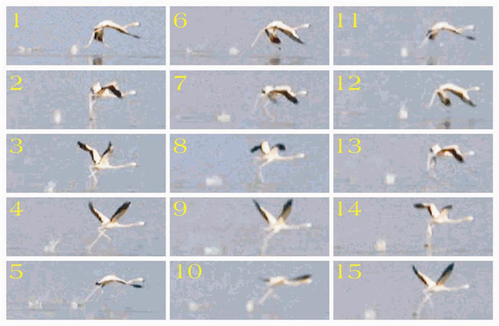
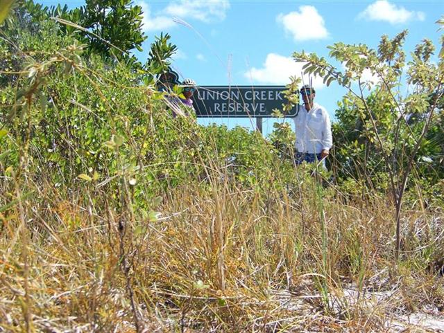
Many spoonbill rosettes were seen
during our tour of the Union Creek Reserve; and I shot a short video of a
flamingo 'running' on the water to facilitate take-off, and extracted these shots for you.
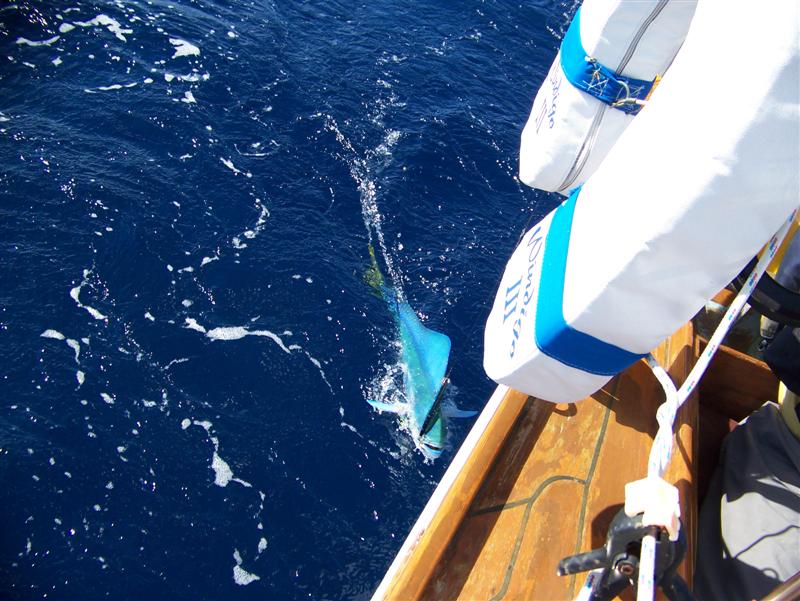
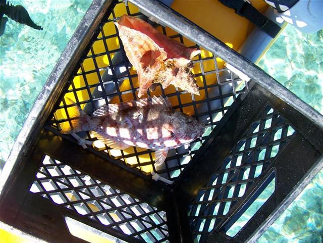
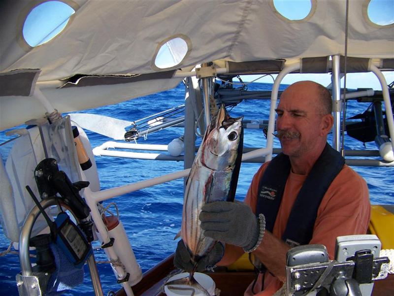
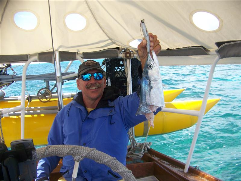
Of particular note
is the skipjack tuna I made friends with upon
entering Man of War Bay at Great Inagua. He was a better companion than the cero I caught entering Abraham's Bay at Mayaguana,
so we decided to get REAL close; you
could say it is now a part of me. It actually wasn't as nice as the dorado I hooked entering Conception Island, but
Conception is a national park and has some fishing restrictions, so I released
the fish as not to antagonize any officials.
Other Activities.
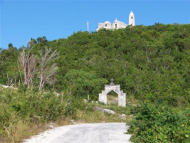
The Hermitage Of Father Jerome
In 1939 he returned
to his favorite place, Cat Island
in The Bahamas, and built his "Hermitage"
(stone-by-stone, by himself!) on the highest point in the country. From there
he directed building projects for four other churches on Cat Island and five
churches on Long Island, both Anglican and Catholic. After seeing many of his
designs, I can see why Evans
Cottman was inspired to build a masonry house on a the highest hill in
Marsh Harbour.
His sturdy designs
appreciated the force of the storms and featured thick-walled masonry buildings
that are in pristine condition today after decades of pounding from hurricanes.
The beauty of the structures come from an interesting blending of the
simplicities of Romanesque, Celtic, and Greek Isle architecture.
____________________
Also of particular
note: I was able to participate in several competitive volleyball games on Stocking
Island across fro George Town. Many of you know that several years ago I was
involved in a daily volleyball regimen; I have neglected to seek out high-level
play since changing to a water-based lifestyle. These were the first games for
me in the 21st century, and although the first couple were pretty
rough, especially seeing I was thrust into doubles and triples in deep sand
right off the bat. I did come around sufficiently to nail my backwards-reverse
roundhouse serve, and exhibit a fair bit of floor defense. I am looking forward
to the next opportunity to continue to exercise my corroded but usable v-ball
persona.
Girlie Stuff.
Kevin will be
writing his Bahamian summary in the next e-letter but I thought that this would
be a good time to write mine.
Finally after 50
years of living in the United States, I was going to get a chance to visit
another country. My emotions and thoughts were running wild with the
anticipation of it all; would I get to see my family as often as I was use to?
Would sailing in the ocean be safe? What kind of people live in the Bahamas and
are they friendly? How would Kevin and I get a long without knowing anyone else
and ALWAYS being together?? And how long
would our money last?
WHEW! I sure was in
need of an attitude adjustment if I was ever going to enjoy this adventure.
Well needless to say it was way more enjoyable than I ever imagined. To answer
all of those initial questions, I look back and think about the memories of the
last year that helped make the Bahamas the wonder that it was to me.
Thank god for the
visitors we had. Kevin's kids and grandkids were such a joy, I didn't want them
to leave. A couple more weeks with those impressionable babies would have been
a blast. Then showing Clift, a seasoned traveler, all the fun things that we
did daily was great. I also had constant email contact with everyone. Once we
discovered that we could make phone calls from our computer (using Skype) I
even got to talk to Nick in Iraq a few times.
Windigo performed
superbly and carried us back and forth across parts of the Atlantic ocean as if
she were made just for that purpose. I worried about the boat "holding
up" but this year proved that Windigo can handle a hell of a lot more than
I can.
Pedigo (our dinghy)
was a different story. It did get us to shore in even the worst of weather. But
we did have some mechanical problems with the eight year old drive failing so
Kevin jury-rigged it a couple times adding months to it's life. Finally it died
completely and we resorted to using either pieces of found wood or a paddle to
get us back to Windigo. A whole new drive system had to be built and now it
works better than ever.? Now if WE could
just remember to anchor it properly so it doesn't "escape" anymore. I
won't go into the gory details but let's just say that I'm aggressively
learning how to swim so I can catch Pedigo if it decides to drift out to sea
again and a rule of thumb will be to always have my clothes on before I decide
to jump in.
The people we met
will be forever in my mind. They were so friendly that I actually had to
remember to start my conversations with stuff like "good morning, what a
beautiful day it is" instead of my usual "where is the closest
laundry and grocery store?". One time I hadn't realized that I had been
racing around George Town, doing some errands and a Bahamian women had seen me
many times when she finally stopped me and said "slow down a bit because
you are in the Bahamas and nothin's that important to be rushing around like
your doing". I thanked her, felt a little embarrassed, then slowed my pace
down (just a hair thou).
The children were
very curious about us just as I was about them. The 9-11 years old girls always
loved to follow me around and chit-chat. They had many, many questions but would
freely talk about themselves also. They especially loved Kevin and I haven't
figured out if it was because of his mustache (which they had probably never
seen before) or the toys that he would pass out on the less populated islands.
When we had come to
the last island in the Bahamas, Great Inagua, I told Kevin that I should have
started this trip talking more to the women about how they felt about their
life here as it is so different from the way I lived in the States. I would
have to say that there wasn't the strong feminism issues here. The roles of the
men and women were very traditional. Everyone seemed satisfied with their lot
in life and I also found it amazing that many, many people had left their
particular Island to seek a "better life" elsewhere but after 10+
years would return to the small settlement on their home island where they
intended to stay the rest of their life - happy & content.
I must say that
Kevin and I got along great after we figured out how we were going "to
attack" these Islands.
He is a social
butterfly whereas I like to just watch, listen and learn. We weren't ones to
just stop for a day then move on. Kevin had goals of riding his bike on ALL the
roads in the Bahama's (which he did riding 3501 miles total), physically locating
all Batelco phone towers and keeping track of their exact locations (which he
did with all 98 of them),? and he loved
finding the most populated gazebo and talking with the locals about history
& politics. Now my goals were a little like his except that I liked to walk
all over the place (at least within a 5 mile radius), and located all public
water spouts, grocery stores and libraries. So we had our different activities
but sharing the stories at the end of the day was a treat.
We also had our nightly
games of backgammon, cribbage and scrabble. We are still studying Spanish
together and try to use it sometimes when talking to each other. Of course
everyone knows how much we love to talk so we soon give us and start rambling
in English again.? We study charts
together, plan our next trip and are constantly discussing the weather.
We have become so
comfortable with each other, making communication about everything imperative
to keeping this relationship working and growing. This is the kind of life that
you either make it or break it and there are many of both kinds out here in the
cruising world.
As for the money
situation...being that neither one of us is financially sound or even thought
about it before leaving the country...well let's just say that now that we're
done here...we will be going back to work...somewhere and probably sooner than
later.
On our very first
Island, Bimini, a woman told me that I would find every single island in the
Bahamas to be different from any other one - and you know what? - she was
right! I'm so glad that I overcame my fears to just enjoy the gift that I've
been given and hope that this will continue for a long, long time.
Cycling Notes.
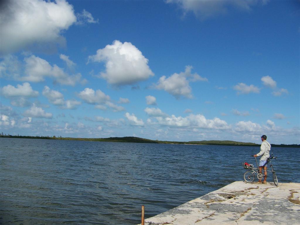
San Salvador
provided one of the most pleasant rides in all of The Bahamas. The main road is
surprisingly good, and I circumnavigated the island on a near windless day with
a bit of cloud cover. The scenery was awesome over both the ocean and the
various bodies of inland water I passed.
I stopped and spoke
with several people, including Joyce, a lighthouse operator, and
"Cowboy" Anderson at the Dixon
Hill Lighthouse. This is the second of three kerosene-powered lighthouses
left operational in the world, all of them in The Bahamas. we visited and
operated this one as we had experience from the Hope Town Lighthouse, pumping the kerosene up the tower and cranking up the weight that rotates the first-order
fresnel lens assembly.
%20&%20fresnel%20lens.jpg)
On a windy Sunday
afternoon, Karin also decided on the spur-of-the-moment to cycle 'round the
island, enticed by the good roads, varied scenery, and friendly inhabitants.
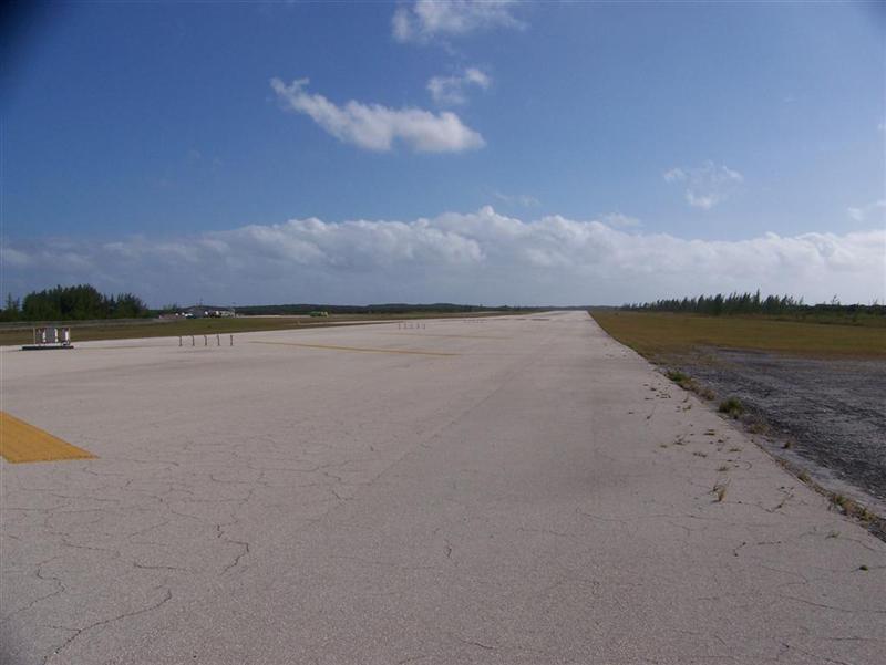
A note of caution if
you ride the back roads east of Cockburn Town: you may end up on the airport runway, and this not being
Eleuthera or Chub Cay, cycling on the runway is frowned upon (forbidden,
actually) and you WILL be arrested if you cannot bullshit your way out of it.
Fortunately, I have LOTS of bullshit . . .
I have preferred an
early Sunday morning start for my longer rides here in The Bahamas; on Cat
Island it was the Sunday before Christmas when I took off from Smiths Bay Harbour
to the north tip of the island past Orange Creek. I needed to return by 2 p.m.
as Cindy & Alfred Moss had promised to bring a Bahamian Christmas dinner to
the boat for us.
The Sunday rides
have always promised light traffic and a chance to see all walks of Bahamian
life, from the church goers of several faiths to the dope-smokers on the beach,
who are usually Rastafarian [and North
Cat Island has more than its fair share of Rastafarians!].
An encounter with a
dog almost made me miss my hot dinner, but Ellamae of Rolle's Taxi Service let
me put my bike with the snapped fork in her trunk and gave me a ride the last
ten miles to the boat.
Crashing aside, Cat
Island provided another excellent cycling environment, with Karin coming with
me on the 50-mile southern loop which included many miles of the unimproved
'white roads' she usually avoids.
I was able to cycle
the north half of Great Exuma Island during our mail-stop in George Town, and
log the position of six more BaTelCo towers. 94 completed, only four to go . .
.
No cycling on
Conception Island, Samana Cay, or Little Inagua (no roads!), and I already rode
every road on Rum Cay [both of them . . .]; so the last two places I cycled
were Mayaguana & Great Inagua, racking up over 100 miles on each.
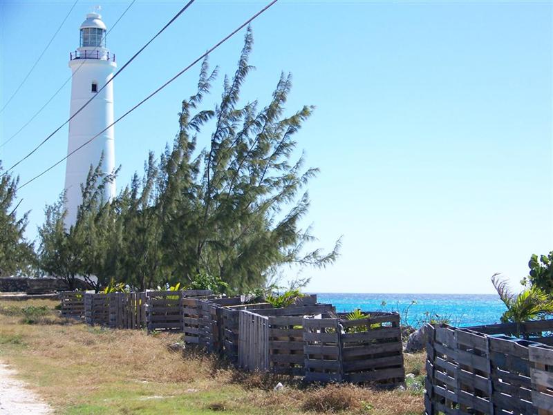
We rode to the
lighthouse on Inagua, which is only a mile south of town. It has an antique first-order fresnel lens and the same mechanism as the other
two Bahamian kerosene treasures, but is temporarily burning a High Intensity
Discharge lamp as the kerosene system is down for repair. Wilfred Wilson still gave us an
interesting view from the top.
Cruising Notes.
The Harbours Of The SE Bahamas.
Here is a synopsis
of the places to stay:
[The BLUE tracks are
Windigo; RED tracks are Pedigo; and GREEN tracks are hiking or cycling]
French
Bay, San Salvador N23?56.900' W074?32.229'
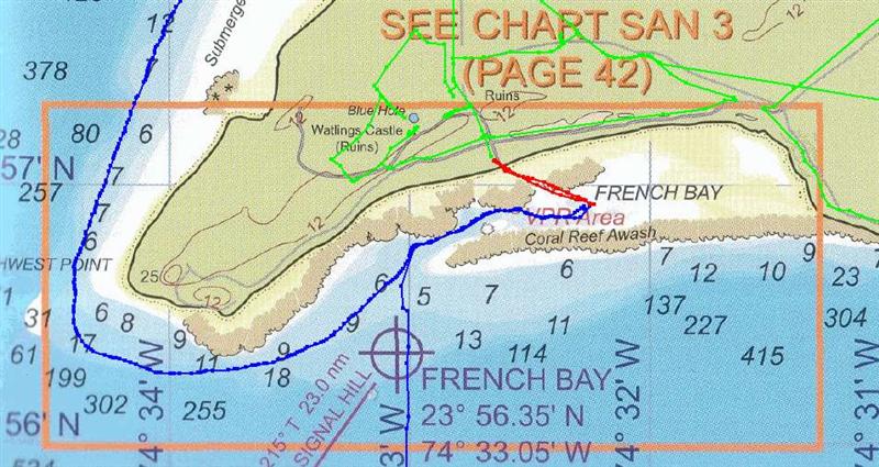
Approaching the Southwest Point [a.k.a. Sandy Point] of San Salvador in
good overhead light in settled conditions, one may consider French Bay as an
anchorage. It provides great beach access with close proximity to roads and
Watling's Castle. The reefs afford minimal protection from any wind, but things
settle out in prevailing? NE swells and
easterly trade winds, and it is a great anchorage in very light winds in any
case. Lots of coral to negotiate, but several sandy spots to set the hook.
Fernandez Bay, San Salvador N24?00.786' W074?31.675'
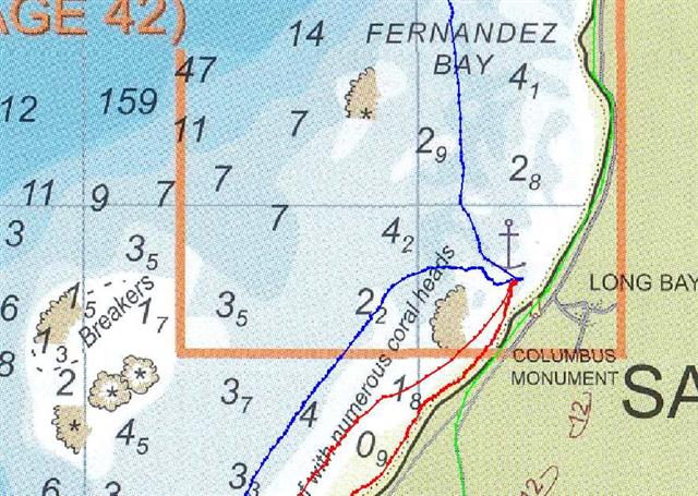
We were closer to the beach than we have been for a long, long time. The
200' Pedigo ride to the monument took three of four pedal strokes! There are quite
a few coral heads and reefs scattered along the western coast of San Salvador,
but many of them are in over 20 feet of water and cannot reach up to the boat.
In between the coral patches is lots and lots of sand, so in good light it is
easy to pick your way through right up to the beach by the monuments. We easily
endured 25-to-30 knot wind here (on a bridle) while Olga made its transit to
the south.
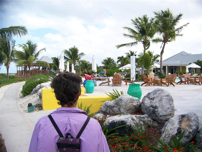
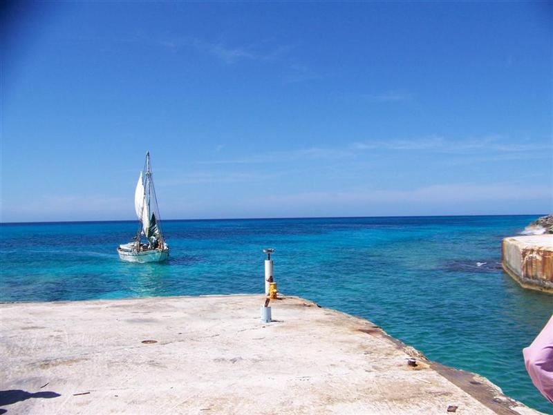
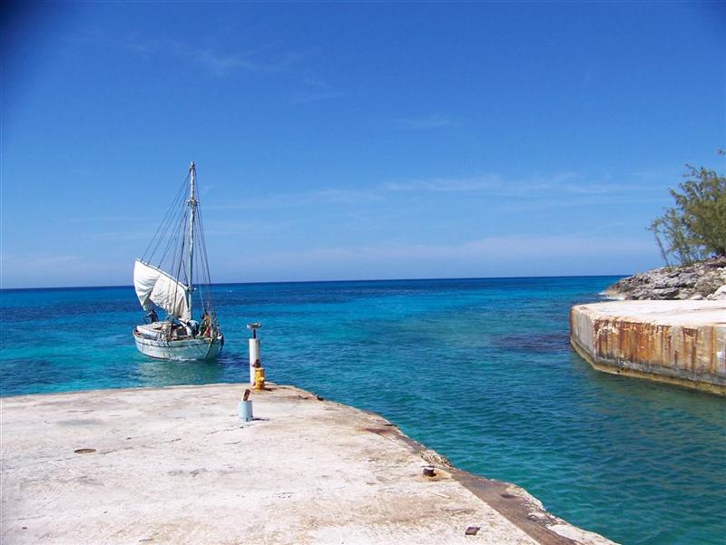
Cockburn Town [don't forget = say "COburn
Town"], San Salvador N24?03.071' W074?32.124'
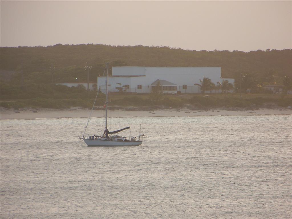
![Cockburn Town [don't forget = say "COburn Town"], San Salvador](cbt.jpg)
A coral-free area between the Government Basin and the cargo [dock
opposite the BaTelCo tower] provides a good anchorage right up to the shore,
although there is a random minor swell, and the BEC generation plant is right
there with it's constant drone. (Actually, you will find one dark coral spot
with about 10' of water covering it.)
A second San Salvador surprise (after the excellent road surface) was
the free RO water on the quay in the Government Basin right next to this
anchorage. Helen and Raymond Russell's store right on the waterfront street is
very clean and well-stocked (and son-in-law Michael is a cut-up). A great
one-night anchorage to get water & provisions; Fernandez Bay or Graham's
Harbour are better long-term choices.
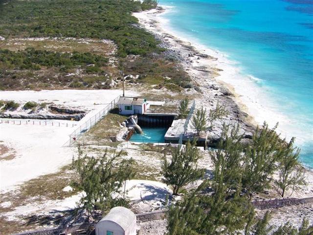
Graham's Harbour, San Salvador N24?07.367' W074?27.628'
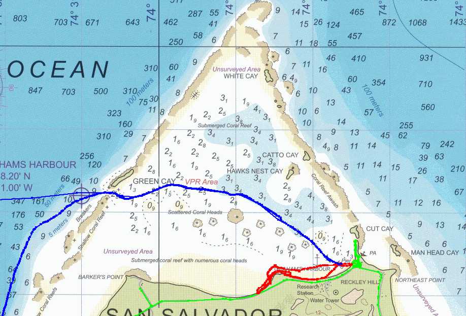
Sneak into this large natural harbour (only under good lighting
conditions) close under Green Cay above the reef protecting Barker's Point just
as it says in the cruising guides. Head towards Hawk's Nest Cay and then down
to the anchorage just off the pier in the southeast corner of the harbour. The Gerace
Research Center (old US Navy base) is there along with the Bahamian Sailing
Regatta Park (old US Navy dock) with a very nice playground (great swings &
teeter totters!).
Great protection and access give this anchorage high marks. If you are
interested in natural sciences, the Research Center always has several
scientists studying all aspects of the island. From January to June, there are
100 to 200 students there also, but if you visit at a slow period, Tom (the
director) might let you use their wireless i-net connection. [The satellite was
not happy during my visit and the signal was unusable.]
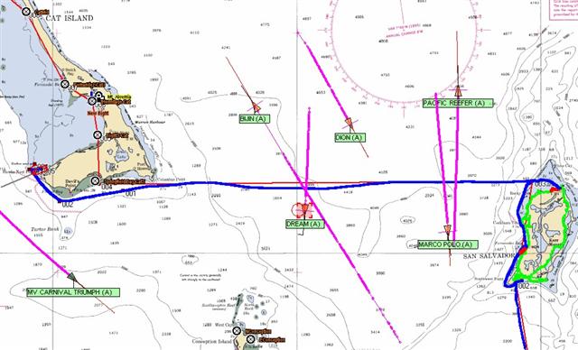
Don't neglect to
stand a diligent watch in the Crooked Island Passage;
?between Long Island & the Acklins Group
past Rum Cay & Conception Island to San Salvador & Cat Island.
We had a typical
crossing, encountering six vessels in our vicinity.
Hawk's Nest Point, Cat Island N24?09.405' W075?31.429'
After a brisk sail in 18-knot wind and 3-meter swells, the wind did not
comply with the strength or direction changes suggested by the weather people,
so we bypassed a possible anchorage under Dolphin Head in Springfield Bay and
scooted around the Point to anchor 250' above the isthmus. The sand spit
extending from the point provides an obstacle to entering the bight, and
minimal protection afterward, but the swells were manageable with a bridle.
Because of the necessity of leaving Graham's Harbour in good light, we barely
anchored here in twilight and applied the bridle in moonlight.
The next day, however, the weather began veering ahead of schedule [who
do I talk to about that?] and we were caught in water too shallow with swells
too big. After releasing our bridle, Windigo rolled
tremendously, and we had to drop our ground tackle with a float to escape
the area. We fled to Old Bight for refuge, and returned later to retrieve our
anchor gear.
Old Bight, Cat Island N24?13.874' W075?23.868'
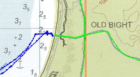
This was an excellent anchorage and with just a little less draft than
Windigo one could get VERY close to shore. A beach landing is there with an old
road that runs to Old Bight, less than a mile away. Fuel and limited supplies
are found here, along with access to the main road.
New Bight, Cat Island N24?17.064' W075?25.013'
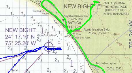
This is the most used anchorage area along Cat Island and is great in
normal southeast wind. It is NOT good in winds with a western component, which
we had, so we moved along to the north.
The Hermitage is walking distance from the beach and the highlight of
the island. A couple tiny stores and typical Bahamian entertainment are located
here. The Regatta Village is along the beach just to the north and this appears
to be one of the better sites for the event.
Fernandez Bay, Cat Island N24?19.113' W075?28.386'
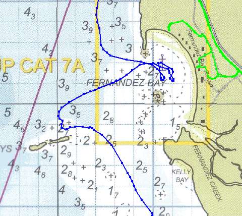
It must be great to be tucked deep into this natural bay when the normal
trade winds drift across the island from the southeast. It is a nasty and
dangerous place when there is a western component in a strong wind. We were
seeking shelter from the (too) slowly veering winds of a front that was not
suppose to reach this far south, and the Fernandez Cays and many corals did not
stop the large swells from inundating the bay.
Actually anchoring out near the Cays would be pleasant in calmer
weather, but beware of the many, many coral heads and reefs in the area.
Smiths Bay Harbour, Cat Island N24?19.910' W075?28.564'
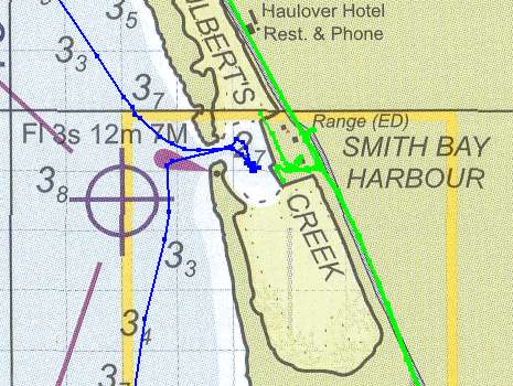
This is where we found relief from the unpredicted wind blowing 20-25 knots
from the northwest, strong enough to delay Captain Granville from getting the
mail boat away from the dock on schedule. Entry into the basin is
straightforward, but it is quite small in
there and room needs to be left for the mail boats (Friday & Saturday)
and the agricultural ships for the packing house (anytime!). Anchoring with two
anchors along the south edge of the dug-out part kept us out of the swells and
the way of the big boats.
Cindy & Alfred's store is at the road here, and the airport is
walking distance away and has regular flights to the States.
Half Moon Bay, Little San Salvador N24?34.787' W075?57.301'
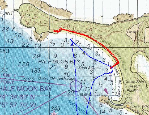
As mentioned in the trip notes, this is a great place to anchor and really
quiet after the big boats leave (about 1600hrs.). During the day, the wakes
from the water toys overrule the swells, which become more noticeable at night.
Staying in the northwest corner (N24?35.086' W075?57.760') during
the day keeps you out of the way of the frolickers, but moving over next to the
swim area at night minimizes the swell. Also, stay away from the cruise
ships, especially when they are moving [duh].
----------------------------------------------------------------------------
During our mail stop in George Town, we were able to join the increasing
number [120] of gathering boats in several of the anchorages including:
Volleyball Beach, Monument Beach, San Dollar Beach, Honeymoon Beach, Hamburger
Beach, Peace & Plenty Anchorage, Kidd's Cove, & Gaviot Bay. I am not
including details of these spots, as figuring out the whole routine is part of
the adventure staying in George Town! (Hint: just ask somebody on the morning
radio net: ch.68 @ 0800.) ENJOY!
I will let you know that if the wireless i-net connection at
Eddy's Edgewater is down (as it was over the holidays), a high-speed wireless
connection emanates from the Exuma Department of Public Works building. I was
able to use this fine connection to email, order supplies on the I-net, and
call (Skype) Bahamas Welding & Fire in Nassau to arrange the delivery of a
bottle of argon to complete my welding projects here. The workers there even
came outside and offered me a chair! The Public Works building is on a road
across from "Fish Fry", just north of town, up a short hill & to
the right. It is a medium-length walk, but a very short bike ride!
----------------------------------------------------------------------------
West Bay, Conception Island? N23?50.863' W075?07.210'
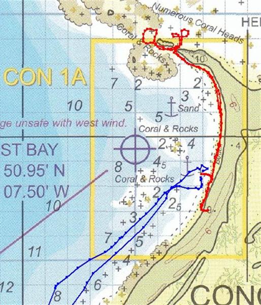
Boats with less of a draft are able to move further north and stay close
to the island providing more protection. But I would never want to be here in
winds veering through the west! It was settled weather for our visit, but we
still utilized a bridle to eliminate rolling. [In fact, starting at this
harbour, we routinely rig two snubber lines of sufficient length to make a
bridle every time we anchor.]
Sandy Point, Rum Cay? N23?39.555' W079?56.930'
It was a bit rough in Flamingo Bay upon our arrival to Rum Cay, so we
hung out just north of Sandy Point on the western shore of the island.
Flamingo Bay, Rum Cay? N23?41.098' W074?55.572'
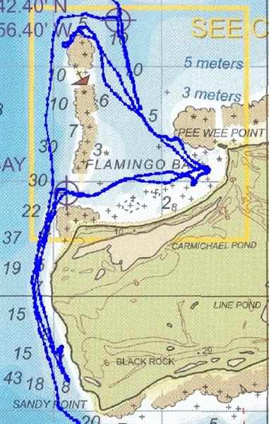
When the wind veered to the southeast, we went into Flamingo Bay and
thoroughly enjoyed this remote anchorage. Access from the north or the west is
easily accomplished in conditions with good visibility. Sure, there are A LOT
of huge coral heads scattered across the southern portion of the bay, but the
spaces between the heads are 15- to 20-feet deep, with a clear sand bottom =
just sail between the heads! We could get quite close to shore even with our 7'
draft.
Excellent protection in anything but strong west-to-north winds.
Port Nelson, Rum Cay? N23?38.822' W074?50.808' & N23?38.357' W075?50.467' &
N23?38.235' W074?51.024'
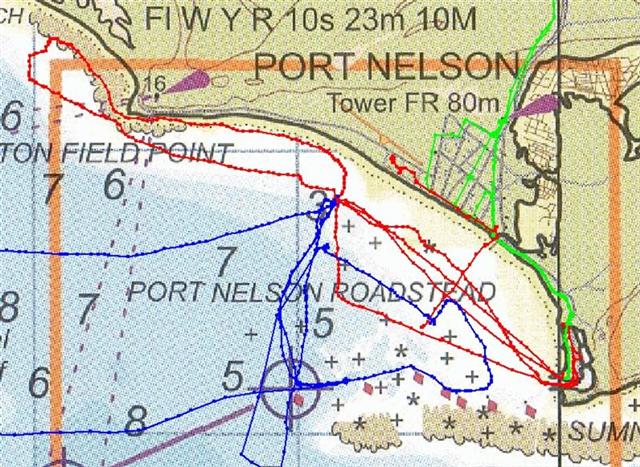
We anchored in various spots, as close as one-third of a mile from the
government dock, to nearly a mile from the marina; but we were able to receive
the wireless i-net signal anywhere we swung. We enjoyed being close to town
with the large government dock to tie the dinghy to.
Columbus Bay, Samana Cay? N23?03.991' W073?44.552' & N23?03.794' W073?44.743'
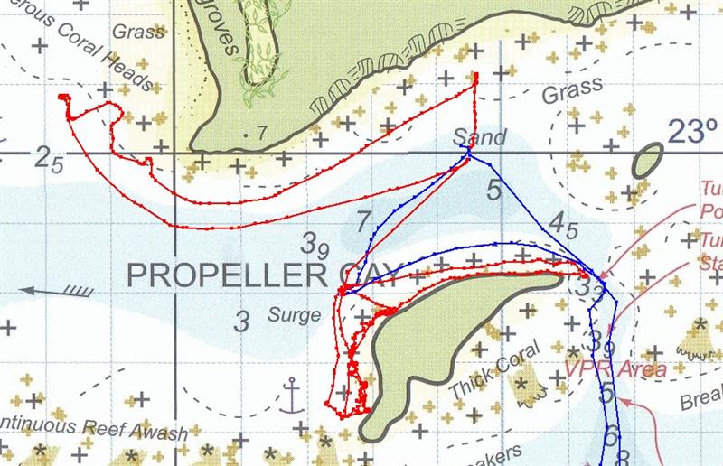
Excellent protection in this less used anchorage if you pay attention
and move around to find the calm spots for the given wind. DO NOT try to enter
at dusk as I did, or without good visibility; the entrance next to Propeller
Cay has a bottom that is a bit tricky to read, but has enough depth to make
navigating straightforward. If you have a deeper draft, entering on a high tide
rising would be a good choice!
?
If you notice some fellows on the shore, let it be known they have a
reputation to ask for "things". They ask for fresh water. They ask
for cigarettes. They ask for passage. And then they ask for more. They are
temporary residents, usually from Acklins or Crooked Island, and spend time on
Samana Cay to fish or just lie low away from trouble they may have started back
home. Act accordingly.
Atwood Harbour, Acklins Island? N22?43.239' W073?52.918'
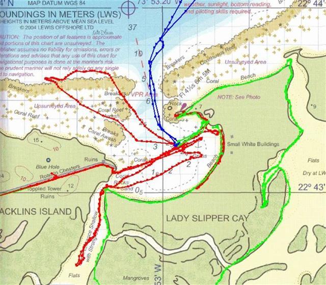
A terrific harbour tucked between Lady Slipper Cay and Acklins Island
with protection from all but wind from the north, which would cause nasty
swells and make passage in or out untenable. Entry into Atwood is a
straightforward north-south course and not at all tricky (but stay the course!)
and anchor as far east as your draft allows.
Access to Acklins Island is convenient and Lovely Bay, a settlement that
lives up to its name is a short bike ride away. Pestel Beach is north of the
bay - be sure to visit Auntie Maude & brother Leo if you go there.
Lady Slipper Cay has a marvelous beach [for a bonfire & beach
combing for interesting coral bits] and there's a creek that flows out of the
south end of the harbour that opens up into a salt pond with lots of wildlife
(sharks, birds, rays, etc.); sand bars; and beaches. Around to the northeast
corner of the cay another creek empties into the ocean around a large rock. The
current runs swift enough through this cut to drift dive and possibly find a
couple lobsters.
West Plana Cay?
N22?36.113' W073?37.490'
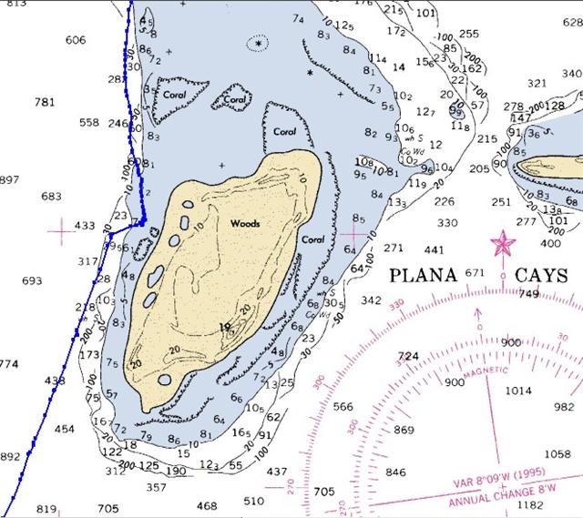
A stop-over anchorage to break up a trip to Mayaguana. Very convenient
and safe place to anchor in normal trade winds with deep water right up to
shore with minimal coral surprises. Our trip
over here was double what we expected = twice the wind strength and wave
height!
Mayaguana Island, Betsy Bay? N22?24.892' W073?08.366'
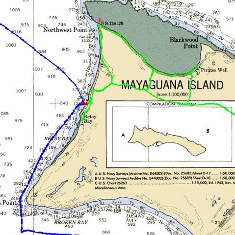
The closest anchorage on Mayaguana if approaching from the northeast. It
is a spot well-protected from prevailing east winds and a delightful tiny
Bahamian settlement, BUT the bottom conditions are completely craptastic. The
deep water shallows in a cracked & ridged layer of rocky marl that has
anchor-swallowing trenches and pits. Three bits of advice: (1) try to arrive in
good light to find one of the few patches of sand to place you anchor on; (2)
lie your anchor in water shallow enough to allow you to dive down and work with
it if necessary; and (3) ALWAYS use a trip line here! A good note is that
construction was in full swing on a boat ramp and landing at the south end of "town"
that will provide excellent access to the main road.
Mayaguana Island, Abraham's Bay? N22?21.772' W072?59.677'
A huge, shallow bay with several spots to
anchor. The coordinates above are for the northernmost useable deep-water
anchorage which has the least amount of swell in the bay [we still used a
bridle]. Others stayed east of us in shallower water that was subject to swells
coming in through the astern cut in the reef. Still others stayed in the
western end of the bay tucked up next to the reef to reduce fetch and swells;
but we were nearly a mile-a-a-half from the town dock and it was a heck of a
trip in unsettled weather - I can't imagine making the trek across the whole
bay in anything but calm conditions.
The dinghy channel to the dock is VERY shallow at low water, marked with
poles that moved and disappeared even during the two weeks we were there. Make
sure you have good visibility and high water the first time you venture to the
dock. With Pedigo, we were able to bypass some of the channel when the tide was
high, but even Pedigo could not cross the sand dunes next to the path at low
tide.
This is the first time water was available anywhere since Rum Cay, and
the first free water available on our route since George Town. It is a stretch
to think about carrying water without a bicycle, but you could walk with a cart
from the spigot behind the BaTelCo building which is 2500' from the dock. This
water tastes good, but has a bit of algae making it greenish. The city cistern
has crystal-clear water and is around the corner (turn right at the gazebo) and
only a little more than a half-mile from the dock. We treat and screen ALL the
water we take into our tank; and our system has sediment, odor/taste, and cyst
filtration at the tap. It was almost six weeks since we last filled our tank,
with only a trickle of rain added to our stores - it is nice having a
130-gallon tank! [Audrey, who clued us in on the spelling bee, will give you a
ride for water if you ask; she owns the store across the road from where she
runs the BaTelCo office.]
Free, super-fast wireless i-net is available at the Baycaner Beach
Resort, which also has a bar and is only a short 12-mile bike ride from
Abraham's Bay. If you don't have a bike, you may pay for a connection at the
BaTelCo building, but it's dry . . .
Little Inagua Island? N21?28.311' W073?03.992'
An uninhabited stop-over to break up the voyage to Great Inagua. We
REALLY enjoyed the sail here as the wind carried us on a beam reach whilst all
the other cruisers leaving Mayaguana bashed into wind and seas to get to the
Turks & Caicos. We will go UP to the Turks & Caicos after going around
Great Inagua Island on a day when we can sail comfortably. Unless it is an
critical immediate emergency for you to go from Mayaguana to the Turks &
Caicos, seriously consider taking the Little Inagua-Great Inagua-Turks &
Caicos route. Besides avoiding nasty motorsailing, you will have the
opportunity to see one of the best-kept-secrets and brightest gems of The
Bahamas . . .
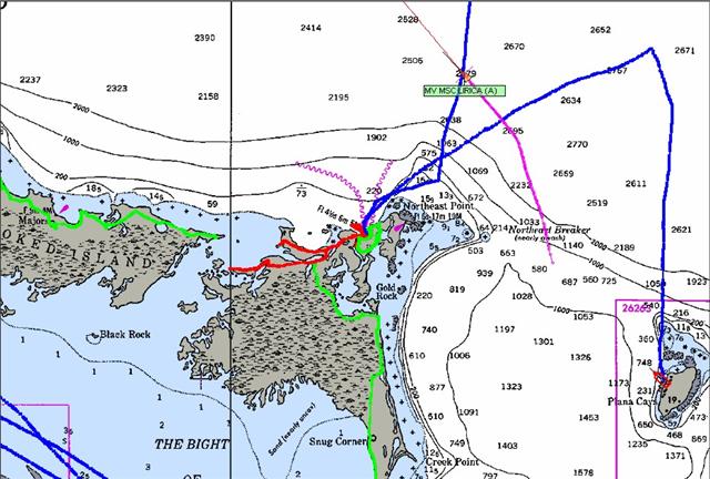
Man of War Bay, Great Inagua Island? N21?05.194' W073?38.822'
A large bay just north of the Morton
Salt docks with lovely sections of beach with brand new bathrooms ashore
and access to the main road. This is the closest easy anchorage to the geocache
near the entrance of the Union Creek
Reserve, and it is still FIVE miles away. The path is very sandy in places
= we had to walk our 'road bikes' for several stretches, and mountain bikes
would be more appropriate; but the scenery was worth the effort. Going south,
the main road is only good enough
to support the heavy equipment used by Morton Salt, expect a bumpy, sandy white
road that causes normal cars & trucks to slow down.
?The bay is nicely protected from
prevailing winds, which truly become the norm in these latitudes; cold fronts
rarely penetrate this far south and east, so the east-southeast trade winds
blow 10-20 knots nearly all the time. When a front causes the wind to veer out
of the east, it usually moves quickly with little strength in any westerly
component.
Matthew Town, Great Inagua Island? N20?56.926' W073?40.731'
One can snug up against the shore with a sandy bottom and no corals
visible (just grassy marl patches) and experience great protection from wind
and seas. In fact, Great Inagua is large enough to change the wind pattern just
as the larger Caribbean islands. Although the trades continue to blow across
the water offshore, on the western shore of the island the wind drops into
single-digits at night and a bridle can negate any effects of swell. Only one
day of the week anchored here was nasty = a front caused the wind to all but
cease, but the distant squalls brought large and confused seas to shore,
rocking poor Windigo vehemently. We simply applied good chafe protection to our
two snubber lines and spent the day ashore. The night? wind created by the island steadied Windigo on its bridle, and
all was well for sleeping. [The front stalled north of us and didn't bring
strong veering winds, but the unsettled
atmosphere still generated interesting weather.]
Free R.O. water is available at the sink in the large public building on
the beach south of the government buildings (it has an adjacent stage on the
street-side). Wireless i-net is strong in front of the main government
building, but during business hours, it may be less obtrusive to sit around
back on the bench under the tree.
If you need any advice at all concerning Matthews Town, call
"Sierra-Foxtrot" on VHF ch.16?
and speak with Capt. Fawkes (pronounced "Fox"). DO NOT under
any circumstances show up at his house (the green & white one across from
the Police Station) around lunchtime, or else you MUST buy him lunch to make up
for the numerous times he fed me during our stay.? ;-]
Airport Anchorage, Great Inagua Island? N20?58.420' W073?40.806'
This spot is a mile-and-a-half north of town and away from the noisy
power plant.
It offers the same protection and road access as the other anchorages,
but this one affords a great view of the daily helicopter landings and takeoffs
from the USCG base at the airport.
Lantern Head Reef, Great Inagua Island? N20?57.352' W073?16.046'
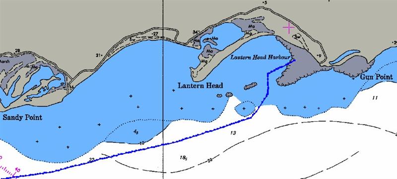
A 30-mile sail from Matthew Town, this is a great staging spot to
continue up to the Caicos Bank. This, our very last anchorage in The Bahamas,
is not detailed on any Explorer Chart, so by this juncture in your travels, you
should have obtained the Wavey Line Charts: WL T1.1- TURKS & CAICOS ISLANDS
and? HISO17- HISPANOLA. The Wavey Line
Bahamian chart sheet for the Bahamas is a superlative small-scale planning
chart with lots of details; but Lantern Head is found on the reverse of the
WL T1.1 chart (It is south of everything else on that chart, so it makes
sense).
The reef provides an extraordinary amount of protection, and is quite
remote and beautiful. We intended it only as a staging point to get to the
Caicos Bank, but with the wind first too strong (30 knots) and then the wrong
direction (on the nose!), we made a week of it!
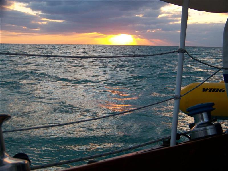
Well, that's it for The Bahamas ? "Windigo has left the
building". And a good thing too, our visa expired months ago! (We paced
ourselves through the Exumas to get to George Town on a certain date to ask for
an extension, but it was refused in a peculiar way = the officer said he could
not officially stamp our visa for a later date, but we had "some
time" to finish our sightseeing, provisioning, and sailing maneuvers. We
interpreted that to mean we could finish our 'tour' of all the remaining
islands . . .)
See where Windigo has been:
<http://shiptrak.org/>
Enter Windigo's callsign: W3IGO
(and zoom in when it starts tracking)
Where we are right now:
<http://map.findu.com/W3IGO>
Our permanent and EXACT address:
Capt.KL & Karin Hughes
S/V WindigoIII ? PMB 365
88005 Overseas Hwy. #9
Islamorada, FL? 36033-3087
Text-only Email addresses aboard Windigo,
checked daily:
[reliable communication]
Email addresses checked when at a land-based
computer
(infrequently, but good for attachments):
And
of course, the Windigo Travelogue Catalogue:
http://www.ciekurzis.org